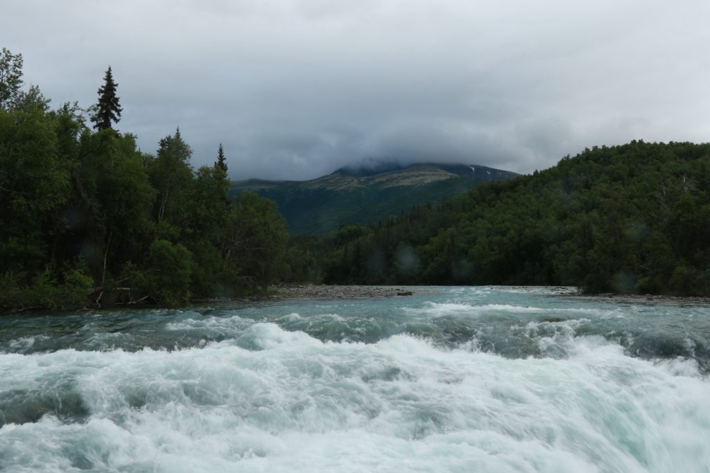
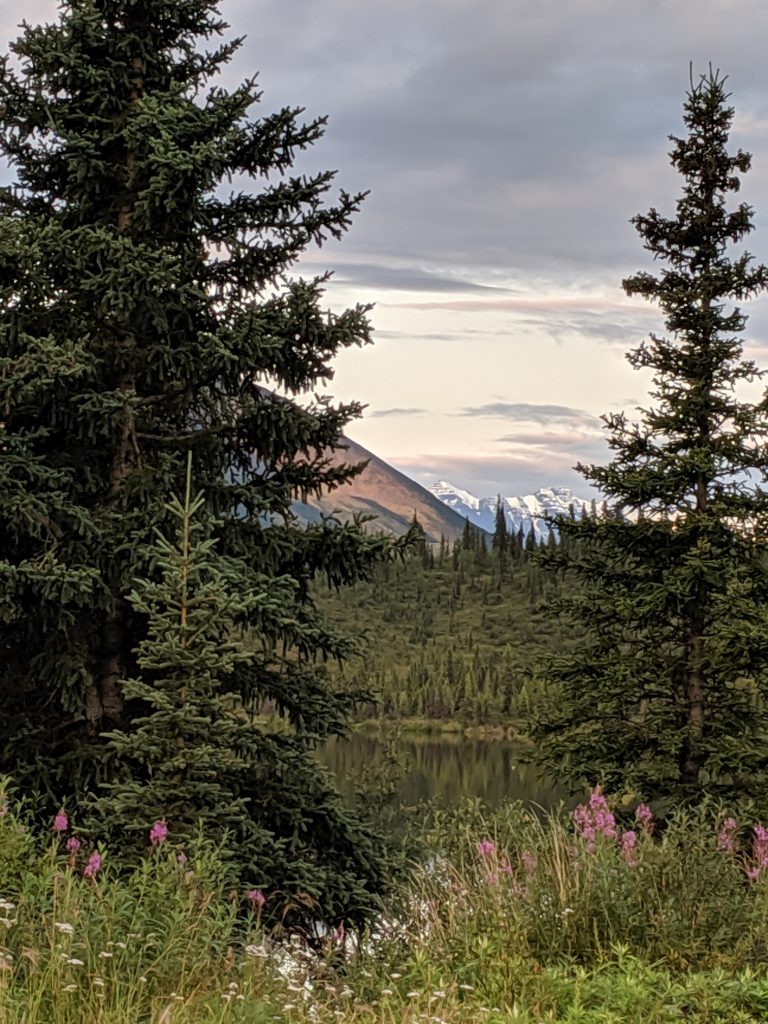
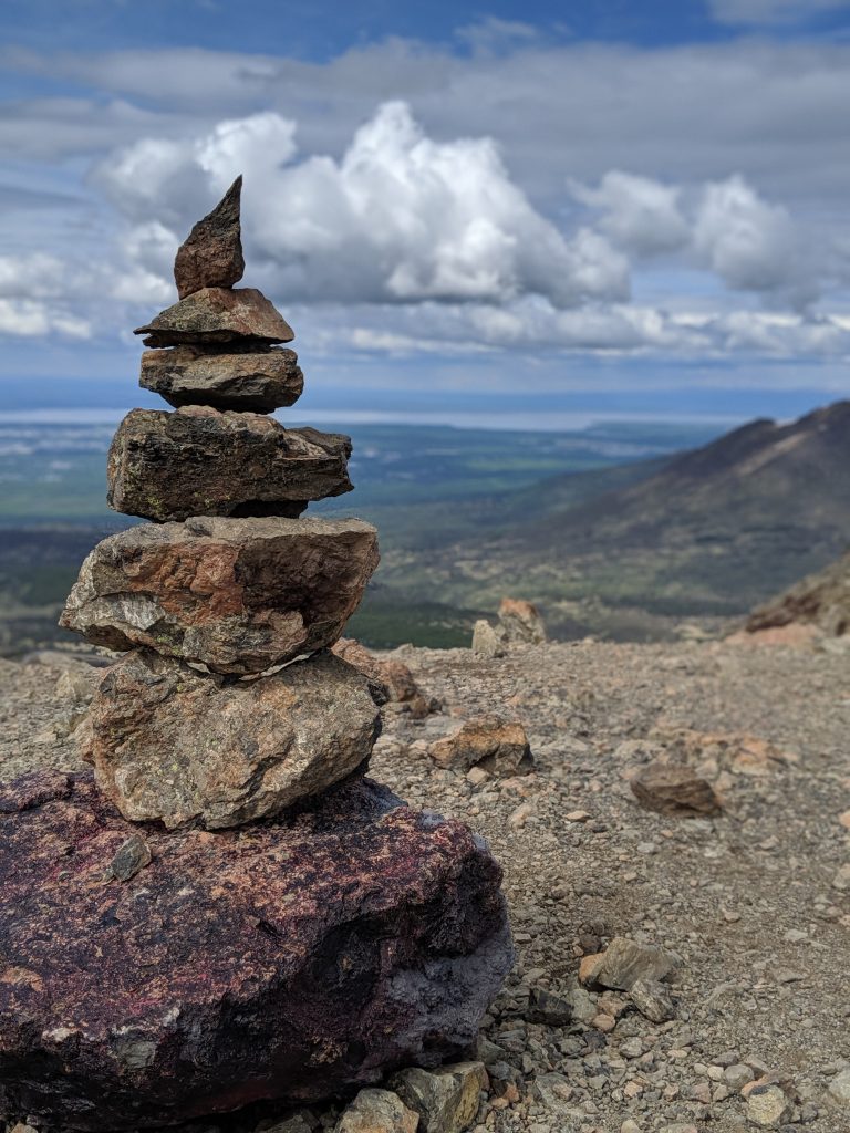
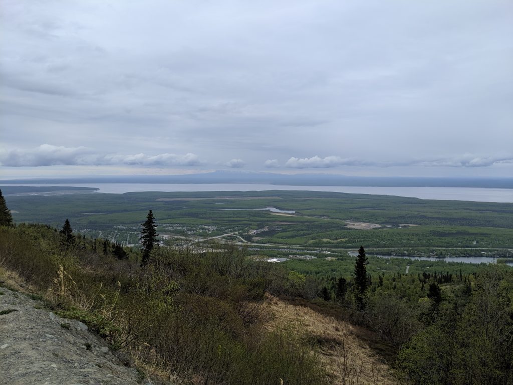
Living in Anchorage
was so bittersweet. A wide and sprawled out city with a Radio Shack and a JC
Penney Furniture store– I was skeptical to say the least. It is also no secret
that Alaska is prone to homelessness, alcoholism, and depression, especially among
the arguably forgotten native population. The disparity between natives and
non-natives is apparent from first glance if one cares to look for it. Filled,
as a general statement, with hipsters who enjoy extreme outdoor activities,
Baby Boomers and Generation Xers with money to spend, fisherman and oil-riggers
hoping to strike it rich, military personnel, and Hawaiians and American
Samoans escaping the high cost of living and low employment rates of their home
towns, Anchorage is, if nothing else, diverse. Yet, Anchorage has managed to
keep some of it’s secluded and small-town appeal.
For me, this meant
the best of all worlds. Every store that one can find in any other major city
can be found here– the REI, Wal-Mart, Target. There are plenty of nail salons,
coffee shops, and restaurants for all diet types and Anchorage is surprisingly
vegan-friendly, Middle Way Café
having some of the best vegan pastries I’ve ever had. Anchorage has a super
cute downtown with great parking options and walkability, whether to the
museum, the bar, or the high-end thrift shop (my favorite being Second Run). Everything is
seemingly 15minutes away while being
spread out in a way that doesn’t bring to mind congestion or pollution as with
most other major cities.
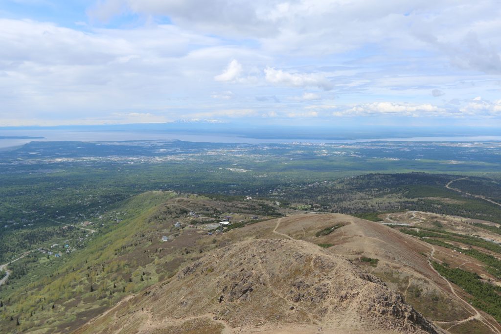
The best part about
Anchorage, though, is undoubtedly it’s location. Literally the
“anchor” for the rest of the state, one can reach anywhere else in
the state from here by either car or plane. That said, it’s no small price to
reach these other places. Though Palmer, Seward, Homer, Fairbanks, and the like
can be reached via vehicle ranging from 45min to 6hrs, hot spots like Katmai
National Park, Lake Clark National Park, Nome, or the two northern national
parks are only accessible via bush planes averaging $400-700 for the roundtrip
ticket alone. Living in Anchorage isn’t cheap either. With most items shipped
in from the “The Lower 48”, costs for food, drink, and grocery
reflect as much. I will admit, though, that being a largely organic shopper,
the items sold in Fred Meyers were comparable– everything except for hummus,
hummus is oddly expensive!
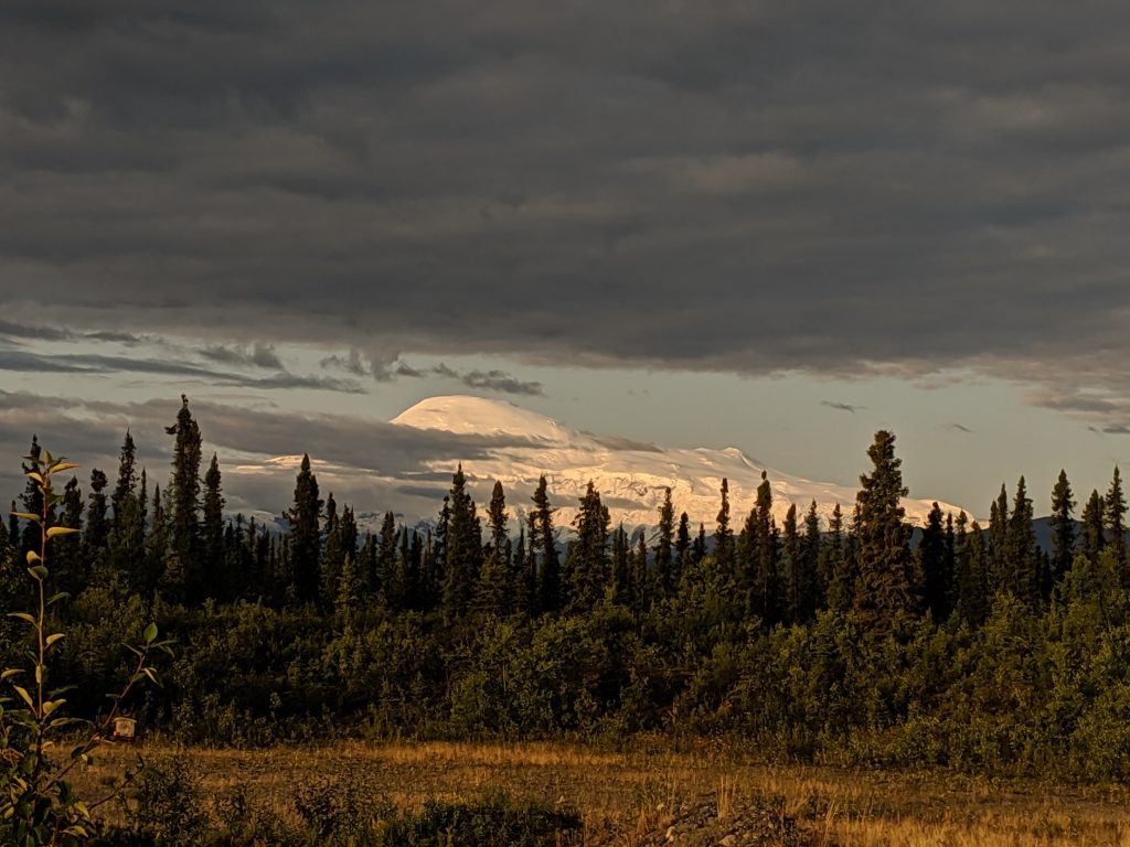
My top reason for
striving for a travel position in Alaska was to visit the above mentioned
national parks. Hitting 6 of the 8 as well as exploring as many other towns and
corners as I could, I was not disappointed. Everywhere I went in Alaska was not
only beautiful but also unique. Homer is nothing like Seward, which is nothing
like Palmer or Talkeetna, or Brooks Falls. I simply couldn’t get enough. I only
quit traveling because I couldn’t afford another trip and buy my plane ticket
back home! Okay, that might be dramatizing it a little, but that is mostly
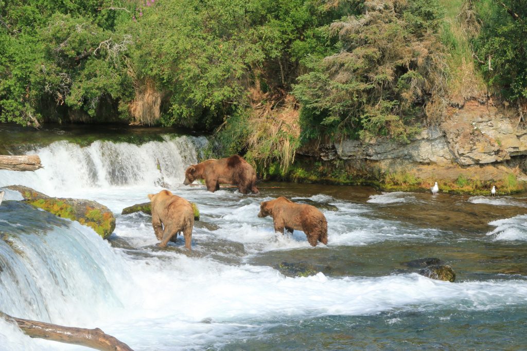
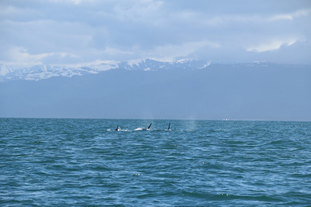
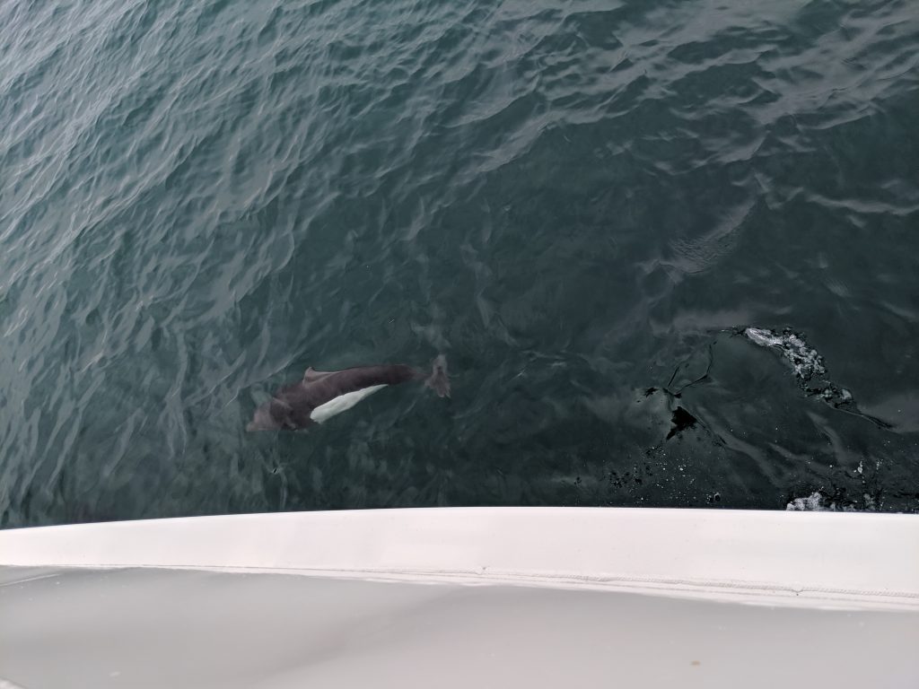
true. Whether I was in the water next to dolphins, orcas, and puffins in Homer
or picking berries on the side of the road in Hatchers Pass, my heart was
filled with pure bliss and gratitude at the opportunity. The sun can often
create a dryness that makes the area prone to wildfires, and this did affect
some ability to travel and enjoy, but not by much.
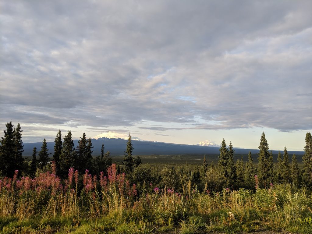
Speaking of sun, the
most infamous characteristic of Alaska is it’s sun, or lack thereof, depending
on the season. Spending the summer in Alaska from May to September was
incredible. There was snow on the mountains when I arrived, no snow by June,
browning fireweed by August, and hints of snow and darker days around the
corner when I left. To go through all four seasons in just 5 months is unheard
of for most people around the world. And my favorite part was driving along the
highway multiple times throughout my time there and seeing the changes
happening before my eyes. If one travels north enough, it is true that the sun
can be seen high in the sky at midnight and even days of 24hrs of sun occur.
This is only in the summer, though. Fall, Winter, and Spring have the opposite
affect and, though it can be equally cold or icy at various times of the year
in places like Western NY and Pennsylvania, it can also be dark for 20-24hrs at
a time as well. Hence the struggle with depression and alcoholism– sometimes
due to mental instability and sometimes due to plain boredom.
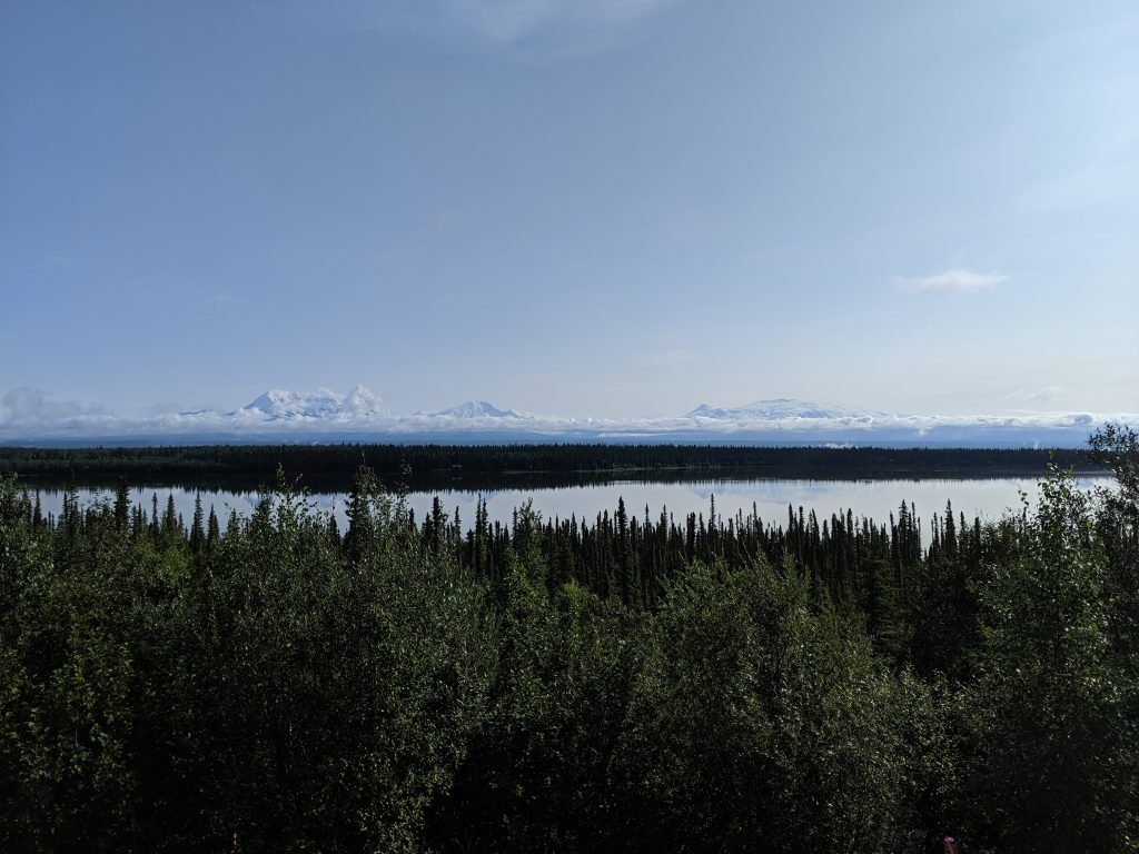
All of this said, would I recommend Anchorage as a place to live? Absolutely. But not if you have family in the Lower 48 that you want to visit or whom you want to visit you. Because that flight– or should I say three– is not easy. Not the way they herd us along and squeeze us in like cattle. Lol. Unless you can afford first-class– then by all means, lay back and enjoy the ride to one of the most majestic places I’ve every visited!
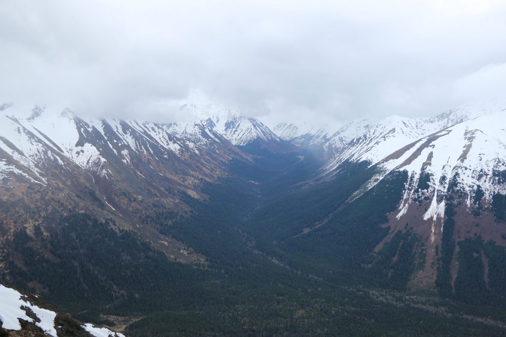
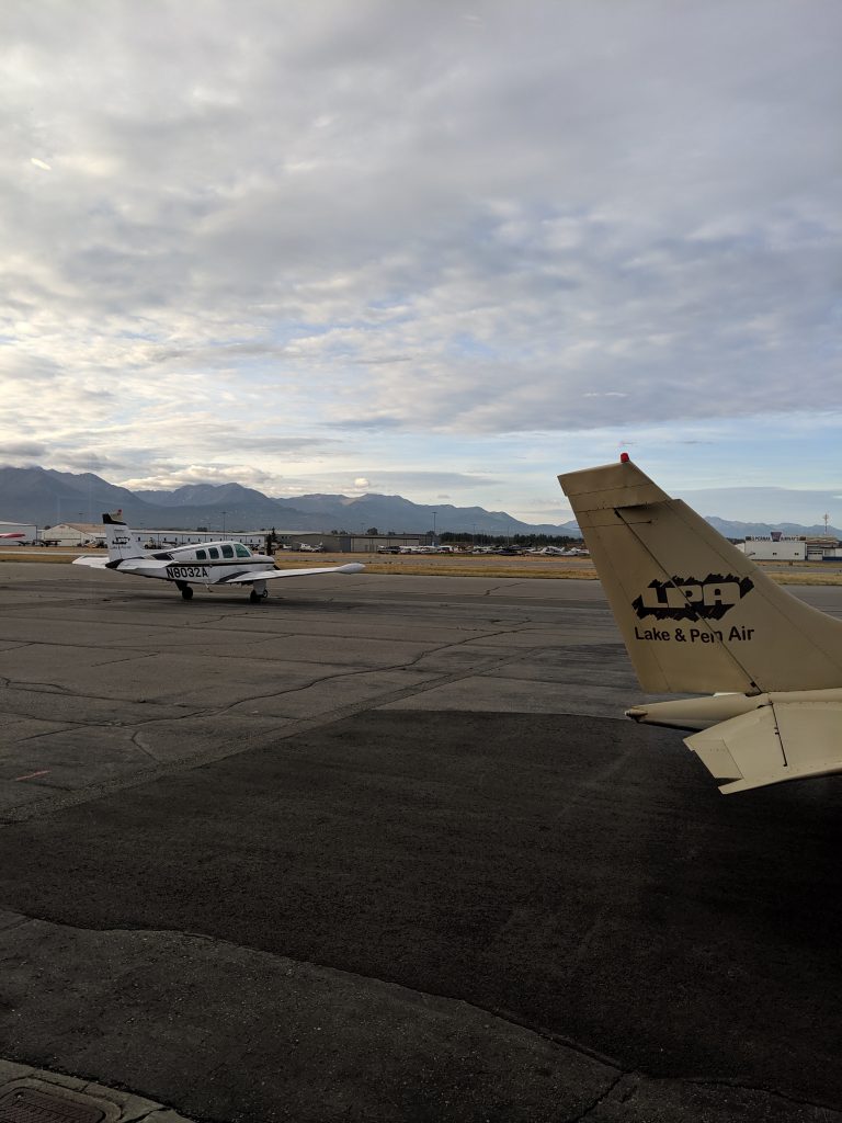
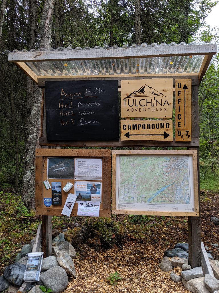
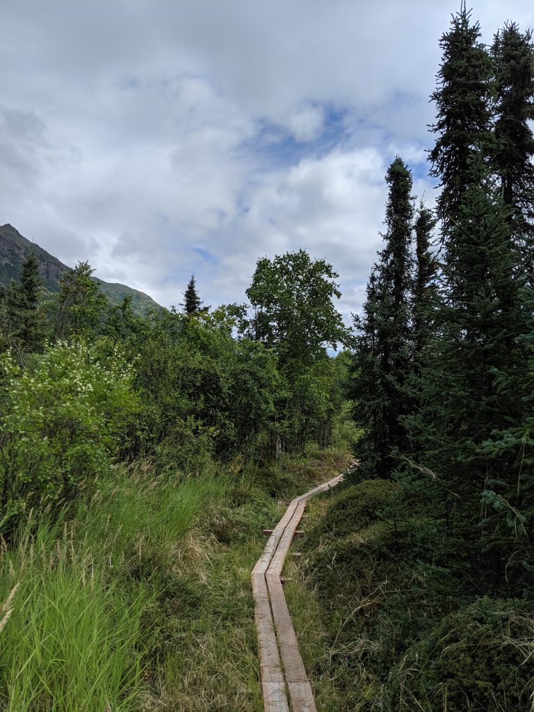
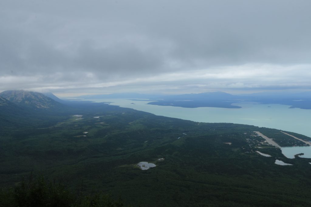
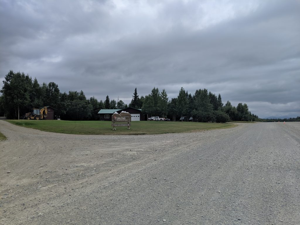
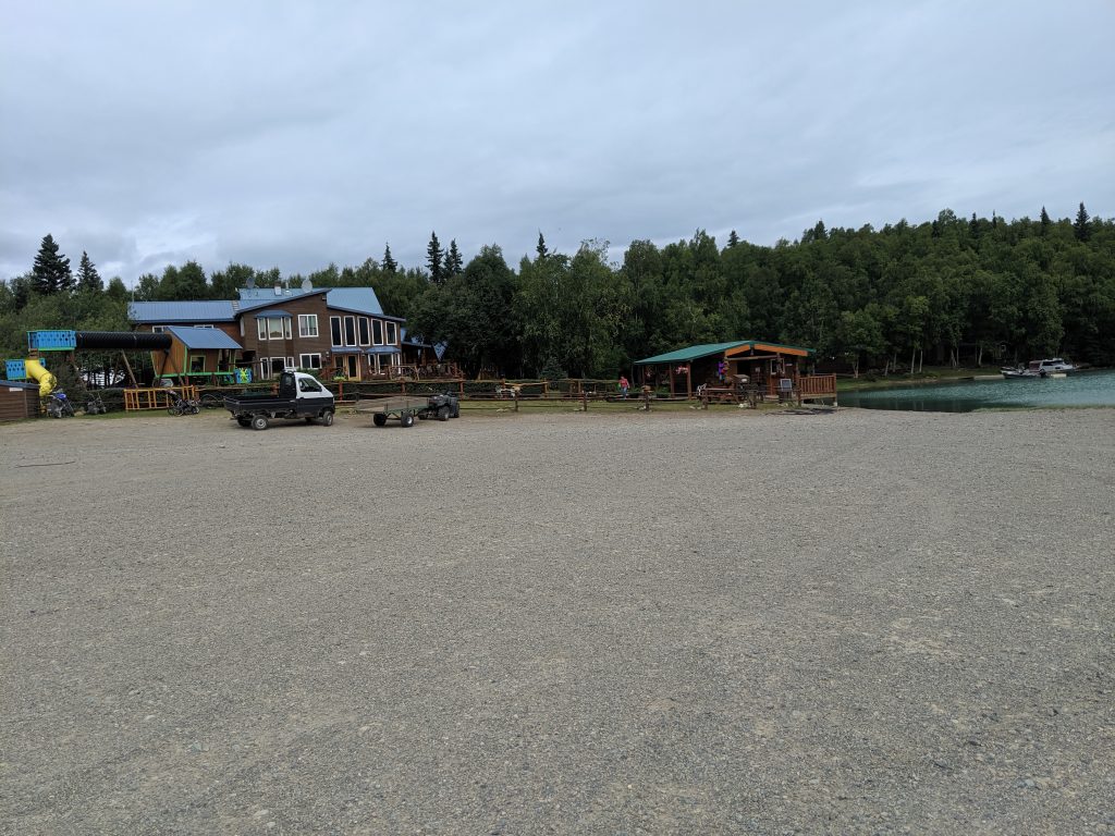
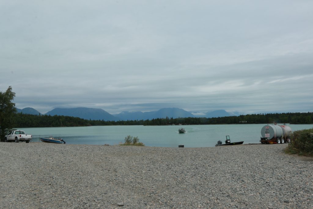
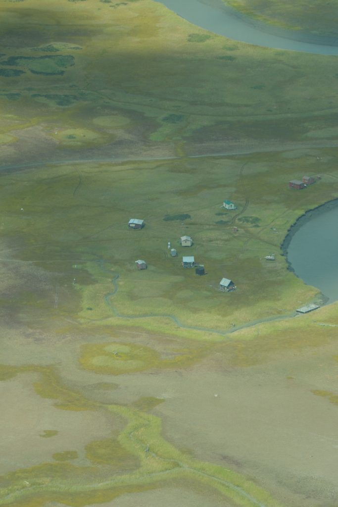
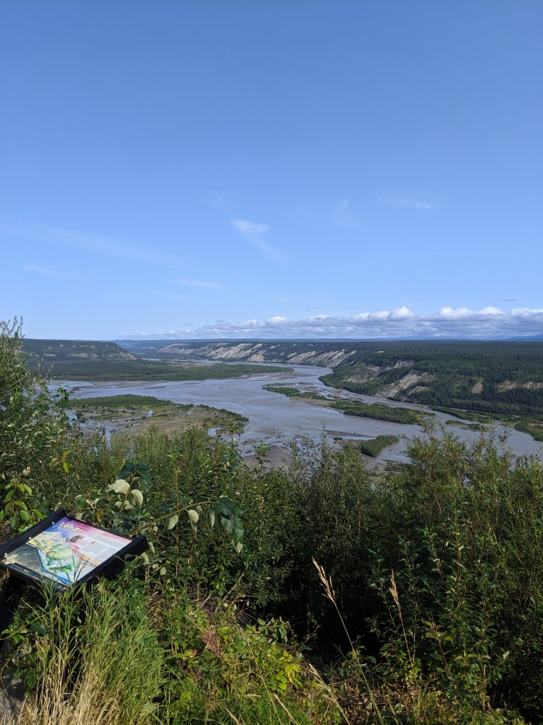
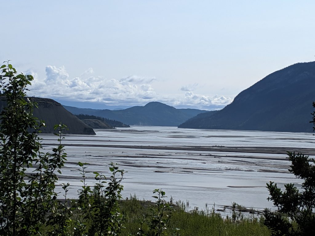
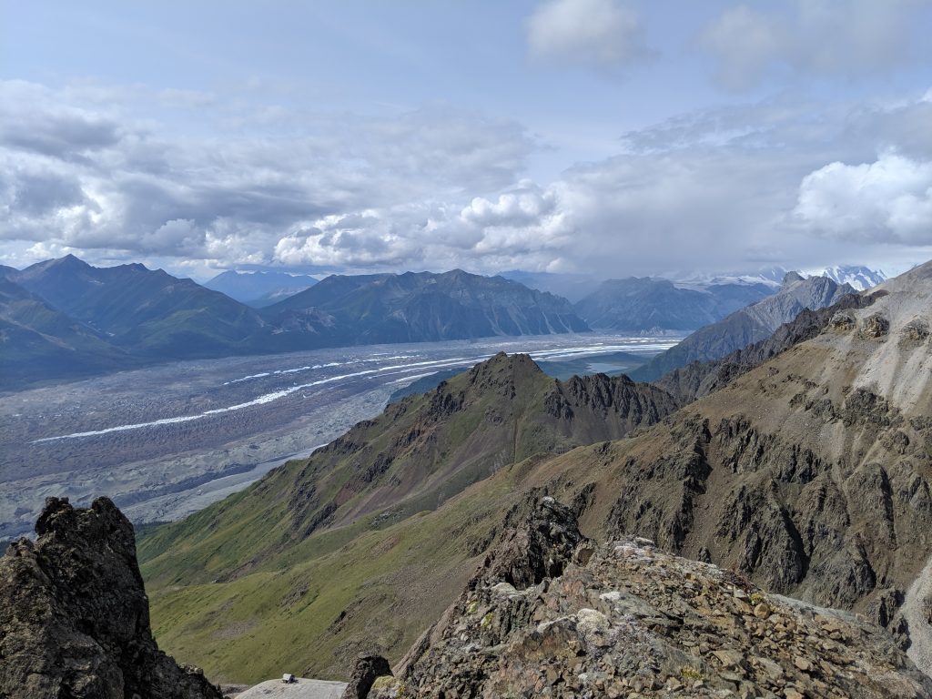
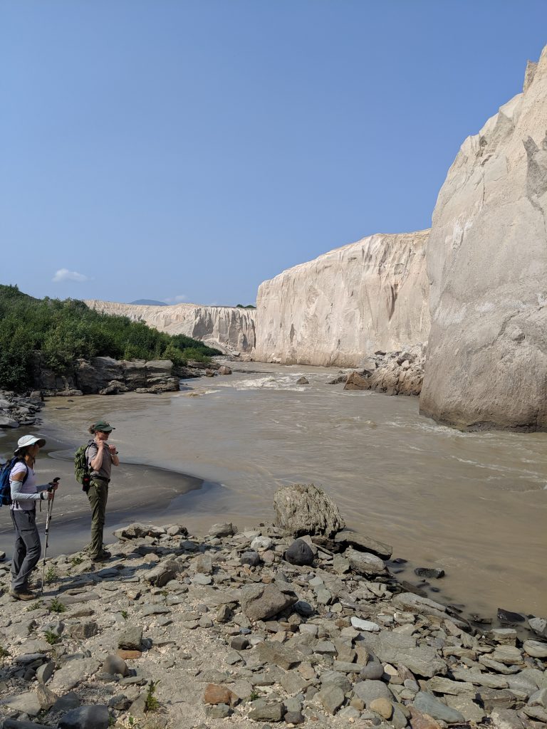
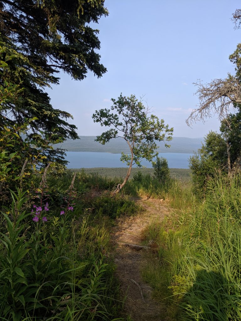
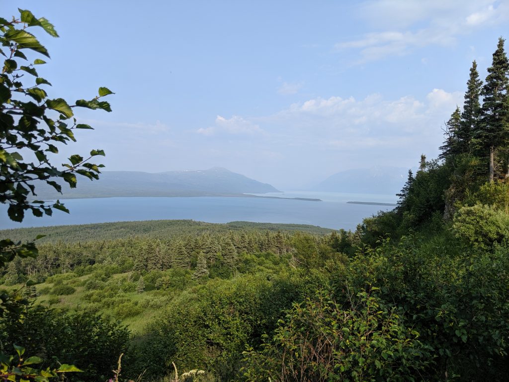
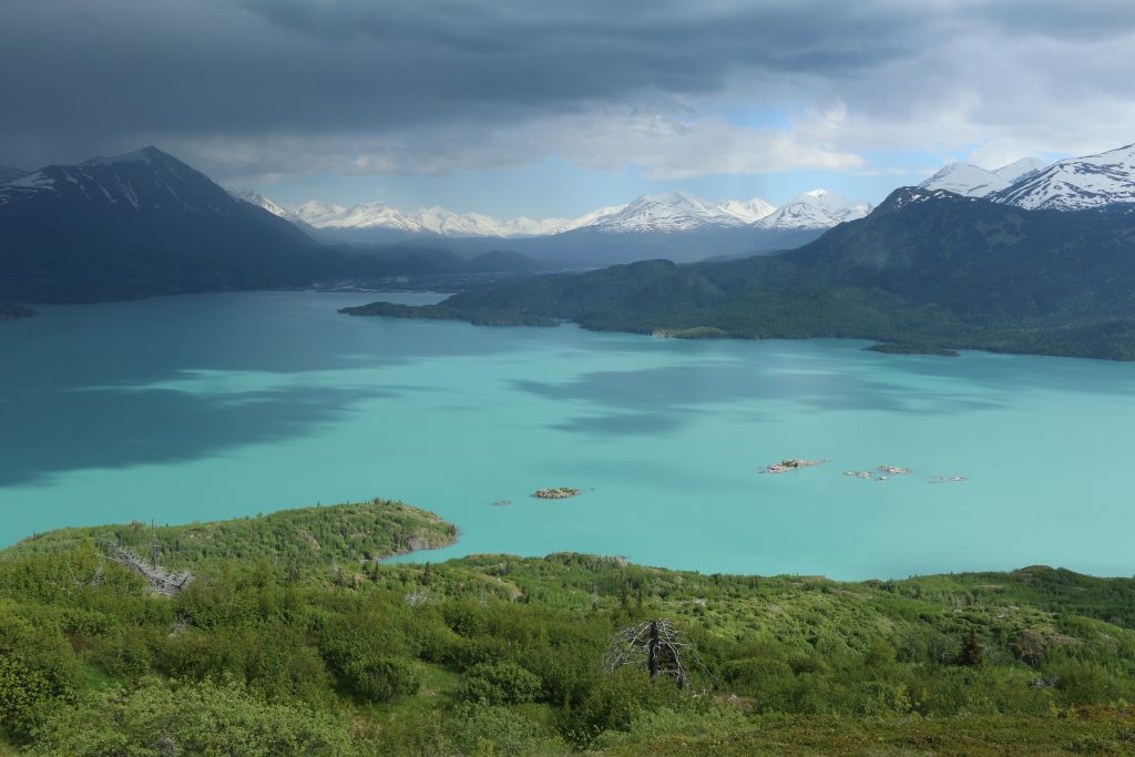
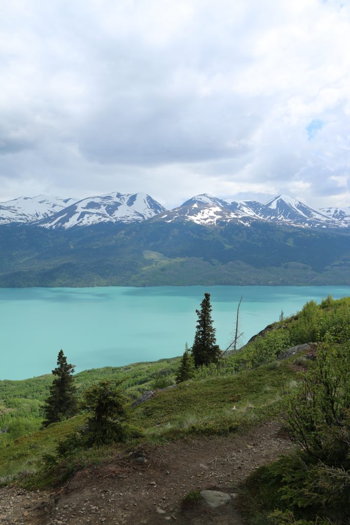
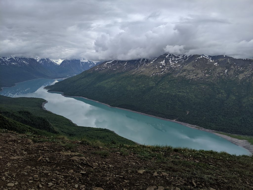
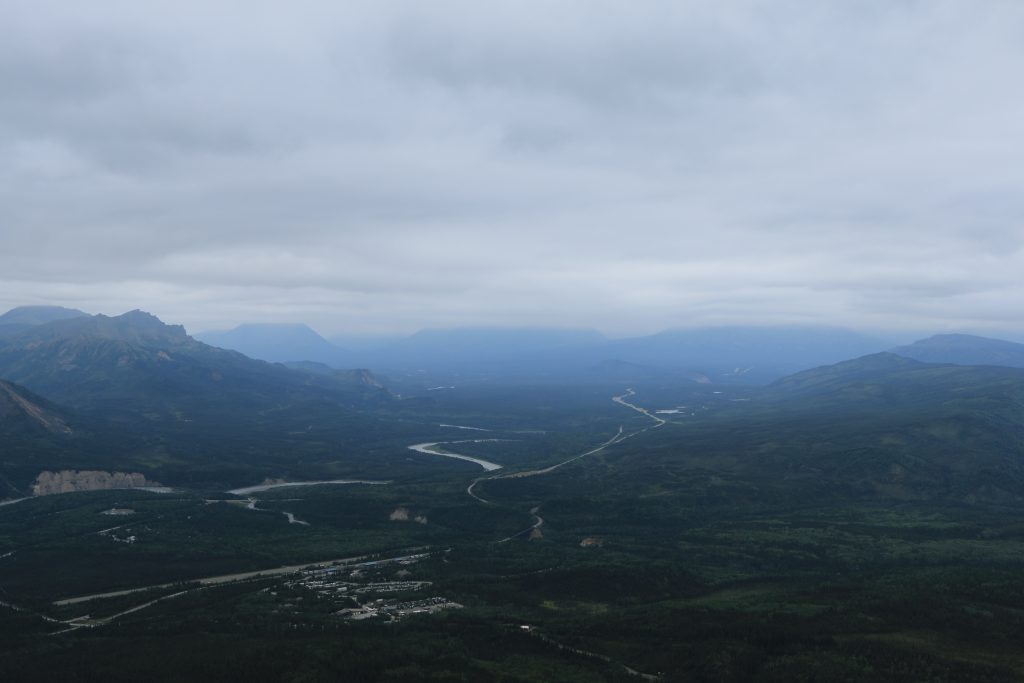
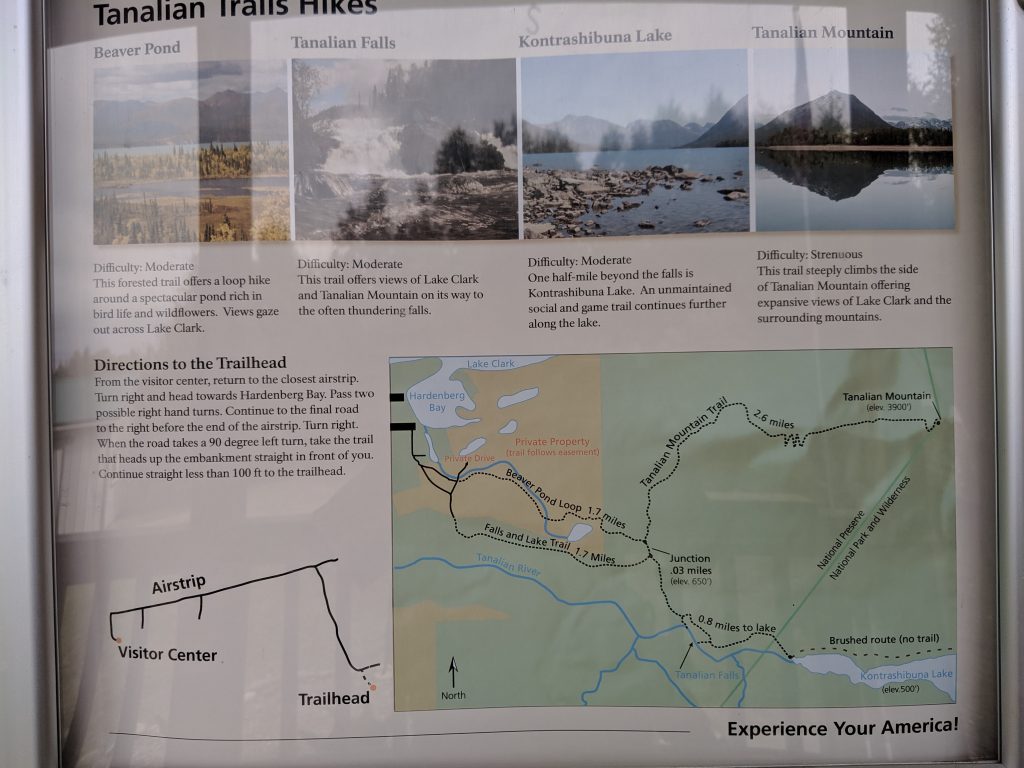
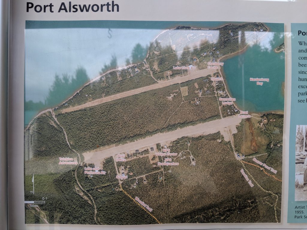
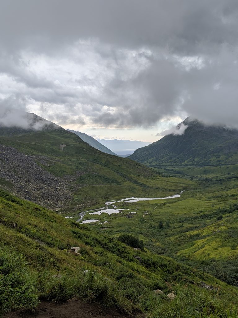
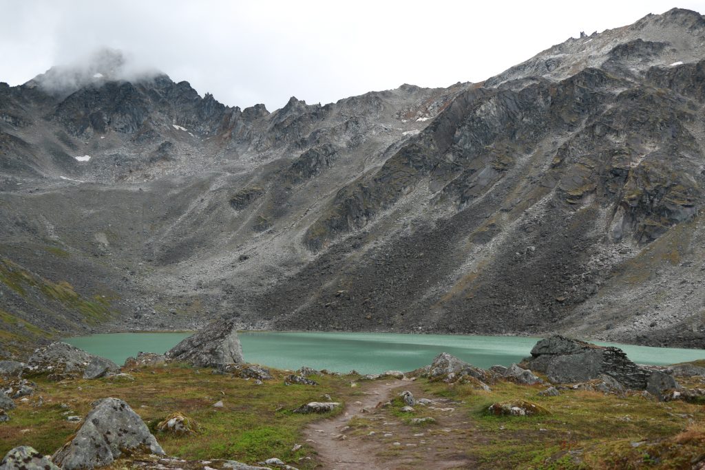
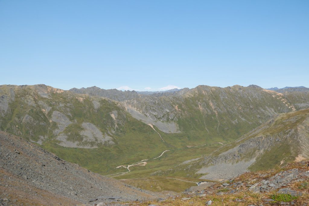
Easily one of the most peaceful trips in Alaska thus far. There is so much to see in Lake Clark– Port Alsworth, Iliamna Volcano, Dick Proenneke’s Cabin on Twin Lakes. But, of course, they are all separate from each other and require access by plane. So I decided to stick to Port Alsworth, the main hub for the national parks service, and soak up all that I could during my last solo excursion in Alaska.
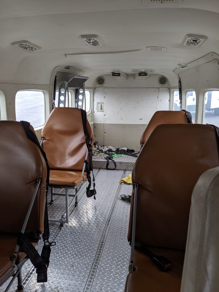
I flew to Port Alsworth with Lake and Penninsula Air (LPA) for $500 roundtrip plus $0.92/pound excess weight over 50lbs. The only thing to keep in mind is that there will likely be passengers going to other areas of the park so the plane will likely make multiple stops to other villages prior to Port Alsworth. The front desk can tell you if the flight will be direct or not. Also, of course, weather will determine how fast the plane will go, if it will go at all.
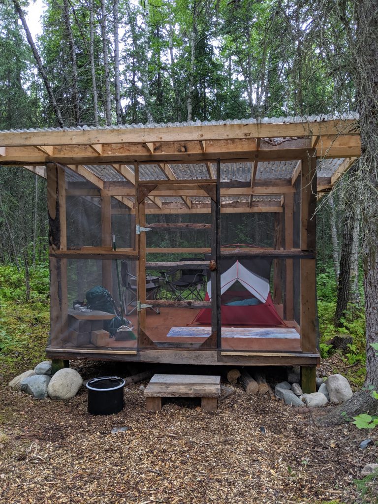
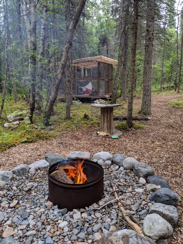
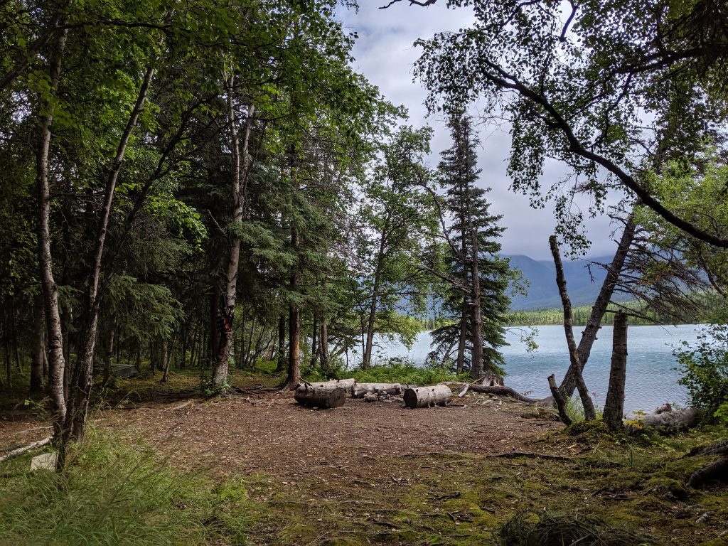
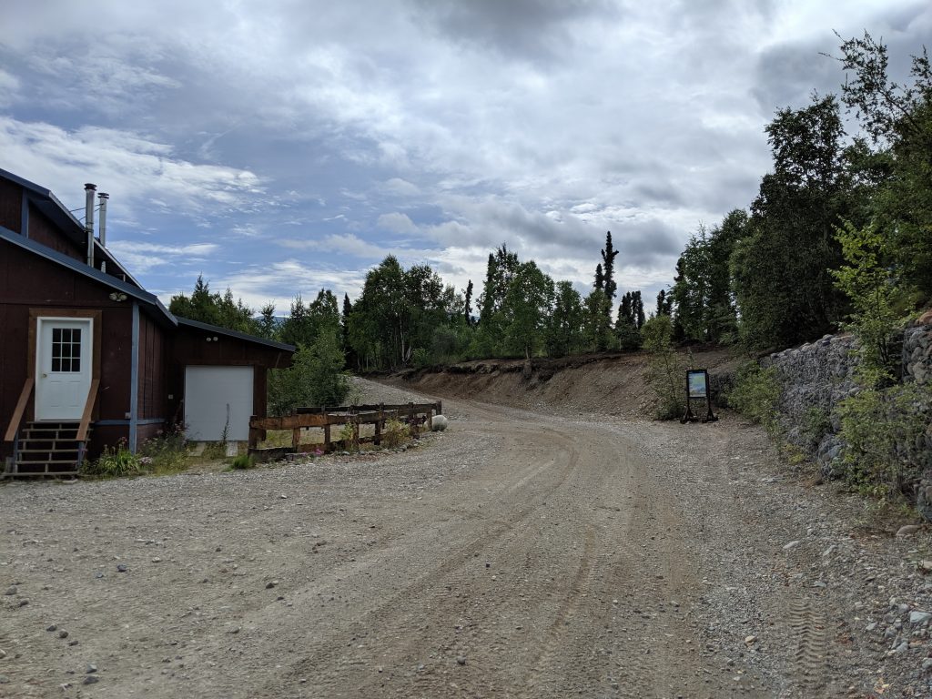
Once on the ground, I was greeted by the hostess of the private campground with whom I chose to camp. Beth of Tulchina Adventures is quiet and sweet. She drove me and my backpacks to my “glamping” hut and gave me the lay of the land. With rain in the forecast for the next few days I was so happy to not have to set up on wet grass amidst a curtain of the mosquitos. “Glamping”, in this case, meant a room on a raised wooden platform large enough in which to set up your tent as well as house the provided camping chairs and table. A few shelves in one corner were plenty for keeping cooking items and toiletries. A bear can was provided to store food and a place to sit and enjoy a fire was just a few feet from the hut. It was cozy and dry and just the extra splurge I was looking for. She charges $50/night to glamp and $25 for tent only. There is a very well-kept outhouse that is shared among the three huts and there is filtered water and firewood at our disposal.
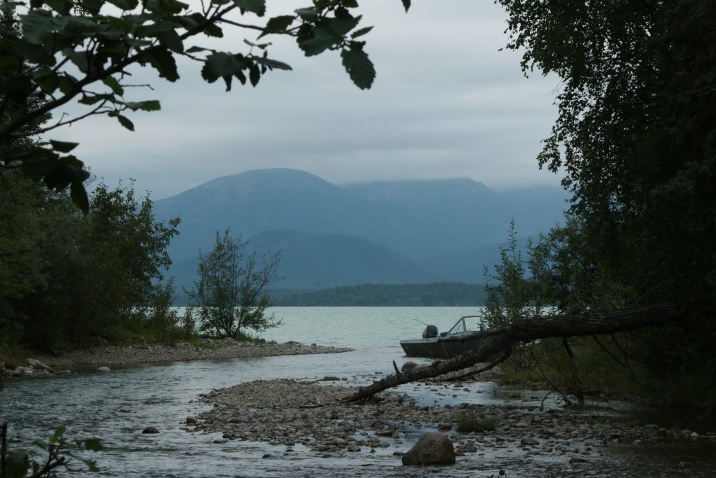
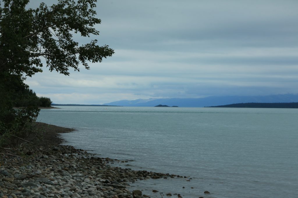
Lake Clark near Tulchina
Lake Clark near Tulchina
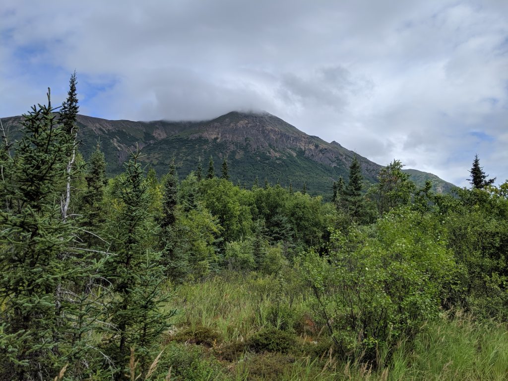
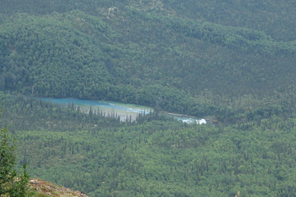
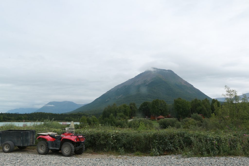
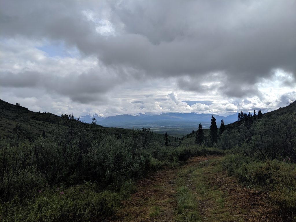
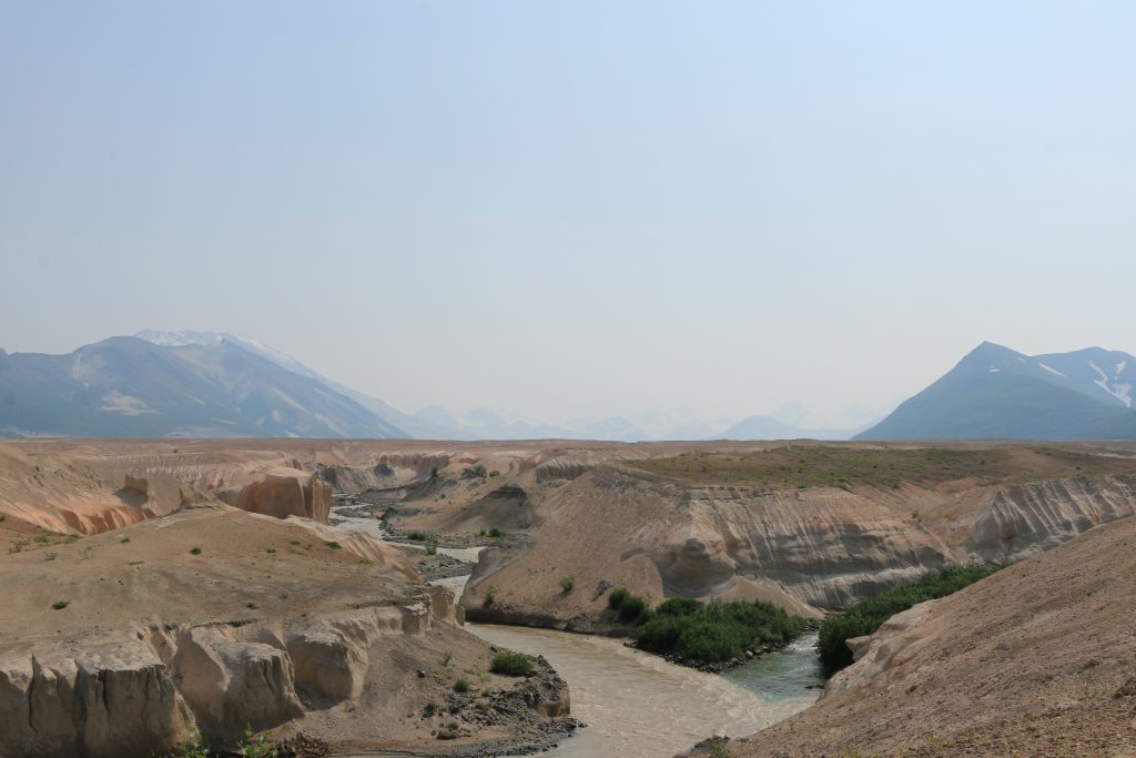
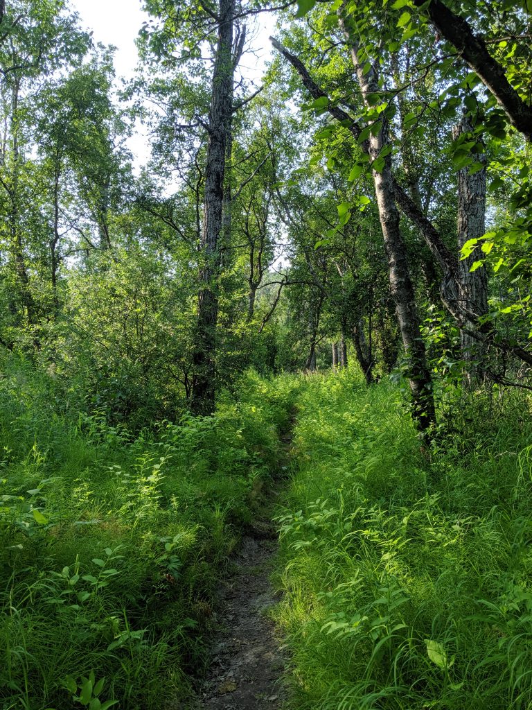
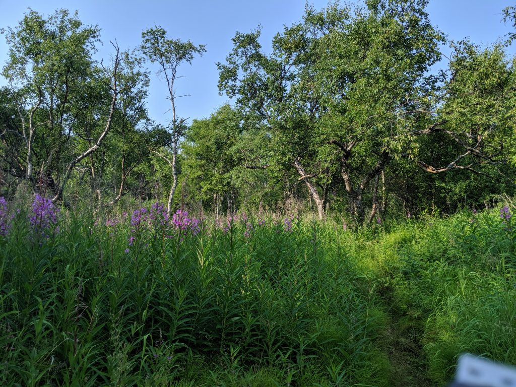
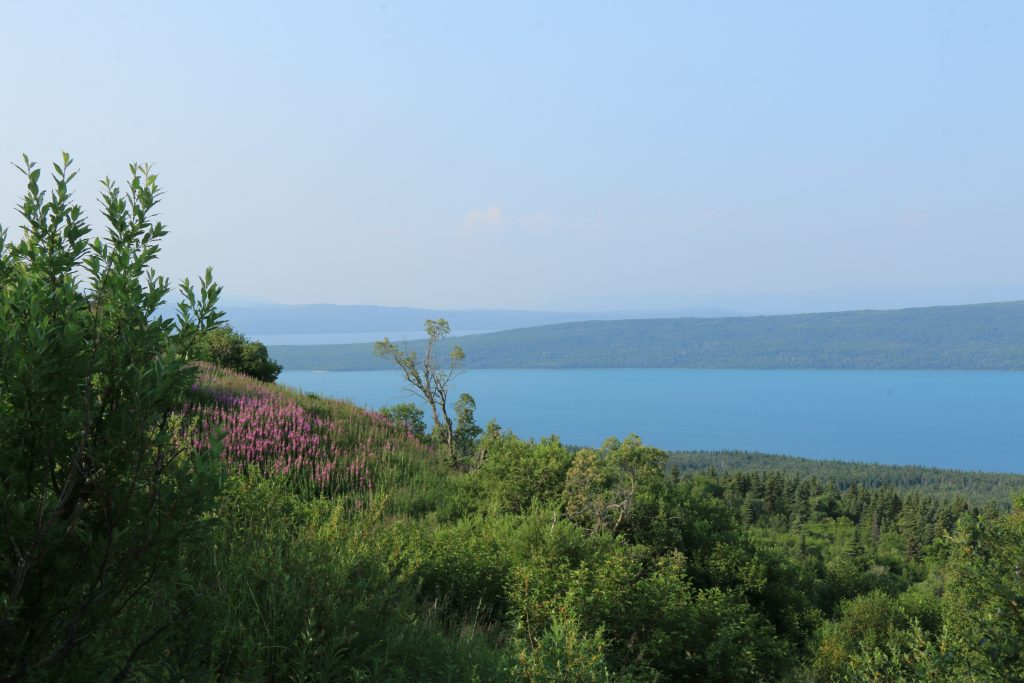
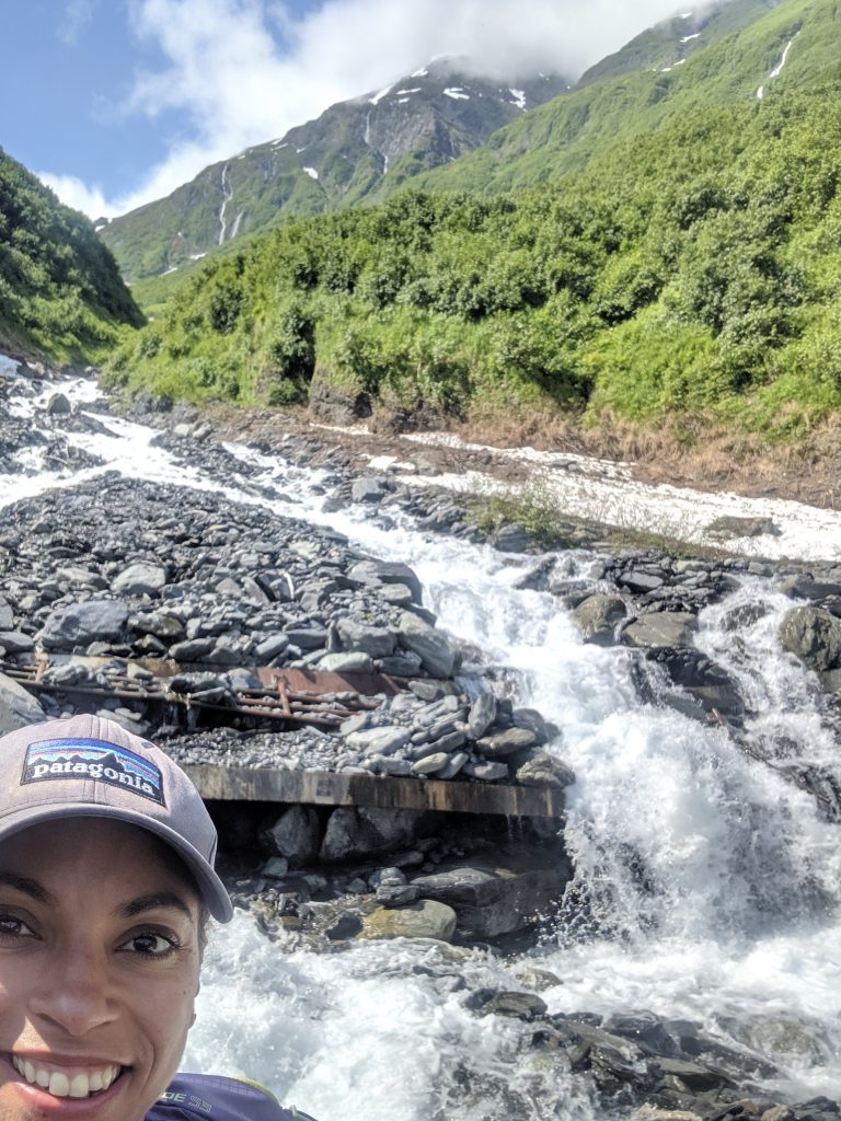
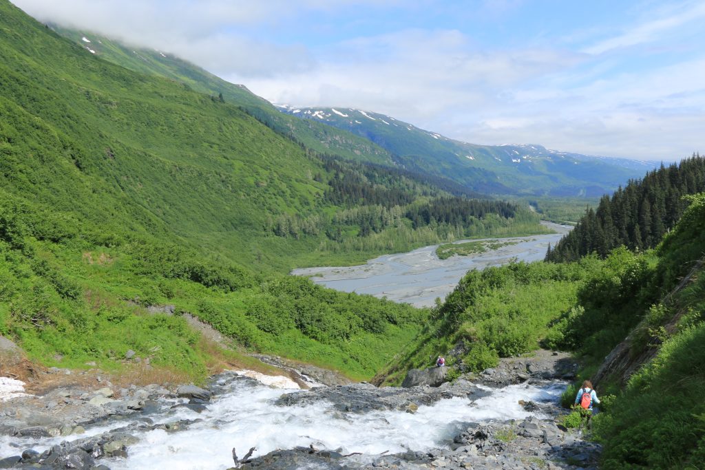
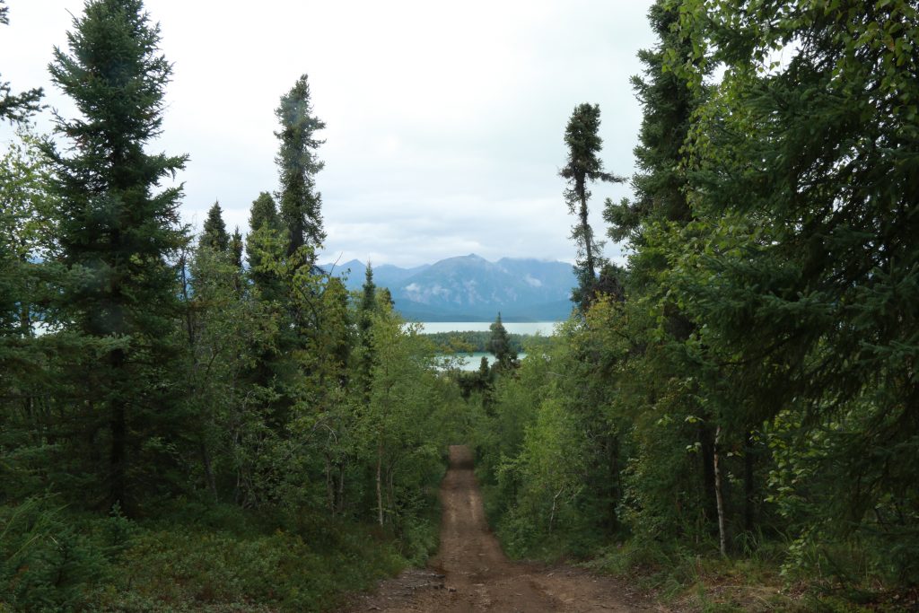
Since it wasn’t raining as predicted and the sun was actually out and the peak of the Tanalian Mountain was in full view, I decided to do all of the Tanalian Trails including the falls, the Kontrashibuna Lake, and the mountain on the first day I landed. This was no small feat. Motivated by the fact that I wasn’t sure if weather would grant me another opportunity, I hiked from roughly 12:30 to 6:30pm to get ‘er done.
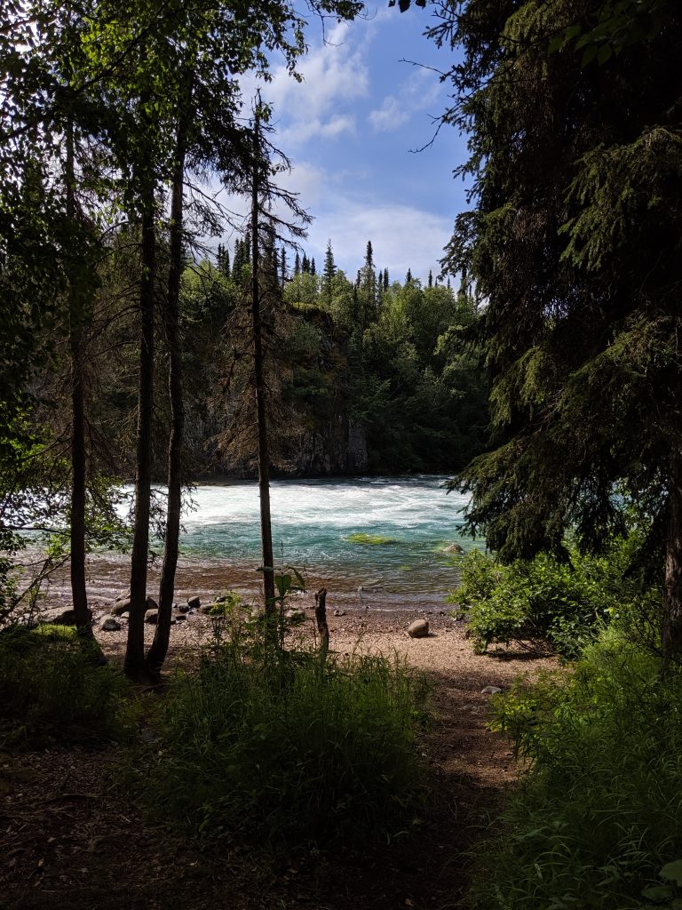
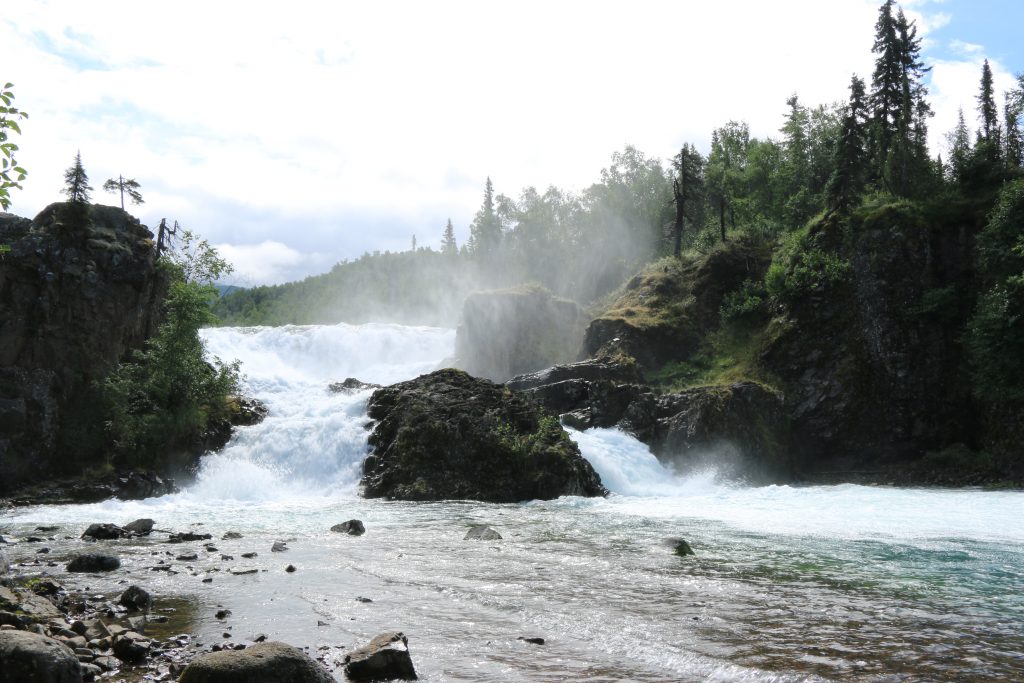
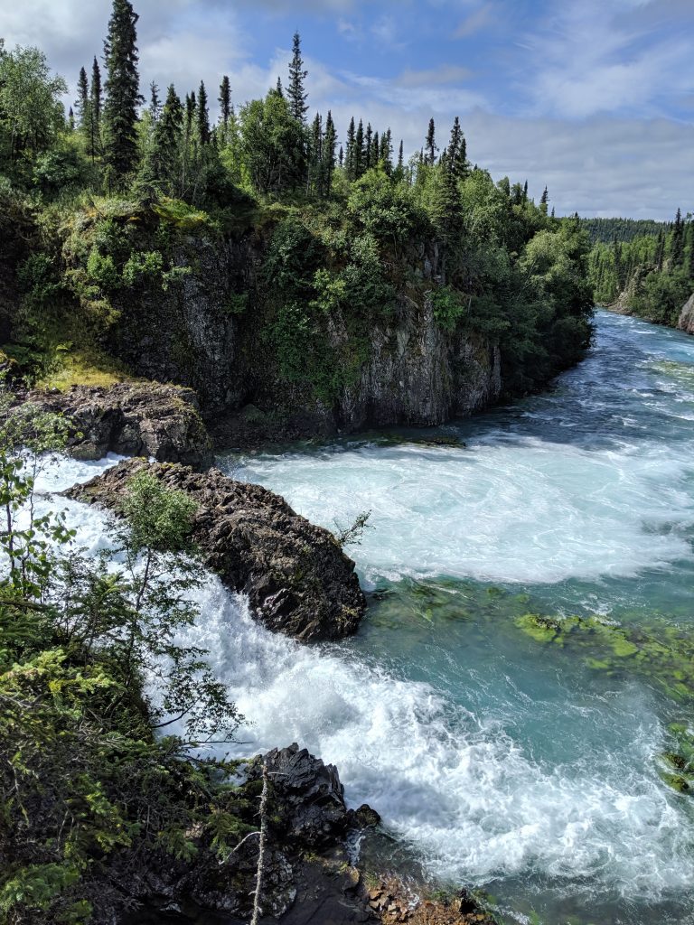
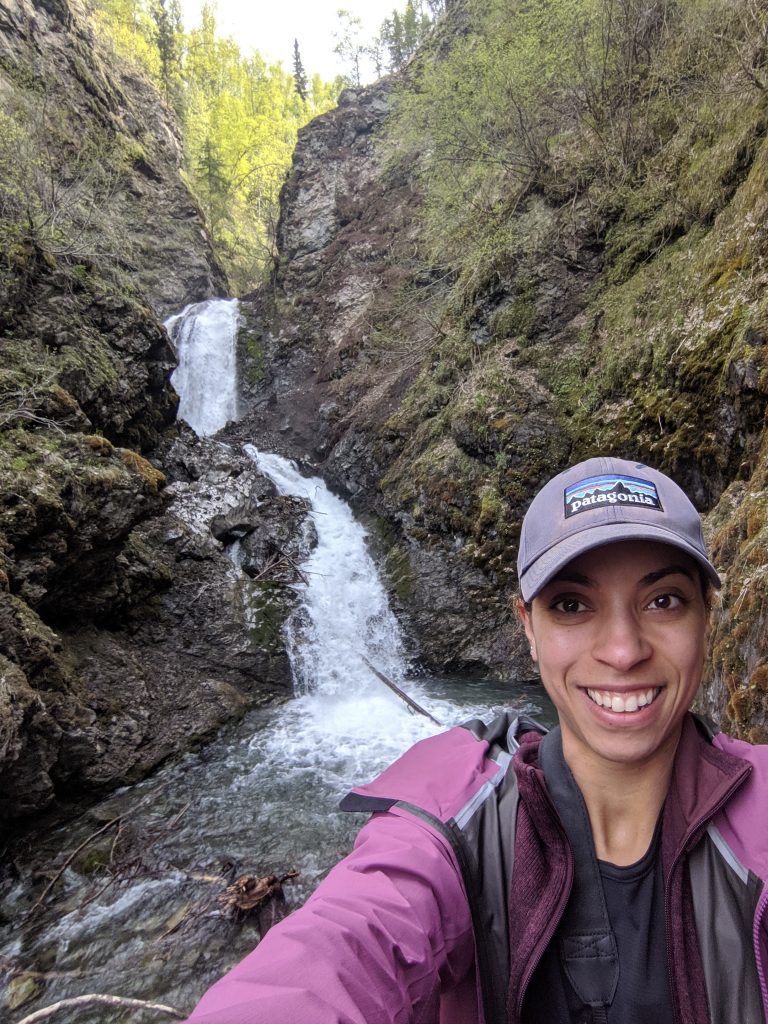
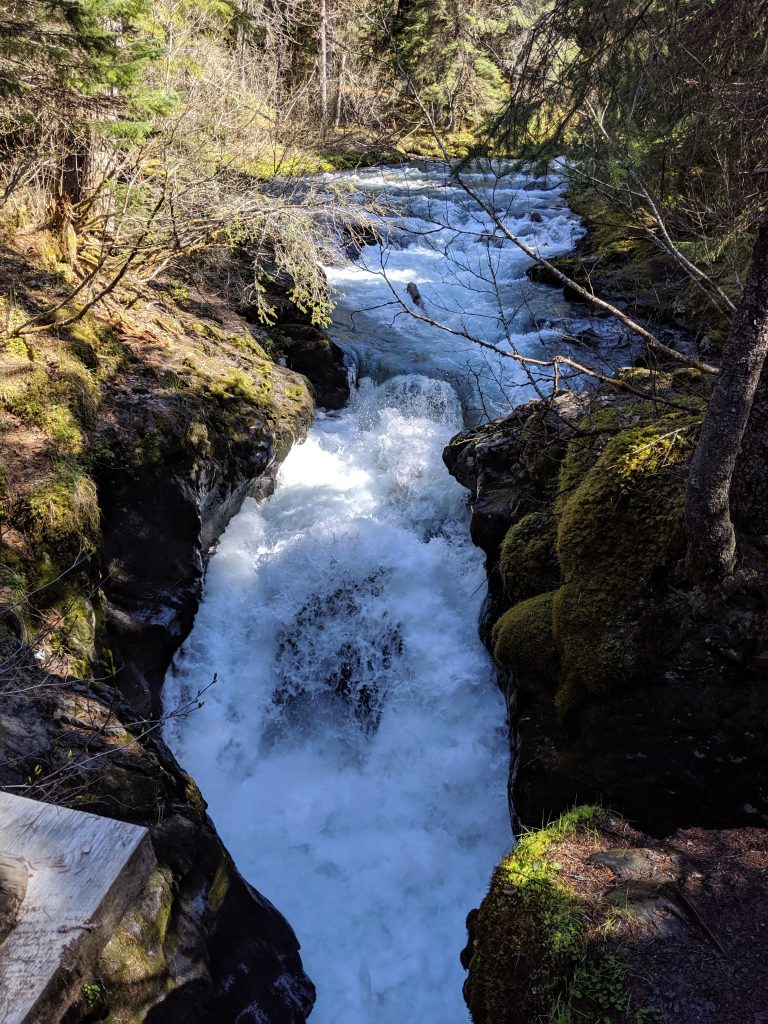
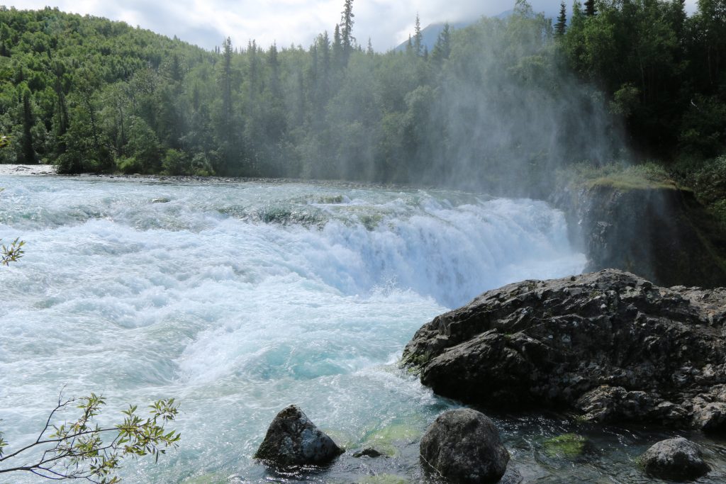
The falls are unheard of. I’ve never seen a falls that small yet that forceful! And when the forest opens up at the Lower Falls it is nothing short of magical. The green-blue color of the water, the island-feel of the cliff across, and the deafening roar of the falls. It had a Gull Island feel from way back when I visited Homer. It was breathtaking. That part of the trek was roughly 1.5hr from the campground with crossing from the far end of the airstrip to the trailhead itself taking about 30min.
Continuing another 30min from the falls, I landed at the obvious ending of the Tanalian Trail at Kontrashibuna Lake. So peaceful. So blue. If one wanted, I suspect the trail continues as a brush path all the way around the lake. A great spot for a picnic or a fire.
Tanalian Mountain along the way
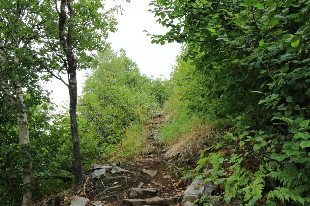
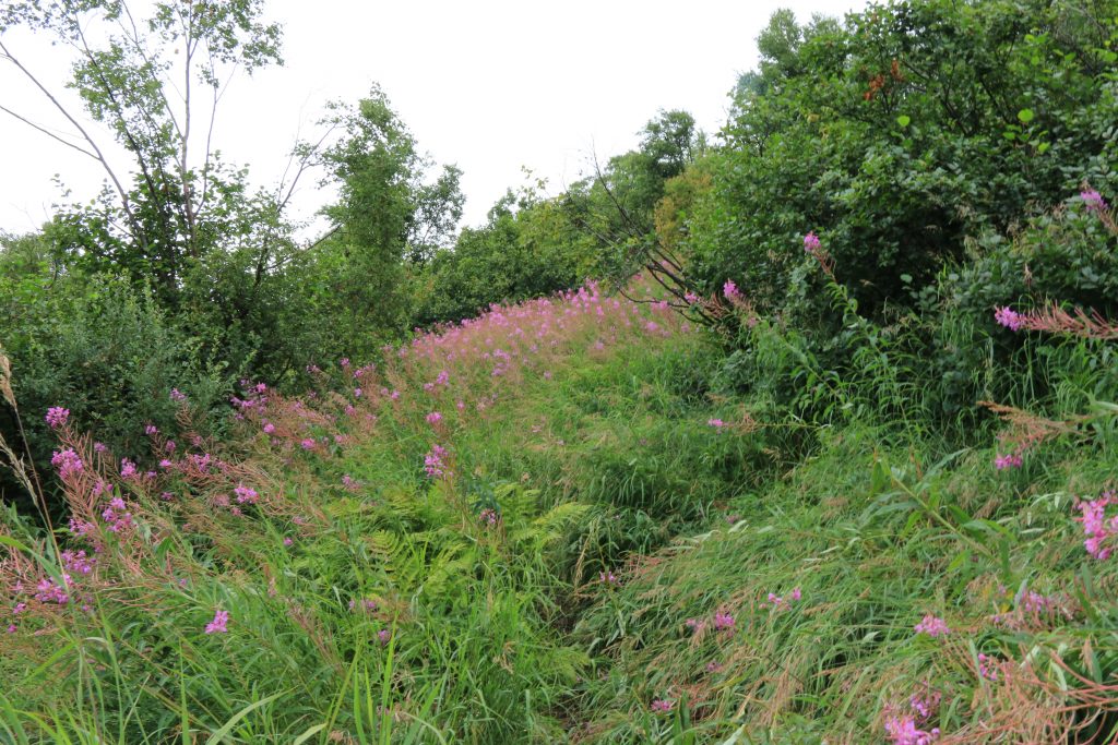
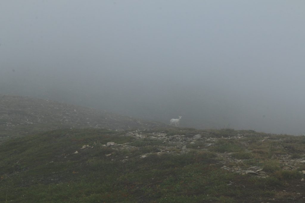
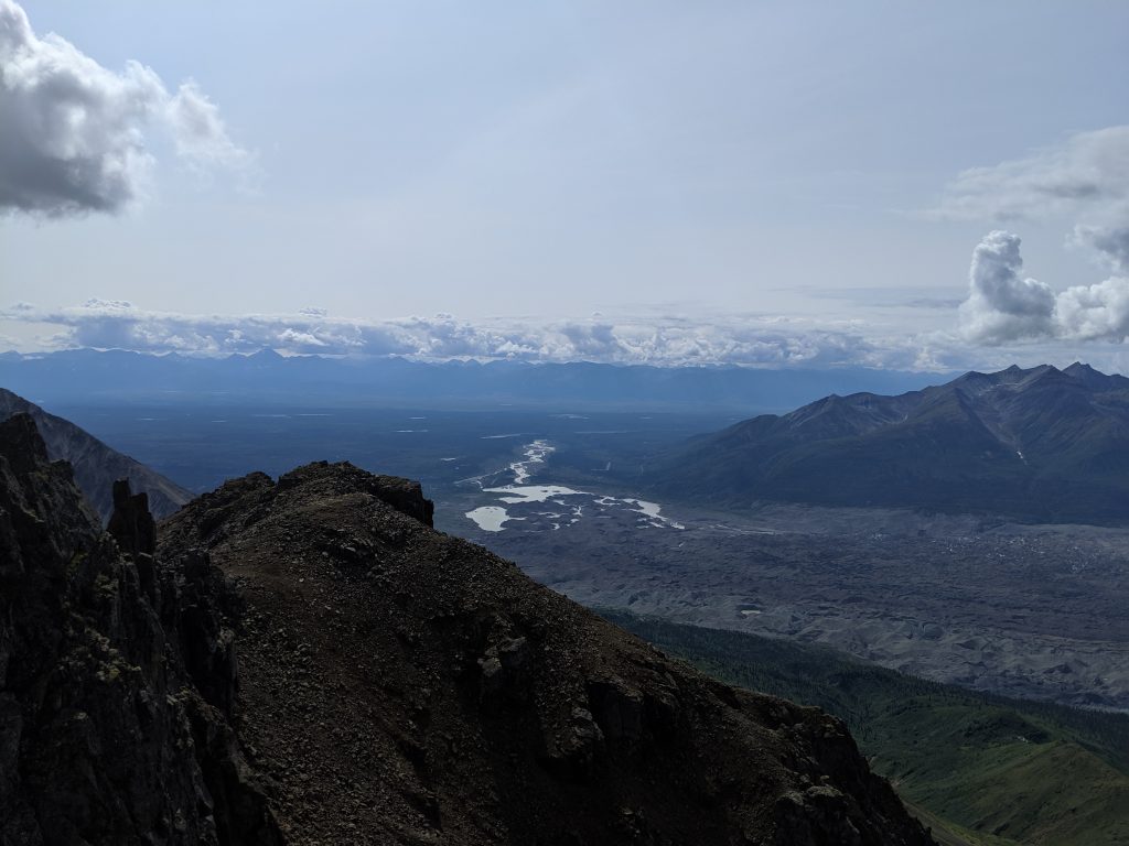
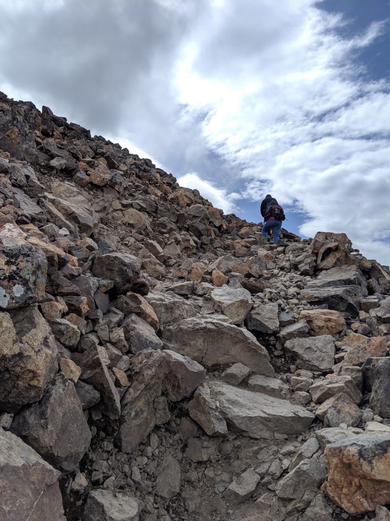
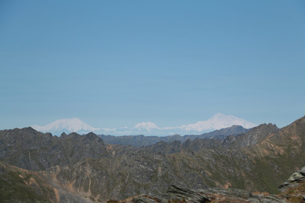
Heading back toward town, I looked up at the mountain, taunting me, and decided that I’d better have a go at it. When the trail split off between continuing back toward town and venturing right to the mountain, I turned right. I made it a bit past the steel pipe surrounded by rocks located along the ridge before being forced to turn back. At roughly 1.5hr in, locals told me I had only about 30 to the summit. Unfortunately, I was well into clouds at that point and couldn’t see more than 10ft in front of me. What really sealed the deal was when I accidentally snuck up on a momma sheep and her calf. I stopped to take a photo (duh), which I don’t think she liked, because suddenly she was running toward me. I then realized that, to my right, a male sheep– you know, the ones with horns!– was running in my direction but at a slightly upward angle. I couldn’t tell if I was witnessing a happy reunion between mom and pop or if the family was coming for me. So I decided that I had done my part. I was floored over and over again by the view along the way. I had some amazing photos to take home. I was winning. Why push my luck? I was also told that it was good I had turned around because the trail is easy to lose the further up you go, especially when in the cloud, and it gets very narrow near the top, so, best I not fall off!
A steep incline
Overgrown trail
Mountain goat in the cloud!
Tanalian Falls from up above!
The view from the pipeline
My feet were hurting so bad as I made my way down the mountain and back to Tulchina– an hour down the mountain and another 1.5hrs from the mountain to the campground. I was literally moaning outloud with each step. When I finally got back to my hut and was ready for bed at roughly 7:30pm, I attempted to journal– I was nodding off in between words! So I listened to my body and woke up with no alarm at 11am the next day. Smh– having gone directly from an evening shift to the airport and getting only a few naps on the flight in, I obviously needed it.
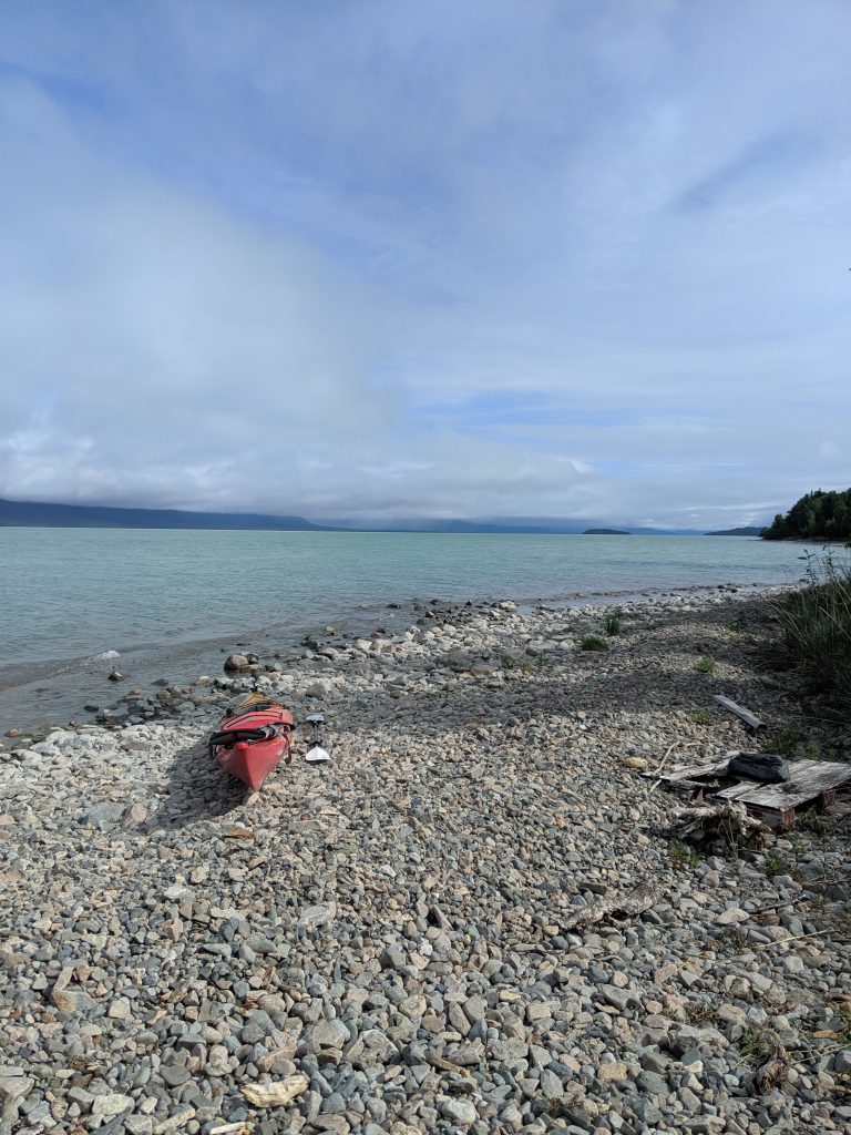
The next few days were relatively uneventful and that made it that much better. I attempted to kayak but only lasted an hour on the water as I was having a great attack the entire time that I might capsize. With so many boats and float planes coming and going and having little to no experience with wakes and it having finally rained overnight, I was beyond myself. I know my limits!
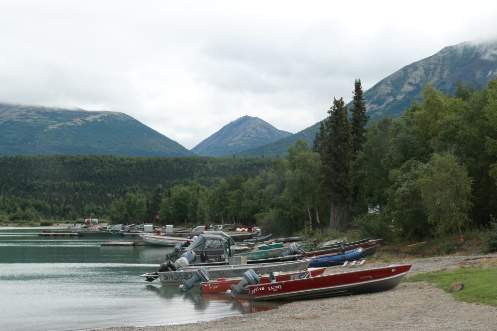
So I filled my free time finishing Pete Holmes’ “Comedy Sex God”, listening to Dan Harris podcast episodes, reading my Dharma books, meditating, and doing yoga. I hung out at the lake, bought coffee at the Cranberry Cache, and chatted frequently with the super nice ranger at the visitor center. I watched the planes come and go at the harbor. I relished in the fact that I had nowhere to be, that there was nothing on the calendar, and that nothing was expected of me. I could just be with amazing mountains in my foreground and the greenest-bluest lake at my feet.
Kayaking adventure
One of the few side roads in town
NPS
Cranberry Cache
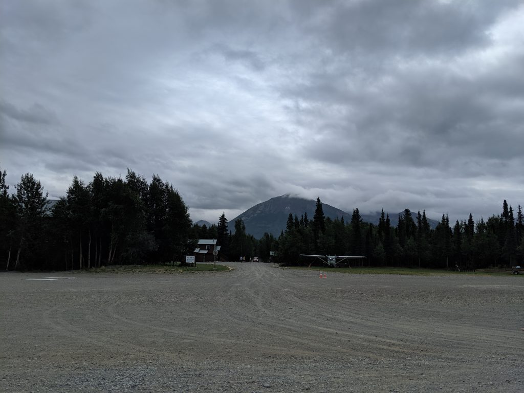
Port Alsworth harbor at the Lake Air airstrip
Tanalian Mountain from town
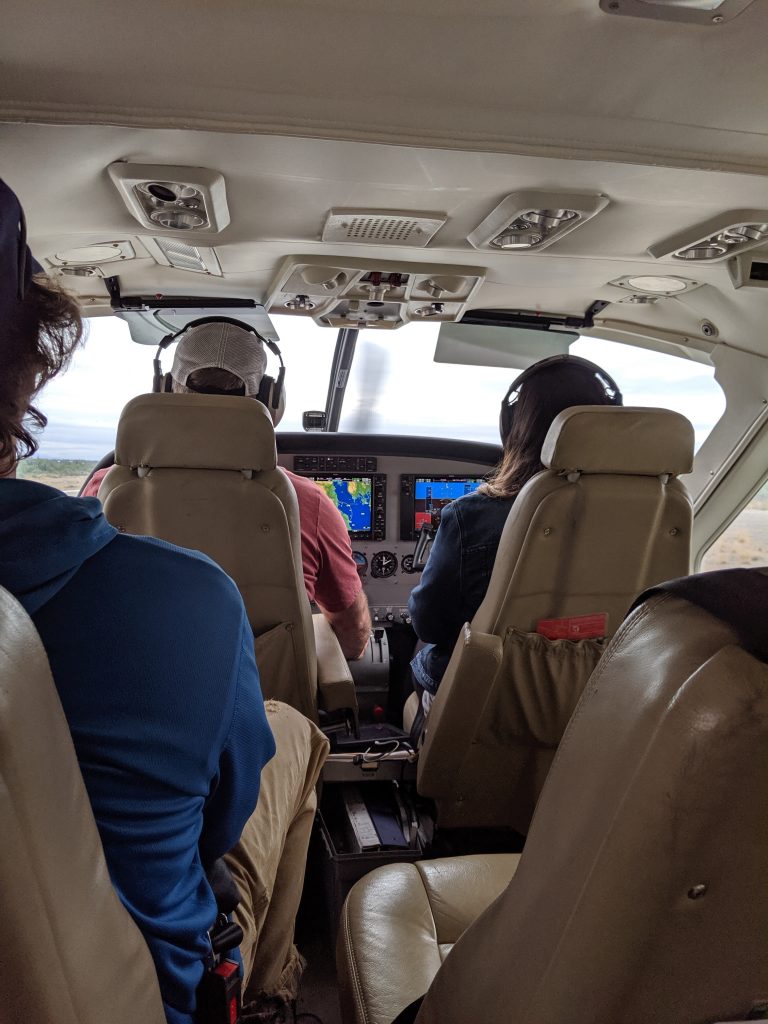
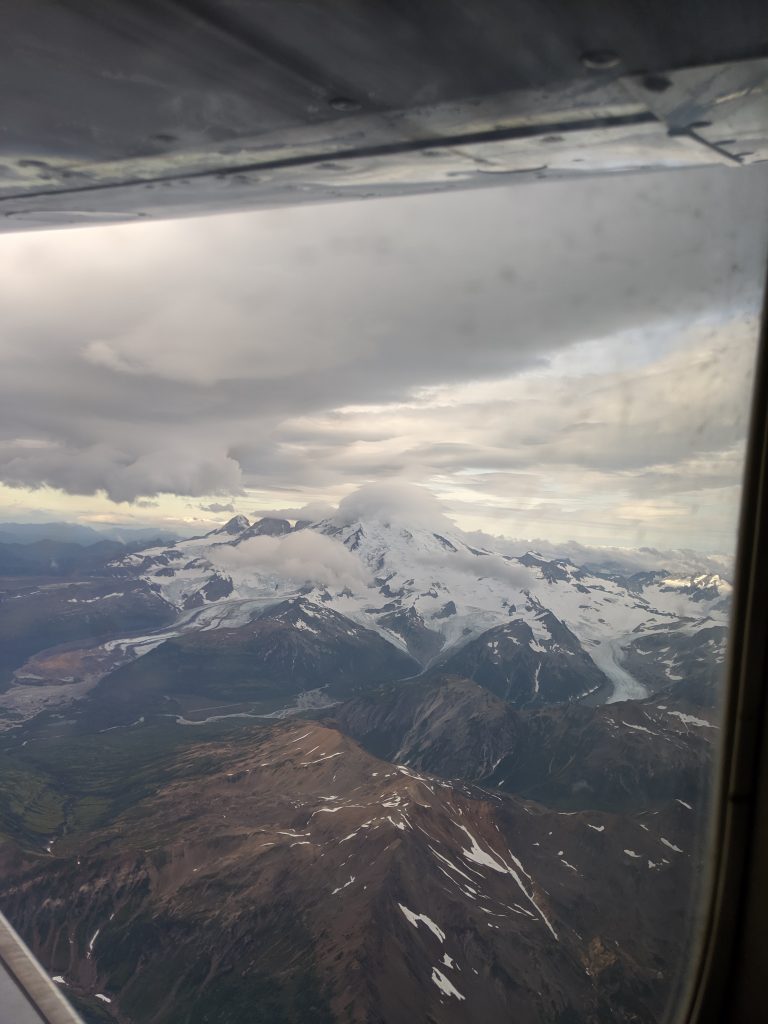
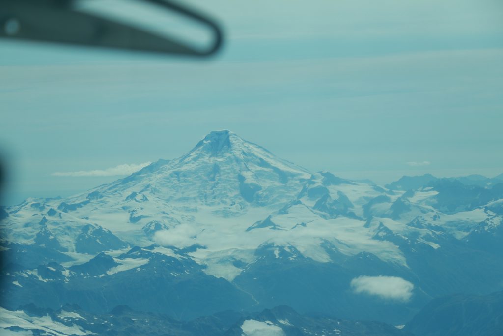
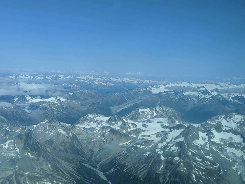
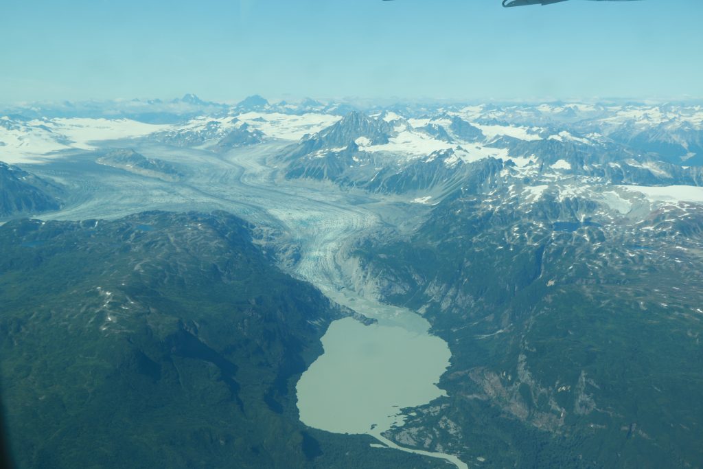
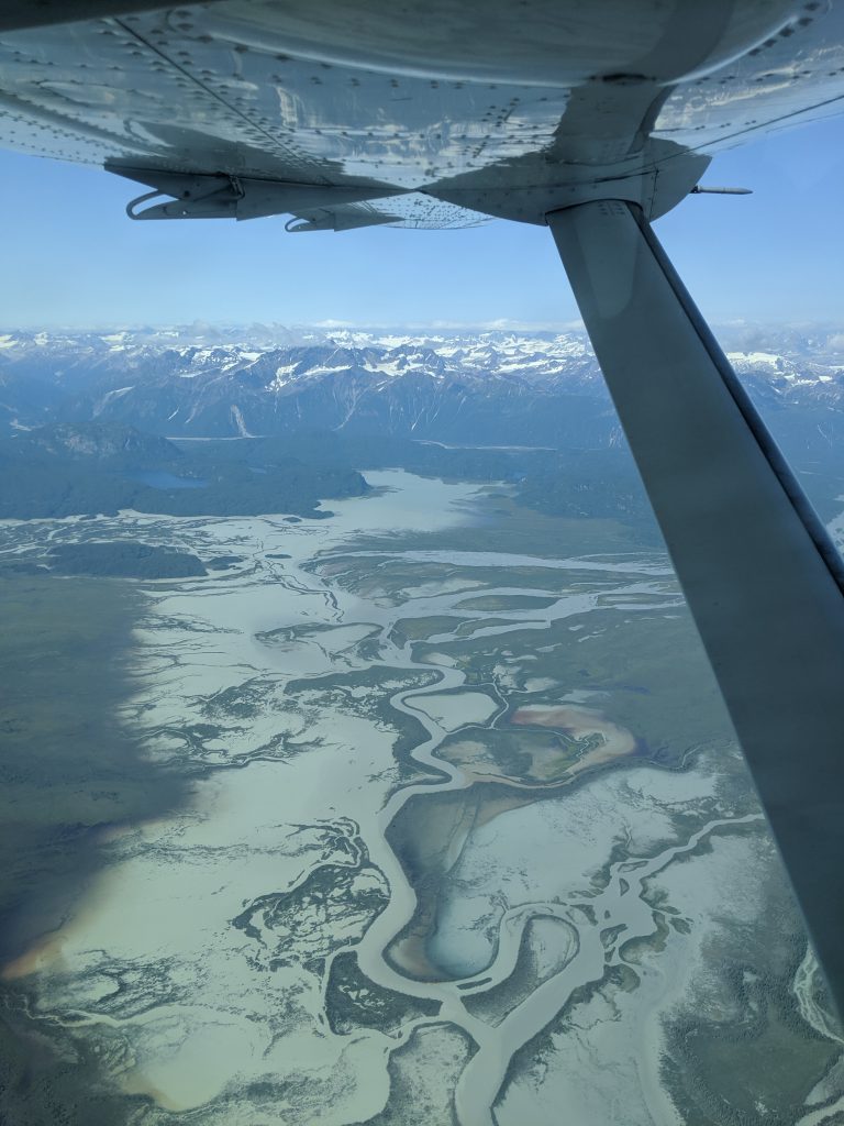
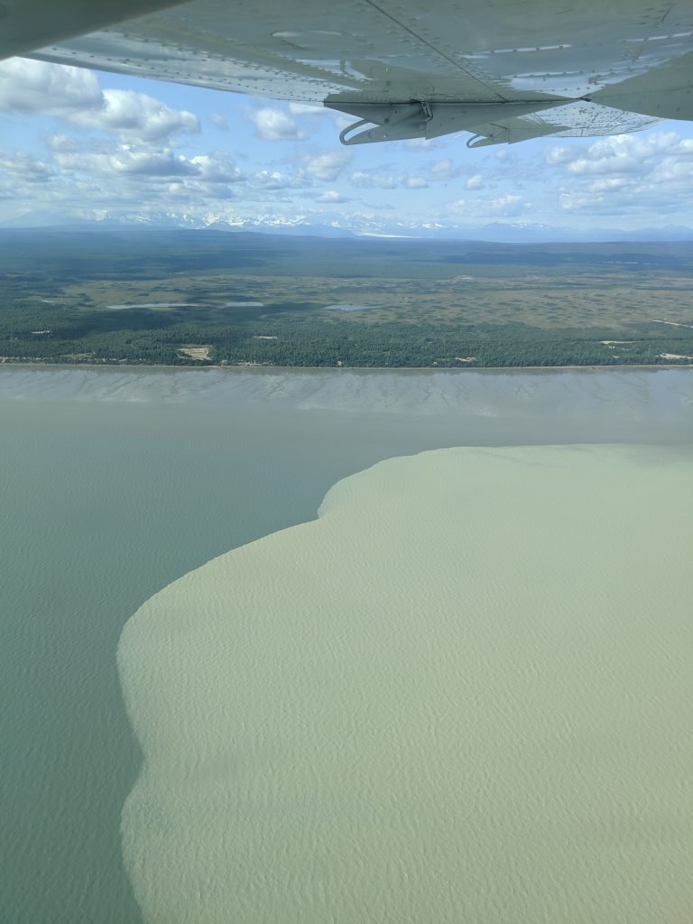
The flight between Anchorage and Port Alsworth, if direct, is about 1hr. And it is a spectacular one hour. Like getting a free sightseeing tour, the plane ventures over the Aleutian Mountain Range, passing over glacier after glacier, Mt. Redoubt, and the Gulf of Alaska. The trip was worth it for this alone. Alaska is a spectacular state with so much unknown to Lower 48ers like myself. What a privilege it was to explore so much of it. And with still a few more places to see, I know it will fall short of nothing less than #blessings.
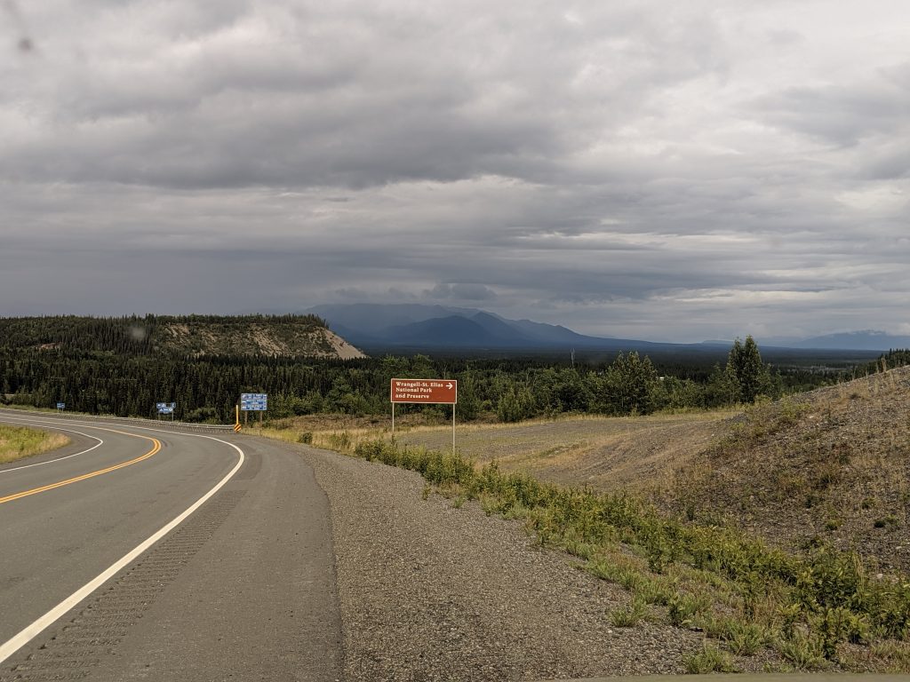
The Route: Anchorage-Nabesna Road-McCarthy
Road-Anchorage
Days: 4
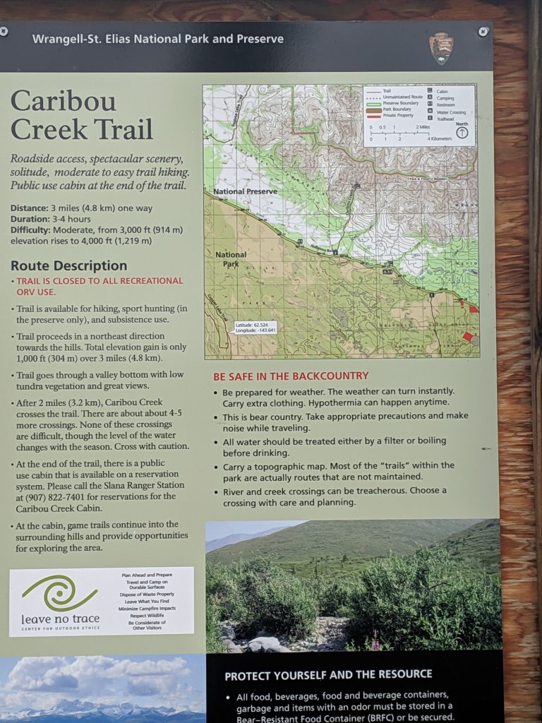
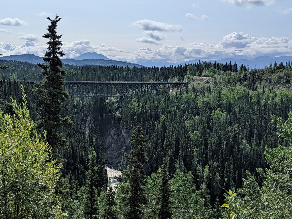
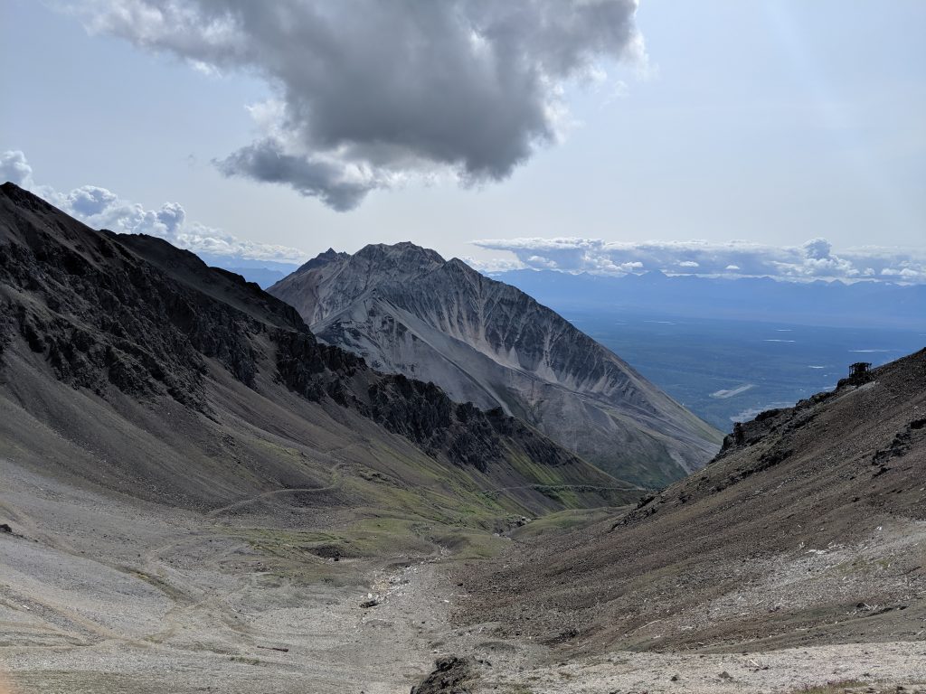
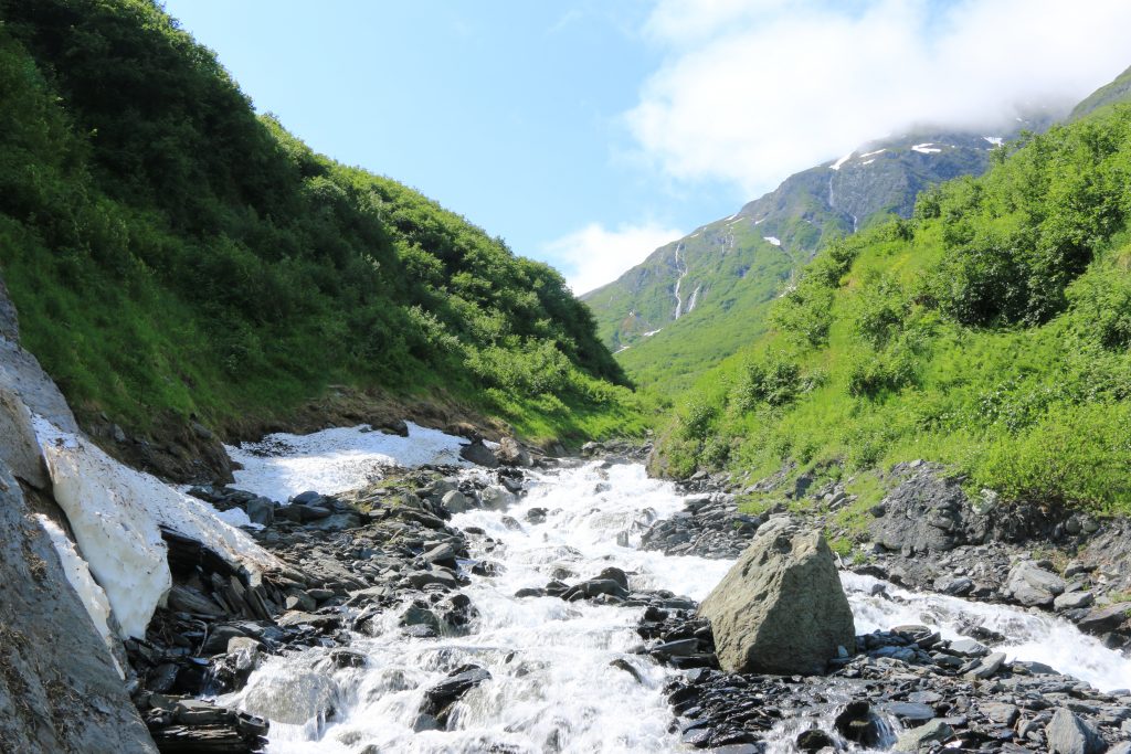
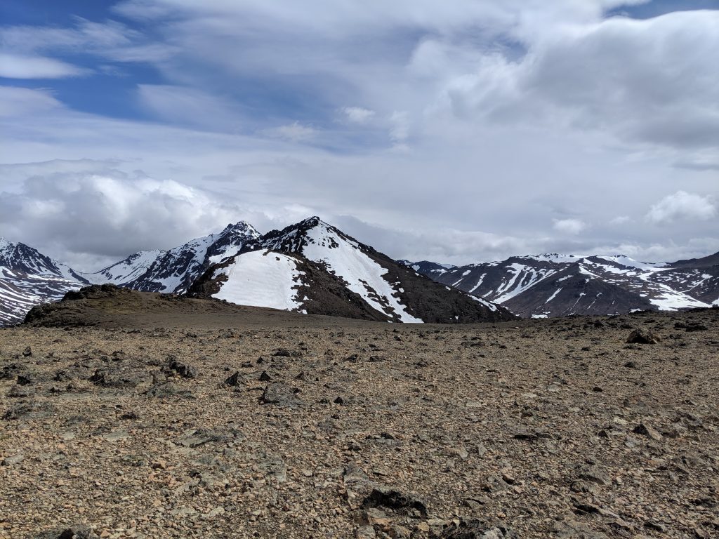
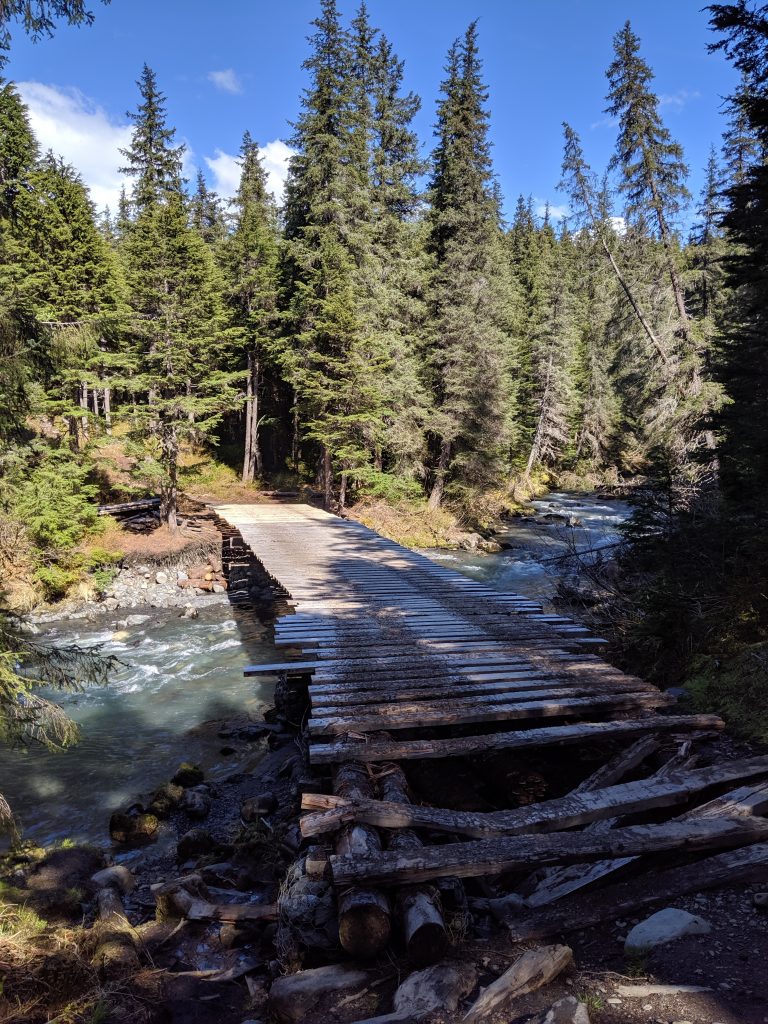
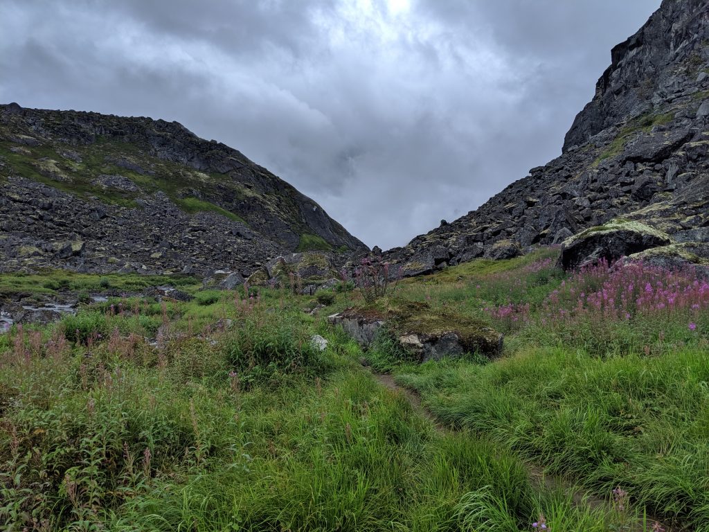
Getting to Wrangell-St Elias National Park from Anchorage is no small feet, no matter which way you enter. Though there is a visitor center roughly 3.5hrs from Anchorage near GlenAllen (turn right at the split and continue another 15minutes or so– entrance is on the left), the two main roads are Nabesna in the North and McCarthy in the center. I had my hopes set on two hikes in Nabesna: Caribou Creek and Skookum Volcano. I got washed out of the latter and couldn’t cross the waters required to reach it but, boy, am I glad it turned out that way!
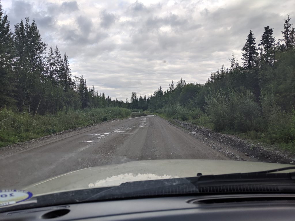
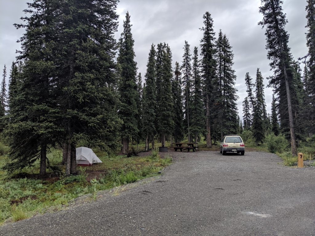
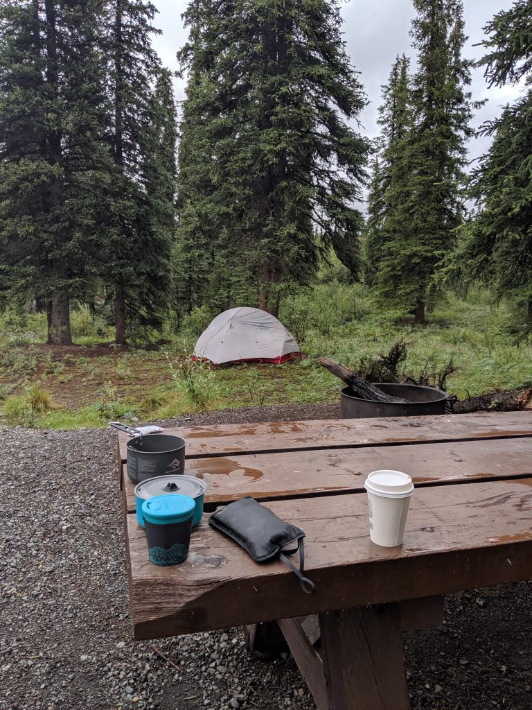
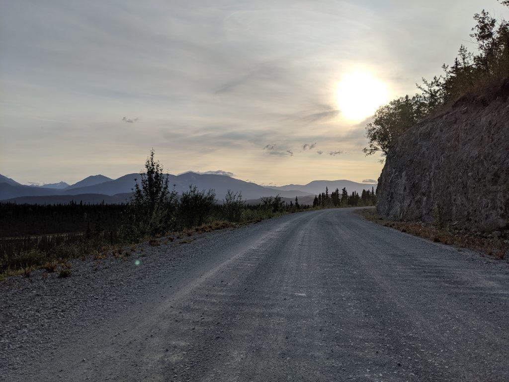
DAY 1: TRAVEL. A 5.5hrs drive from Anchorage to Nabesna. Despite prior weather reports, it rained half of the day on the way in and all throughout the night. Luckily I got a spot at the main Kendesnii Campground and found a small area beneath a tree where I could pitch my tent and get a small amount of reprieve. The Nabesna Road is full of potholes and it was slow going, so I didn’t finish setting up my tent and getting ready for bed until roughly 10pm. With just enough light to see and the rain letting up a bit, everything fell into place and my eyes were closed before I knew it.
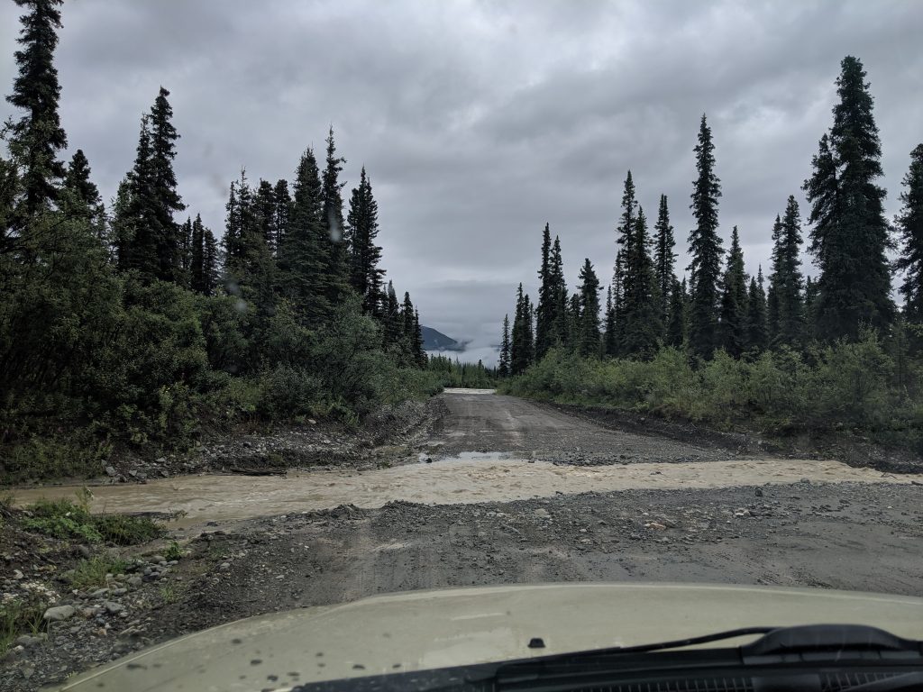
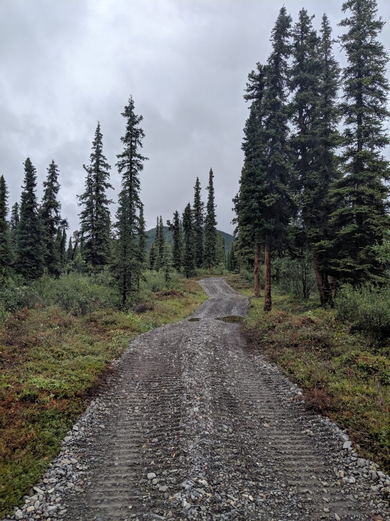
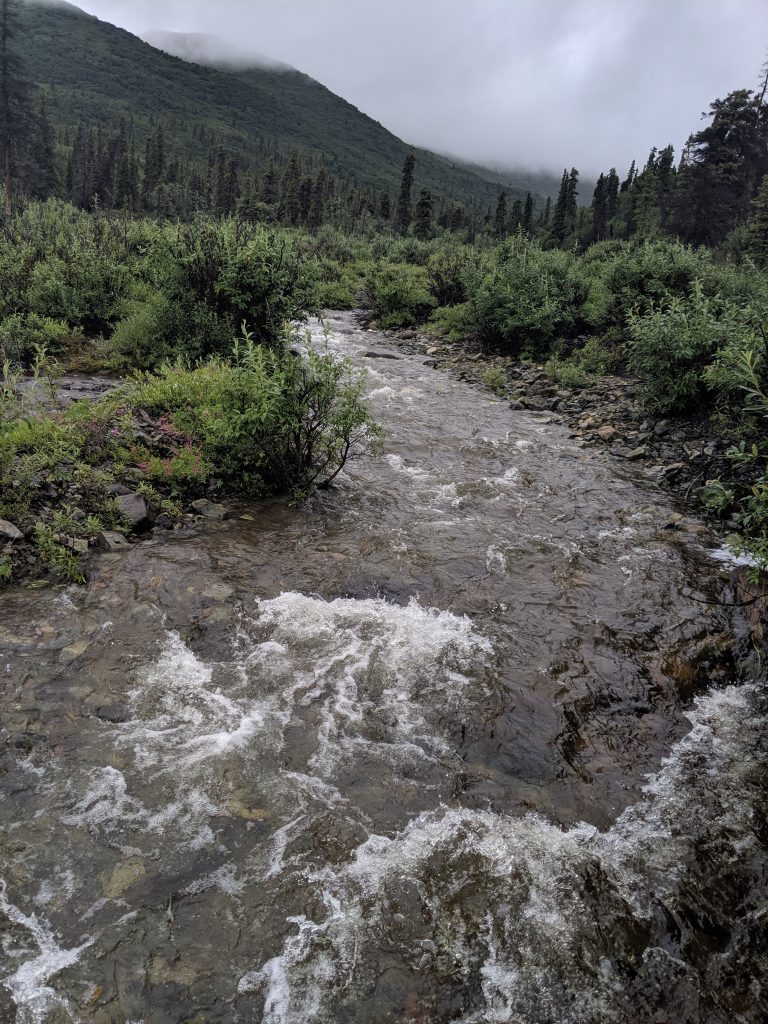
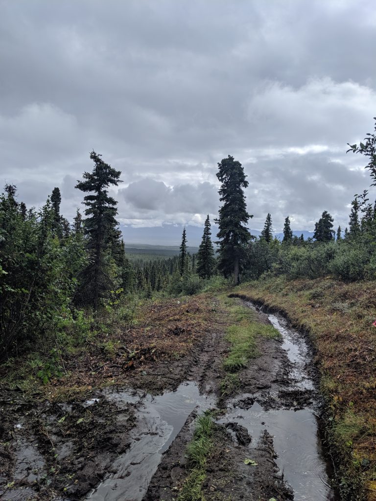
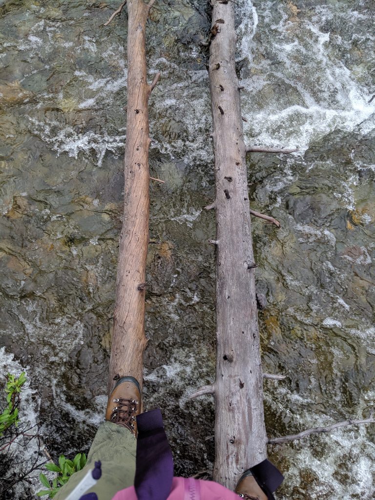
DAY 2: HIKING. I was so excited to wake up that morning to tackle those two hikes. From looking at the AllTrails app, it appeared that I could do both in the same day if the road conditions were good enough. Out of the campgrounds I turned to the right and drove approximately 10 minutes before encountering my first stream. There was no way through it. The rain had made the current so strong and the water so high, that I couldn’t see how deep it was or where it was shallow and safe for my car to pass. I’m also driving a low to the ground, 2001, Subaru outback. Not exactly a high riding ATV! So, going against my heart but in alignment with my adult mind, I turned around and headed for the Caribou Creek trailhead instead. The road, with so many potholes, was long for even those few miles but, as luck would have it, the trail itself was open and manageable. It was roughly 30 minutes before I came to my first on-foot water crossing. And to my pleasure, after a little bit if hunting, I found two logs that had been placed across the stream by someone before me. I scrambled carefully across. I still got wet due to the little bit of bush whacking required to get back on the main path but the challenge of it was so exciting! The rest of the hike was a moderate uphill, relatively muddy, but with views that got better and better as I climbed. I knew that the trail ended at a cabin and the cabin soon came into site. Unfortunately, there was one more water crossing at which I could not find a way to keep my boots from getting wet so I decided that I’d better not cross. At just a few yards away from the end of the trail I consider myself successful! Going down was even more fun with the views easier to enjoy and the lay of the land before me. Within 3 hours I was back at the car. On my drive back to the campsite I couldn’t resisted going the extra 10 minutes past the campground to scope out that first vehicle-water crossing, just in case… And to my delight, because it hadn’t rained since last night, the water was significantly lower and slower. I could see where my car should drive! But, thinking better of it, I decided, again, not to attempt crossing because I had no cellphone service and no way of knowing if the rain would return. I recognized that, even if I made it the remaining 7miles to the Skookum Volcano trail, I had no way of knowing if I could make it back. So after much deliberation, I decided that maybe it was more worth driving to the other part of Wrangall-St Elias National Park instead of staying two more days in Nabesna where I was washed in. In the interest of time, I was cutting it close to do both sections of the largest national park in the United States (it’s 6x the sizes of Yellowstone!). So, having made the decision, I raced back to the campsite, got all my things in order, and rushed to bed for an early morning start.
The cabin is there in the distance!
That view, though!
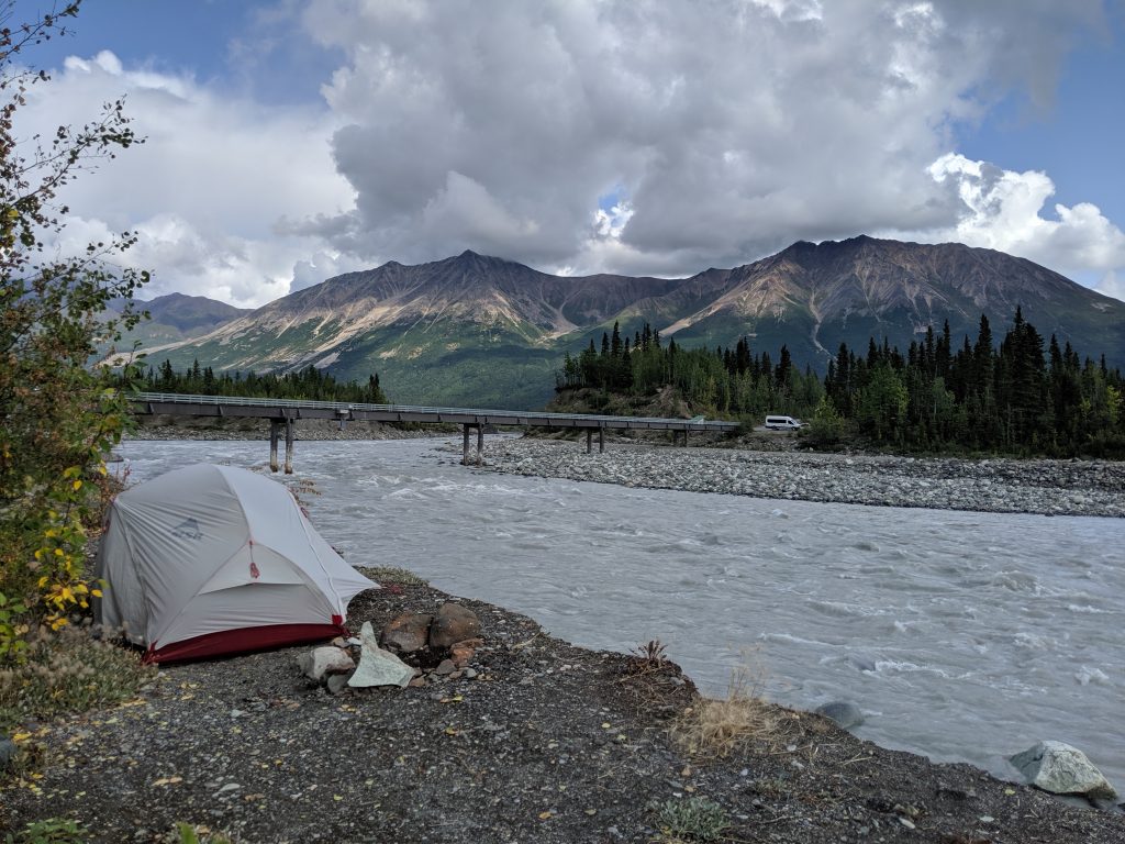
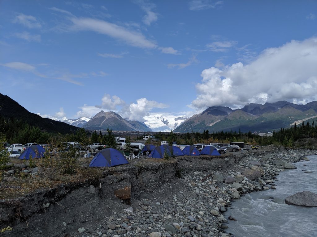
DAY 3: TRAVEL. I am so glad I made this decision! Hands down one of the best drives I’ve ever taken! Waking at 5am and on the road by 6, the sky was clear, the sun was rising, and the mountains were in full view and gorgeous the entirety of Nabesna Road back to the highway and all the way down the highway to the turn towards Chitna and McCarthy. One of the reasons why it took me roughly 8.5hours to get from the Kendesnii Campground to the Kennicott Basecamp outside of McCarthy is because I couldn’t stop myself from pulling over and taking pictures! I was beyond high. The hares on the side of the road were a delight, as well, and accompanied me my entire way to the basecamp. Breakfast shortly after Chitna on the side of the road with this (see below) as my foreground didn’t hurt either! McCarthy Road is equal, if not worse, to Nabesna Road with regard to potholes. For long stretches I was driving roughly 15 to 20 mph. It was a true practice in the Zen I don’t have! When I finally arrived it was 3:30pm. Not enough time to truly enjoy Kennicott before the several national park service exhibits closed at 5. So, instead, I made a reservation for the 9:30am Kennicott tour, bought a ticket for the shuttle from McCarthy to Kennicott at the main office building in McCarthy, enjoyed a hot beverage from a small shop and a salad from The Potato, and surveyed the rest of the small town before returning to basecamp. There, I pitched my tent right on the river ($25/night; $5 4hr parking; $10 all day parking), did yoga with the evening sun shining down on me, and settled in early.
Breakfast spot!
Glacier in our backyard
Camping on the river
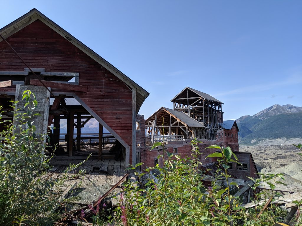
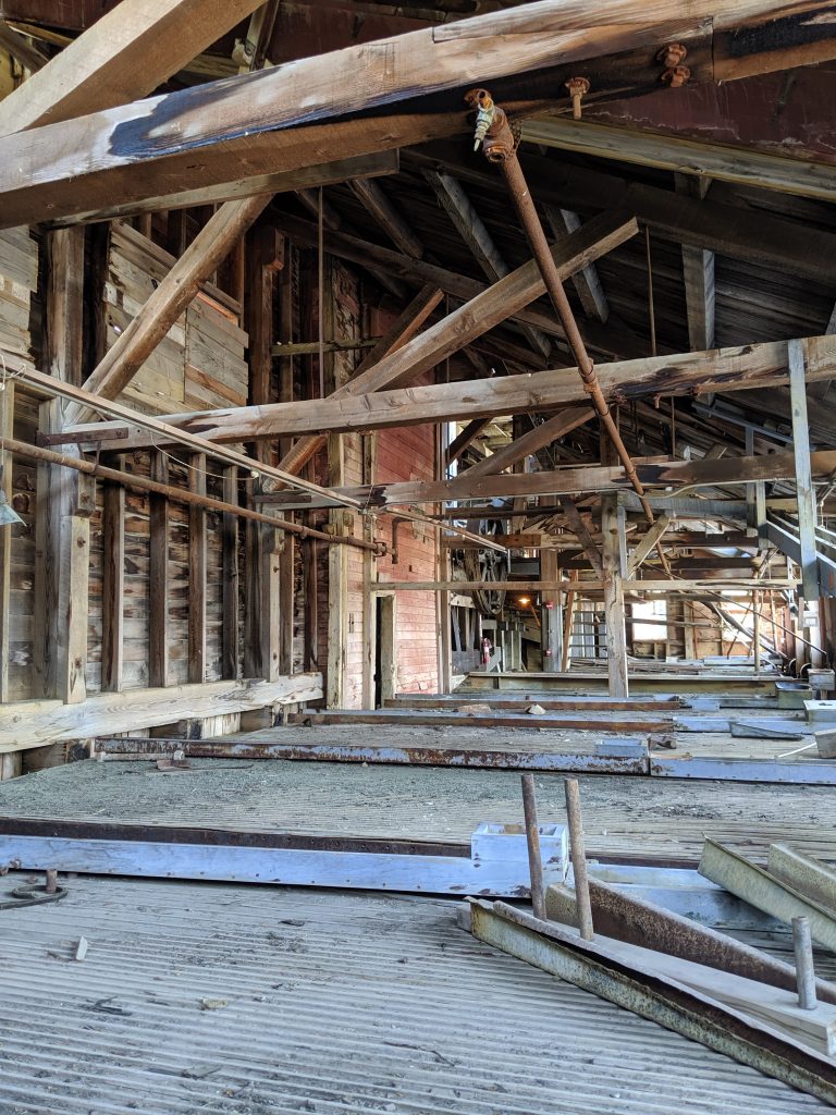
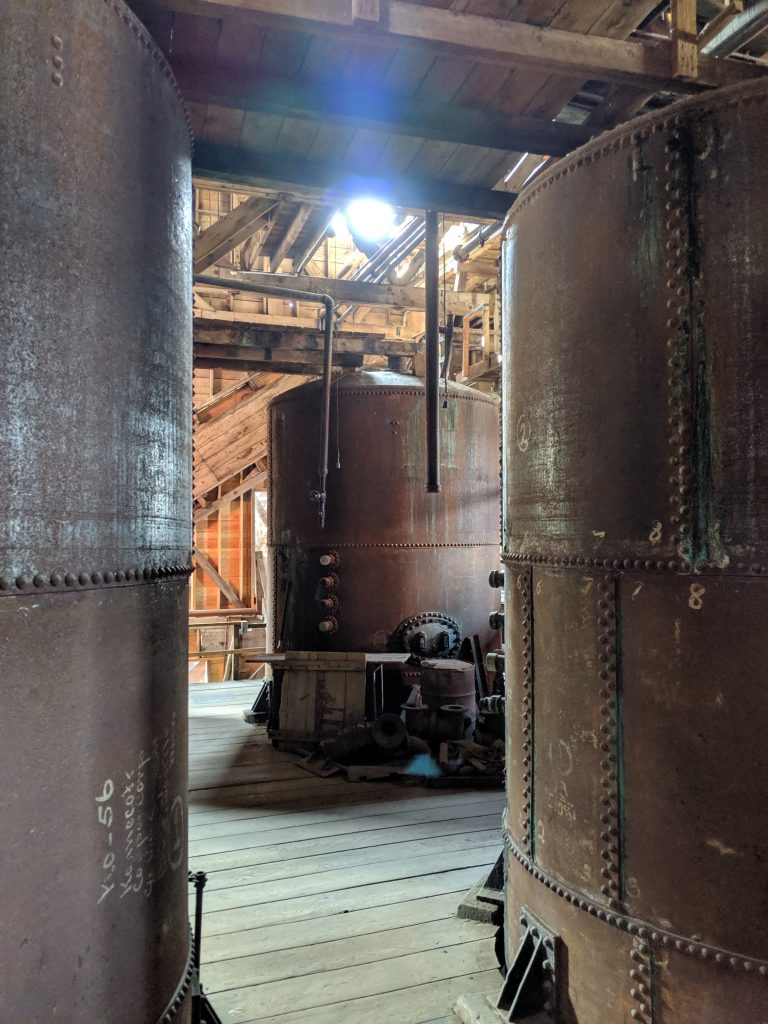
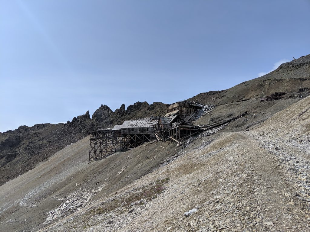
DAY 4: KENNICOTT. Poking my head out of my tent at 5am rewarded me with a sunrise behind Kennicott glacier located behind the campsite. I always love waking for a sunrise. Gaining a little bit more sleep, I was able to wake at 7am, pack my belongings, prepare breakfast and lunch, and make it to the 9am shuttle with seconds to spare. The day just went too splendidly! The 2.5hr walking tour involved going through the old copper mine and learning what it was like in the early 1900s when fully up and running. Our guide was extensive in her knowledge and fun to be around. The coolest part for me was learning how advanced the hospital was– partly to encourage men from around the country to work for 6months straight in the mine or the mill, they decided to use state of the art equipment as incentive. Turns out that Kennicott was the first hospital in all of Alaska to have an x-ray machine! I took more than enough photos of every piece of lingering machinery, in awe of the physical history just left behind once most of the copper had been mined and the mill was shut down.
Kennicott Mill
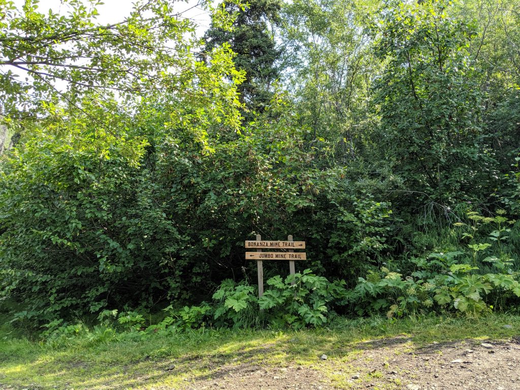
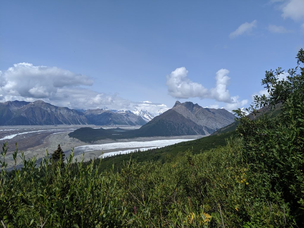
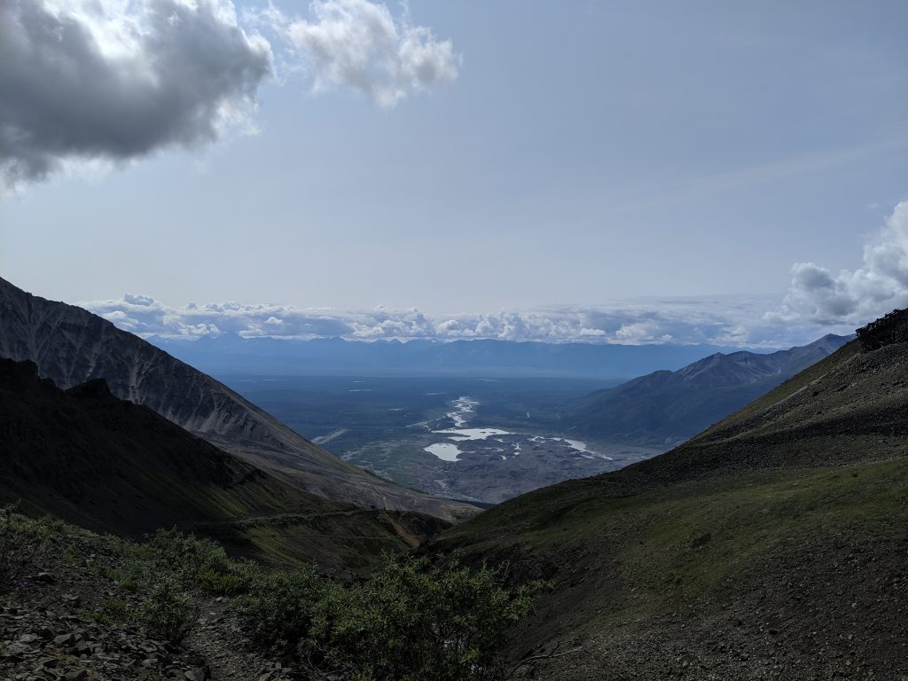
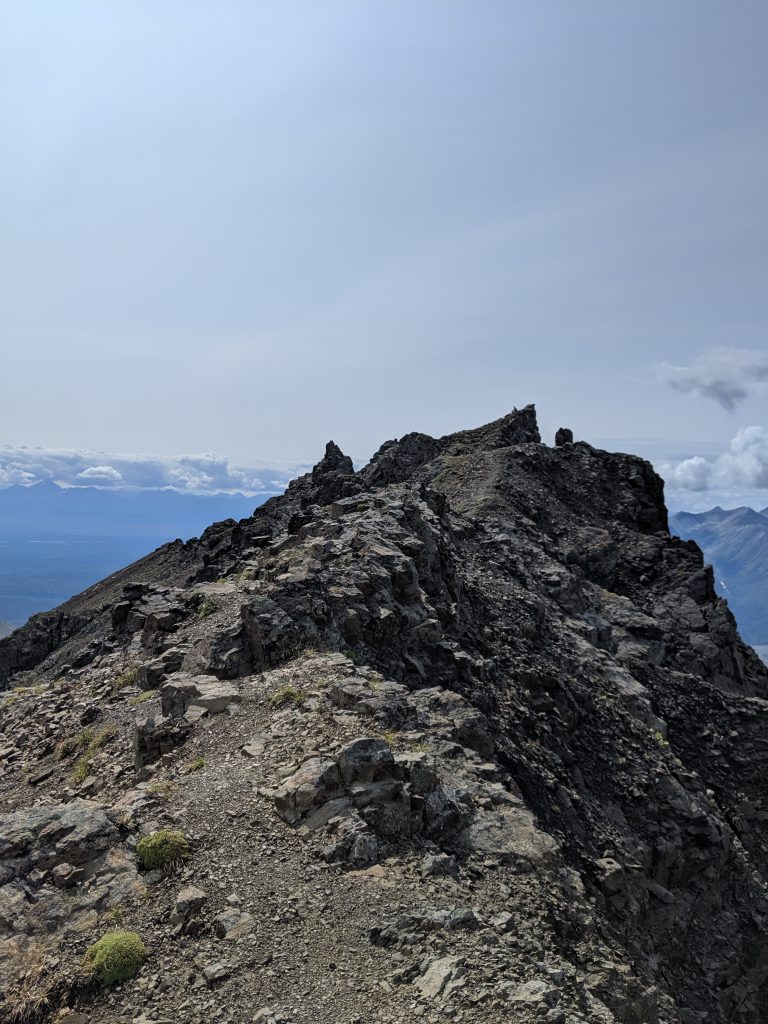
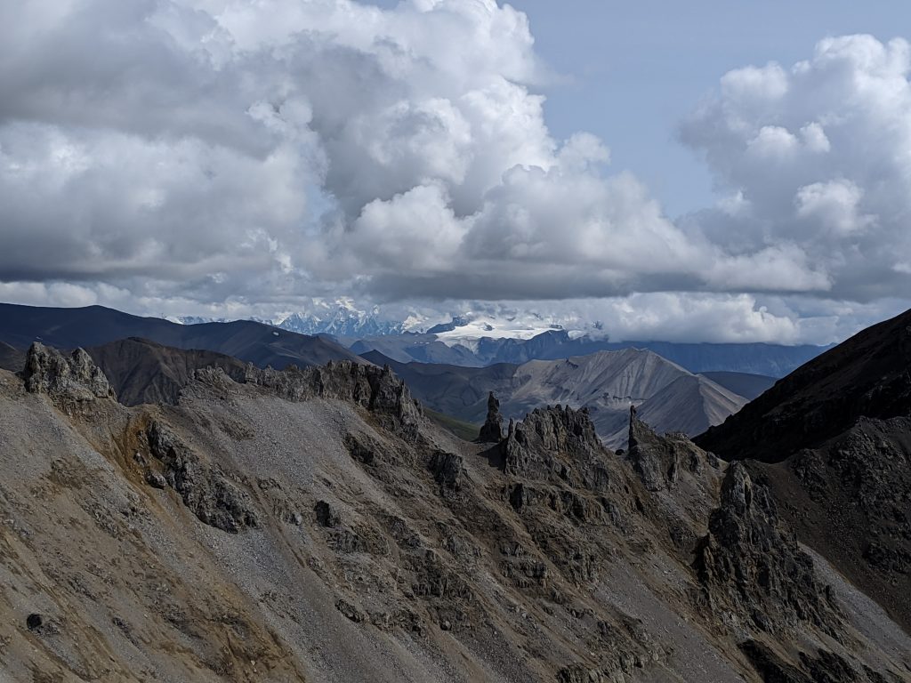
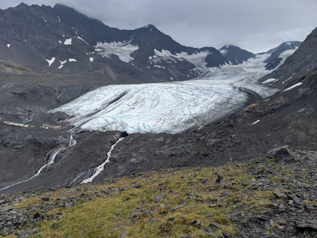
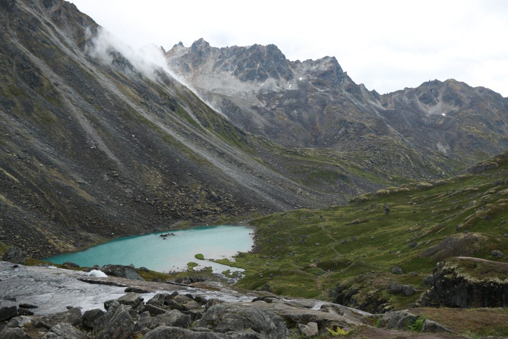
Next, on a whim, I decided to hike Bonanza Mine Trail. I had no idea what I was up against! 3.5hours roundtrip, it took me roughly 2-2.5hrs of straight incline to the ridge that is just past the ruins of one of the old mines and 1hr to essentially fly down. It was no joke. Though the first 1.5hrs was not technically challenging as it is a wide gravel road with pitch-offs to houses owned by locals, the remainder of the trail turns into a narrow foot-path just after the first piece of ruins (I think part of the old tram system that would bring copper and limestone down from the mine and into the mill) and increases in incline. The trail ends at the main ruins but one can partake in a very steep scramble up small rocks to the ridge for a spectacular view of what you just climbed as well as Mt. Blackburn, the valley, and Root Glacier on the other side. It is well worth the scramble but be ready to slide back a few times and to use your hands to grip onto larger rocks to get there. I didn’t want to come down.
The trail splits with Jumbo a short way in.
Glacier!
The view from the valley
That final 20min…
Bonanza Mine Ruins
The valley between
The peak
Glacier!
But eventually I had to make my way back to Anchorage. After one more meal in McCarthy, I finally got myself to walk the 3/4 mile back to basecamp (10-15min; minimal incline) and drive back to Anchorage. After 10 moose sightings and several breath-taking sunset stops along the way, I was finally back in Anchorage at 2am and exhausted. I knew this park was going to be fun but I had no idea that it would be this amazing and this beautiful. I would definitely visit again. I’m even tempted to become a local myself– but something must be done about those roads! 😋
The Route: Katmai National Park- Brooks Falls and The Valley of 10,000 Smokes Days: 2
Getting There:
Ravn Alaska airlines – $608/person after fees/taxes for roundtrip flight Anchorage to King Salmon.
Katmai Water Taxi – $195/person roundtrip King Salmon to Brooks Camp. Found it easier to book over the phone as online doesn’t clearly tell if return water taxi is available or not until after you’ve already booked the first way of the trip to Brooks Camp and paid the total fee for both departure and return.
A staff member of Katmi Water Taxi will greet you at the airport and shuttle you to the Gold Creek Lodge. This is a stunning lodge that offers dining and lounging along with private cabanas and a dock for wildlife viewing. A great option for those unable to stay or not wishing to stay in Brooks Lodge as packages can include the water taxi to and from Brooks Camp each day. https://www.alaskasgoldcreeklodge.com/
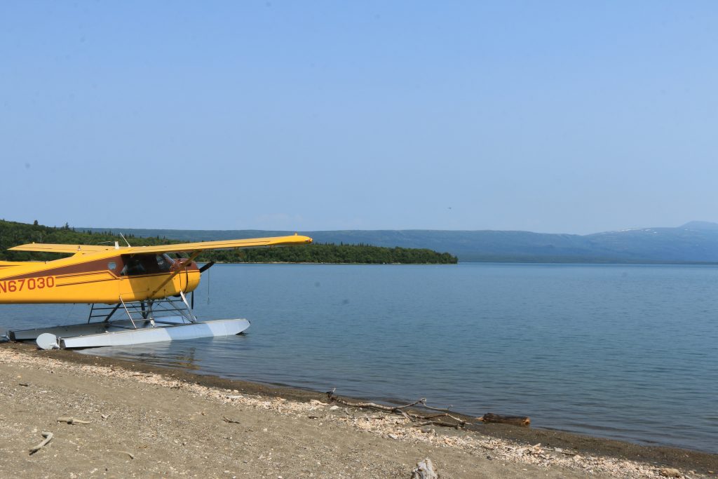
Float planes are also available through Katmailand for roughly $240/person. I found the float planes to be less convenient due to lower weight capacities and unable to fly in poor weather.
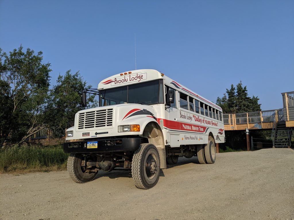
Katmailand – packages are also available through Katmailand as well. A one-day Brooks Falls only trip from Anchorage is $895. This includes lunch/dinner at Brooks Lodge and discounts on items in the gift shop but it doesn’t permit one time to hike within the park or go on the Valley of 10,000 Smokes tour. There don’t appear to be packaged options for those want two days in the park to do both the Valley tour and the Falls. http://www.katmailand.com/packages/daytrip-from-anchorage-to-brooks-lodge
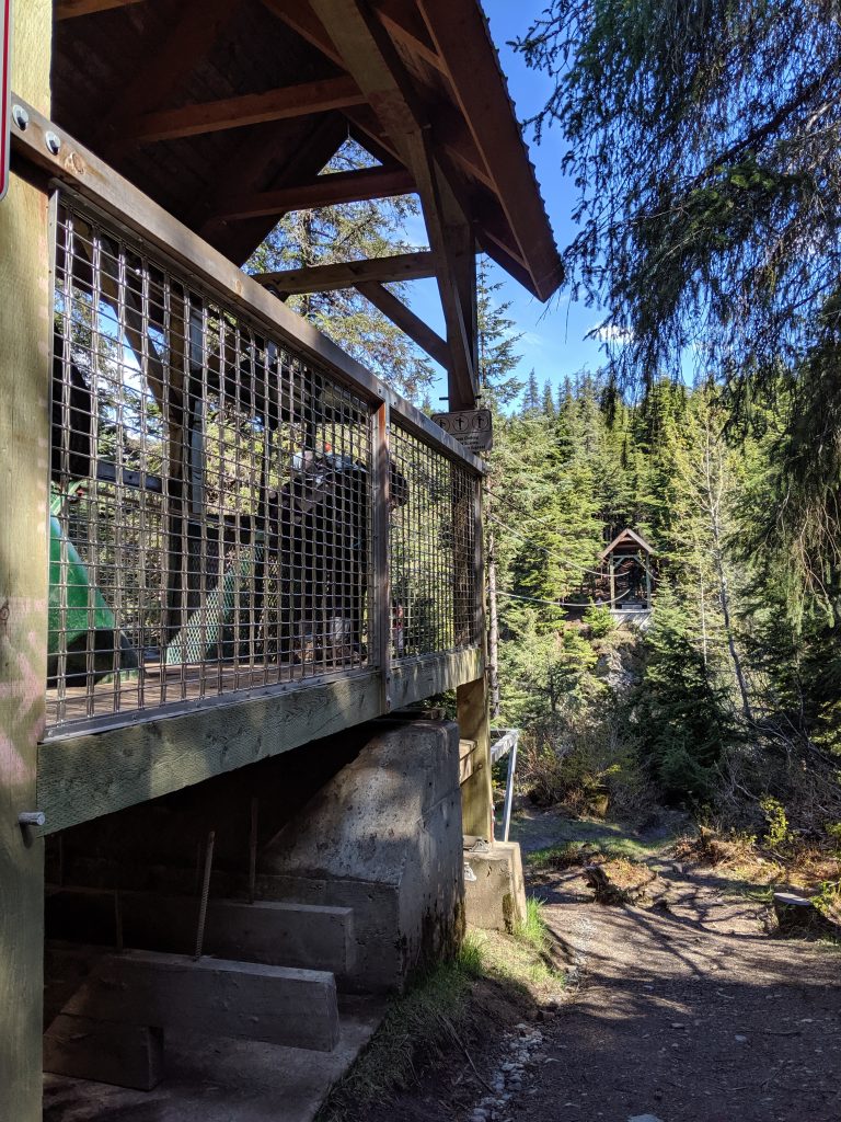
The Visitor Center:
This is your first stop after the water taxi or float plane drops you on the beach. Put you gear in the gear cache and food in the food cache, both located on the right after walking up from the beach, and then go into the visitor center building on the left. Bathrooms are on the opposite side of the caches on the right.
Park rangers are stationed at the entrance and watching as people get off of the water and float taxis to shepherd you to the visitor center. You can’t enter the remainder of the park without attending the bear aware talk/video given at the visitor center. Don’t lose the pin you get at the end of the talk– they’ll make you attend the talk again!
Main bear-aware take-aways:
No food allowed anywhere except designated areas. Don’t allow bears to associate humans with food!
Don’t leave your belongings unattended. Don’t allow bears to associate humans with toys. They really are that smart!
Remain 50yards away at all times. This may mean that you have to turn around and try the trail again later. This may mean stepping to the side off of the trail and letting a bear pass if rounding a corner and accidentally coming close to a bear.
Never run! This ignites the instinct for the bear to chase you. Just stop and step to the side or start inching backwards and wait to see what the bear does. If anything, make yourself bigger to appear more threatening.
Hike in groups as bears find multiple people more threatening than one and will more-likely walk away than attack if startled.
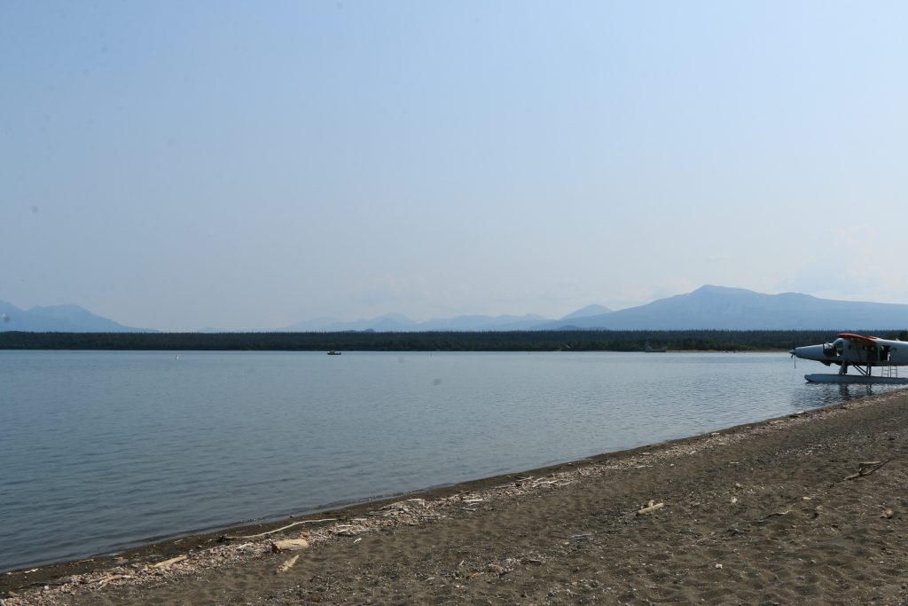
Where you land…
…and adventure begins!
Things to Do:
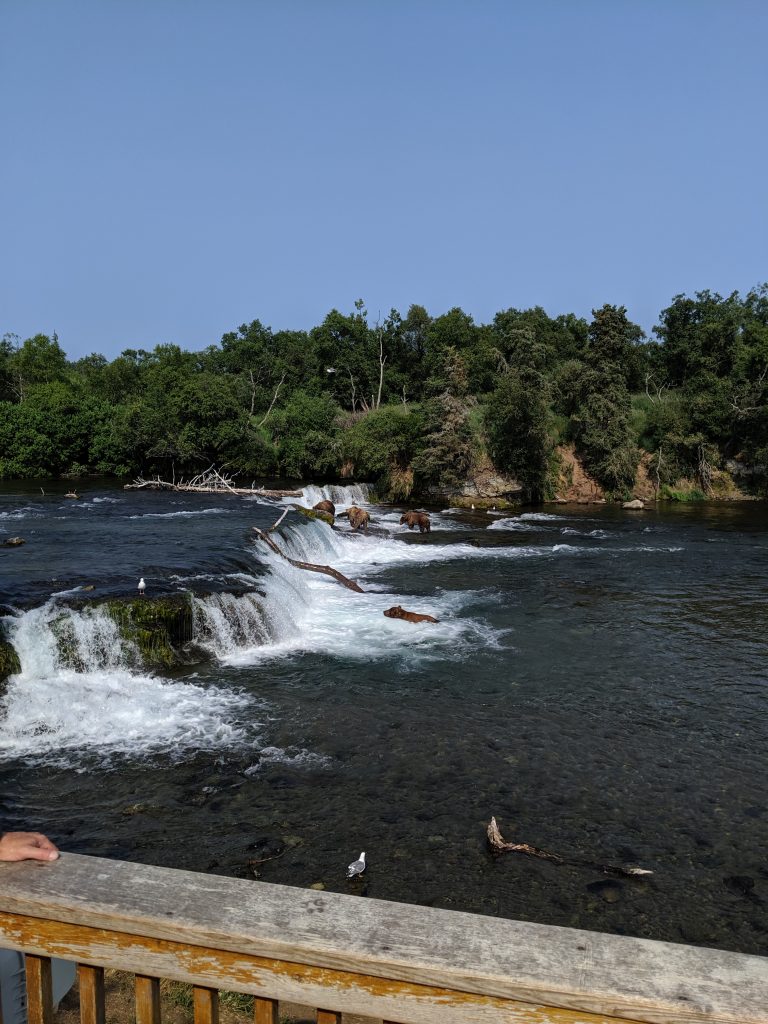
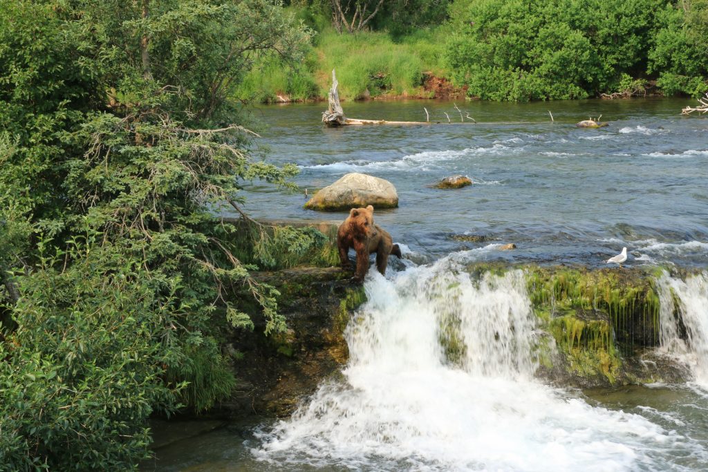
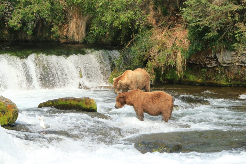
Brooks Falls – bear viewing deck is free; 1hr viewing limit per person regulated by park rangers
Roughly 20-25min walk from visitor center to platform. 15-20min from Brooks Lodge to platform. Keep curving right whenever faced with a fork. You’ll come upon a sign on the right that will tell you to take the trail on the right after about 5min. All are well-maintained, wide dirt paths.
Note: the walk is long not because of distance but because of bear-aware practices. Don’t walk quickly! You honestly might encounter a bear and/or a mom with cubs crossing the path or in the treeline next to the path. Keep 50yards away. Plan for “bear jams” as you wait to safely continue on the path.
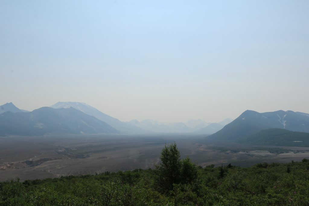
Valley of 10,000 smokes tour – daily 9am-4:30pm. $88/person without lunch and $96/person with lunch (vegan option available). Purchase through Katmailand (aka Bristol Adventures)
Drive a few hours with a park ranger who tells you the history of the Valley of 10,000 smokes and how it was this location that got President Eisenhower to Katmai into a national monument.
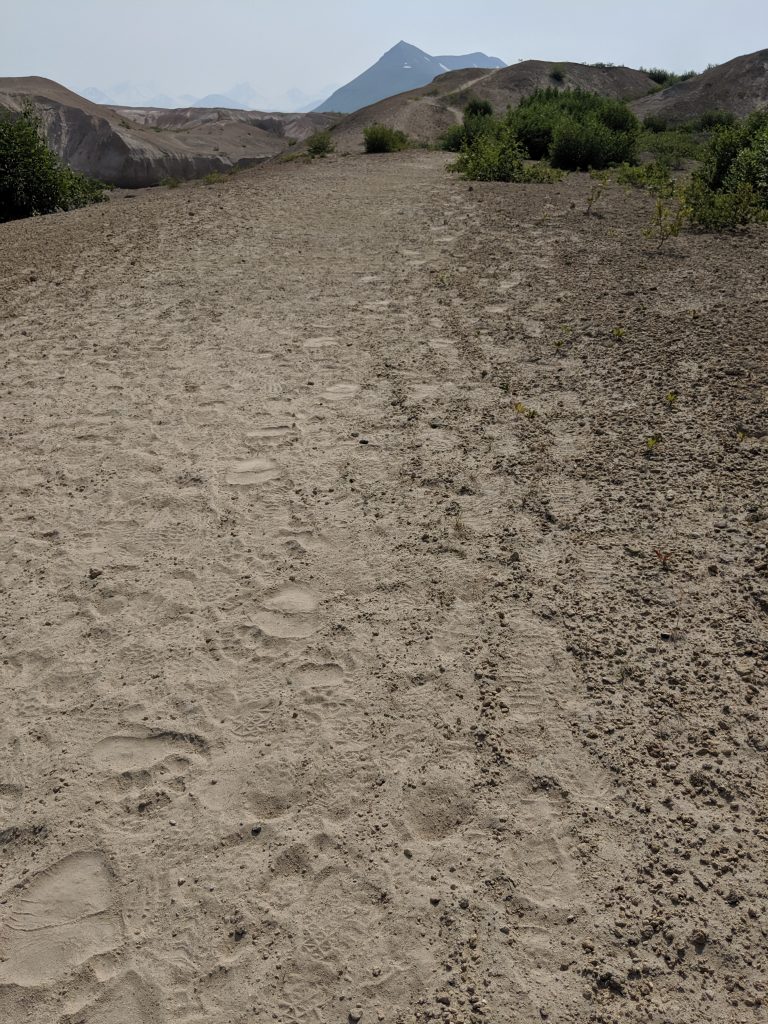
Optional 3-hour round trip hike down to the valley itself. Amazing and well-worth it. Beautiful sight to see. Try to spot bear or lynx tracks along the way! Possible to do on your own without the ranger if you want to explore more paths or move more quickly than the rest of the group. http://www.katmailand.com/valley-10000-smokes
The valley from visitor center
Bear prints!
Down in the Valley
3 Rivers Collide
Fireweed!
Fishing – though I didn’t do this on my trip, several people that I met were going on guided and unguided fishing trips. Some just waded into the water next to the walking bridge that starts the trip to Brooks Falls. The cool thing about this activity is that you could find yourself fishing right next to bears who are fishing themselves. Remember to maintain those 50yards away and be ready to break your line and/or wade out as needed!
Dumpling Mountain – 4mi to the summit; 8mi roundtrip. 1.5mi to the first overlook. This first overlook is beautiful and enough. Venture to the summit if you have time or a broader view of the water and landscape. https://www.hikingproject.com/trail/7044247/dumpling-mountain-trail
Narrow path; overgrown
Vista from the Overlooks #1
Vista from the Overlooks #2
Places to Stay:
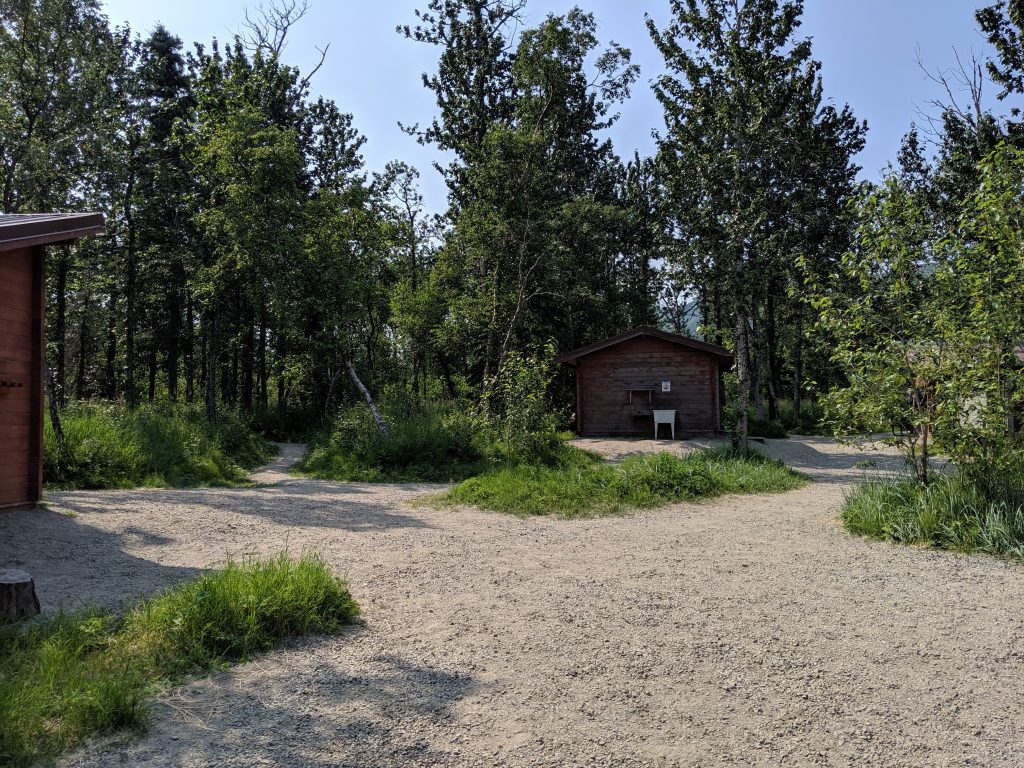
Brooks Camp – $18/person, entrance fee included
Food and gear caches
Designated eating sites
RULES:
Not allowed to bring anything food related except plain water while outside of designated eating areas
Cannot fly with bear spray or buy onsite
Cannot fly with fuel, lighters, or lithium batteries; these you can rent onsite
Can rent bear canisters onsite
Can buy food water onsite & Brooks Lodge
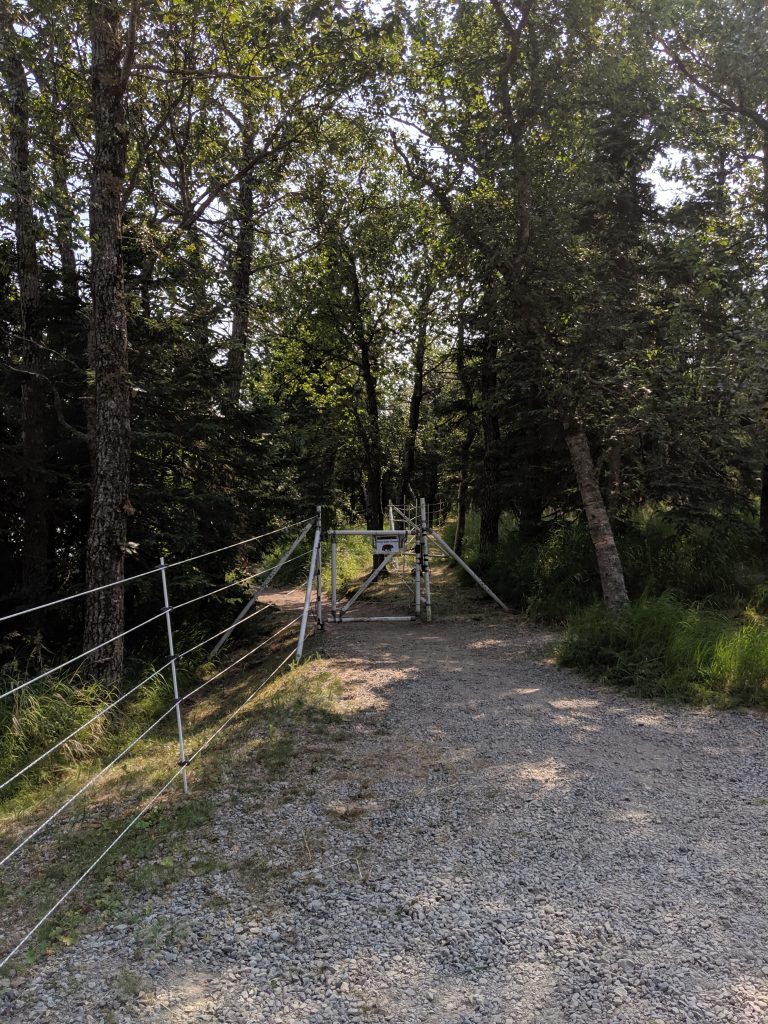
Keep electric fence gates closed at all times to attempt to keep bears out of the campsite.
Electric Fence
2 Cubs
Don’t get too close!
Mama bear
Brooks Lodge
Lodging — details can be found on the website.
Buffet Restaurant
Breakfast Buffet $17
Continental Breakfast $12
Lunch Buffet $24
Lunch Soup & Salad only $18
Dinner Buffett $40
Linch Soup & Salad only $20
Coffee, tea, bread, and dessert included in each option listed above
Entrance to Brooks Lodge
Backcountry camping
As long as your tent is set up outside of a 1.5mi radius of the campground and lodge, you’re golden.
My Personal Experience:
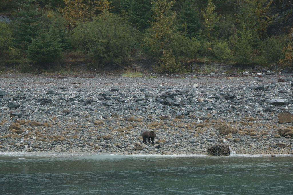
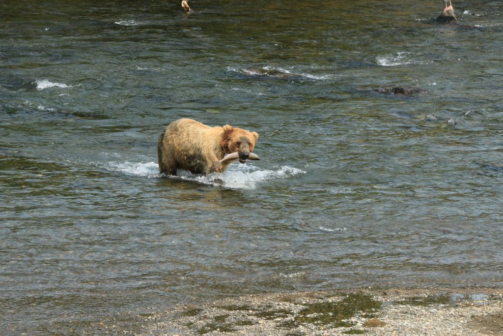
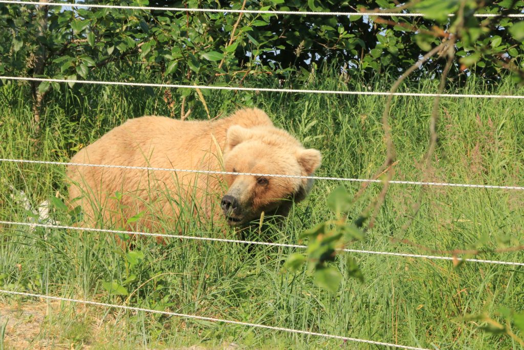
Saw a mom and her three cubs on the beach while walking to Brooks Campground right after finishing the bear-aware talk. They weren’t kidding about bears being everywhere!
Very little bear activity at Brooks Falls platform itself due to unusually high temperatures over the last few weeks in Alaska.
A woman almost fainted from a mixture of low blood sugar and heat while at Brooks Falls and had to be wheel-chaired out.
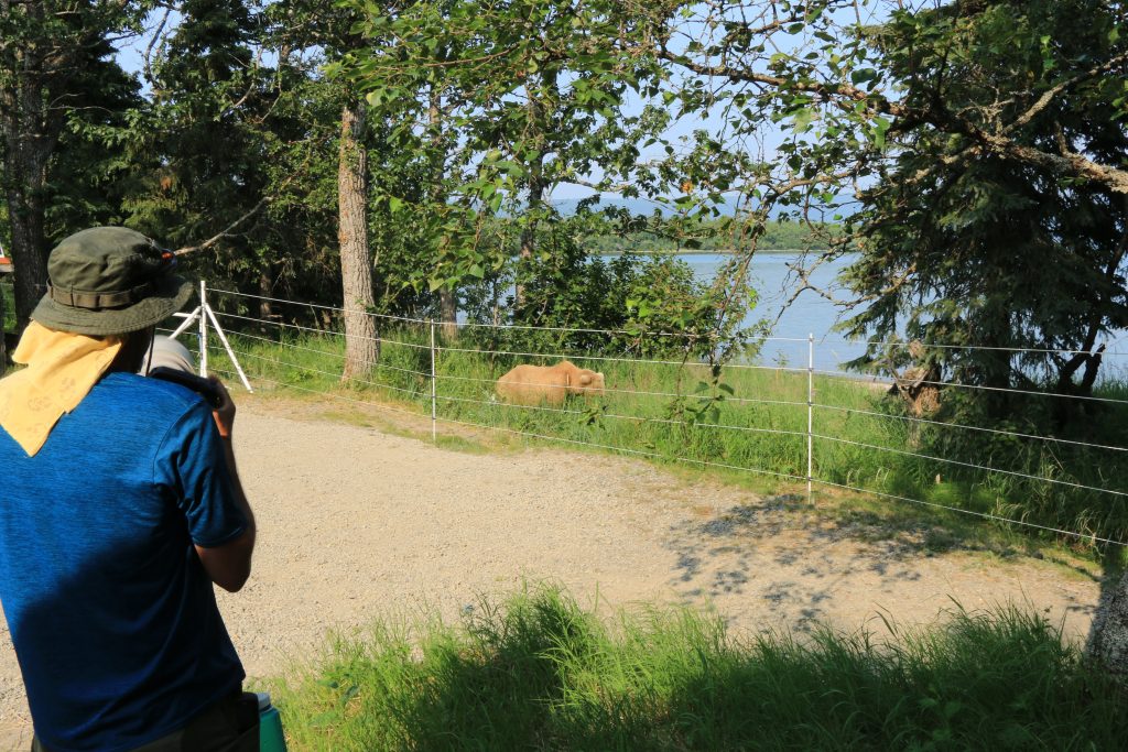
Encountered a bear walking along the beach essentially passing no less than 30yards away from me to continue parallel to the pedestrian path. A tourist was nearby. I was sure this was going to end in that stereotypical way when dealing with certain tourists as he inched closer and closer with his camera… Luckily, it did not. We both survived and no antagonizing of the bear occurred. Whew!
That same tourist immediately turned around when I informed him that the Brooks campground was half a mile away from the Visitor Center. Apparently that was too far.
Too bad for him, because he missed some serious action that occurred on that walk to the campground:
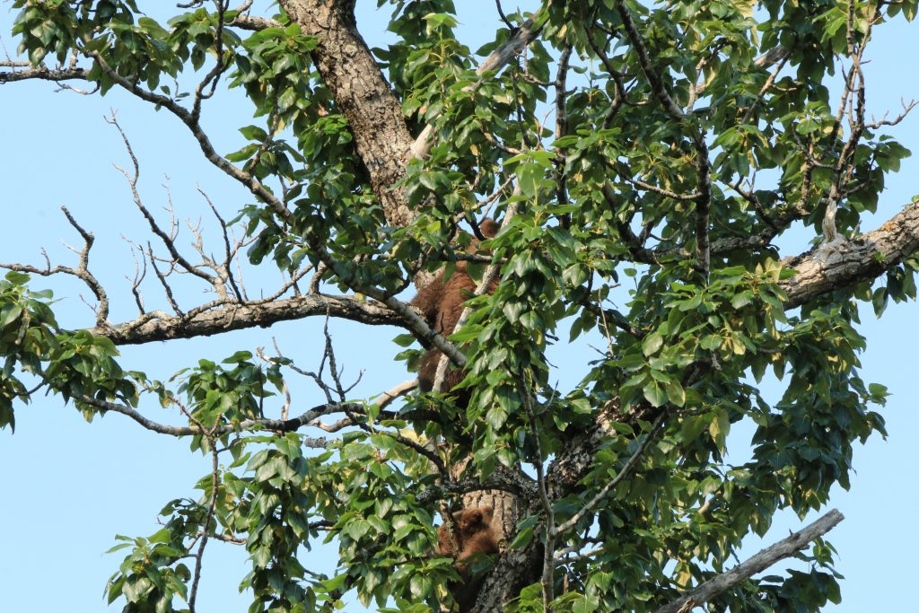
Bear #1 chased away bear #2 on the beach literally right next to me as I was walking along the trail to the campground. Maybe 20ft separated me on the trail from them on the beach to my right. My heart was pounding. At first, all I heard was multiple legs running and several grunts and I could see nothing. Once I could make out through the tree-line that there were two bears running in my general direction on my right I thought they were both running at me. Once bear #1 stopped running and bear #2 kept walking past me, I came to understand that bear #2 was not wanted there. Only problem was that after bear #1 had scared off bear #2, it promptly turned around and went back in the direction that I was going. So here I was, on the trail roughly 20ft to the left of a near bear-fight with one bear ahead of me and one bear behind me… :/ Continuing toward bear #1 was the only way to the campground and turning around back toward the visitor center meant heading toward bear #2! So, not knowing what to, I just hung back, kept my distance, ensured that bear #2 was still walking away, prayed that neither of them noticed me, and then slowly continued forward to the campground. My only thought was that I needed to get behind the electric fence that deters bears from entering the campground and there I would be safe. Well, turns out that the one bear was actually a mama bear protecting her cubs whom she had perched in a tree right next to that electric fence!
Able to catch a video of a young bear absolutely failing at fishing. His technique was far from stellar! Check out my Instagram post for the video.
The Valley of 10,000 Smokes was fascinating to learn about and amazing to witness in person. The hike was not very technical but very rewarding with amazing views and a chance to go down right to the water. A path branches off to the right that allows one to see where the three nearby rivers combine. We spotted bear and lynx tracks throughout the hike and even some semi-fresh bear skat! I was taught by a member of the group that one can approximate a bear’s width/height by measuring the width of the bear’s front paw print and then adding an inch to that. A dollar bill is exactly 6in and a handy trick to help with measuring.
Plenty of bears on the beach, swimming in the water, and wandering near the bridged walkway on the way to Brooks Falls. One even walked right underneath where I was standing!! Good thing I caught that on video!
Hiked to the first overlook of Dumpling Mountain. After experiencing how close these bears are willing to get to humans on the trail, I was very nervous to hike alone. Listened to a podcast with several people talking to give bears the illusion of a pack. If it didn’t deter them it certainly helped my psyche! Trail is easy to follow but not greatly maintained or very wide so wading through tall plants is required.
Disclaimer: I am writing this post for anyone looking for
details on the Valdez Goat Trail hike and find themselves coming up short.
Nothing written here is official or approved. Just what I’ve pieced together
from the hodge-podge of information I found from sources online, local
brochures, the AllTrails app, and Lonely Planet.
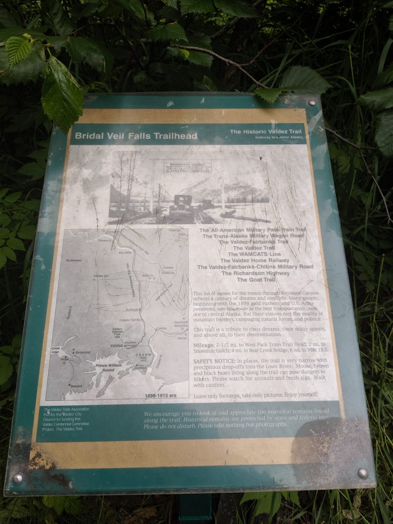
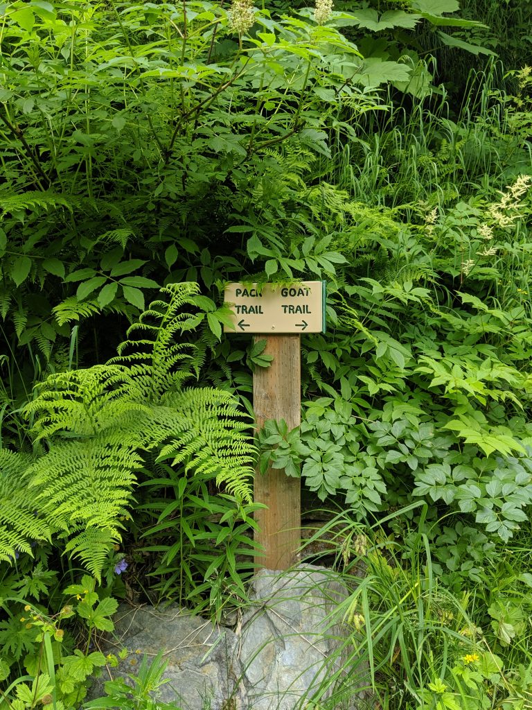
Valdez Goat Trail is
also sometimes referred to as Bridal Falls Trail, Wagon Trail, or simply Goat
Trail and branches off from the Keystone Canyon Pack Trail which starts at mile
marker 12 along the Richardson Highway (AK-4) and crosses Horsetail Falls Creek
via foot bridge before eventually meeting up with and turning into the Valdez
Goat Trail at mile marker 13.5. The trailhead is located just before Bridal
Falls on the Left if traveling North from Valdez on Richardson Highway (AK-4)
or just after Bridal Falls on the Right if traveling South toward Valdez. If
you have approached Horse Tail Falls while traveling South, you have gone too
far and if you have approached Horse Tail Falls while traveling North go just a
bit further and park in the next vehicle pull-off on the Left. The trail head
is closer to Bridal Falls than Horse Tail Falls but can be reached easily from
either vehicle pull-off. Make sure to take pictures and admire both falls–
they have earned their popularity!
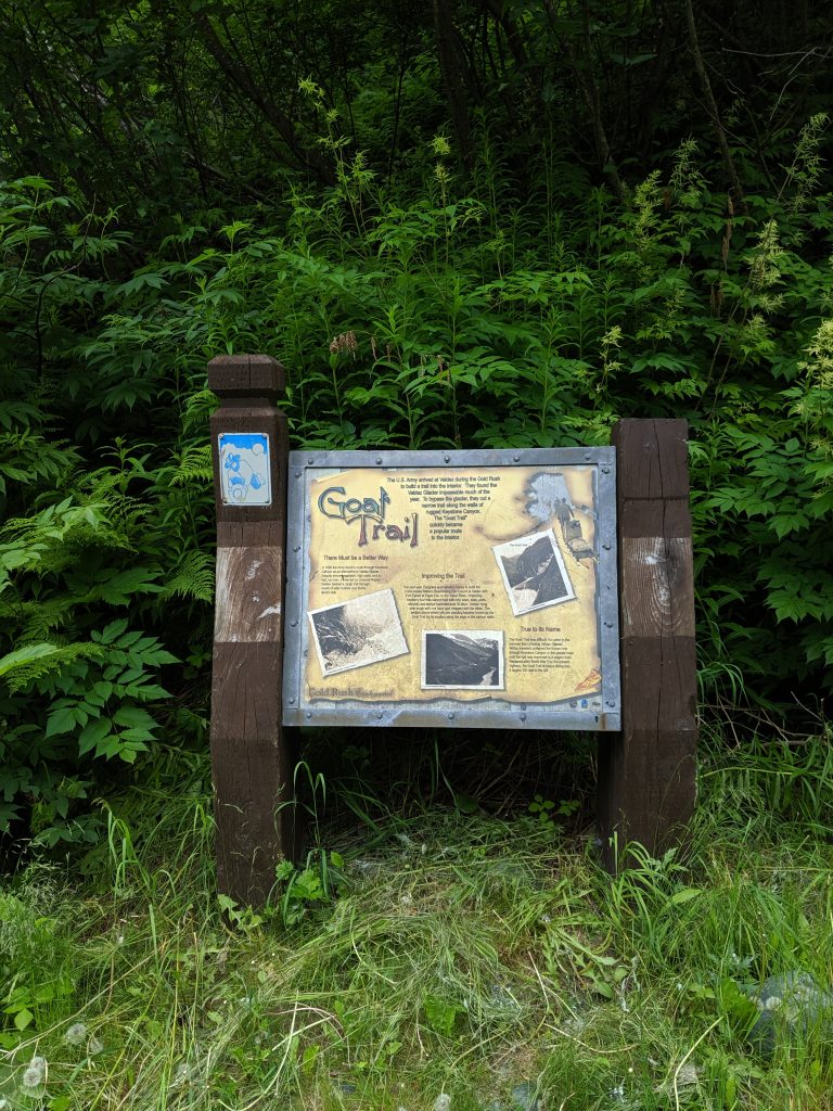
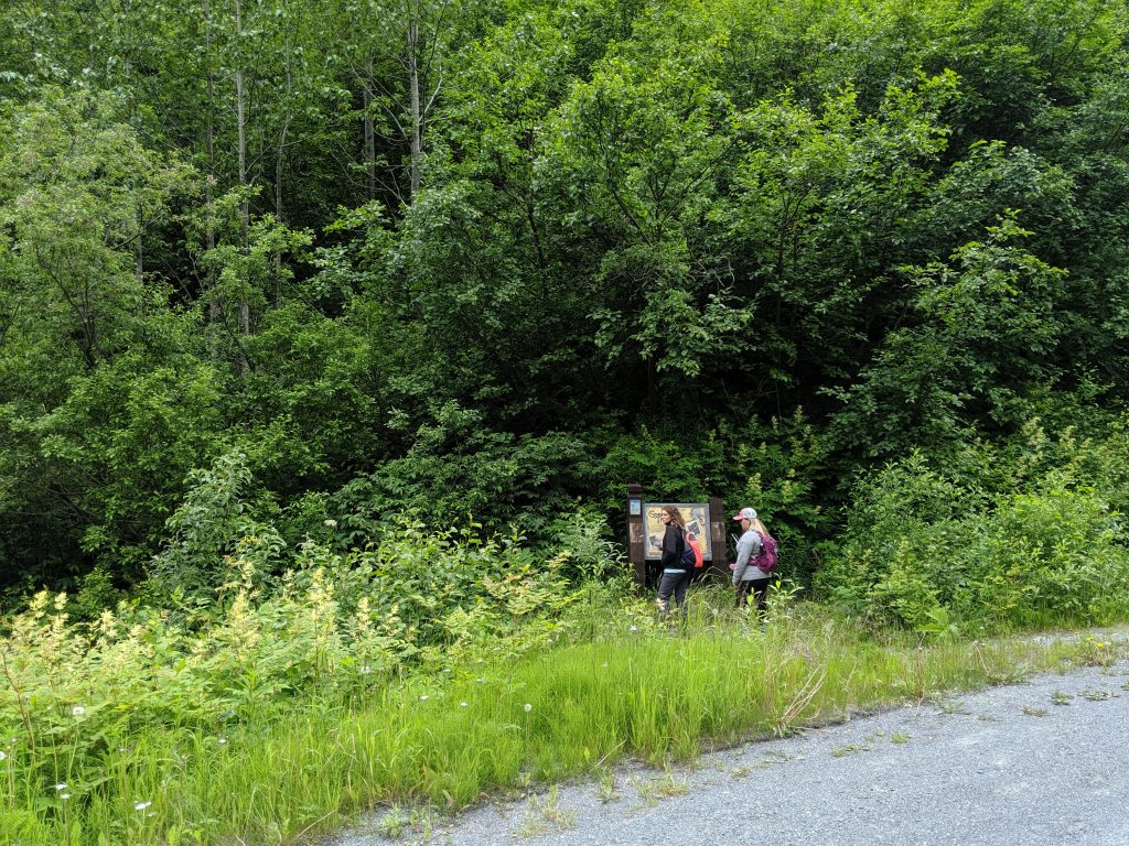
The trailhead for
the Goat Trail is marked by a placard located in the ditch on the side of the
highway and is mostly covered by trees so it is not visible from the road. You
come upon it only after you start walking down toward the canyon wall. There are
a few placards and signs early on explaining the history of Bridal Falls and
showing Pack Trail Left and Goat Trail Right. My friends and I continued Right.
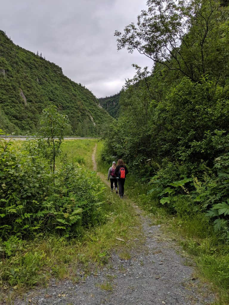
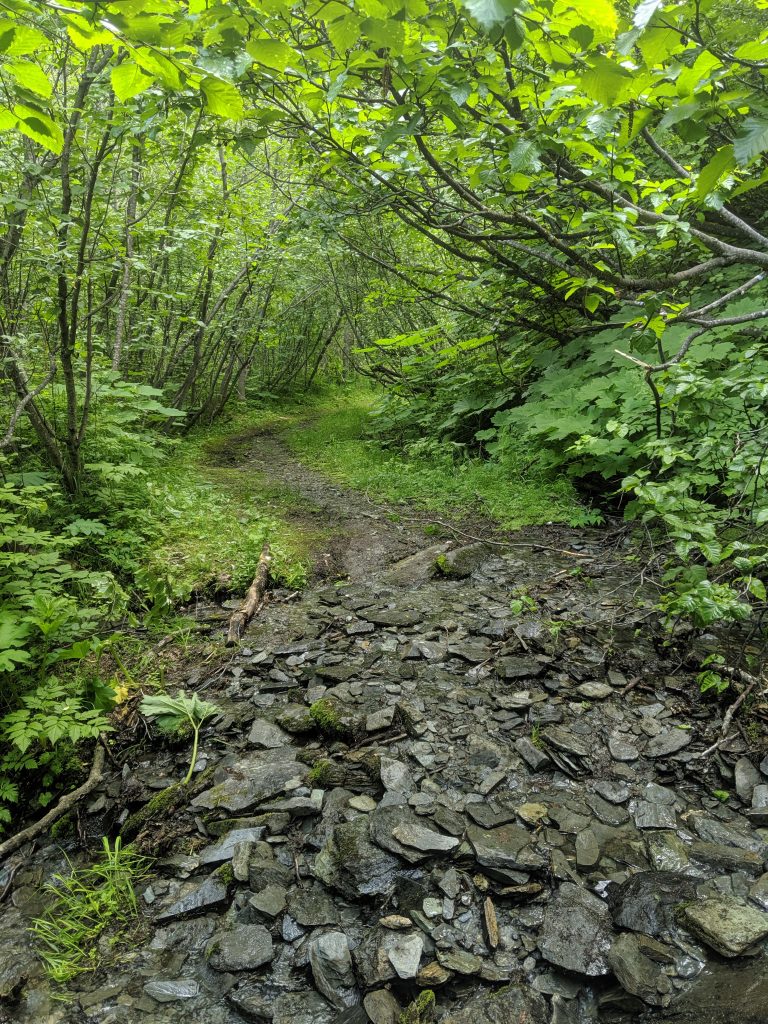
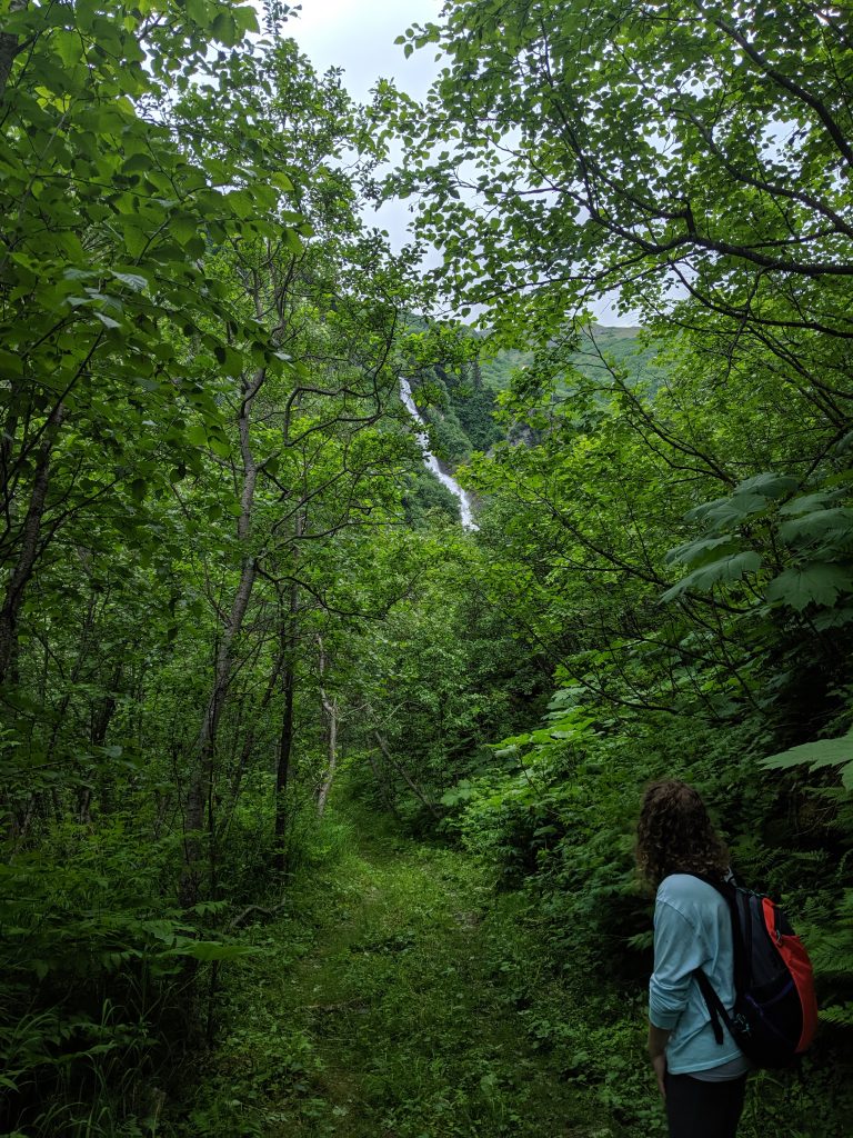
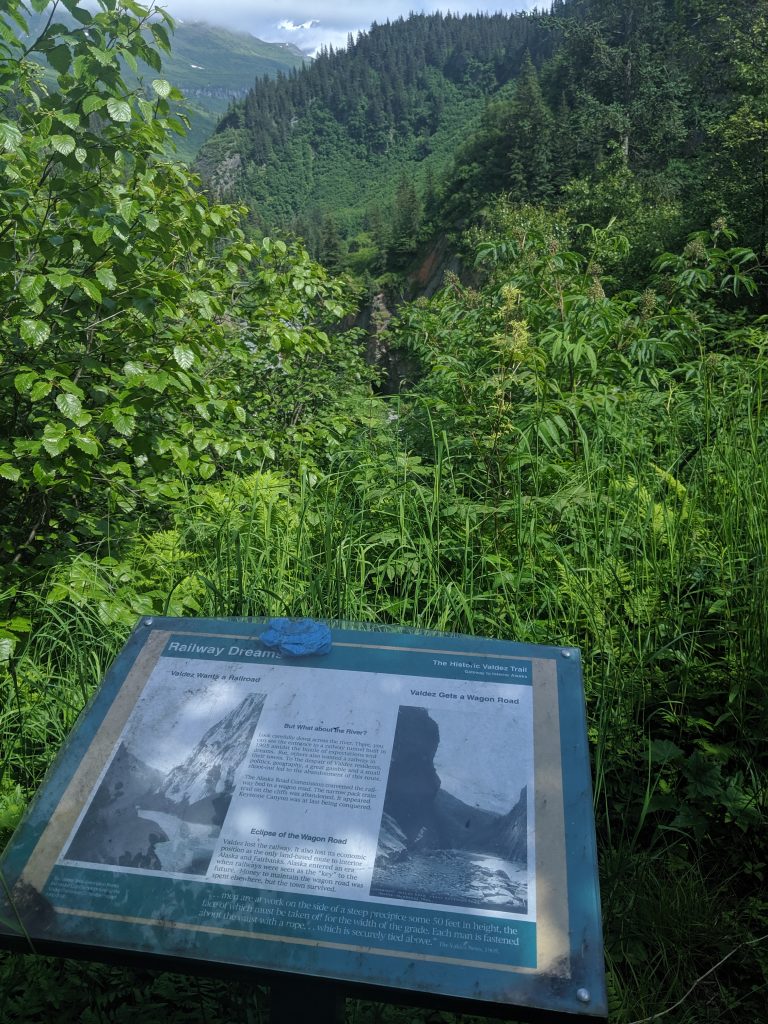
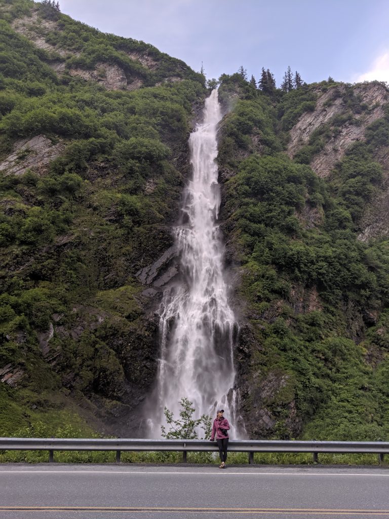
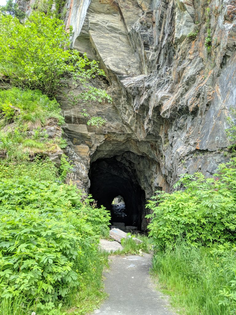
It was a wonderful choice! At roughly 800ft elevation over roughly 2.3miles, the trail is well maintained, easy to follow, and easy to moderate in difficulty. There are a few narrow sections that have a steep drop to one side but all areas of the trail are easily traversed and are at least one person’s width. Along the way are two lookouts, one with a view of the unfinished railroad on the opposite side of the street– but be cautious, this drop would be unforgiving! The trail ends as you open up to the middle of one of the many waterfalls visible from the road. I don’t advise attempting to cross the waterfall as it is quite wide and the current is very strong. But scrambling up a ways is possible for even better landscape views and selfies.
Leaving plenty of time for selfies and safe travels with a small dog, this trail takes roughly 2-3hrs roundtrip. If eager to get ‘er done, one could make it out and back in probably 1.5-2hrs. My friends and I were pleasantly surprised by the jungle feel of this hike, the vistas, and the waterfall at the end. Bring lots of bug spray and be prepared for a muddy patch here and there. High on my list of favorite hikes in Alaska so far! Check out my prior blog for details on the others I’ve done. Hope this helps and ENJOY! 🙂
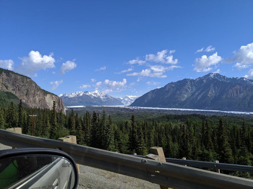
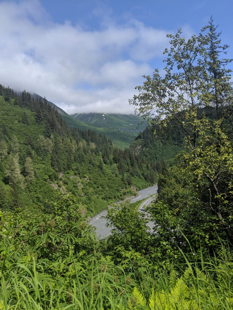
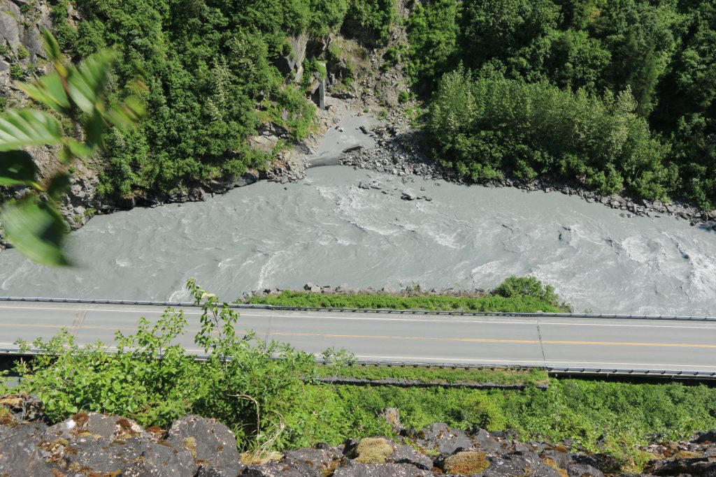
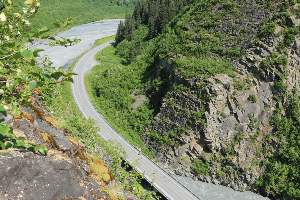
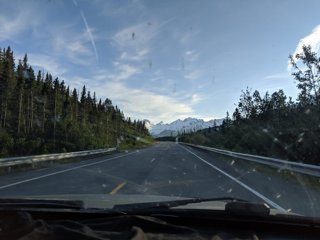
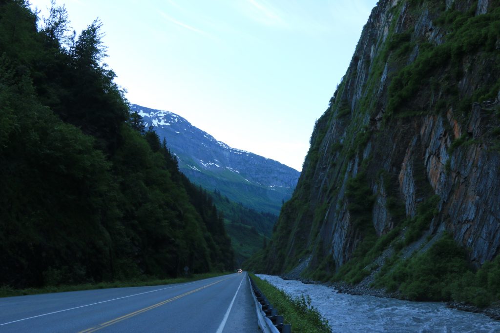
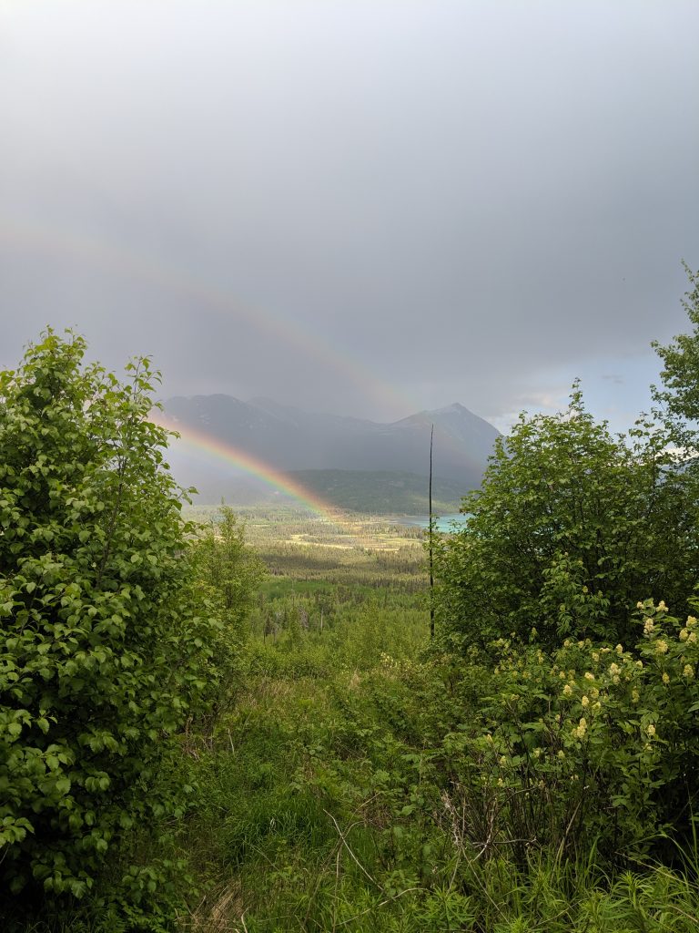
The Route: Anchorage-Mantanuska Glacier-Valdez-Anchorage via Glenn Highway (route 1) to Richardson Highway (route 4).
Days: 3
The trip to Valdez
was enhanced by the presence of a friend from home joining me and my co-worker.
The goal: to create a “real” Alaskan adventure, seeing and doing as
much as we could on a short amount of time. Don’t worry: we succeeded!
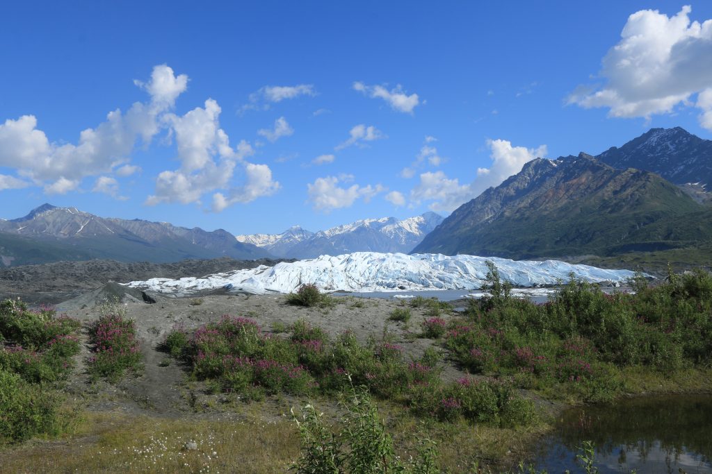
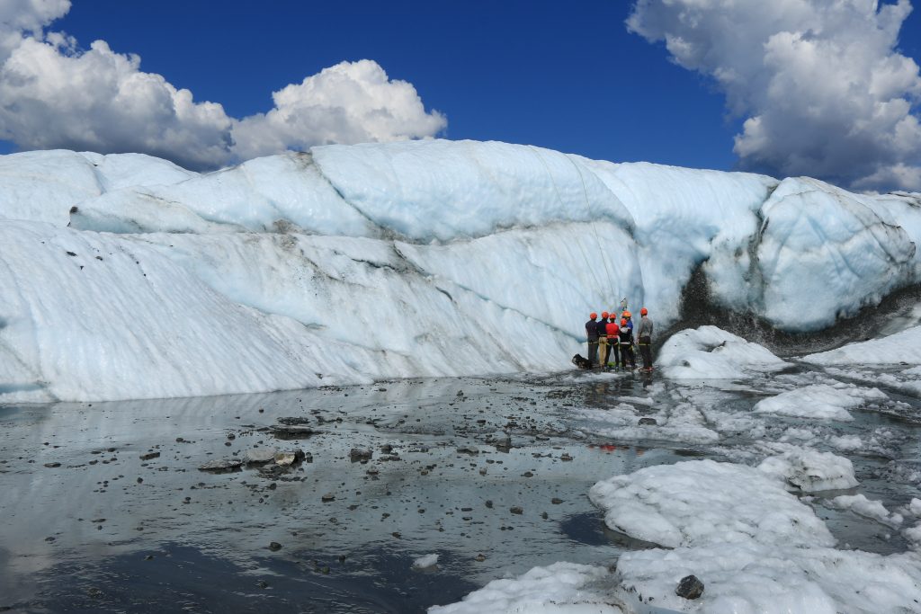
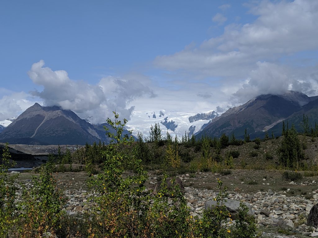
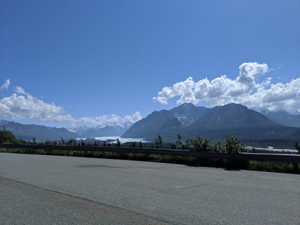
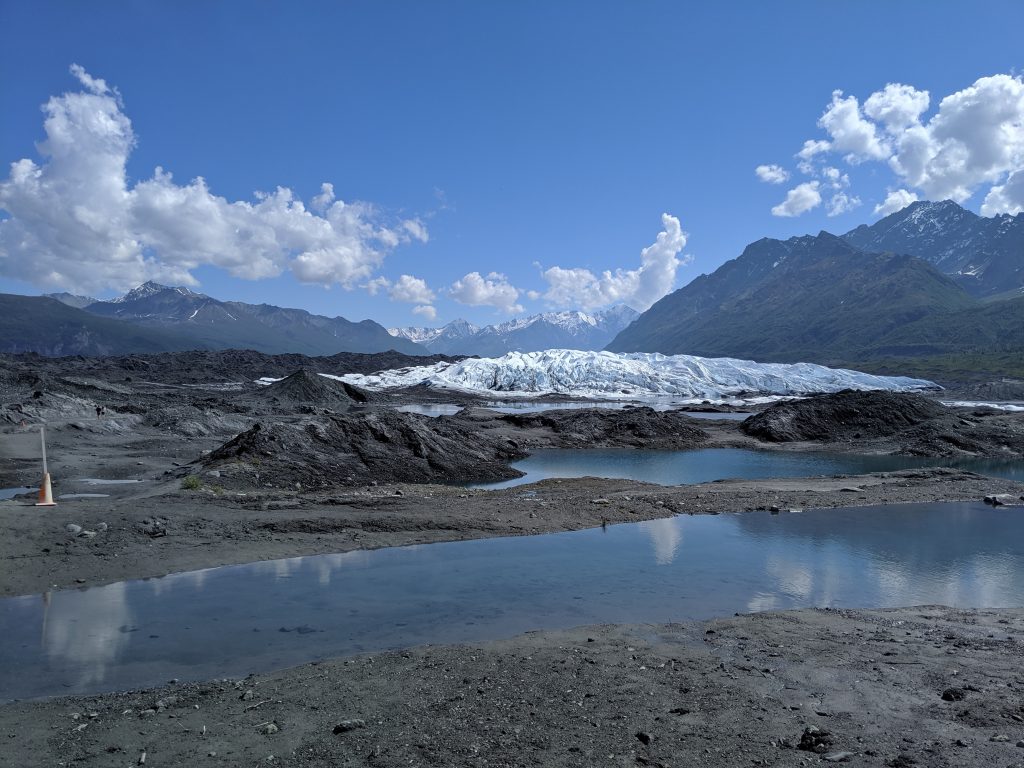
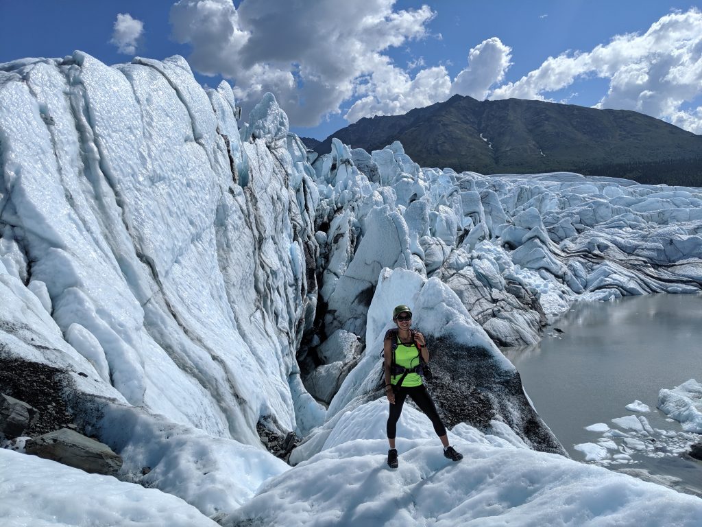
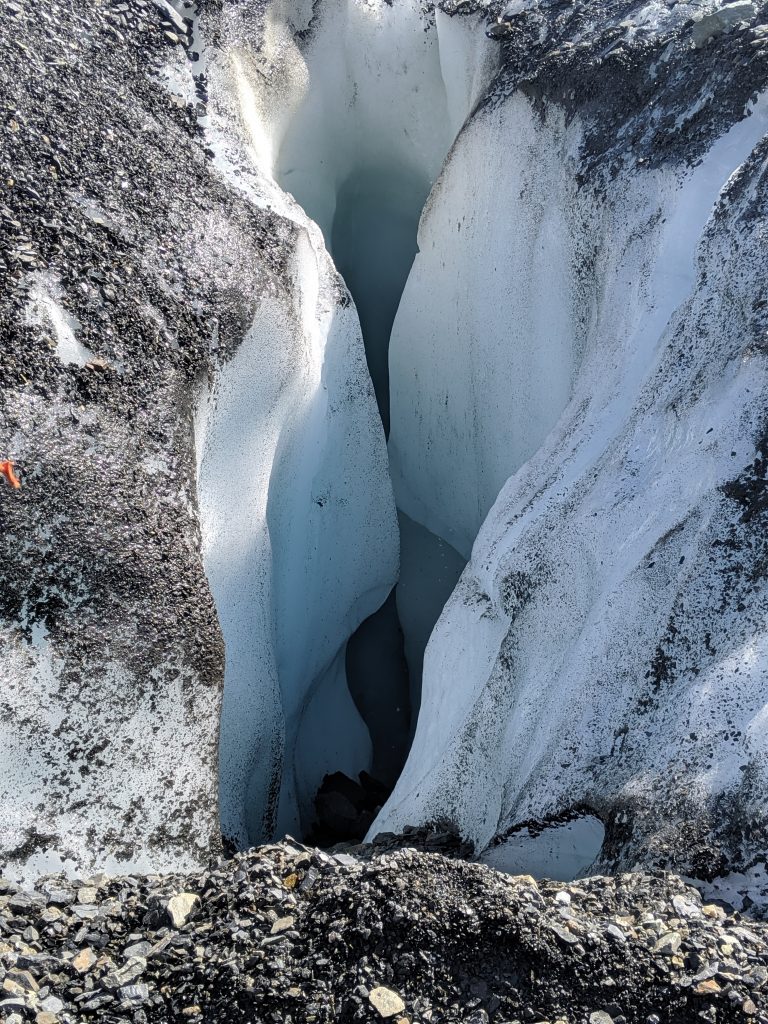
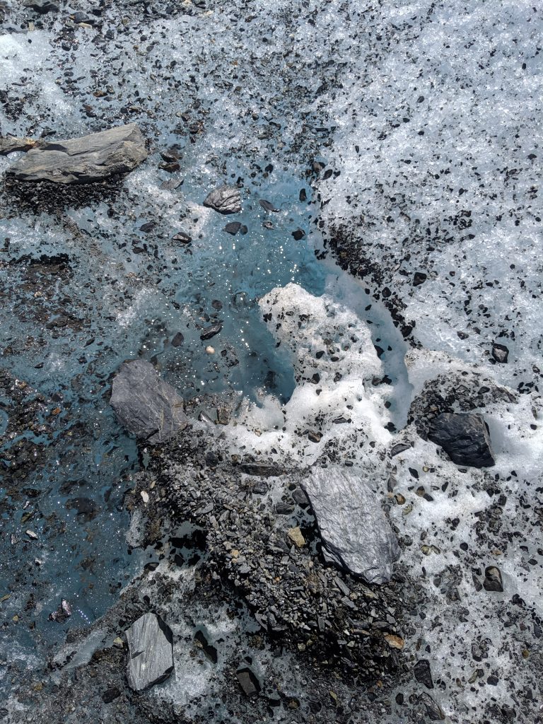
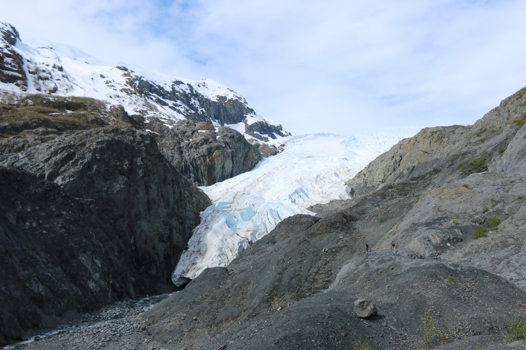
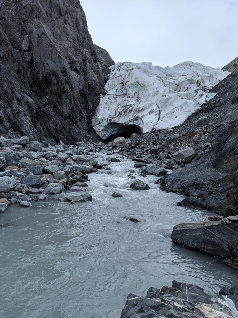
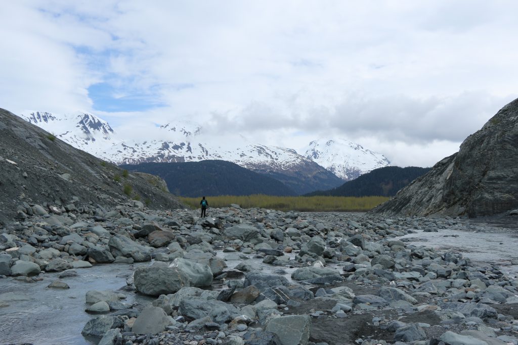
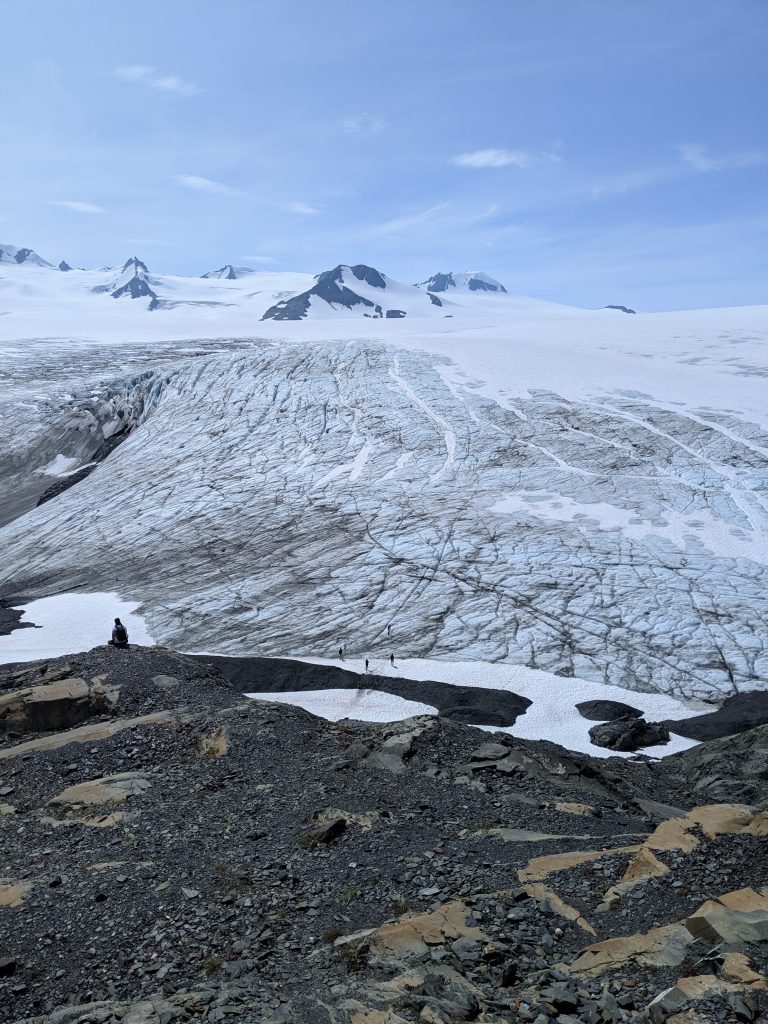
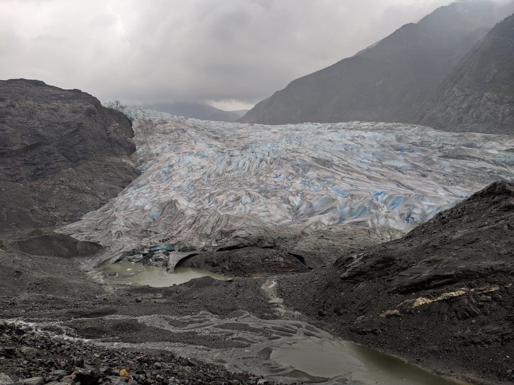
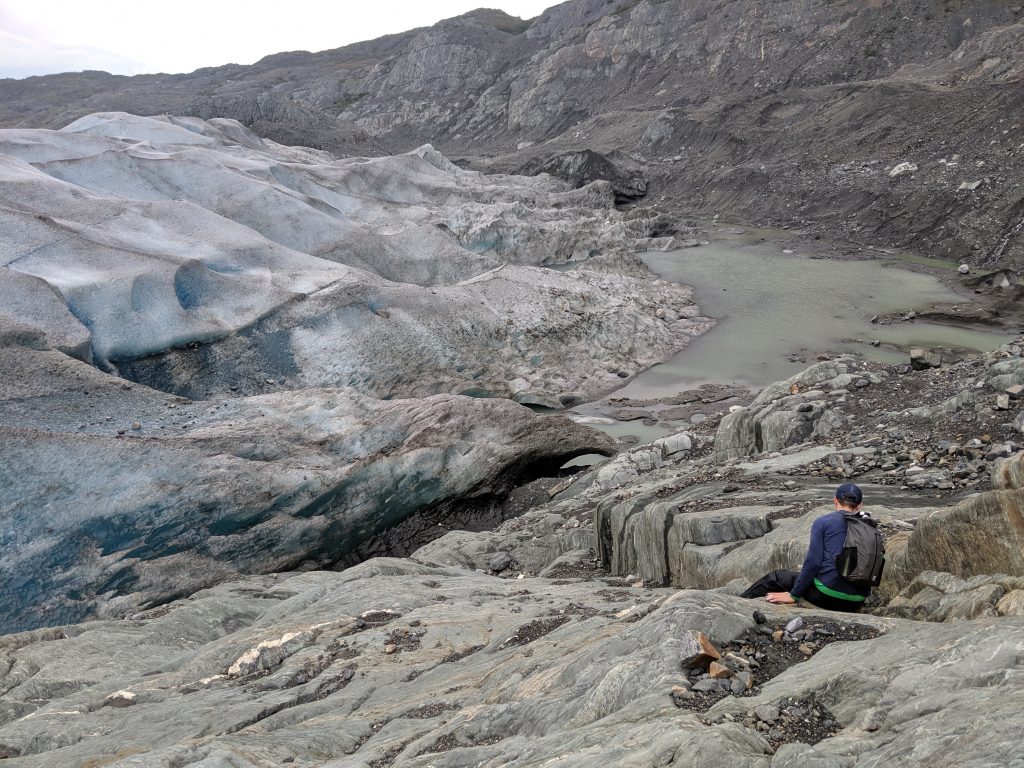
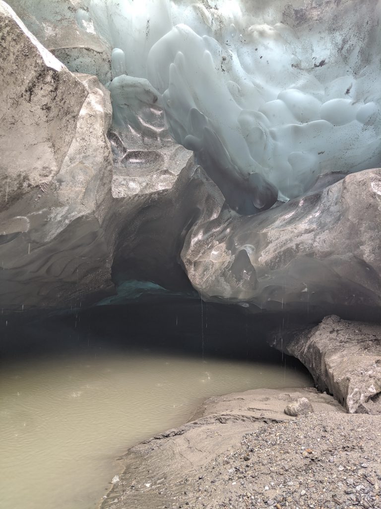
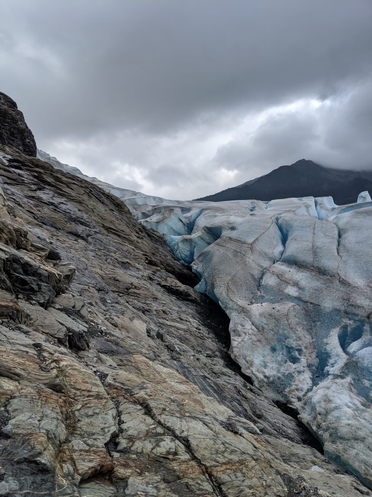
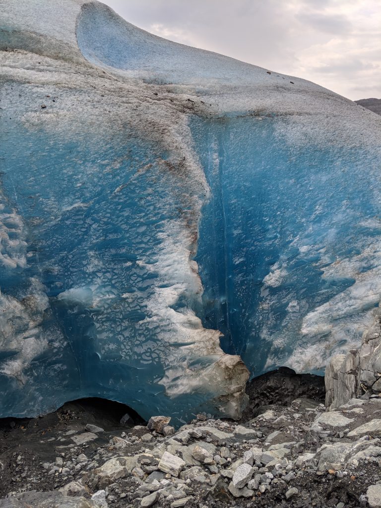
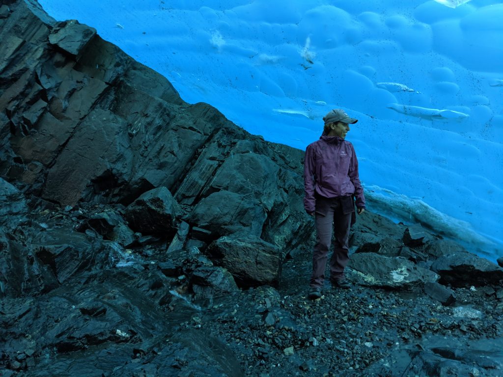
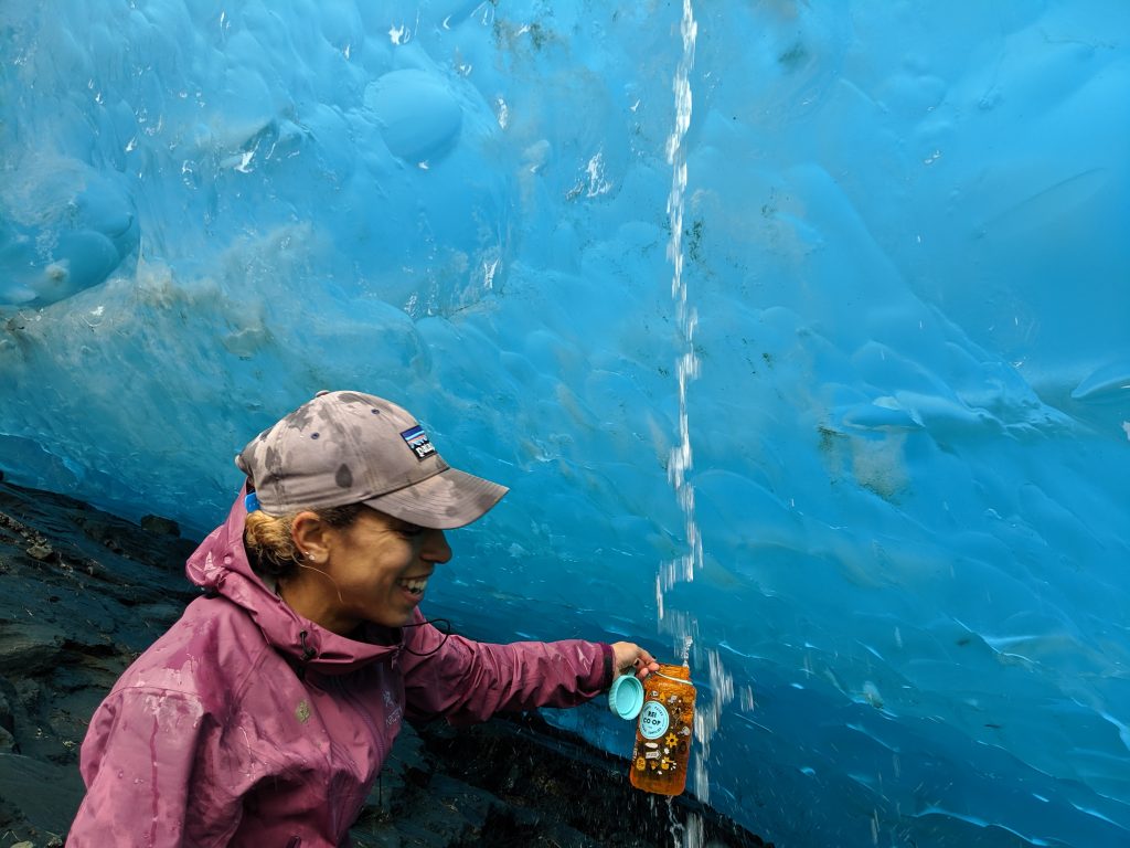
First stop: Glacier View to hike on Mantanuska Glacier. Though I had seen quite a few since my arrival here in May, many visible from just the highway, walking on one was a new dynamic. Though access to this glacier is 24hrs and $30/person entrance fee if venturing on your own, we chose to pay for a guide with Mantanuska Glacier Adventures so that we could pay the entrance fee, rent micro spikes, and learn about glaciers from a guide all in one. An added bonus is that tour guides know the good places to go, where not to step, and get quote unquote exclusive access to certain areas as the trail marked for solo hikers is marked specifically to try to maintain safety and so doesn’t venture to every corner. Needless to say, we got our money’s worth. Our guide, Michelle, was awesome– knowledgeable, funny, and friendly. She made us feel like rock stars while we posed for photo ops and, due to our ability, she took us farther/deeper into the glacier than she does most groups. Starting out it seemed like we were walking along a dirt path to get the the glacier. We were pleasantly surprised to learn that we were walking on a layer of ice miles deep with rocks and sediment from high up in the mountains dusted across the glacier– there only because the movement of the glacier took it along for the ride. Some areas you can even scrape your boot across the surface and see the sheet of ice below. The micro spikes were a must as we hiked. I couldn’t imagine doing it without. We traversed the mud and rocks and eventually made our way into the blue ice where we saw admired mulans (vertical well-like shafts where water enters from the surface and acts as a drainage system), threw rocks down deep crevasses, and drank from a glacial waterfall. We ended with a short wade out to mermaid rock for one last photo shoot.
View from the Road
Crevasse
Walking on a sheet of blue ice!
Mermaid Rock
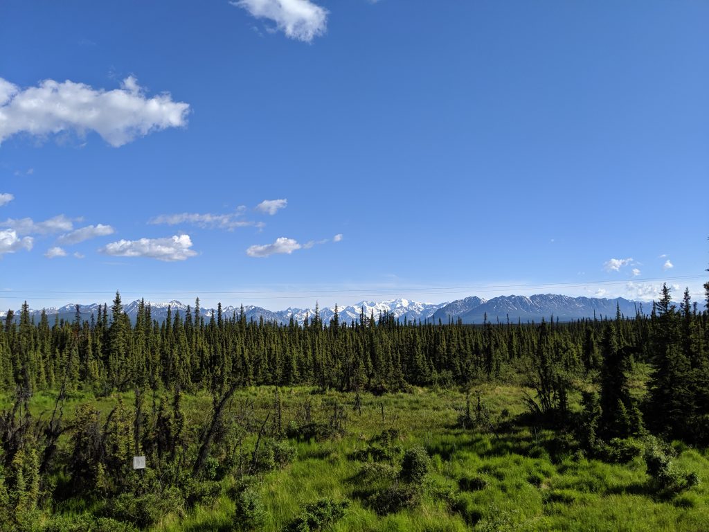
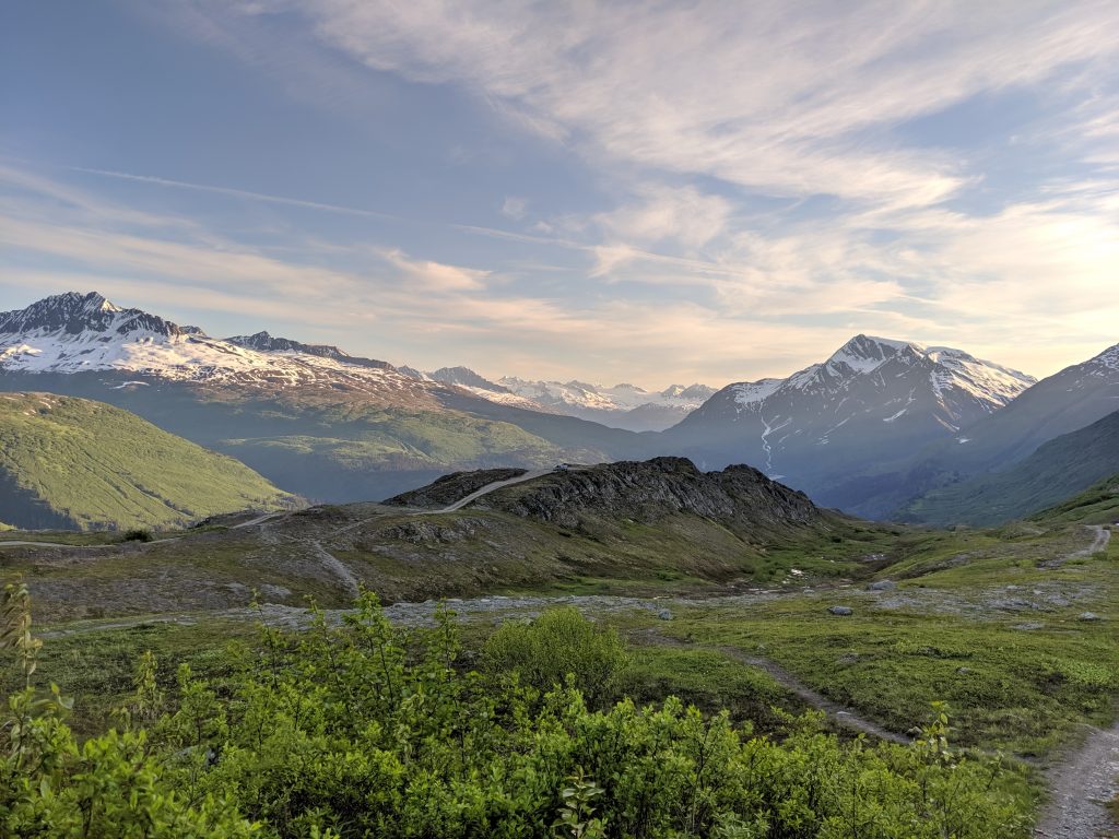
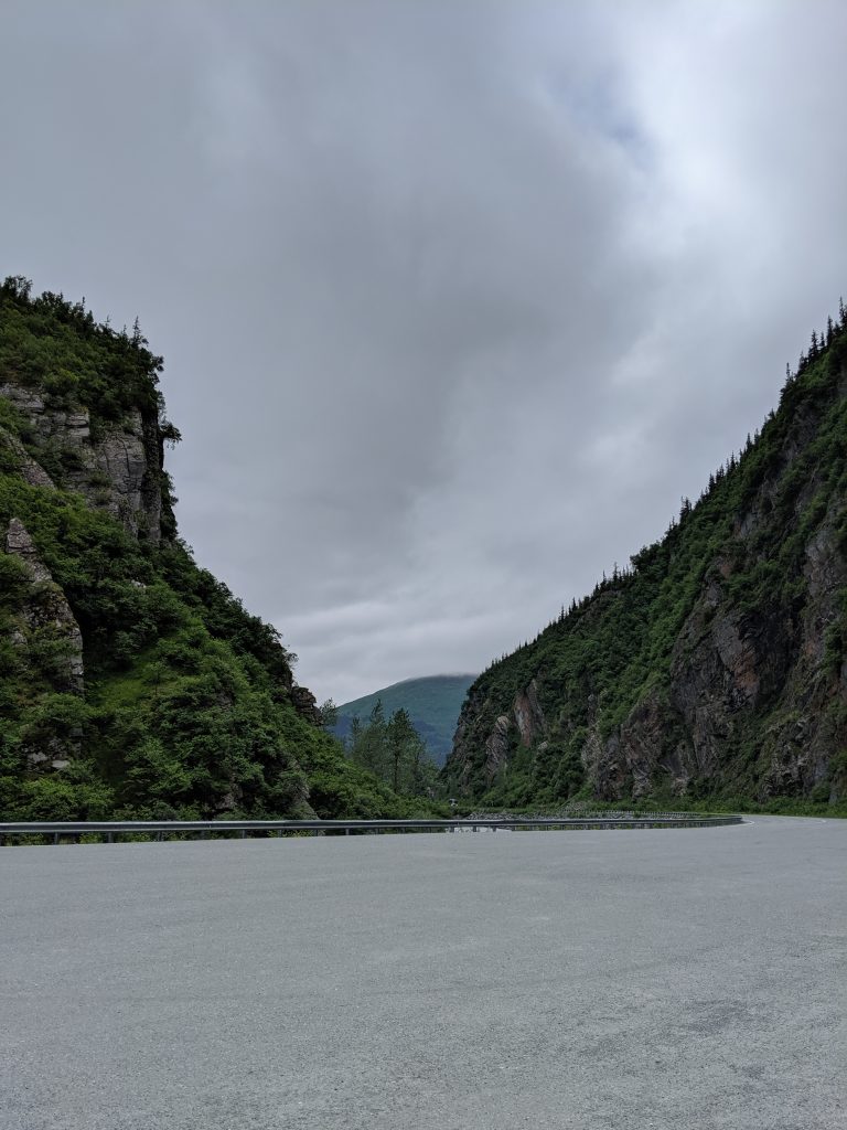
The drive to Valdez was equally impressionable. The mountains of Wrangell- St. Elias National Park is in the background for the majority of the first part of the drive. The road twists and turns and eventually narrows a bit. We eventually came across Worthington Glacier falling seemingly onto the highway ahead of us. A few turns later we emerged through Thompson Pass into a wide clearing of mountains and a ridge jutting out to the right. Purposefully, there is a pull-off immediately after emerging. It is well worth the stop– this clearing was both majestic and picturesque.
Somewhere in the Mat-Su area
Worthington Glacier
Thompson Pass
Thompson Pass
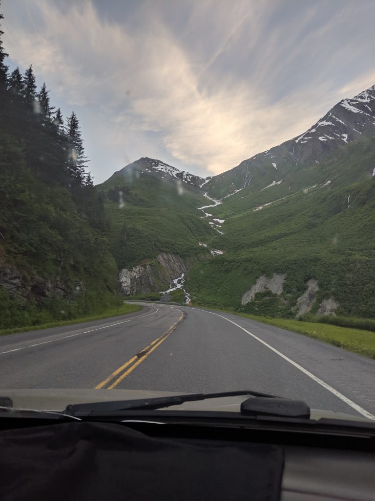
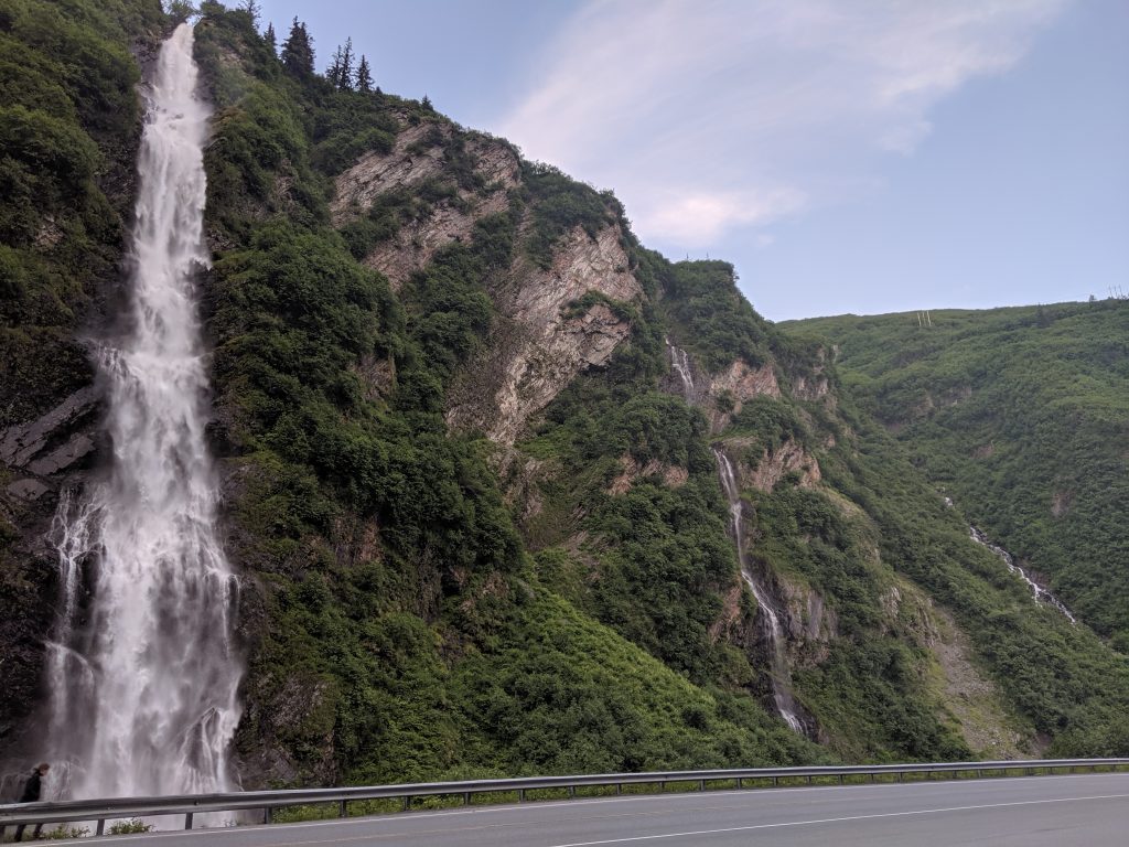
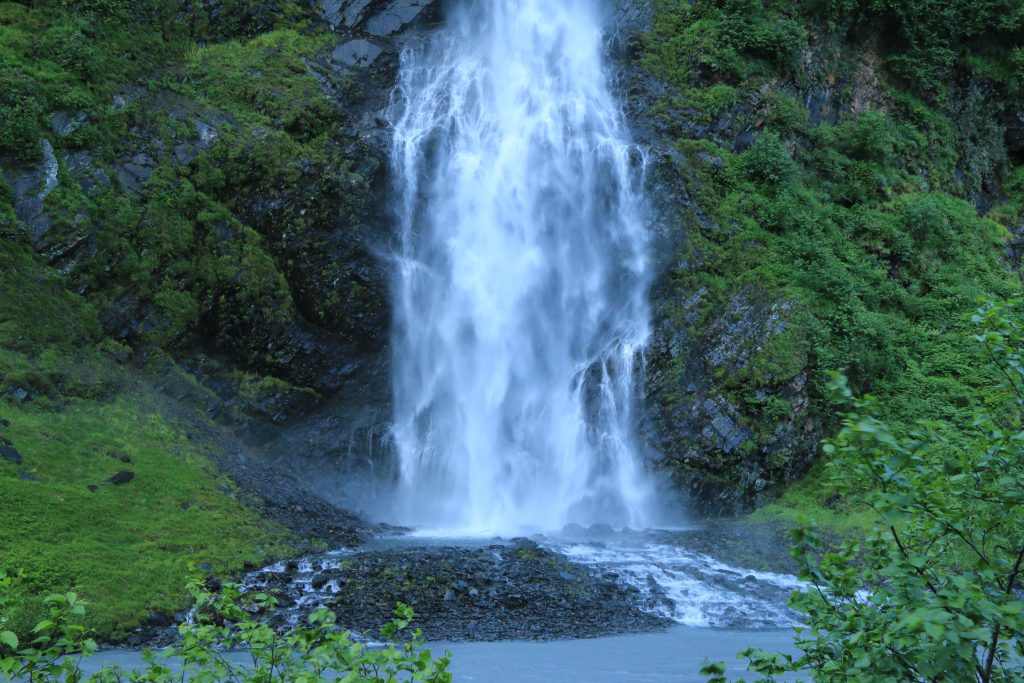
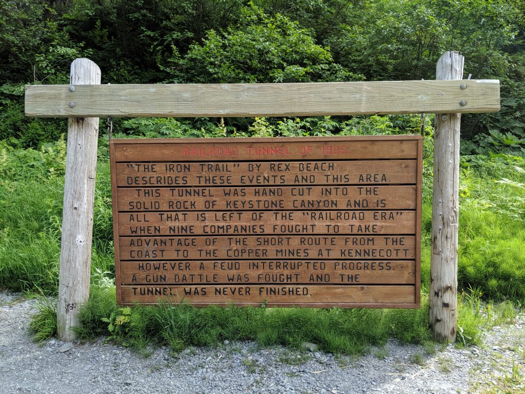
The next milestone along the drive was Keystone Canyon. What a wonder!! Waterfalls galore with one powering down right beside the road, it’s mist able to reach out (Bridal Veil Falls). I am a huge fan of waterfalls, so I was in heaven. In the same location is the historic site where they started to build a railroad in 1906 that ended unsuccessfully due to a gunfight.
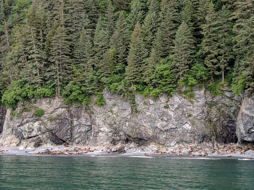
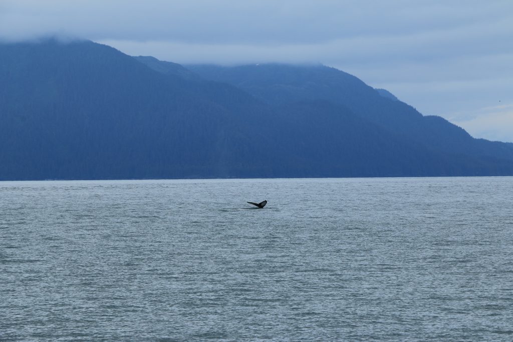
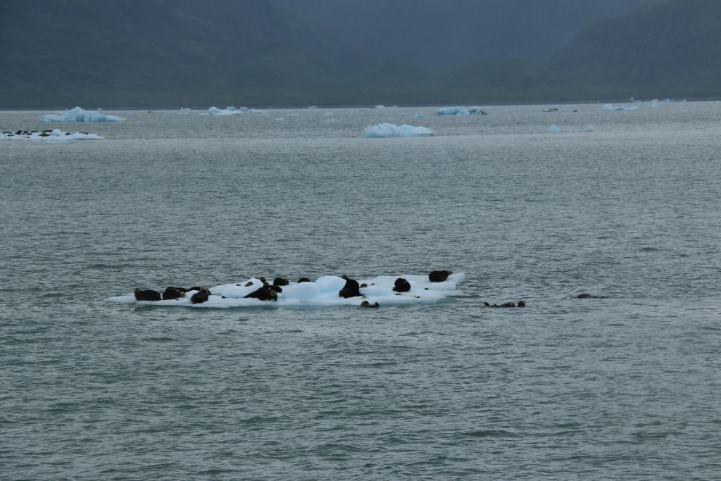
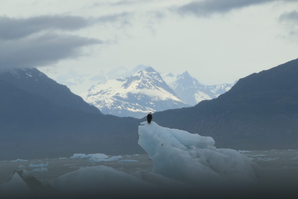
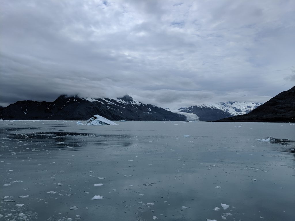
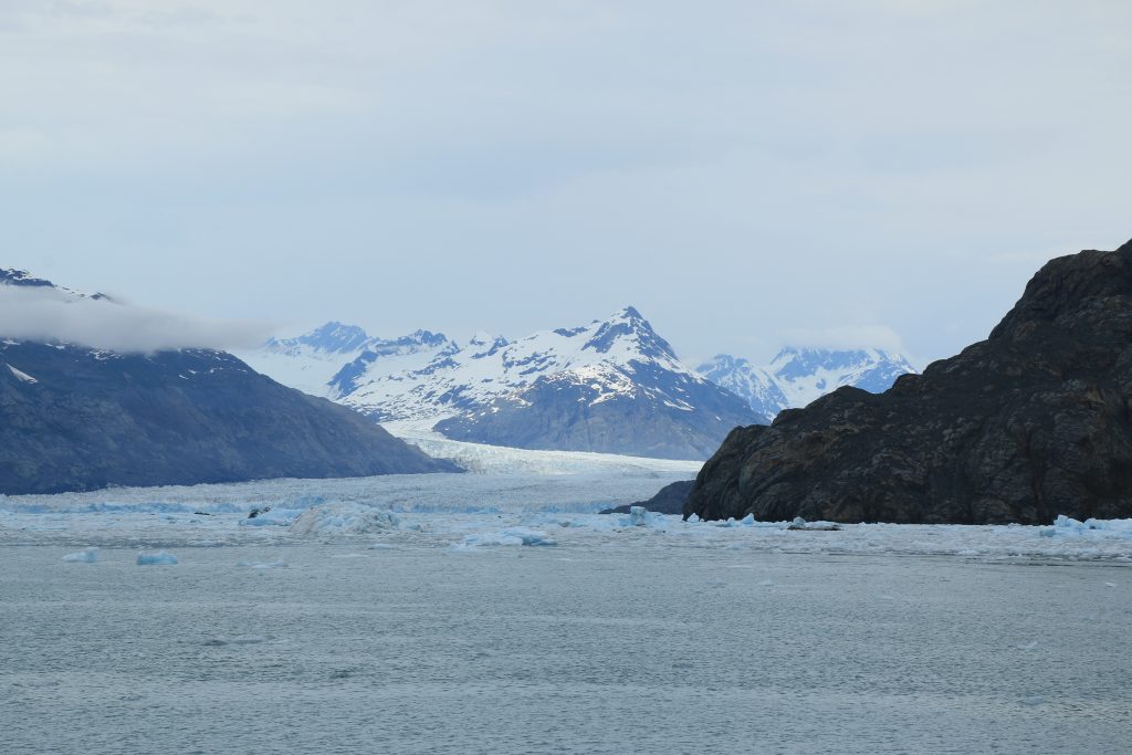
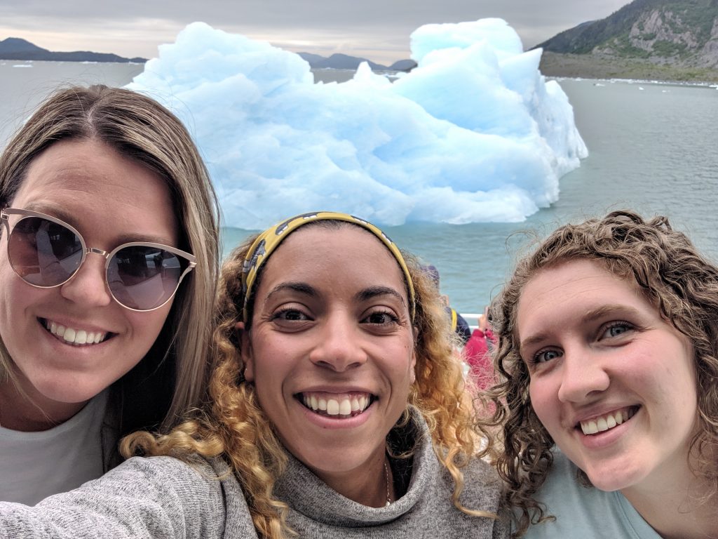
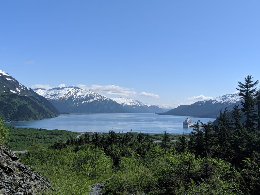
Finally, we made it to Valdez, and, after a quick dinner at Fat Mermaid we called it a night to prep for the next day: wildlife glacier cruise. With few options as far as tours go, we went with Stan Stephens’ Columbia Glacier tour ($109+taxes/person). A cup of Kaladi Brothers joe in hand from a cute cafe called Latte Dah (I see what you did there!), we were ready to go. Starting out warm but on the chilly side, we saw otters almost immediately. Next came porpoises playfully skipping along our boat and sea lions relaxing along the coast. Then we caught a bald eagle perched on top of an iceberg. As we neared the massive Columbia Glacier, the air felt frozen and the water filled quickly with icebergs that eventually turned into an ice barrier through which the ferry couldn’t pass. We were so grateful that we brought layers! Temperature aside, the view was magnificent. Columbia Glacier is the second largest glacier in North America. NBD!
Sealions sunbathing
Porpoise!
A Whale’s Tail
Otters
Bald Eagle
Columbia glacier
Columbia Glacier up-close
The evening was spent in town getting dinner at Nat Shack, ice cream at Northern Treats, and drinks at The Boardroom where we were pleasantly surprised by the shenanigans of a live rock band at 10pm. Before that we visited the Maxine and Jesse Whitney Museum to learn about and admire the collection of native art and artifacts. Though the town is small and follows suit with the majority of other towns in Alaska, it was pleasant enough and we enjoyed ourselves plenty.
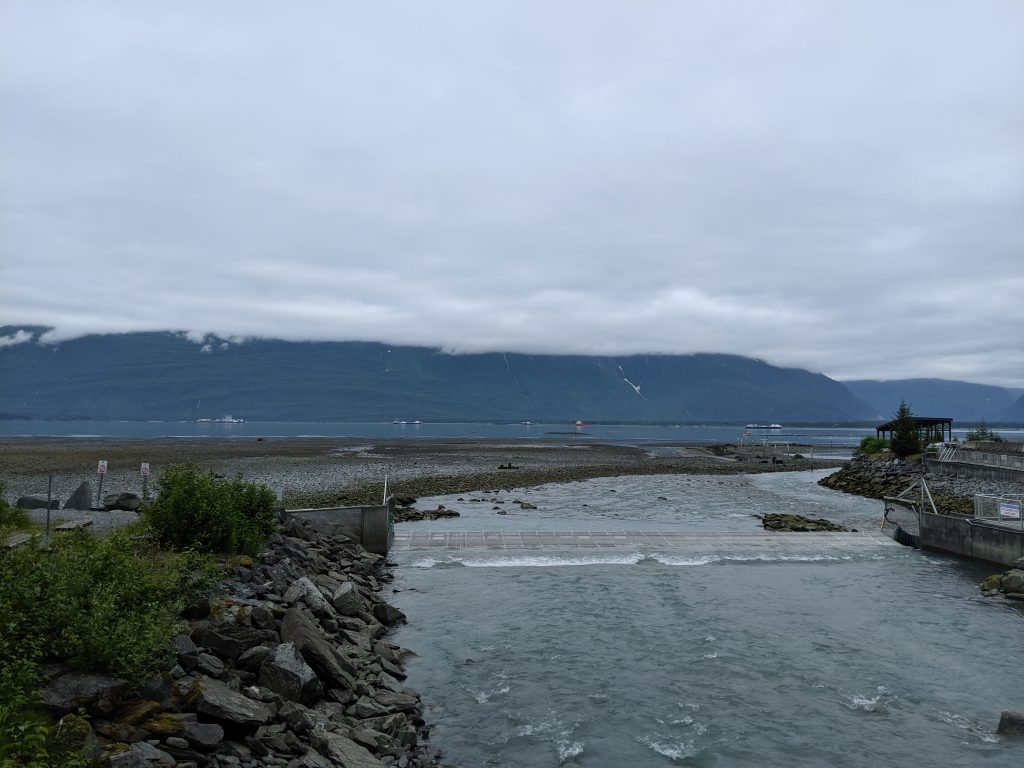
The drive back to Anchorage was equally eventful. We stopped at the Solomon Gulch Hatchery and learned about salmon migration and the incubation of their eggs. Next we hiked Valdez Goat Trail, also known as Bridal Falls Trail, which branches from the Pack or Wagon Trail. An easy 4mi roundtrip trek along the Richardson Highway, this trail features 2 outlooks and a massive waterfall at the end and is a must see for anyone looking for a shorter hike near town. Next we stopped again at the portion of Thompson Pass that overlooks the valley from a rocky vantage point. We had to get the photos that we didn’t get on the way down!
Solomon Gultch Hatchery
Valdez Goat Trail
Waterfall at the end of the rainbow
Though held up
slightly by traffic, the rest of the ride to Anchorage was smooth and sunny. We
had such amazing luck on this adventure– even spotting 3 moose on the side of
the road. Truly, a must-do drive for anyone visiting Alaska.
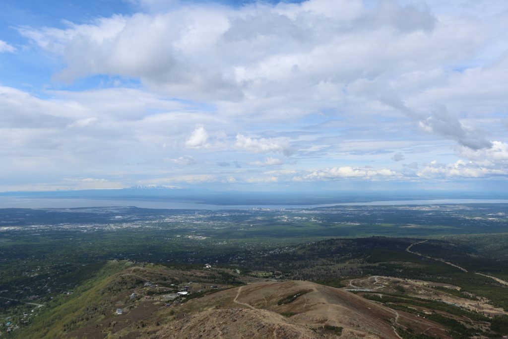
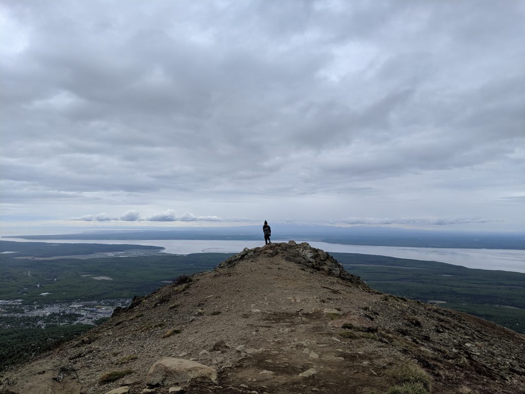
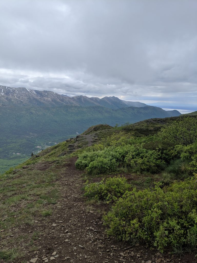
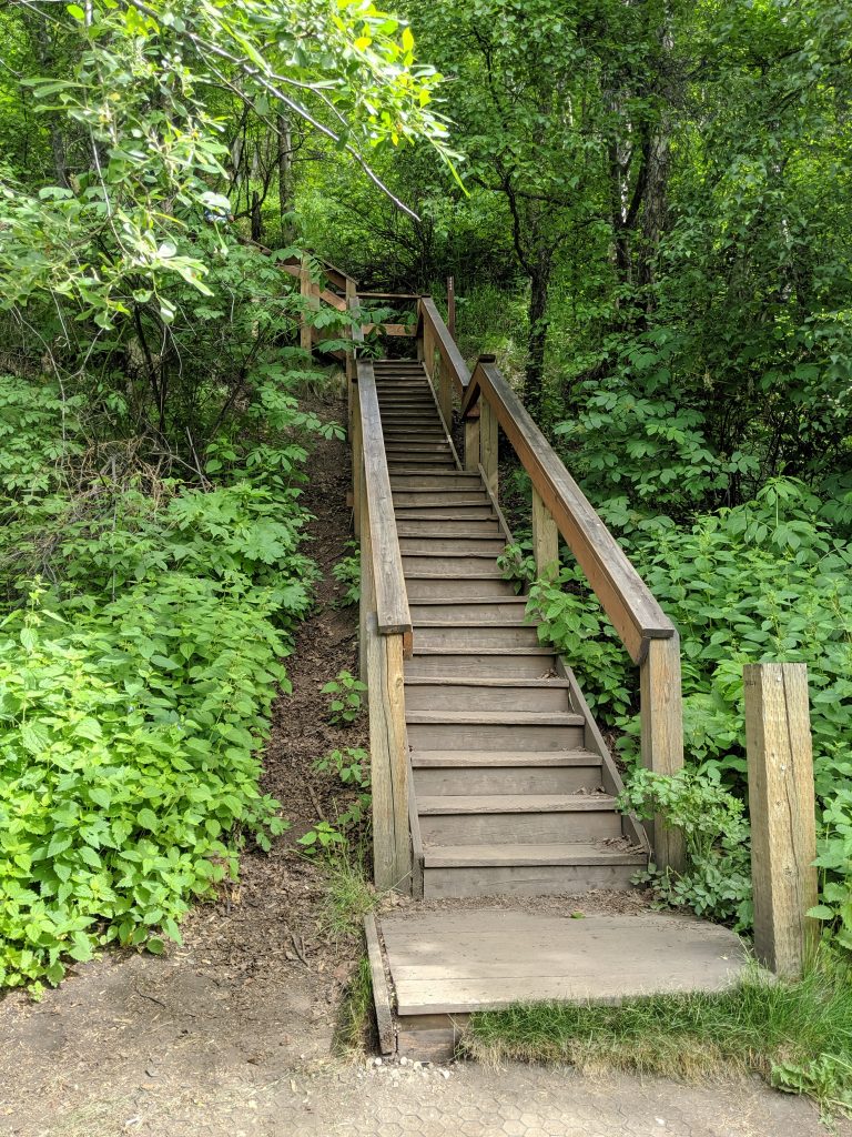
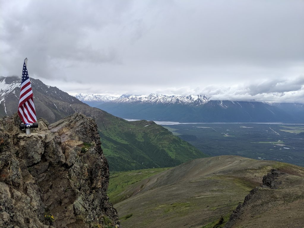
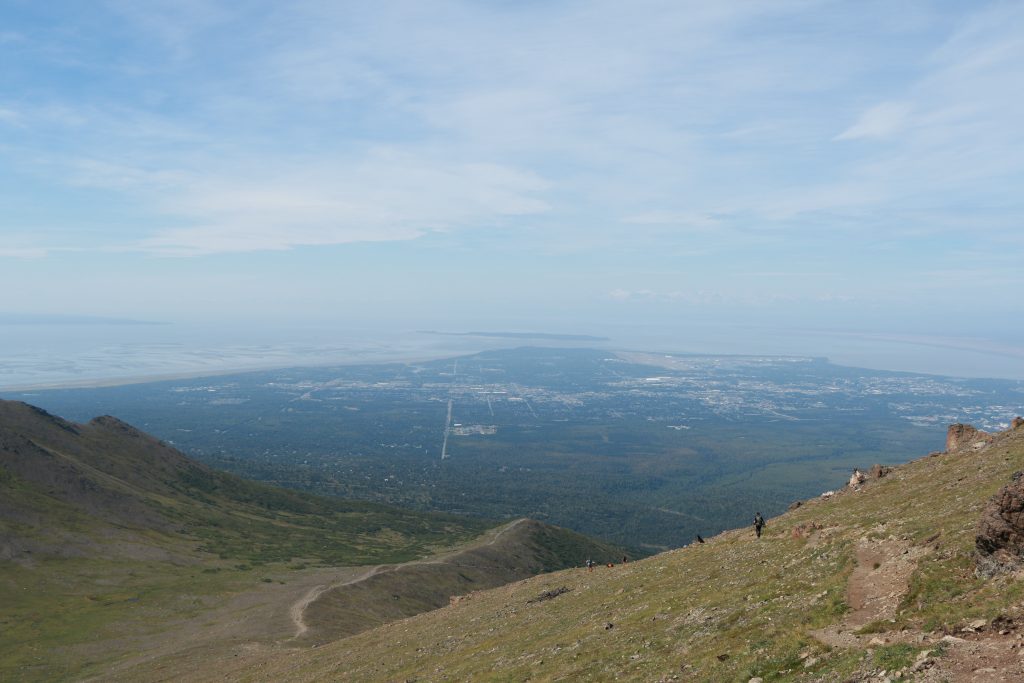
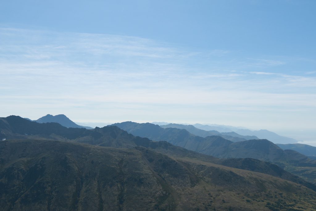
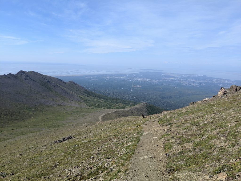
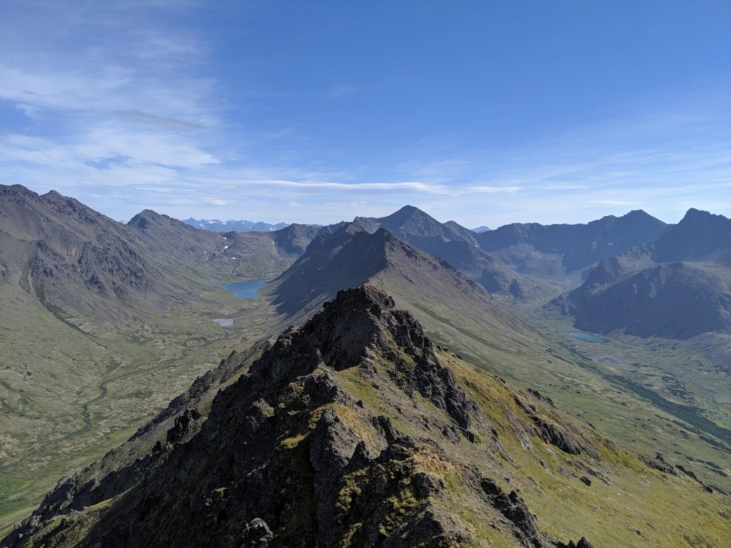
Flattop— Anchorage. 3.3mi roundtrip. 1400ft elevation. 1hr to the top. 2hrs roundtrip. Rock scramble/climbing to summit– a true create-your-own-adventure-style hike. Can be windy a the top. Views of the city and the water. Many go further to summits two and three for added challenge.
Exit Glacier Trail-– Seward. Kenai Fjords National Park. 1.8mi roundtrip. 260ft elevation. 30min to the view. 1hr to the toe. 2hrs roundtrip. Has greatly receded over the years. Still a wonder to take in.
Bird Ridge— Girdwood. 4.6mi roundtrip. 3200ft elevation. 2-2.5hrs to the top. 4hrs roundtrip. Amazing views of the surrounding mountains and Turnagain Arm.
Thunderbird Falls— Chugiak. 1.8mi roundtrip. 1.5hrs roundtrip with time at the falls. Easy trail with 300ft elevation gain. Ends at the falls. Hidden feel though well-trafficked.
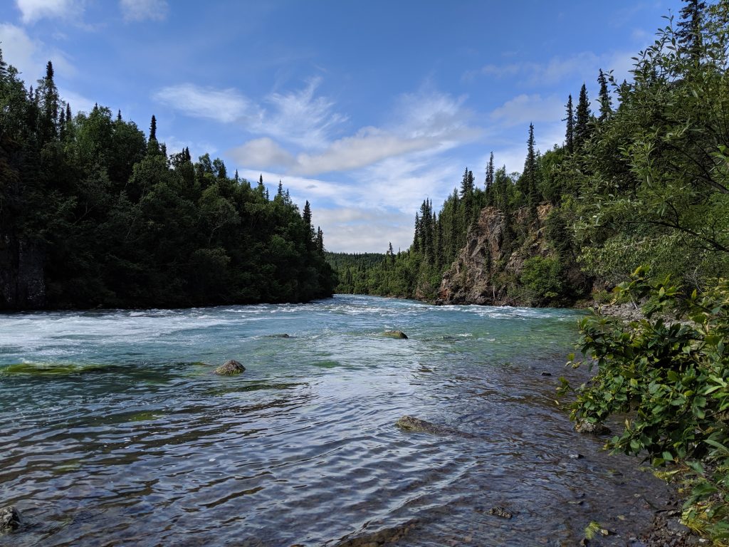
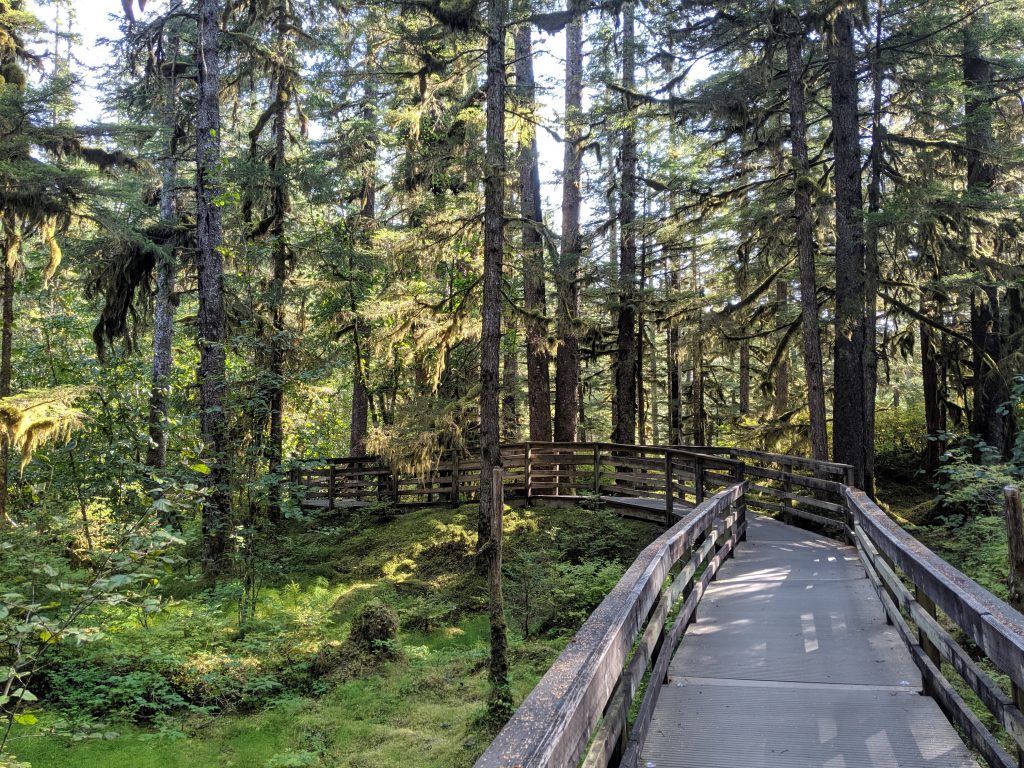
Winner Creek Trail & Handtram— Girdwood. 6.4mi roundtrip. 1200ft elevation gain. 2-2-2.5hrs roundtrip. Easy, wide, and well-maintained trail that features small waterfalls and beautiful green forest. Planks bridges cross smaller waters. Handtram in the middle for the river. Very fun and vibrant hike.
Handtram!
Some elevation gain
Mini waterfall!
Love the brightness of this green!
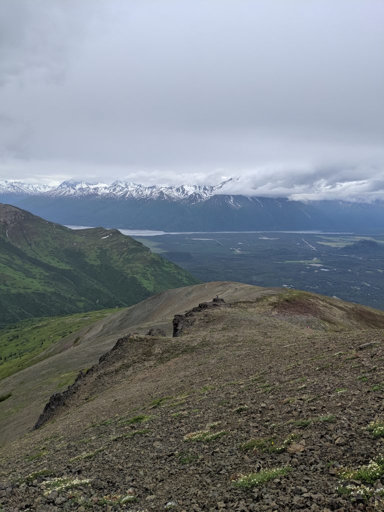
Mt. Baldy— Eagle River. 2mi roundtrip. 1500ft elevation. 45min to the top. 1.5hrs roundtrip. Though this trail can technically be a loop making it 4.6mi roundtrip, a stop at the peak is more than enough. Straight up. Tough. Beautiful views of Eagle River Valley and the water.
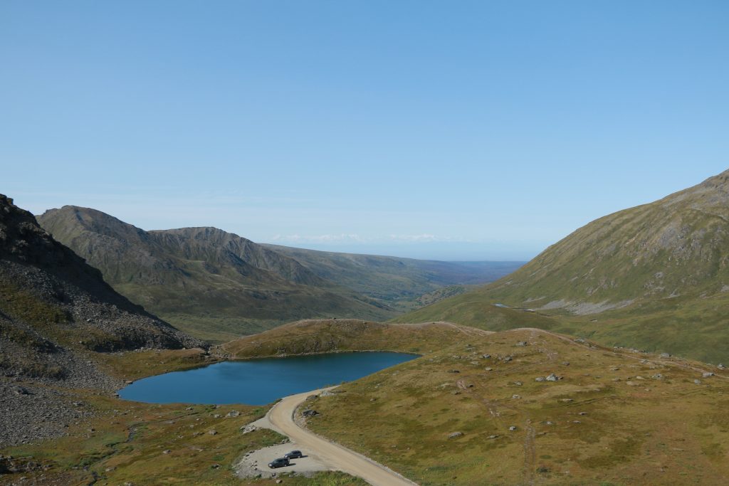
Skilak Lookout Trail— Cooper Landing. 4 1mi roundtrip. 800ft elevation. 45min to the top. 2hrs roundtrip. Magical experience. Unique blue color of the lake. Steep.
Slaughter Gulch— Cooper Landing. 3.9mi roundtrip. 2600ft elevation. 2hrs to the top. 3hrs roundtrip. Every bit a slaughter! Steep uphill. False summits. View of the lakes including Skilak Lake way off in the distance to the right.
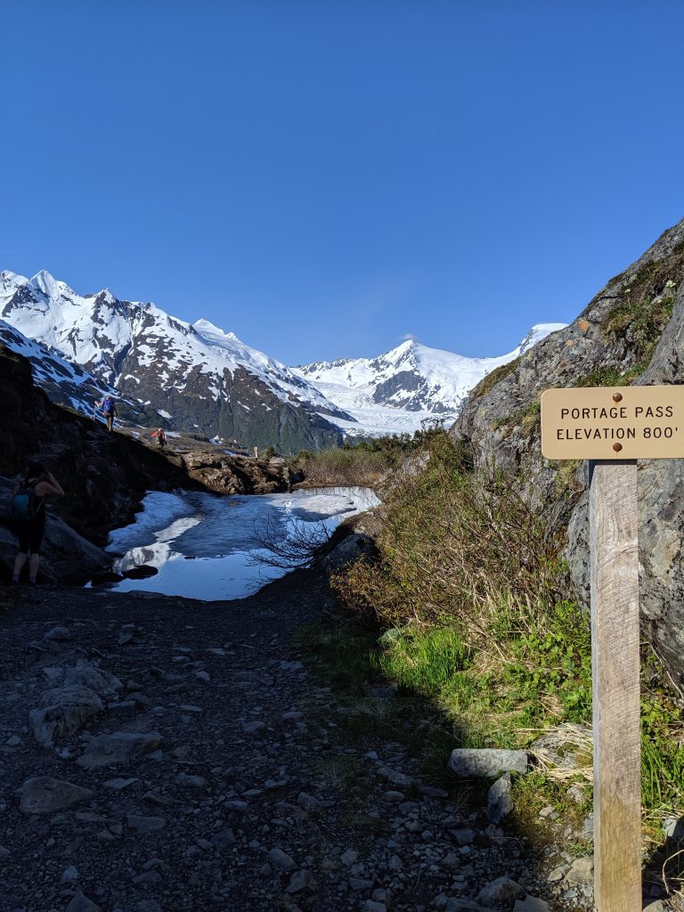
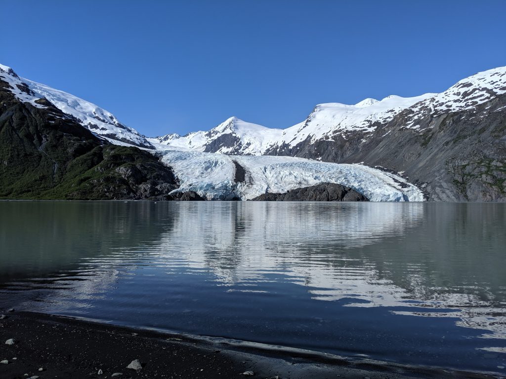
Portage Pass Trail— Whittier. 5.4mi roundtrip. 1600ft elevation. 2hrs roundtrip not including time relaxing at the lake. Starts out very steep until reaching to actual Portage Pass. Remaining is relatively flat with some inclines here and there and then a steeper decline for a few minutes to the actual lake. Small lake on the right roughly half way through the pass. Trail ends right at the lake with Portage Glacier across from it. Great place for a picnic. No obvious way to hike up to or onto the glacier.
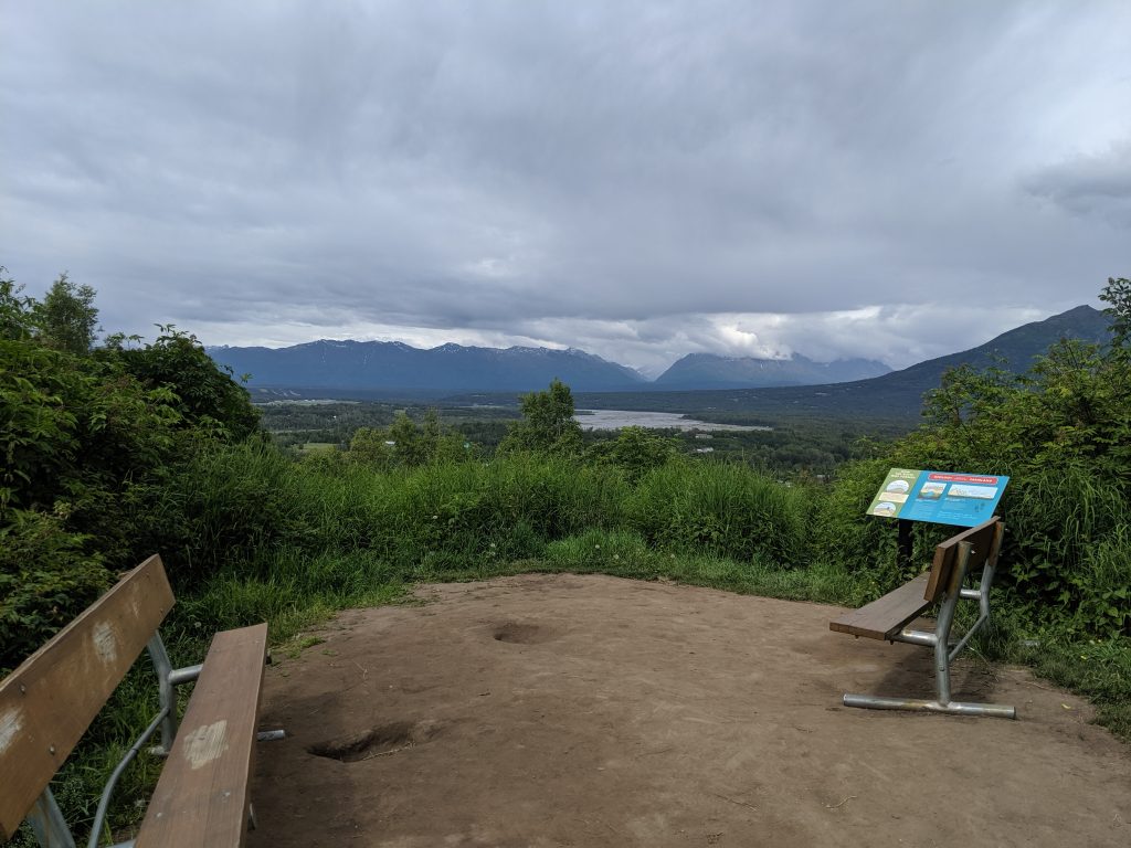
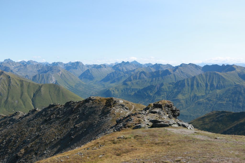
Twin Peaks w/ Lake Eklutna Overlook-– North of Anchorage. 4.8mi roundtrip. Roughly 1hr to the first Lake Eklutna overlook. Roughly 40min to Twin Peaks overlook. Roughly 2hrs 15min to the peak and second Lake Eklutna overlook. Beautiful views the entire way. Steep but manageable. Trail well-maintained. Well worth the effort– continue endlessly along the ridge line or just bask in the glory of the lake below!
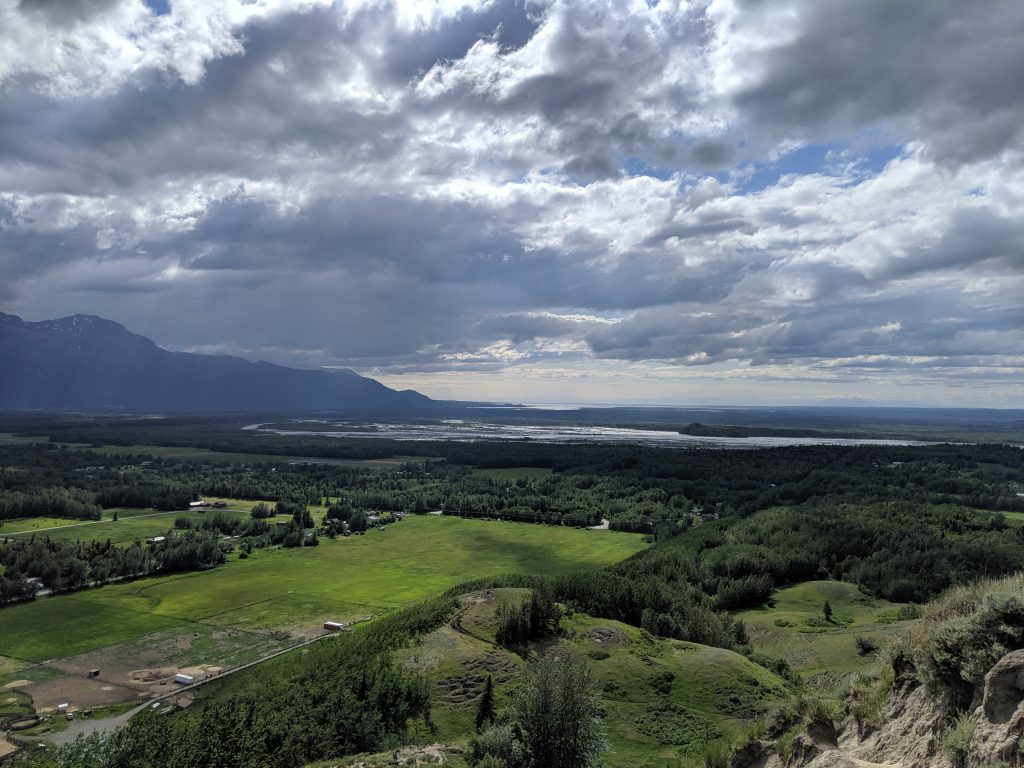
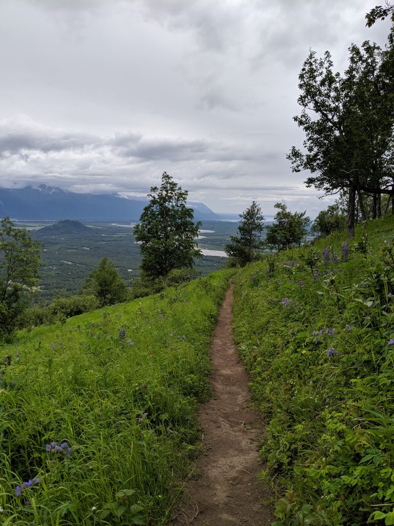
The Bodenburg Butte— Palmer. 0.9mi roundtrip. 670ft elevation. 40min to the top. 1.5hrs round trip. Steep, dusty trail with choose-your-own-adventure to the top of you want to stick to the trail it climb a few rocks. Glacier, farm land, and river all in view.
West Butte— Palmer. 2.3mi roundtrip. 700ft elevation. 30min to the top. 1hr round trip. Same ending as above. Easier trail, though, several stairs to the top for the second half.
Lazy Mountain-– Palmer. 4mi roundtrip. 3000ft elevation. 1hr 40min to the top. 3hrs 20min roundtrip if you take the Loose Moose trail down. Take roughly 30min off if you just throw yourself back down Lazy Mountain. At start of trail, signs point Lazy left and Moose right. The two trails eventually meet up to scale the ridge. Extremely steep on Lazy. Switchbacks on Moose. Gorgeous views the entire way either trail. Added bonus of wildflowers on Moose.
Valdez Goat Trail— Just north of Valdez. 4.3mi roundtrip. 800ft elevation. 2-3hrs roundtrip. Easy-moderate difficulty with some narrow spots along the way with steep drops offs the whole way. Muddy patches. Buggy. Easily traversed and family/pet friendly. Amazing outlooks. Ends at a wide and powerful waterfall. Very beautiful, jungle-like trail with high payoffs. Highly recommend. Trailhead starts off of the Richardson Highway between the two vehicle pulls-off between Bridal Veil Falls and Horsetail Falls closer to Bridal Veil Falls. AllTrails app is accurate.
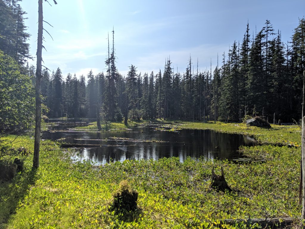
Dumpling Overlook— Brooks Campground; Katmai NP. 4mi roundtrip. Roughly 45-50min to the Outlook if being very bear aware and turning corners slowly and cautiously. 30min if walking a normal pace. To the summit is 4mi one-way so about 8mi roundtrip and roughly 5-6hr roundtrip if being cautious and bear aware. Well worn path but not greatly maintained so lots of over growth. Wear long sleeves and pants to avoid accidental exposures to harmful plants. Beautiful view of the lakes, mountains, and flowers at outlook– solid choice if pressed for time or traveling solo and don’t want to push your not-yet-eaten-by-a-bear luck.
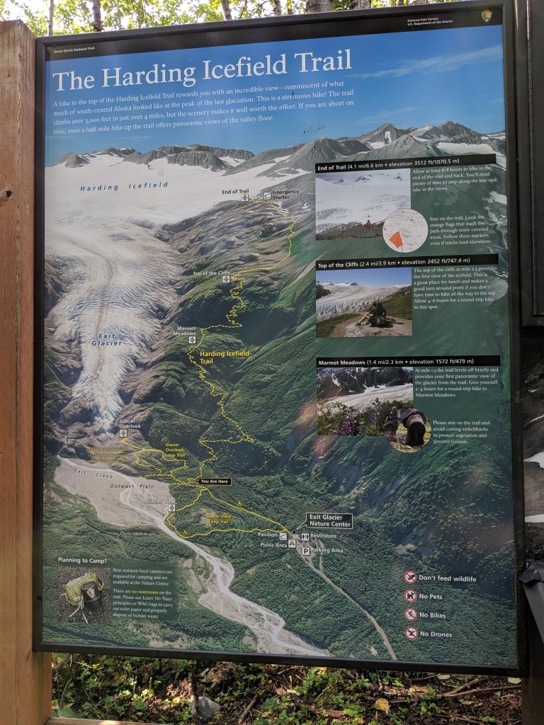
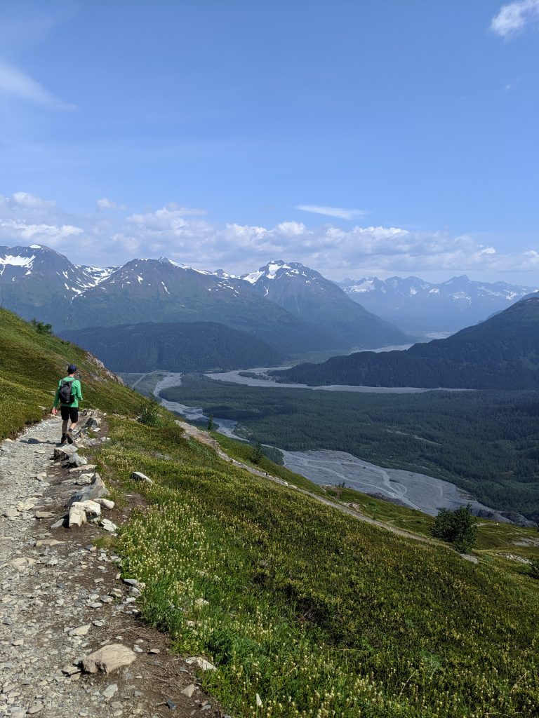
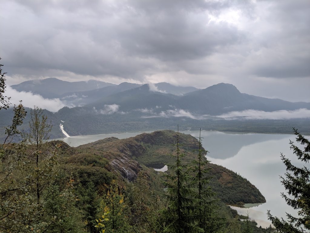
Harding Icefield – Seward; Kenai Fjords NP. 9.7mi roundtrip. 4hrs roundtrip. 3800 ft elevation gain. Moderate hike. First half is below treeline with enough flies to drive you mad. At roughly 1hr in, you come to the first overlook or clearing and many people stop here to picnic and enjoy the view. Continue on another 45min or so to reach the cabin. Another 30min past the cabin and down the ridge will take you onto the ice of the glacier. Beautiful view of the glacier and the water the entire way. 360 panoramic views once above treeline. Look out for mountain goats!
Exit Glacier’s silt below
Traversing the snow
Hikers on the ice of Exit Glacier!
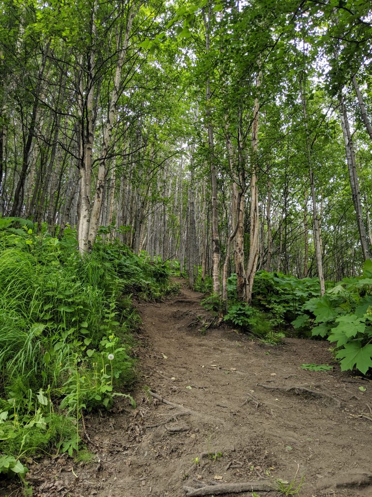
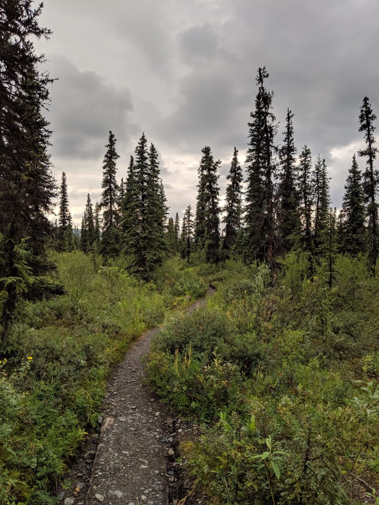
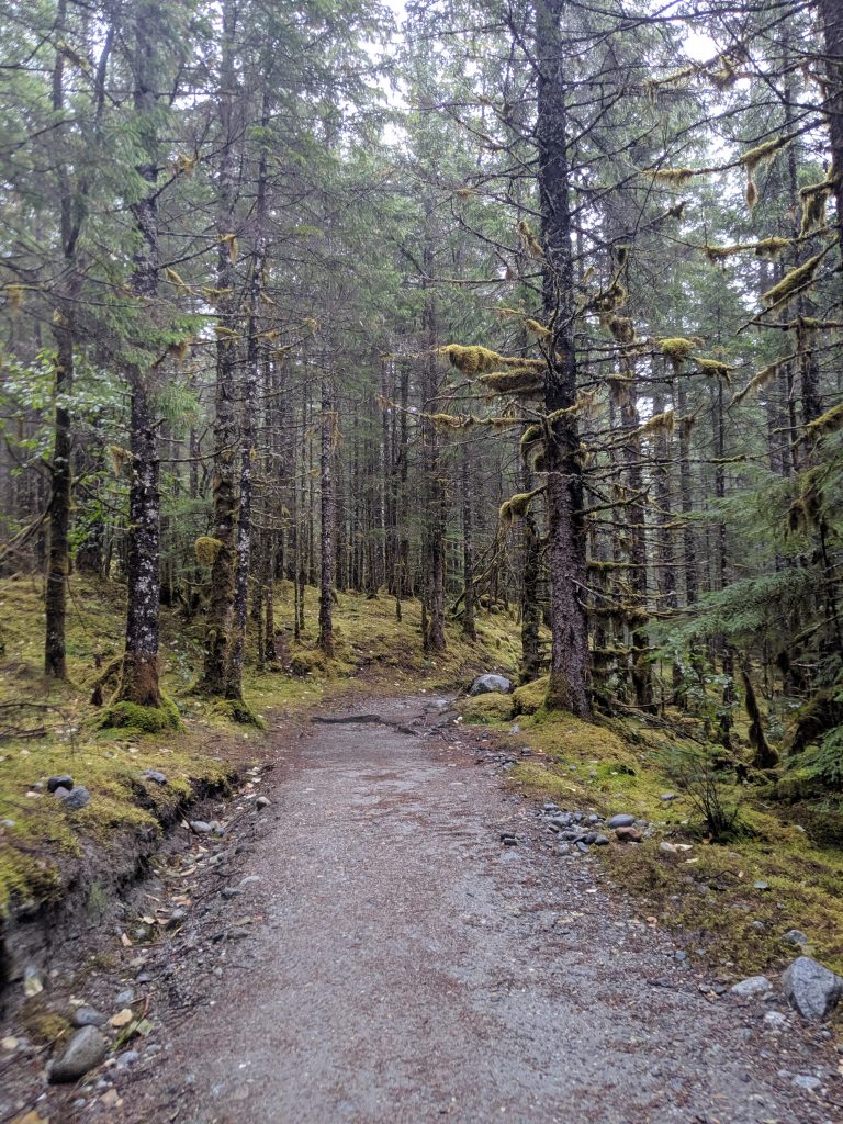
McKinley Bar Trail— Wonder Lake; Denali NP. 4.3mi roundtrip. Roughly 2hr roundtrip. 1000ft elevation gain. An easy and beautiful trail that traverses rocks, crosses streams, and travels through spruce forest ending at the river. Mosquito infested during the later summer days.
Spruce forest
The river
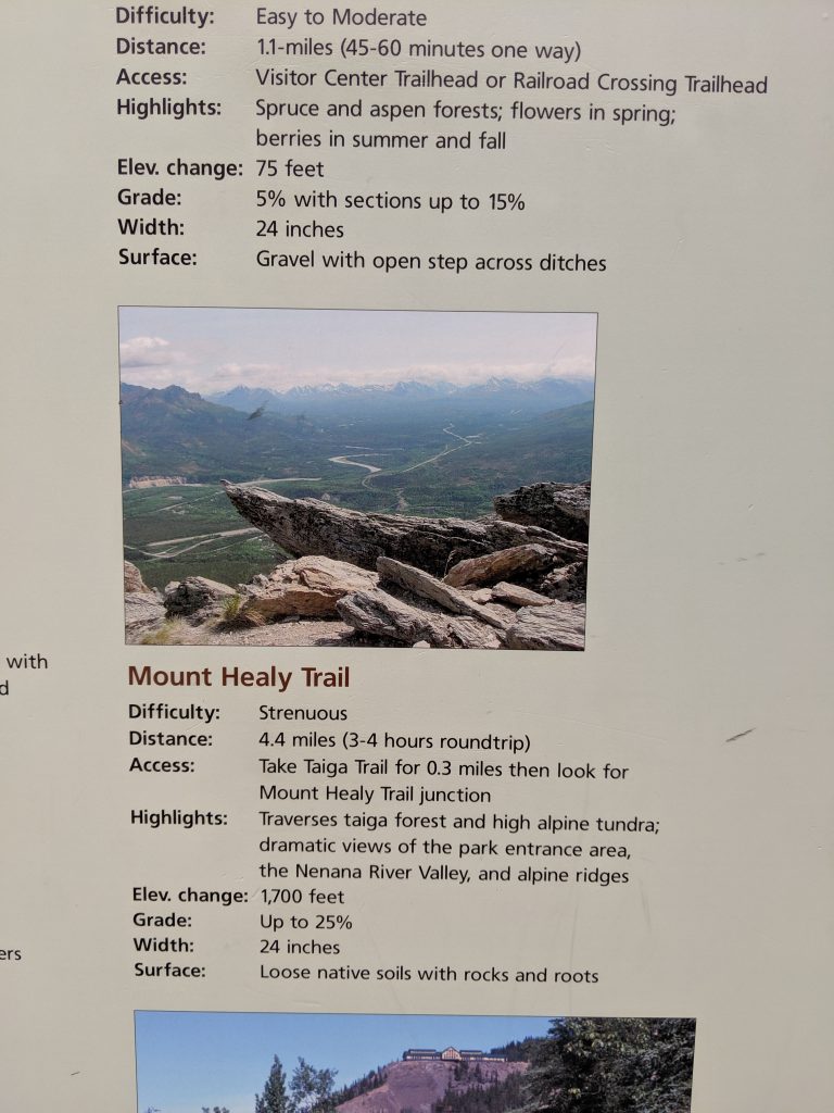
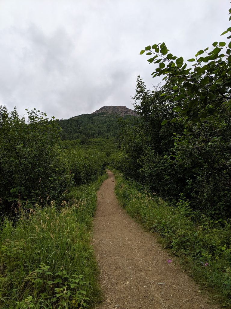
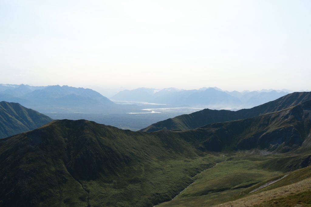
Mt. Healy Overlook— Denali NP. 4.4mi roundtrip. 2.5hr roundtrip w/ roughly 1hr and 15min to the top. 1600ft elevation gain. Views of Denali on a clear day. Rewarding hike. Not too difficult. Ridgeline continues endlessly.
Caribou Creek Trail— Nabesna; Wrangell-St. Elias NP. 7mi roundtrip. 3hrs roundtrip. Requires two wide and possibly forceful but not deep stream crossings that are manageable w/ appropriate footware and a walking stick or trekking pole. If you bushwack to the right of the trail where it meets the first water-crossing and remain along the water’s edge, someone placed a few logs over which one can scramble. Trail starts as a very wide dirt/stone path where construction is being done– minimal elevation gain. Once past the first water-crossing, a steady and moderate incline begins. Beautiful views of the water and valley opens up behind you as you climb. Muddy trail. Ends at the cabin just on the other side of the 2nd water crossing. A very serene hike. Accessible from Nabesna Road prior to any potential vehicle water crossings.
Bonanza Mine Trail-– Kennicott; Wrangell-St. Elias NP. 8.3mi roundtrip. 3.5hrs roundtrip; 2.5hrs to the summit. 3900ft elevation gain. One hell of a hike! Trail starts as a moderately steep town road with homes on both sides along the way. Trail opens up to a smaller summit on the right and the first set of mine ruins on the right (what I assume is remains of the tram system). A perfect spot for a picnic. Just past this, the trail becomes a footpath only– get ready to work! Very steep. Waterfall in the center of the valley. Trail curves left past the waterfall to the mine ruins. Scramble up past the ruins (a true scramble on small rocks, some two steps forward and one step sliding back required) until you are on the ridgeline. Enjoy amazing views of the Mt. Blackburn, the glaciers, the town, the water, and the mountain range. A fabulous hike but definitely difficult for the 2nd half to the top.
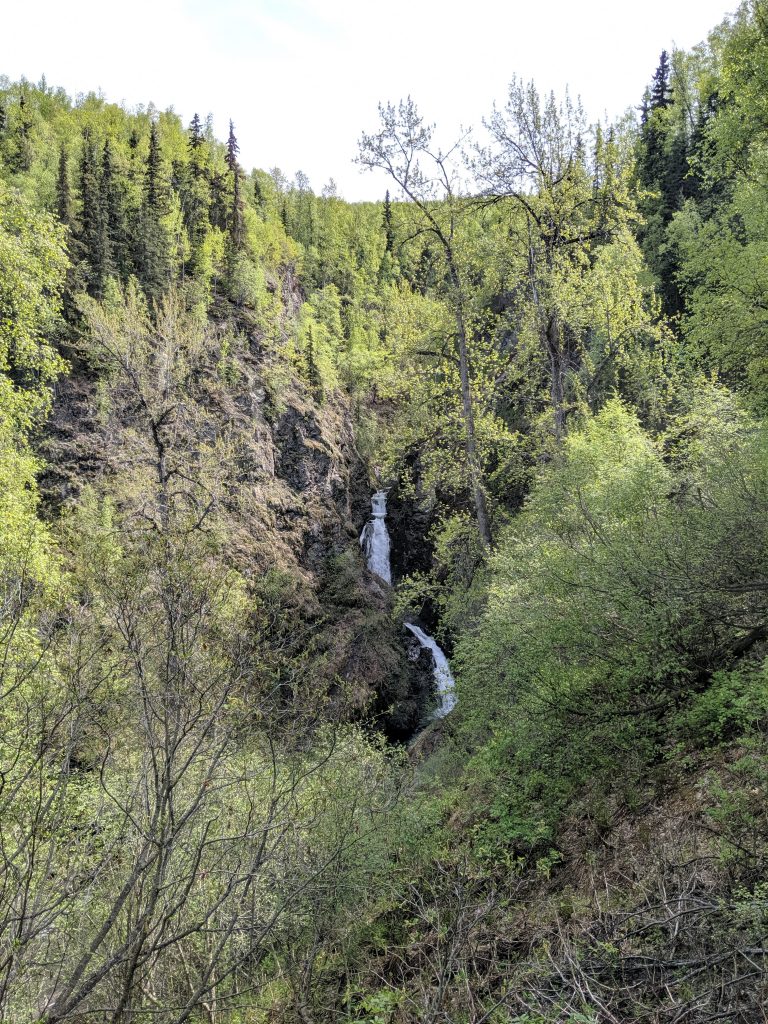
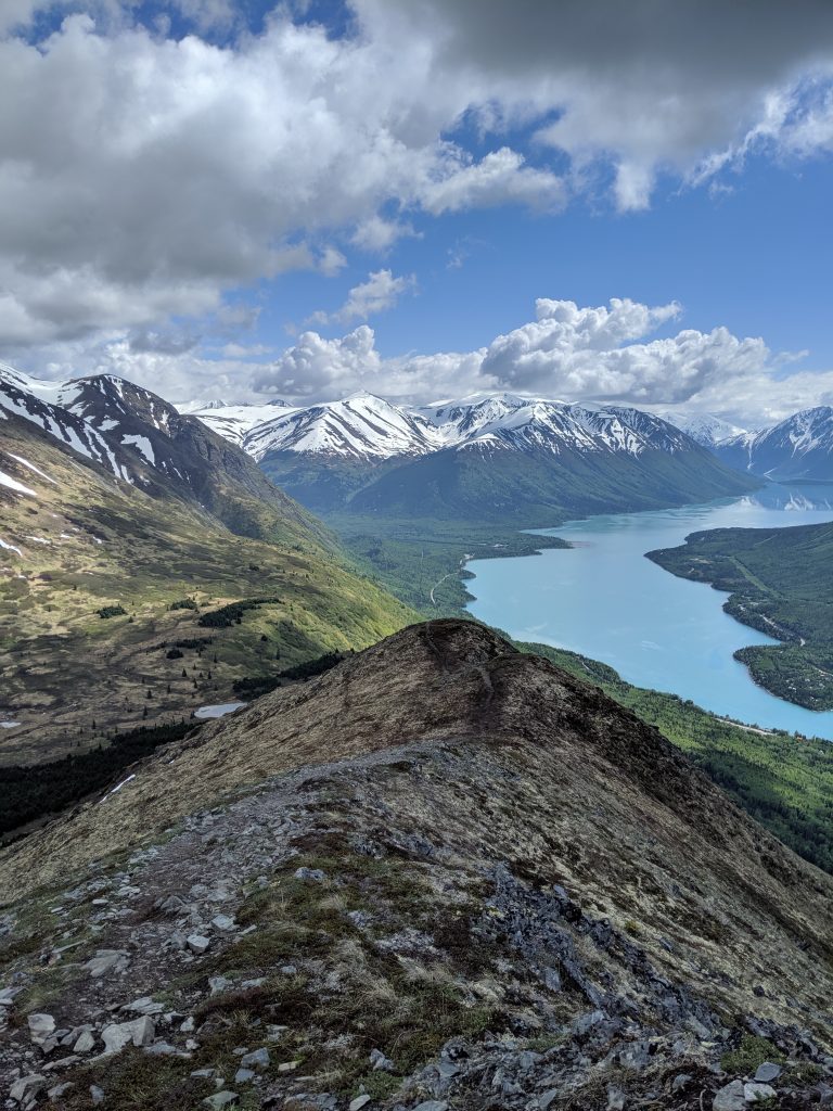
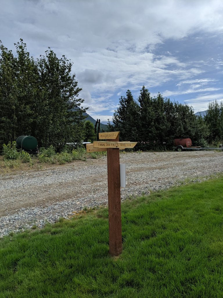
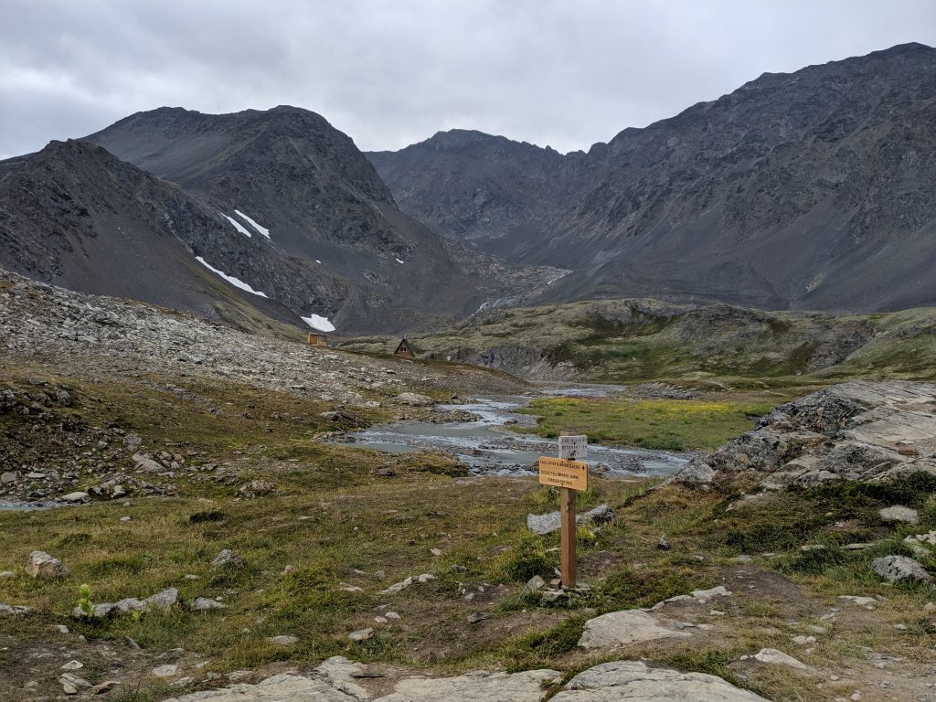
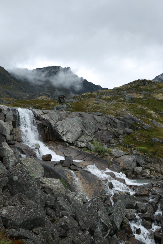
Tanalian Falls— Port Alsworth; Lake Clark NP. Roughly 1 hr one way. Part of the roughly 7.5mi roundtrip maintained parks service trail. Moments of steep incline and uphill/downhill; generally a flat trail. Views of the Tanalian Mountain as you go. A breath-taking site to see. One of the most impactful waterfalls I have ever seen in my life. The force of it. The array of colors. The clarity of the water. The way the trail opens up to the falls and the river feels like you just stepped out of the jungle and into a fairytale. Stay at the lower falls or walk 3 more minutes up the trail and scramble onto the rocks at the upper falls– you won’t be disappointed!
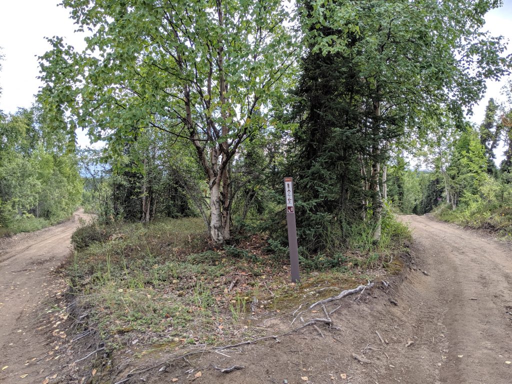
Markers along the way for Tanalian Falls Trail vs. Mountain vs. Beaver Pond Trail
Lake Kontrashibuna via Tanalian Trail— Port Alsworth; Lake Clark NP. 1.5hrs one way. Completes the roughly 7.5mi roundtrip trail maintained by the parks service. Moments of steep incline and uphill/downhill; generally a flat trail. Roughly 30min past the Tanalian waterfall. Clear ending where trail opens up to the lake with firepit in the center but one can follow the brush trail around the majority of the lake. So peaceful!
Tanalian Mountain along the way
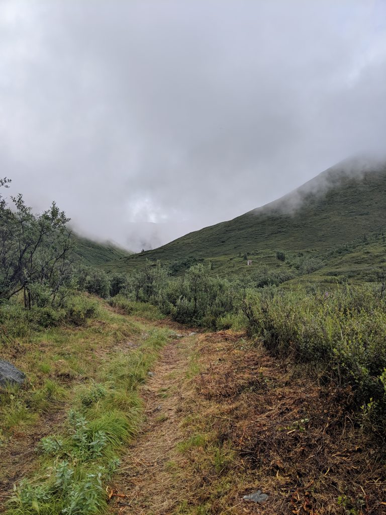
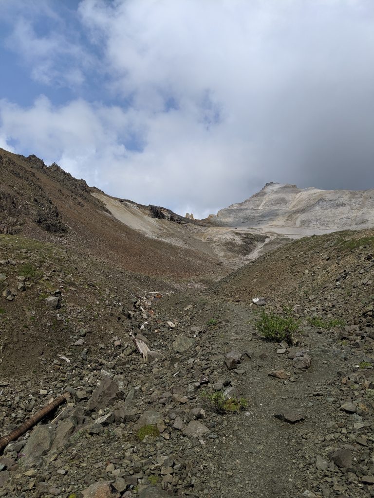
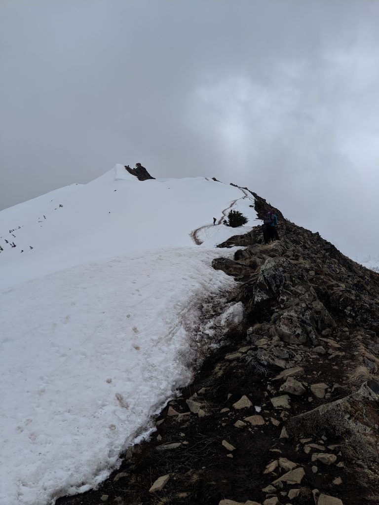
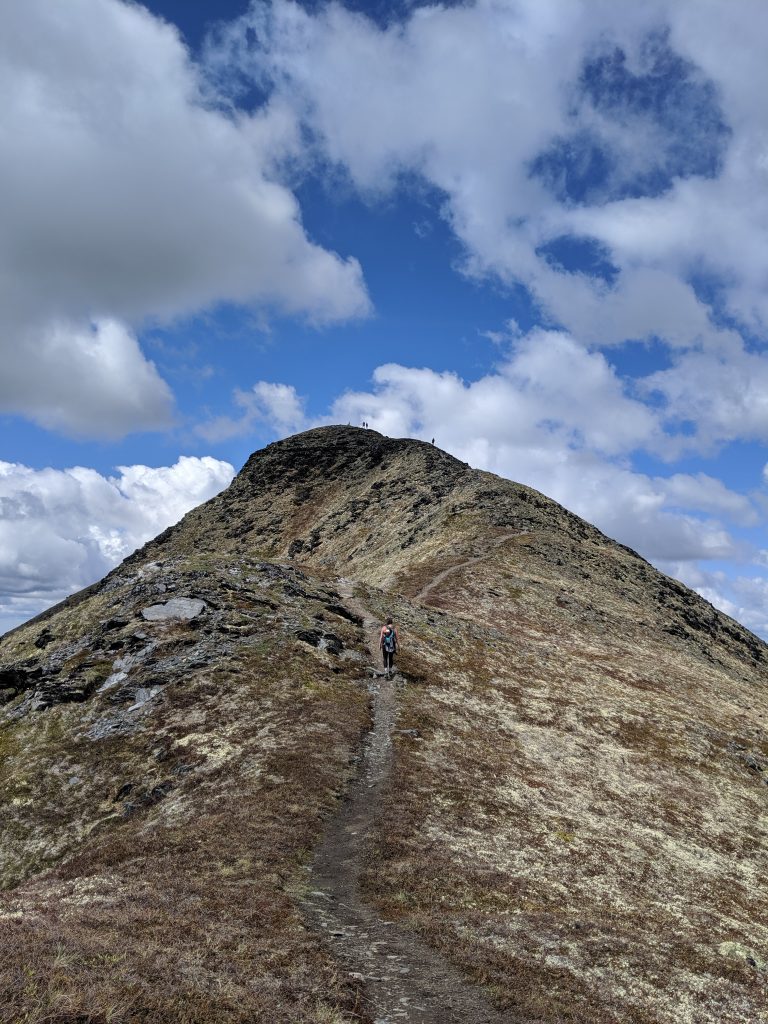
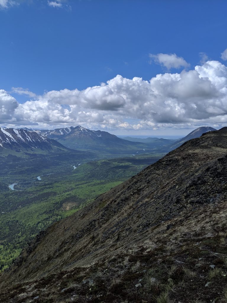
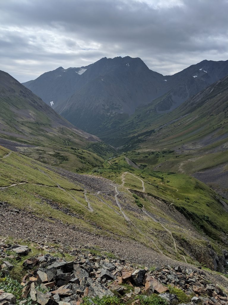
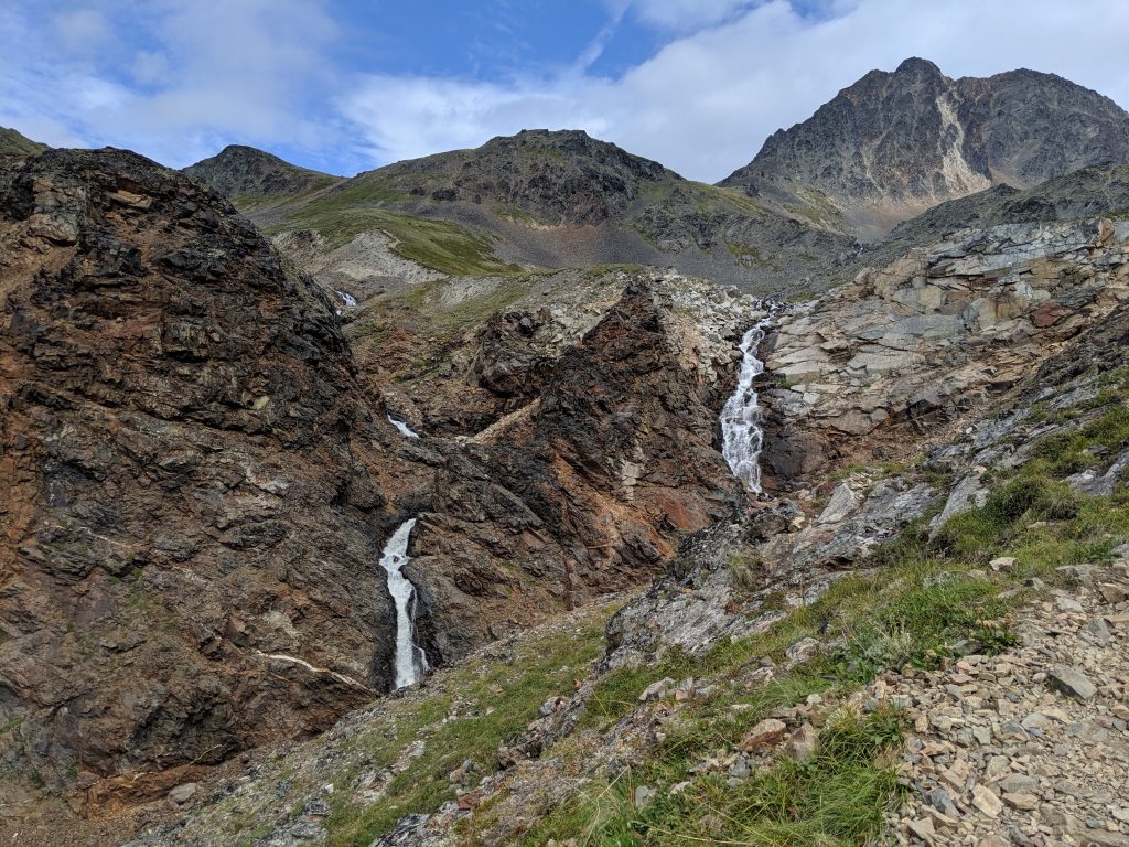
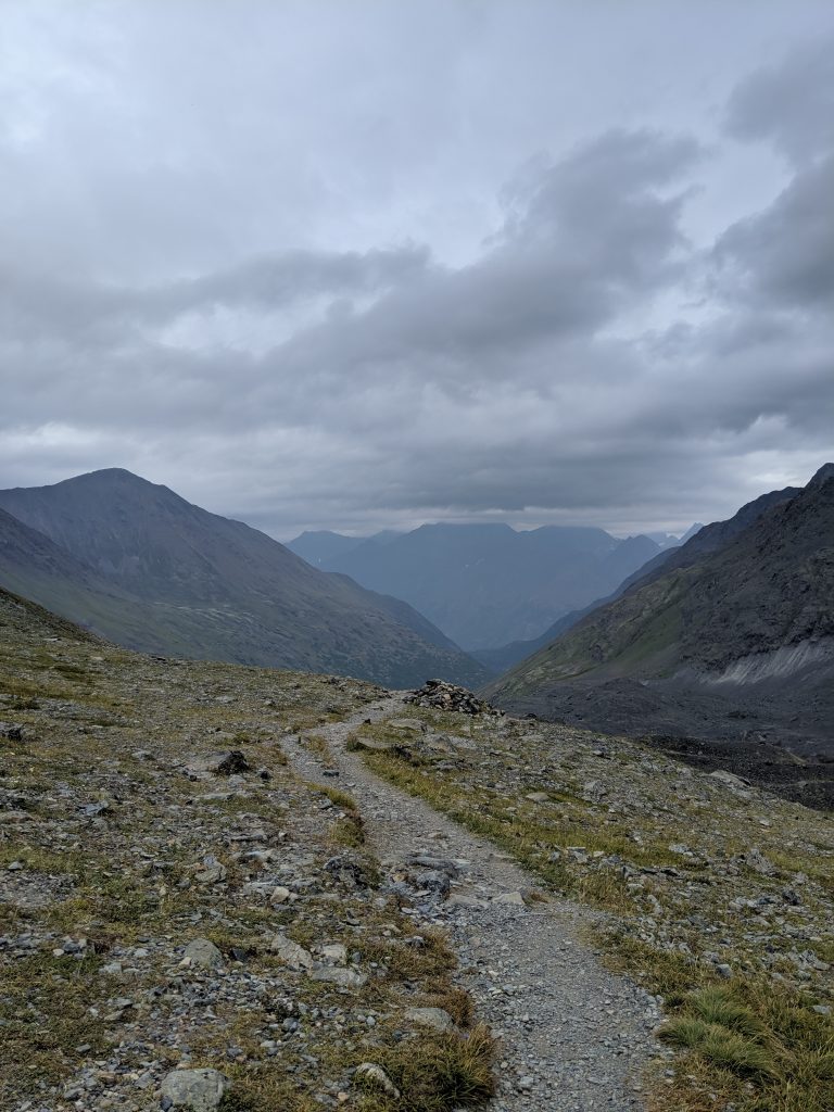
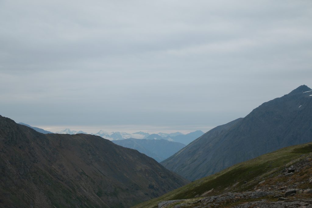
Tanalian Mountain— Port Alsworth; Lake Clark NP. 8.2mi roundtrip. 3800 ft elevation. 2hrs to the summit from the start of the Tanalian Mountain trailhead. About 3hrs to the summit from the Tanalian Trails marker at the very beginning at the airstrip in town. About 5hrs roundtrip from airstrip. Roughly 30min more along the ridgeline once past the pipe marker. Narrows quite a bit over rock near the summit so be careful and don’t attempt if the peak is in the cloud. Trail opens up the entire way for sweeping panoramic views of Port Alsworth, Lake Clark, the Tanalian Falls, and the surrounding mountains. View keeps getting better as you go up. Very overgrown on the switchbacks near where the trail becomes above treeline but very easy to follow. Trail overall very well maintained. Would do it again in a heartbeat. Would do it multiple times a year for the joy of the hike and the breathtaking views if I could!
A steep incline
Overgrown trail
Mountain goat in the cloud!
Tanalian Falls from up above!
The view from the pipeline
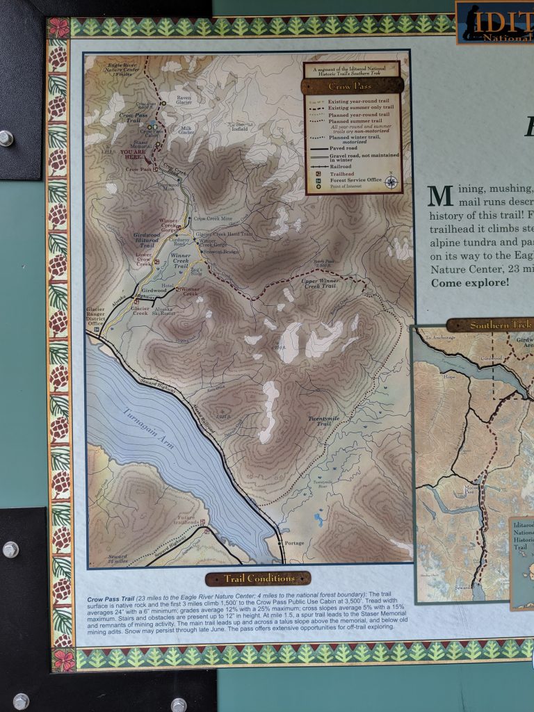
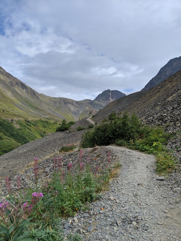
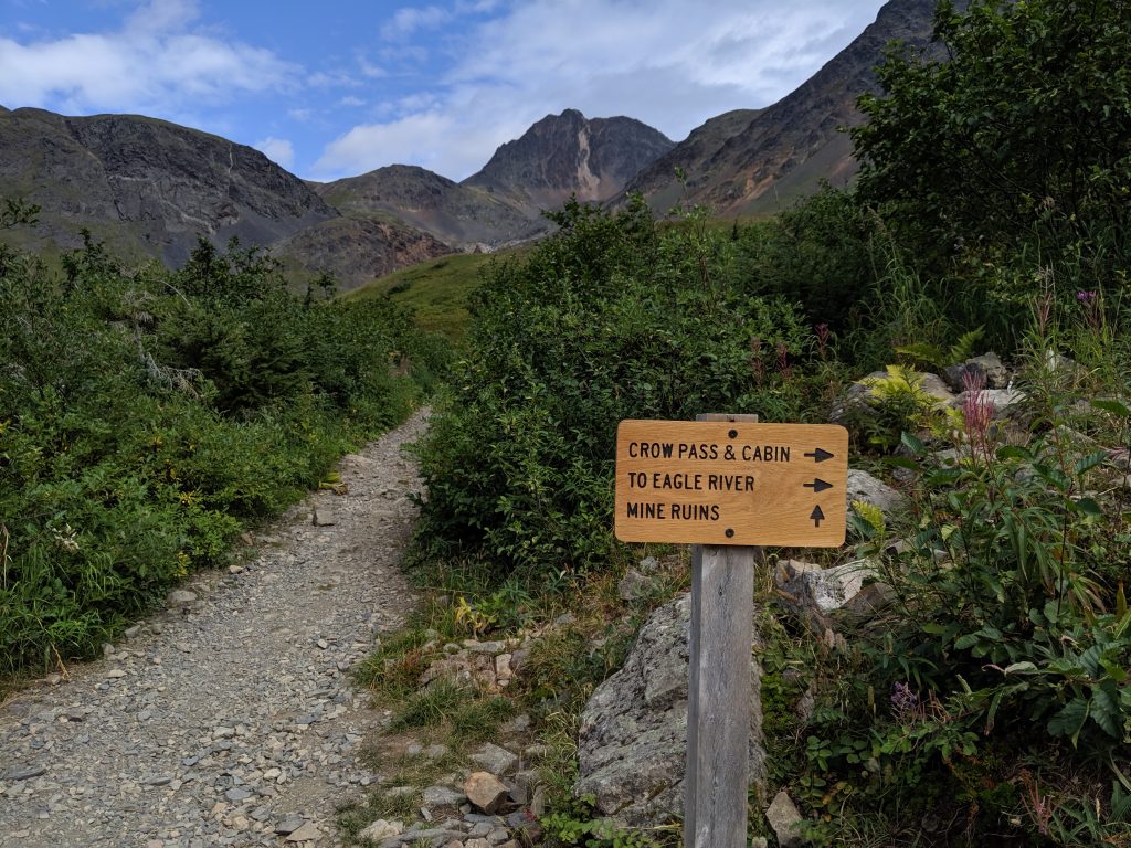
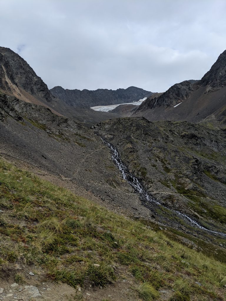
Crow Pass: Crystal Lake & Raven Glacier— Girdwood. 6.2mi roundtrip. 1900 elevation gain. 3hrs roundtrip with time spent on the at the lake and/or glacier. Trail splits once in the valley– to the left is more steep because it takes you too the waterfall at the mine tailing and then requires one to scramble up to where the trail converges again; keep to the R for a much more steady ascent. Trail steepens to the lake traveling along the waterfall on the left. Amazing views the entire time once above treeline/ in the valley. Historic trail due to the mines. They ask that you not go on the tailings. Cabin at the lake is booked by reservation only– so serene, peaceful, and beautiful as it is right on the lake. Glacier only a short walk past the cabin– maybe 20-30min. Trail continues on to the rest of Crow Pass.
Reed Lakes— Hatcher Pass near Palmer. 8.7mi roundtrip. 2250ft elevation gain. 4hr 20min roundtrip. Several areas of larger boulder scrambling. Can be very slippery. Very worth the danger! First section is a relatively flat, wide path. Trail features a small pond after the largest rock scramble, the Lower Reed Lake roughly 30min later with a waterfall just next to it, and the Upper Reed Lake roughly 30 more min at the end trail.
View of beginning valley
Boulder Scramble
Lower Reed Lakes
Waterfall!
Upper Reed Lake
Wolverine Peak— Anchorage. 8.3mi roundtrip. 3600ft elevation gain. 4-6hrs roundtrip depending on tolerance for incline and number of stops. Roughly 2-3hrs to the top. Better view than Flattop though similar terrain. Beautiful lakes in the valley on the other side of the peak. Flat overlook half way to the peak is a great place to stop or to enjoy lunch on the way.
Anchorage w/ snow capped mountains in the back!
Mountains for dayzz!
We climbed that… :/
Lakes seen from the peak!
April Bowl— Hatcher Pass near Palmer. 2.2mi roundtrip. 850ft elevation gain. 2hrs roundtrip. Starts immediately with incline and doesn’t stop until at the ridgeline. Offers miraculous views of the Denali Range. Trailhead is unmarked and located across the road from the Hatcher Pass stone monument and main overlook/ parking lot.
Bartlett Lake Trail— Roughly 7mi and 4hrs roundtrip. Follow Tlingit Trail from Visitor Park Services (VPS) about 0.6mi and cross the park road where trail picks back up as the Barlett Lake Trail on the left. Continue straight to go to the river on the Barlett River Trail or veer right to hike to the lake. DO NOT follow AllTrails version of Barlett Lake Trail as it starts you several miles away from the VPS and the lodge at the end of Park Road, which doesn’t make sense if you are camping or staying at that the lodge. Instead, follow the Barlett River AllTrails map and zoom in to confirm placement along the lake trail.
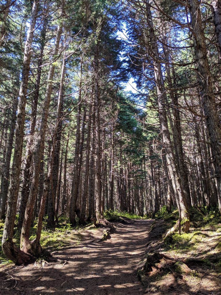
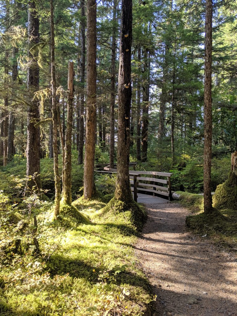
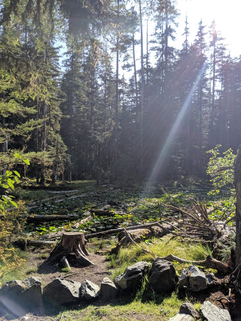
Bartlett Cove & Forest Loop Trail— 1.1mi roundtrip. 100ft elevation. Leisurely walk from Glacier Bay Lodge & Visitor Center that passes campground site and loops back to lodge. Features small ponds. Great representation of the temperate forest.
West Glacier Trail to West Glacier Spur Trail— 4hrs roundtrip just hiking plus roughly 1hr at the glacier exploring the ice caves. Take the West Glacier Trail to the West Glacier Spur Trail which is a split to the right shortly before it becomes the Mt. McGinnis Trail. Trail is slightly hidden– stay straight whereas Mt. McGinnis trail curves left as a switchback; look for pink and yellow ribbons throughout– lifesavers! For two amazing vistas, go 5-10min on the Mt. McGinnis trail and then double back. DO NOT take the first available split to the right called Ice Cave Trail. Unnecessarily difficult rock climb with nearly same reward and only slightly more front-on views of the glacier and Nugget Falls. AllTrails is not correct with total milage if trying to reach the glacier as trail on map ends at a viewpoint. Keep curving to the left if facing the glacier and go around the water to find where glacier meets rockface– this is where ice caves are. Very slippery and larger rocks cannot be depended upon for stability or balance. Be safe and have fun!
I left my hometown of Rochester, NY on May 4th to pursue a career in travel nursing. Formally a staff nurse in the local emergency department, I’ve decided that there is too much in the world still yet to see and experience. From landscapes to cultures to illness, I want to absorb it all and base my world view on a broader spectrum and describe it with a more fruitful vocabulary. So, where to first? Alaska. I KNOW! I can picture no better way to spend my summer than with 22hrs of sunshine daily and a glacier in my backyard. High temperatures in the 60s is… alright, but I’ll take what I can get because Rochester has been nothing but clouds, rain, and early May snow-showers. So my first ever blog is a detailed account of my adventure before the adventure, purposefully naming favorite places and specific experiences. This one is mainly for me. Goodbye Rochester. Goodbye family and friends. Hello Alaskan strangers!
First Goodbye: Rochester
The first, and hardest, goodbye was to my family and friends in Rochester. Involving several small get-togethers at my apartment as well as several more one-on-one’s at bars and restaurants , I was overcome with gratitude at the people I had gathered in my life. Even my cousin from hours away came through to wish me good luck. Saying goodbye to my hometown AGAIN has been one of the most important parts of this journey for me. The first time I was in a hurry to grow up and become someone. This time, I was in no rush. I am a fully formed human with many aspirations but I have a brighter head on my shoulders and stronger roots in the ground. I’ve never been one to feel strongly about a place. I’ve never needed to be physically near my family. The itch in me to run off somewhere new, fueled by fear and positive intentions, has always been too powerful to ignore. So I often set off at record speed, hardly looking behind me to see how it affected my family and those I left behind. But this time was different. This time I made sure to see as many family members as I could, as many friends as I could, as many times as I could, by whatever means possible. The morning of my departure, I walked onto my front porch, the metal knob cold in my hand as I closed the door behind me. I had checked and rechecked the house several times. My father waited patiently in the car. I paced up and down the porch steps, running through everything in my mind, checking off boxes that had already been checked. I was reluctant to leave, though. The clock read 6am. The longer we waited the more we were pushing it for a 7:40am departure and the later it would make my dad who had work at 7am. We both knew this. But what we were waiting for was too important. It was my last Rochester goodbye. After a week or more of missing each other, my brother and I had still not met up to say goodbye. It was a long shot, but I remembered that he usually gets out of work around when I would be leaving for the airport. He said he’d try to get out on time. The sound of his tires pulling into my driveway nearly brought tears to my eyes. If it hadn’t worked out, I guess it wouldn’t have been a big deal. Our lives would have kept going. The world would have kept spinning. But there’s something unique about a sibling relationship. A total stranger in many rights but the one who understands why you are the way you are in a way that no one else can. I guess I could say that hugging my brother goodbye in the nick of time, wishing him well, and asking that he stay in touch was no big deal. Except that it was the biggest deal of all.
Second Goodbye: NYC
The city that never
sleeps. Where I met some of my very best friends. The place that introduced to
me both Buddhism and molly. Only a one-day stop, but always worth it. My
favorite place to eat: Peacefood Cafe.
I leave with a grasshopper cookie in hand and a smile on my face every time.
Though a slightly disappointing mani-pedi from Haven ensued, the trip was necessary. There
is a certain energy about New York. A certain unspoken understanding among
pedestrians that we are all unique, all artists, all on this Earth for a
purpose. As cheesy as it sounds, there’s a vibration in the air that is
contagious. I hold my head higher. I walk taller. My back straighter. I feel
the value of hard work and creativity.
A quick visit with a
friend currently studying for law school exams beautifully captured the essence
of true friendship. I feel emotional when she thanks me for making time to see
her during my busy schedule. MY busy
schedule! Such a sweetheart.
After an
enlightening discussion with my Dharma
teacher about habits and human nature and an elegant Epsom salt bath, I was
more than ready for bed. The problem: I was too wired to sleep! #theworst. I
tossed and turned for at least five hours and before I knew it, my alarm rang
2:30am and I was dreading life. Luckily for me, my host and dear friend sensed
my rising, brewed a pot of coffee despite my protestation, and saw me off. I
left New York feeling truly loved. My former home. My former love. No pictures
or shenanigans. A quiet hello and a somber goodbye as I officially leave the
East coast for the foreseeable future.
Shortly after a
swift and expensive Lyft, I found myself at my gate with leftover tofu scramble
and a coffee in hand. A grin across my lips, silently bragging, I enjoyed my
time being EARLY to the airport. No scrambling for this girl! AND my vegan food
made it through security. Because I would have held up the TSA line to eat that
tofu. No chance I was throwing that out… lol.
Third Goodbye: Las Vegas
But first, get the
rental car. Now, when I tell you that it was a process, I mean it was a
PROCESS! Three shuttles later we arrive at Fox Enterprise. And that’s three
shuttles where I had to lug around two suitcases and a bag wearing 4 layers of
clothing which I had to wear in order to keep my checked bag under 50lbs.
Which, if we can go back for a moment– how dare they start charging for both
carry-on space and checked luggage! They cram us in like sardines and then have
the audacity to charge us for space that just last year was free. I hate being
taken advantage of. Who travels without a carry on?? But I guess that’s the
point… I digress.
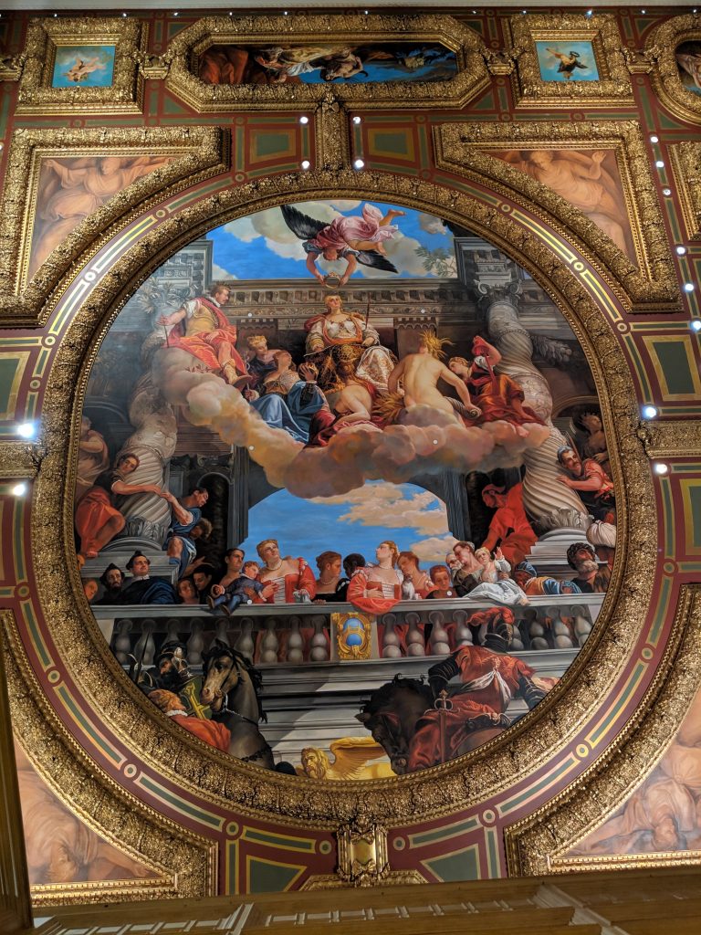
And so, with sweat dripping from my brow and my shirt(s) sticking to my clammy back, my Las Vegas travel companion and I were finally sitting in the rental and ready to leave the lot. The agenda for day 1 comprised of day-drinking and hotel lobby spotting. We ate brunch at Vegenation, one of my favorite Las Vegas spots, and it did not disappoint. It is a self-proclaimed mission for me to try each vegan restaurant’s version of buffalo wings and to rate them. My travel companion eagerly agreed to join the cause. :p. Per our expert opinion, Vegenation gets high marks for both taste and texture. After landing at Luxor and struggling to figure out how to self-park, we took in the impressive display of Egyptian art and got dressed for our first day on the Strip. Since everyone says that day clubs are “uniquely Vegas” and “the place to be,” we made that our first stop. We felt awkward and too old to be at Marquee Day Club, though. Kids in their early 20s were hitting on us and there was no where available to sit down or even place our belongings while we danced. We paid $16 a piece for gin and sodas and there was a clump of hair in the pool. Suffice it to say, we will be trying out a different spot next time. Next came dinner at A Slice of Vegas where we shared a most delicious pie of vegan BBQ pizza and rated their cauliflower wings as “good” but not surpassing those from Vegenation. Their distinctly cauliflower taste was refreshing though, we agreed. Visiting the hotel lobbies at night was a highlight and always proves worthy of one’s time. Having been to Las Vegas before, I was familiar with Caesars Palace and Bellagio and I did not regret seeing them again. Magnificent works of art detailed the main entrances, the casinos, and the shops playing with negative space and various themes. My newfound favorite: The Venetian. I love museums, especially art museums with paintings, so I found this to be a wonderful adaptation.
My travel companion and I @ Marquee Dayclub
Artwork on the ceiling of The Venetian Hotel
Day 2 was a mix of planning meets spontaneity. Inspired by the addition of one more friend, we ventured to an art piece that she had seen on Instagram: Seven Magic Mountains. Created by Swiss artist, Ugo Rondinone, as a “creative expression of human presence in the desert” (see link, homepage), this public art display is located in the Ivanpah Valley just 10miles south of Las Vegas and open for viewing until 2021. I realized at this moment that a theme in my life is appreciating art in it’s varying modes of expression. Even when being spontaneous, it somehow involves artwork. I am not upset by this revelation. The three of us girls then continued North to take in Red Rock Canyon. We entered with my National Parks Pass, which I highly recommend purchasing. At only $80, this pass is good for one full year from the month of purchase and allows one vehicle free entry into all federal lands including national parks and forests. The only caveat is that only two signatures are allowed on the back of the card, meaning that one of those two people must be present, with photo ID, in order to use the pass. Since purchasing in April of 2019, I have already saved $50 on entrance fees– one more entrance and I will have broken even on the cost of the pass! And so, back to Red Rock Canyon, it was beautiful, yadda yadda. What can I say? I’m a sucker for nature and am continuously blown away by it’s history and marvel at the notion of how it all comes to be. The sun dances across bold dashes of bright red rock that was produced thousands of years ago by iron deposits. We hike for a short while, meeting bugs and flowers scattered along the way, and we talk about all of the topics. Three girls enjoying nature. What more could we ask for?? Well, I’m glad you asked! Because, in stark contrast, for dinner we find ourselves back in Vegas enjoying a meal at Carson Kitchen (where I eat the most amazing rainbow carrots w/ sautéed chickpeas and quinoa that I have ever eaten in my whole life and have yet to stop thinking about!) and taking a tour of Old Town which is nothing like what we expected (which, in all fairness, we didn’t do much research about it in the first place so expectations were minimal). For several blocks that are pedestrian only, we walked and we people-watched. Some were drinking and laughing, impersonators of all types were present, and a different band was playing on each block ranging from country to rock. Luckily, we quickly found ourselves tired and heading back to the hotel. Part of me feels sad but drinking and nightlife have not found their way into my #thisis30!
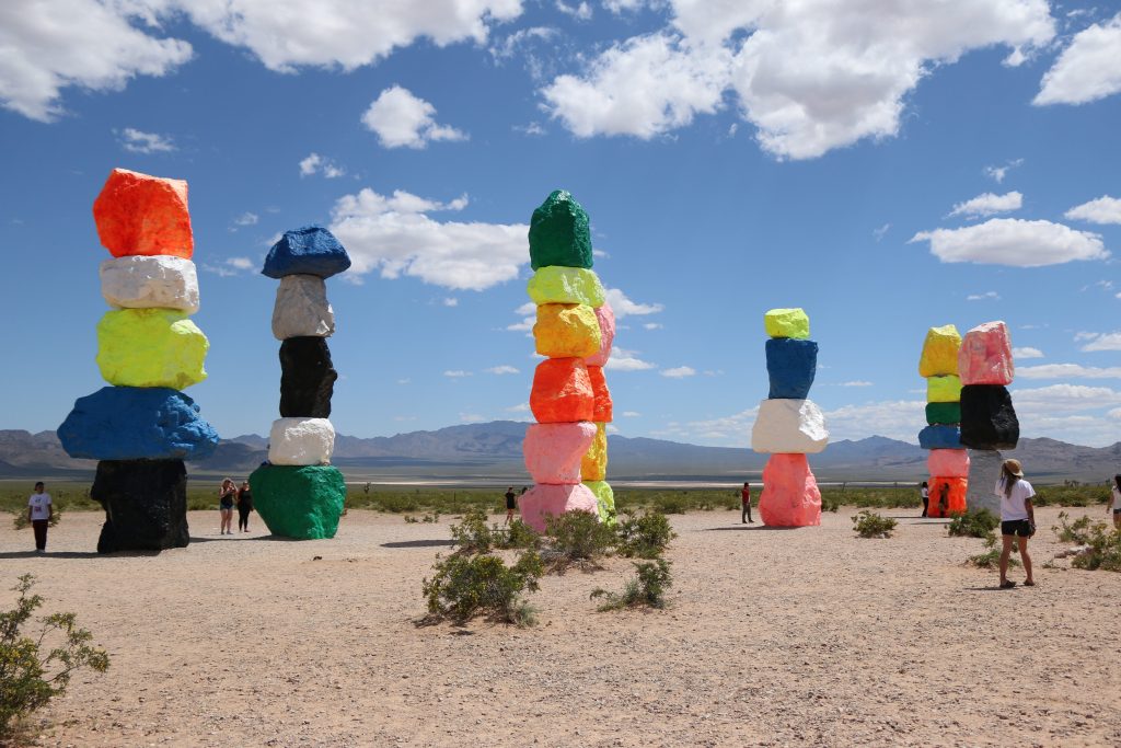
Seven Magic Mountains
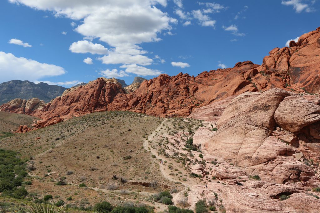
Red Rock Canyon
Seven Magic Mountains (Left); Red Rock Canyon (Right)
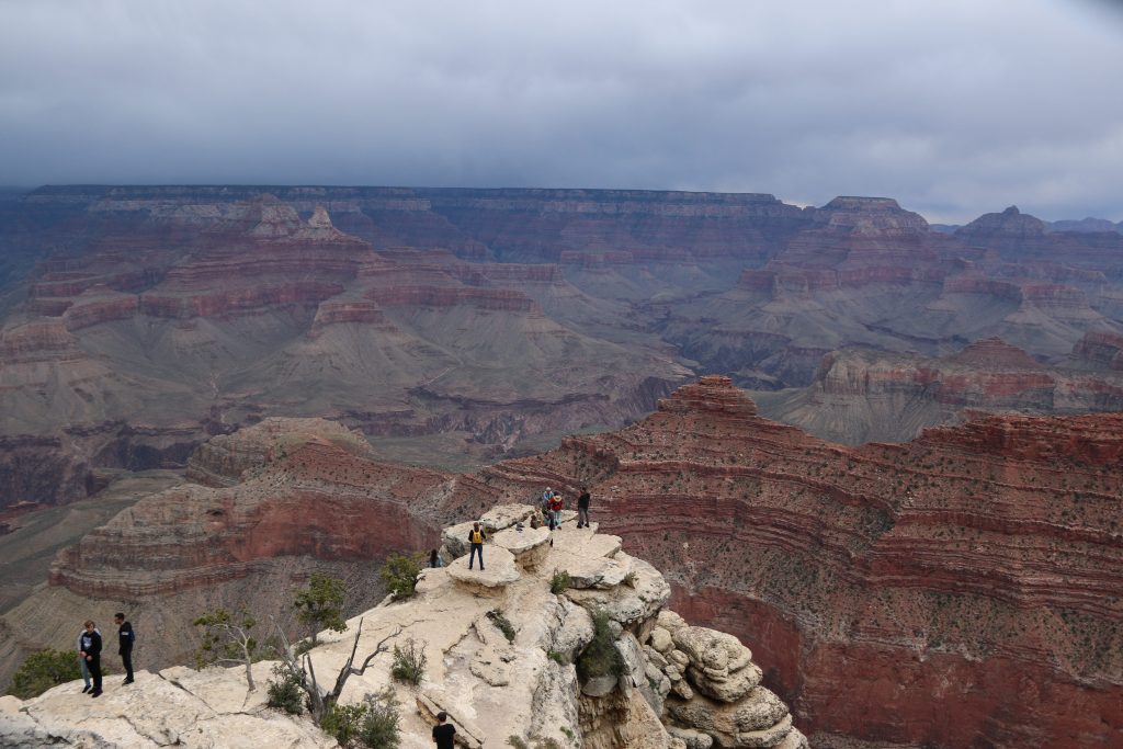
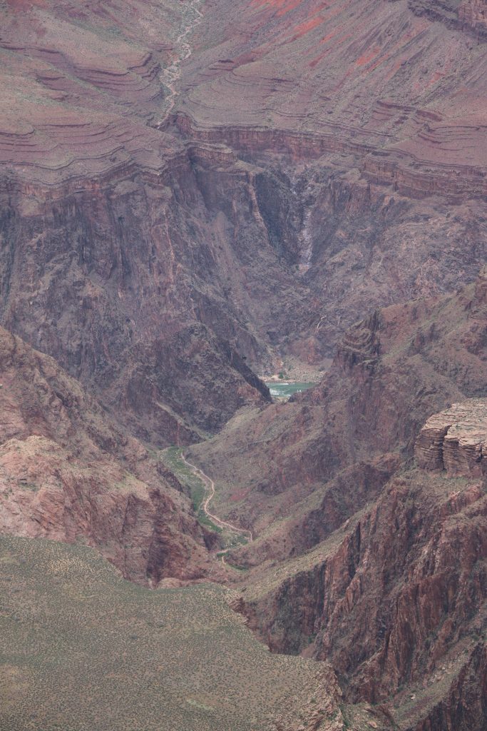
Day 3 was sketchy but ultimately very successful. It was soon discovered that my friend and I are not great planners or communicators. We had narrowed down our goals to Grand Canyon in the morning/afternoon and Hoover Dam in the evening. Typical us, we didn’t check closing times or leave early enough. It all started when I woke up 30 minutes late on only 6 hours of sleep. I shortened my workout to a 20 minute run and was out the door as fast as I could be. With a Starbucks oatmeal (made with soy milk, I added almond slices and a banana) and a soy latte in hand, we set out. Only problem was that it was already 9:30am and we had planned to hit the road closer to 8am after factoring in gym, breakfast, and traffic. So we trudged along through the desert, driving past more desert and then past more desert passing cows and small communities here and there. The view was obviously breathtaking but so different from New York. No pine trees line the roads and obstruct the view. Just an endless distance. And speaking of distance: The Grand Canyon. After 4.5 hours of driving, we finally made it. Dark clouds rolled closer and closer to the rim, so I scrambled as quickly, AND SAFELY, as possible to nearest edge, took a few photos, and we ran back to the car with rain dripping down our necks. Having spent only an hour, I know that this national park warrants much more and I vow to myself that I will return with my boyfriend for the scenic drive around the rim and an overnight hike. After this short but inspirational visit, we reluctantly headed home because we found out too late that the Hoover Dam closes at 5pm and the hike to the nearby hot spring is 3 hours roundtrip…
Grand Canyon
Grand Canyon
Day 4 was only a half-day in town. We treated ourselves to a $50 buffet at Caesars which, unfortunately, I enjoyed but don’t find worth the money. We squeezed as much as we could out of the last few hours in Vegas by partaking in some much needed tanning and relaxation at the pool of The Mirage and mentally prepared for another 4 hour drive. This time to Los Angeles.
Final Goodbye: Los Angeles
As the last vacation
spot before my final destination, I indulged in the Smokin’ dish for dinner and
the Content dish for breakfast at Café
Gratitude— one of my all-time favorite vegan restaurants, I snapped photos
of the Hollywood Sign and visited the Hollywood Walk of Fame, and I experienced
hot yoga at Modo Yoga in
Venice, CA. The sky was cloudy and the weather cool, not at all what I was
expecting, so my dreams of soaking in the sun on an LA beach will have to come
true during another visit.
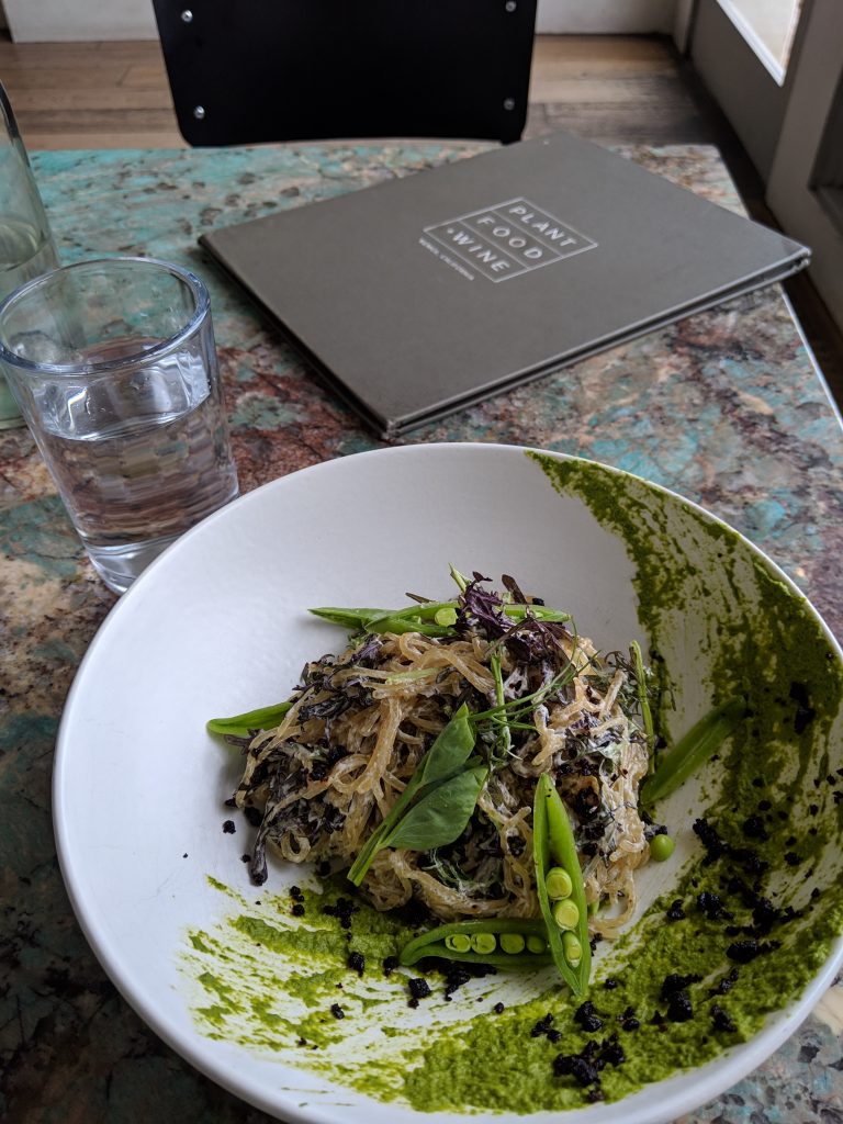
Other highlights of this goodbye included partaking in a cup of coffee at the large and workspace oriented café, Intelligentsia, and dinner at Plant Food & Wine, an upscale restaurant deserving of it’s pricy menu. I ordered the kelp noodles, avocado tikka, and tiramisu and nearly landed myself in a food coma it was so delicious. Abbott Kinney Blvd is a main hub for all things shopping and dining. A bustling street full of energy and opportunity while also maintaining a suburban feel. From there I enjoyed a 12min walk West to Venice Beach. Due to the clouds and breeze, parts of the boardwalk were virtually empty, several shops were closed, and I felt as though I had a treasure all to myself. I snapped a few more photos and took a moment to collect my thoughts and call my mother– the first time since leaving Rochester. She “walked” me around and kept me company while I was alone. A common activity that my parents have engaged in several times during my past adventures. Though 30 years old this year, I still look forward to my parents. What a blessing. The only downside to my visit to Venice Beach was my exposure to the number of homeless that live or hang out there. It made me so sad and brought back quick bursts of memories of the many homeless men and women I had cared for in the emergency department– often quite ineffective care given what these individuals really need.
Venice Beach
Kelp Noodle dish @ Plant Food & Wine
Chickpea Souffle @ Cafe Gratitude
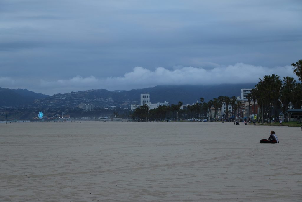
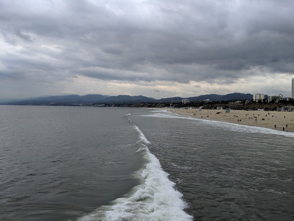
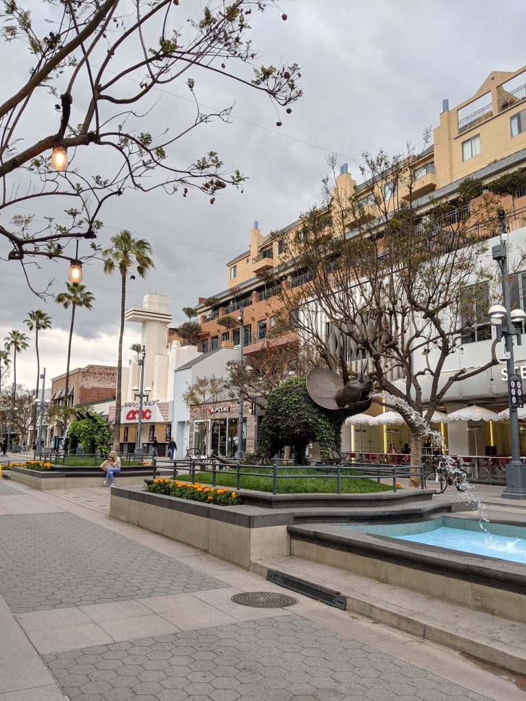
This experience was in stark contrast to the one I had at Santa Monica Pier. Though the weather was more or less the same the following day, this visit to the beach was met with many more people enjoying the ferris wheel, playing arcade games, and sitting in the sand. People were dancing for tips and selling hand-made art. And I has happy to find the same energy a few blocks away at the pedestrian-only shopping area. Greeted by a statue of a rhino spewing out water into a pond, I fed off of the atmosphere around me until it was time to finally say goodbye to my Las Vegas companion and head back to Venice.
Santa Monica Beach
Downtown Santa Monica
A final goodbye
proved pivotal when it revealed itself as actually several hellos. The former
NYC friend who is now my LA friend invited me to her early birthday party:
bowling. I don’t really enjoy bowling (though I do have to admit that I’m not
half bad when I get into the swing of it), but I wouldn’t miss it for the
world. Initially overwhelming, I quickly warmed up to several of my friend’s
friends and co-workers and it soon dawned on my why it was so important that
this spontaneous event had transpired. I had seen my LA friend several times
since my arrival, so it wasn’t necessarily so important that I could partake in
this particular activity with her. Instead, my friend’s gift to me was the gift
of meeting strangers. Going to her party and meeting new people helped me
recognize in real time how the world will keep going despite me moving to
Alaska. How there will always be opportunities to meet old friends and make new
ones, If only I am willing to take them. How the time to make new friends is
always now, and not just when I arrive at a new destination.
My goodbyes have
been so meaningful, so fruitful. I am so humbled. I am so grateful. I am so
scared. As my Uber inches toward LAX, the L.A. lights blinding me and the L.A.
traffic smothering me, I have to accept that, from here on out, it will be
mostly HELLOs.