A Moderate Hiker:
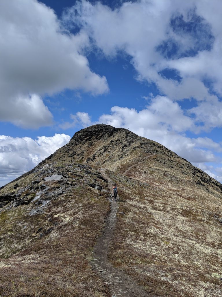
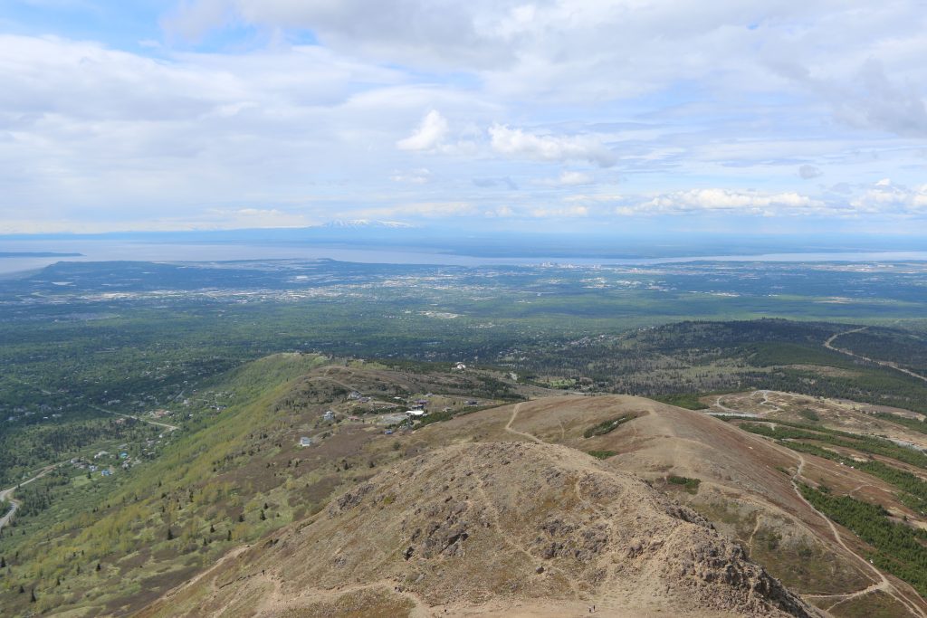
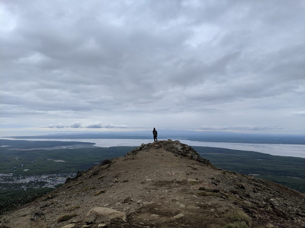
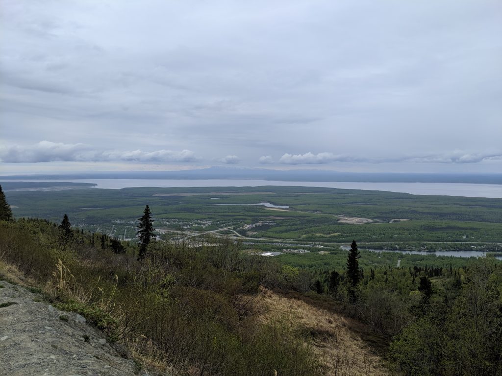
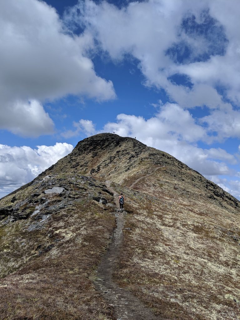
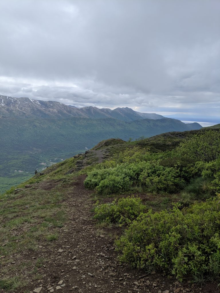
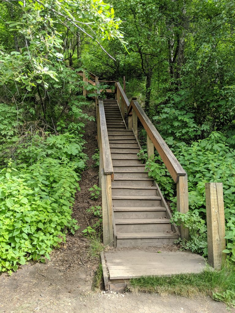
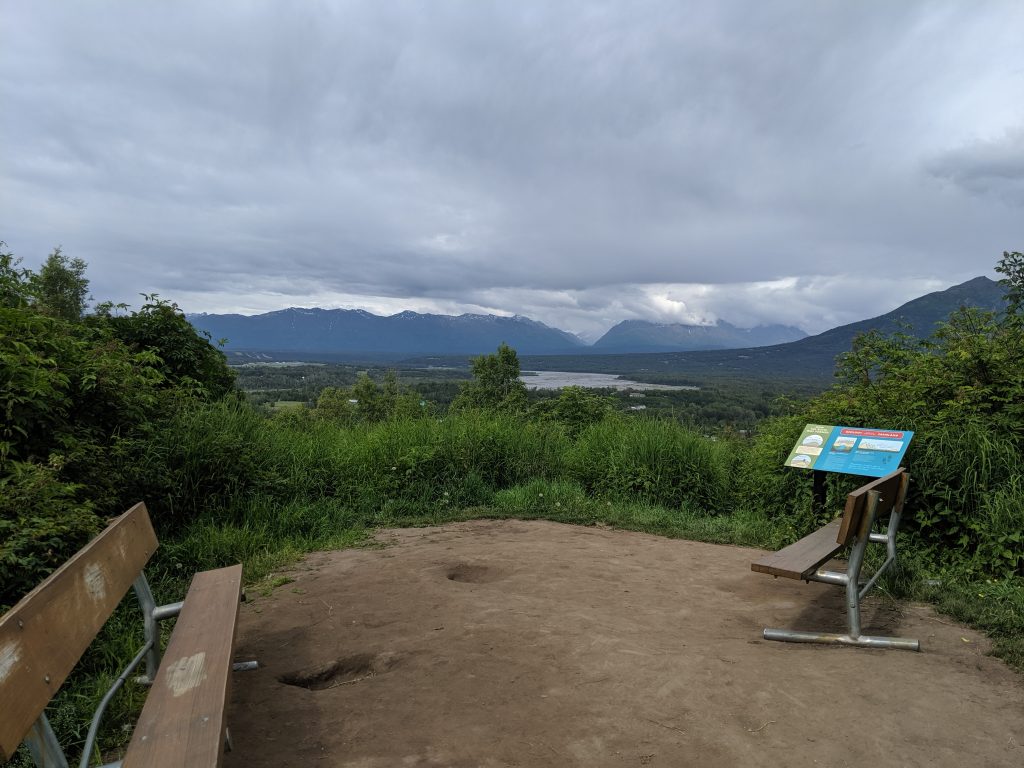
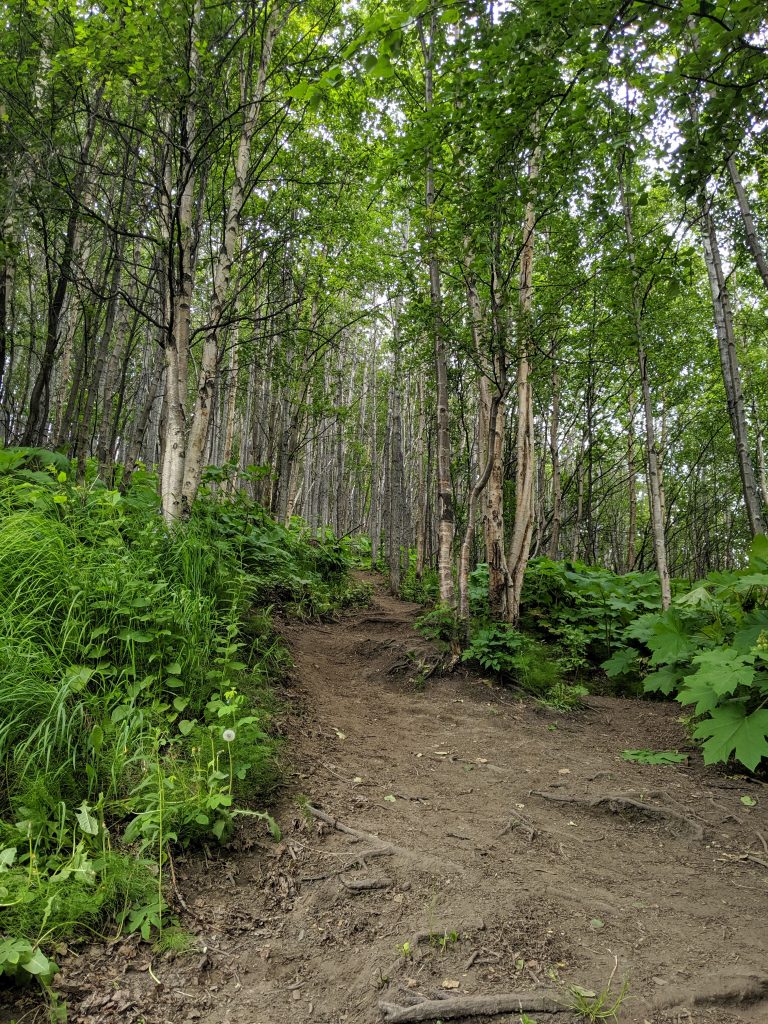
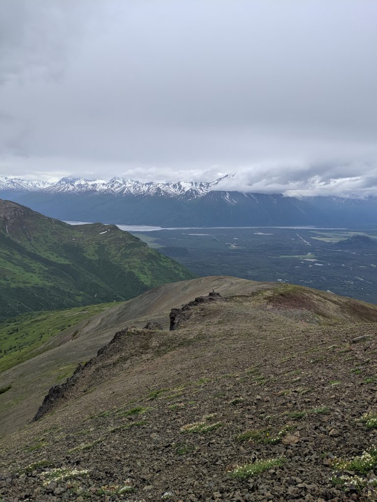
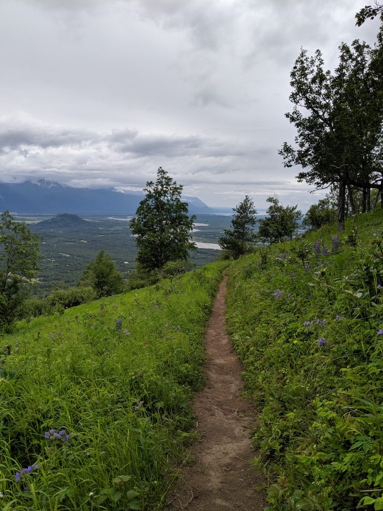
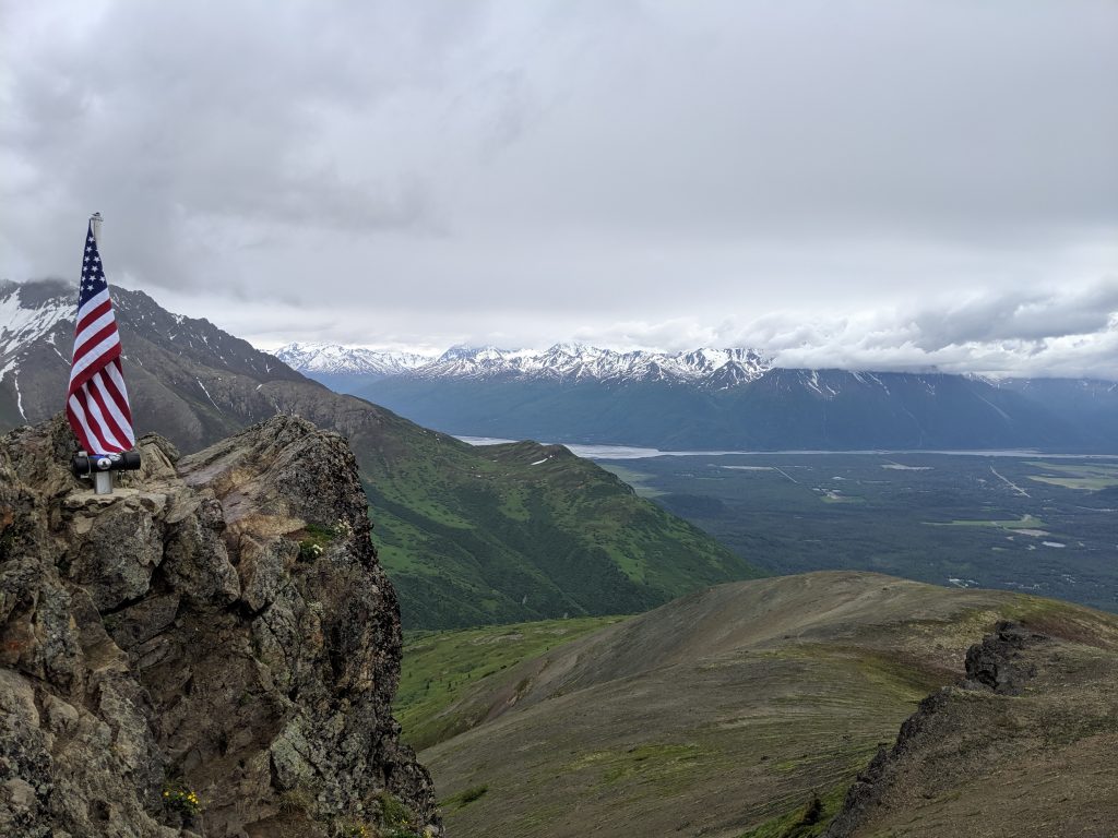
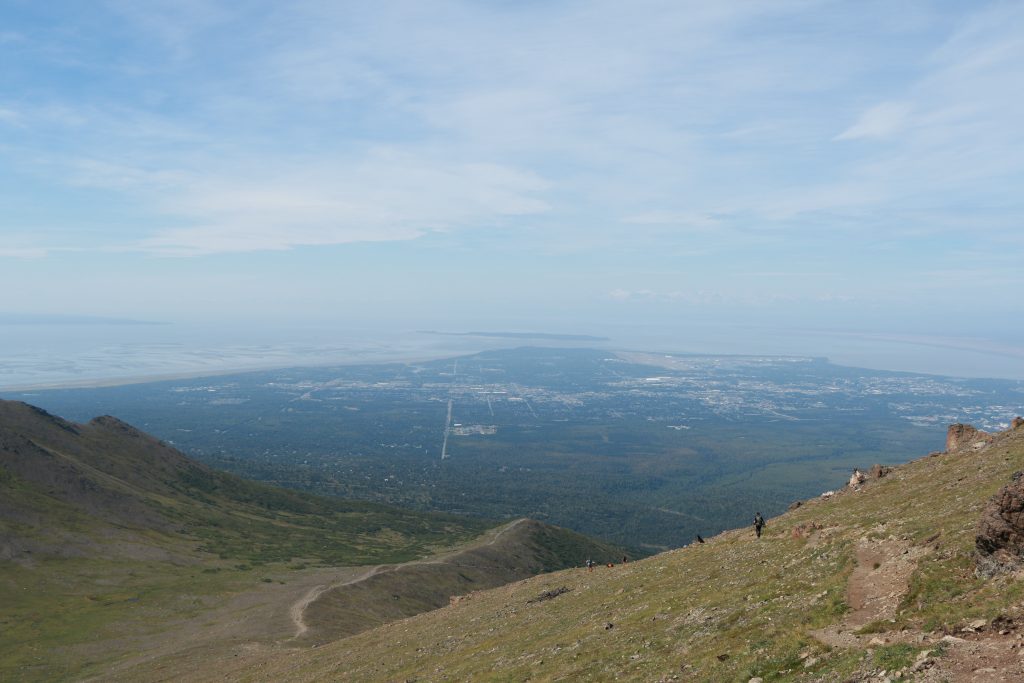
Flattop— Anchorage. 3.3mi roundtrip. 1400ft elevation. 1hr to the top. 2hrs roundtrip. Rock scramble/climbing to summit– a true create-your-own-adventure-style hike. Can be windy a the top. Views of the city and the water. Many go further to summits two and three for added challenge.
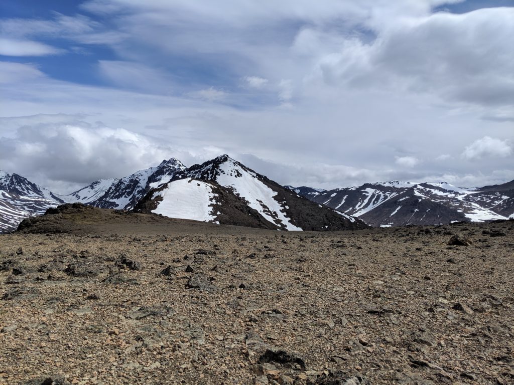
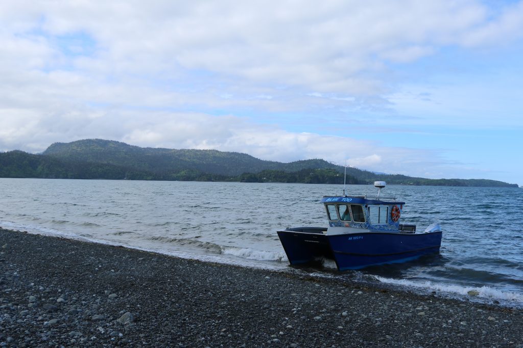
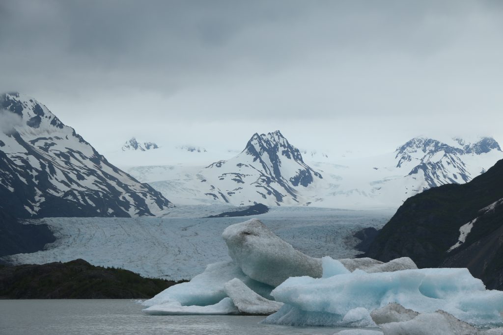
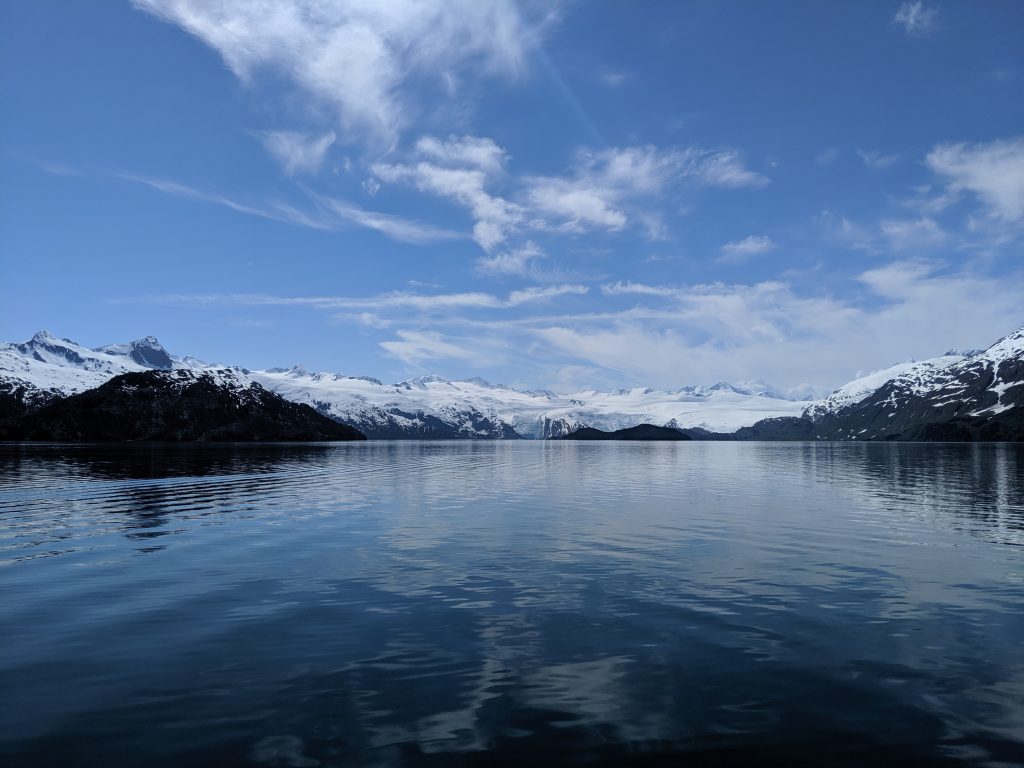
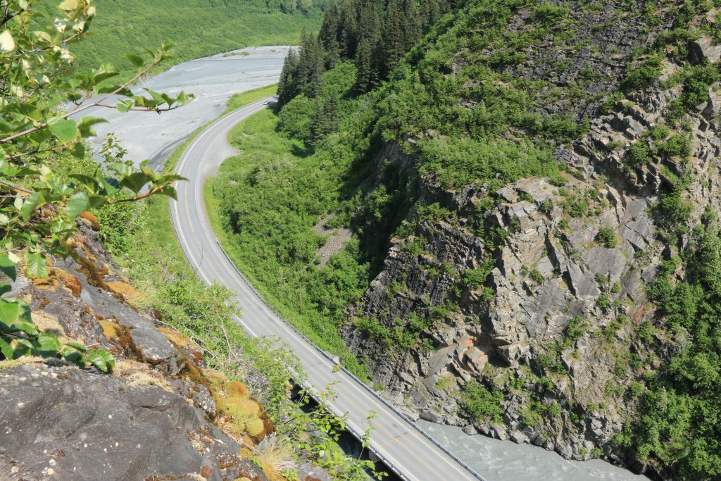
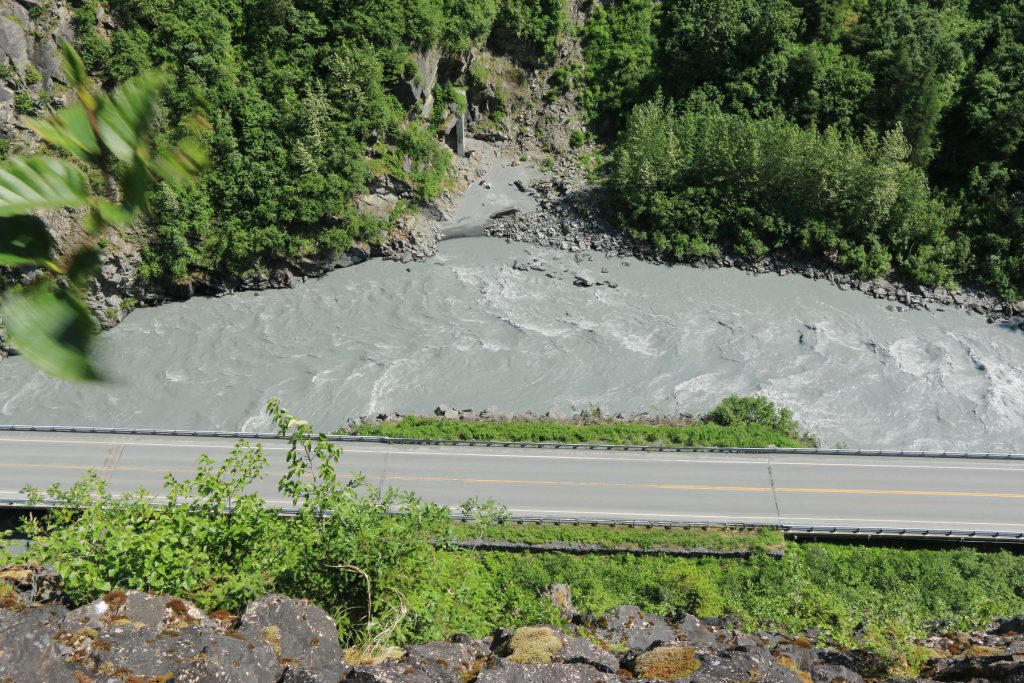
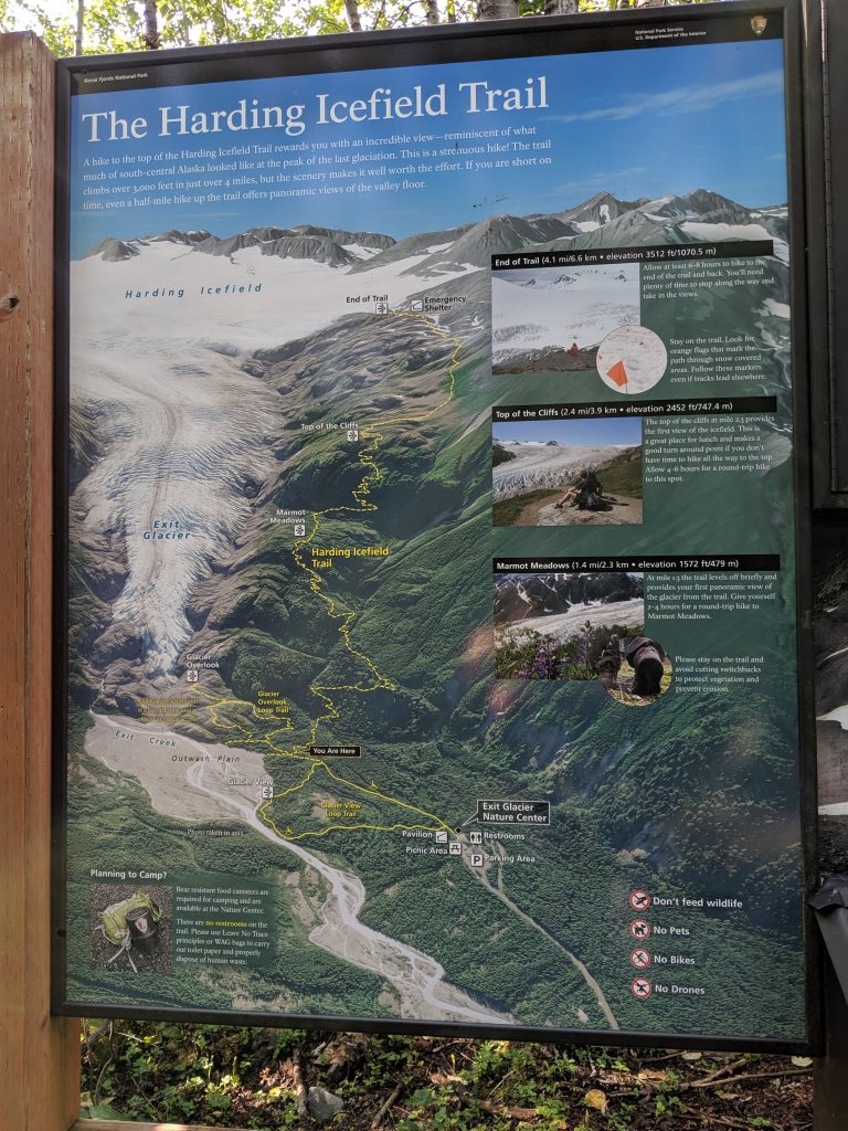
Exit Glacier Trail-– Seward. Kenai Fjords National Park. 1.8mi roundtrip. 260ft elevation. 30min to the view. 1hr to the toe. 2hrs roundtrip. Has greatly receded over the years. Still a wonder to take in.
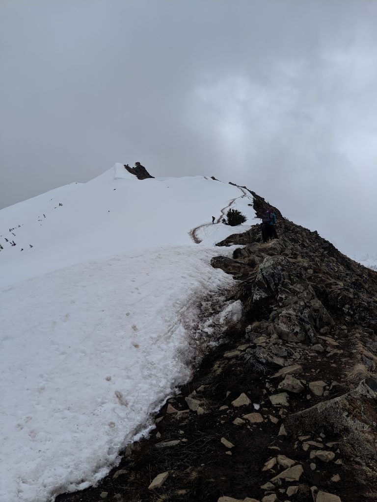
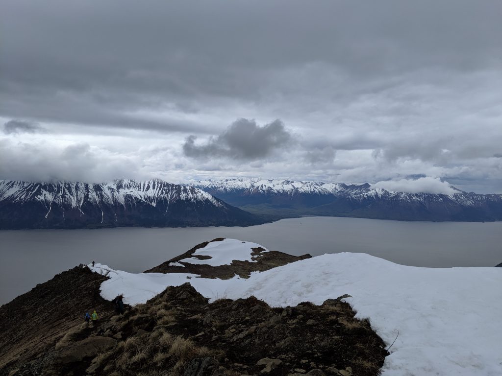
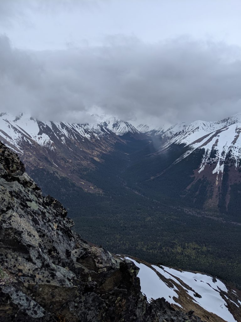
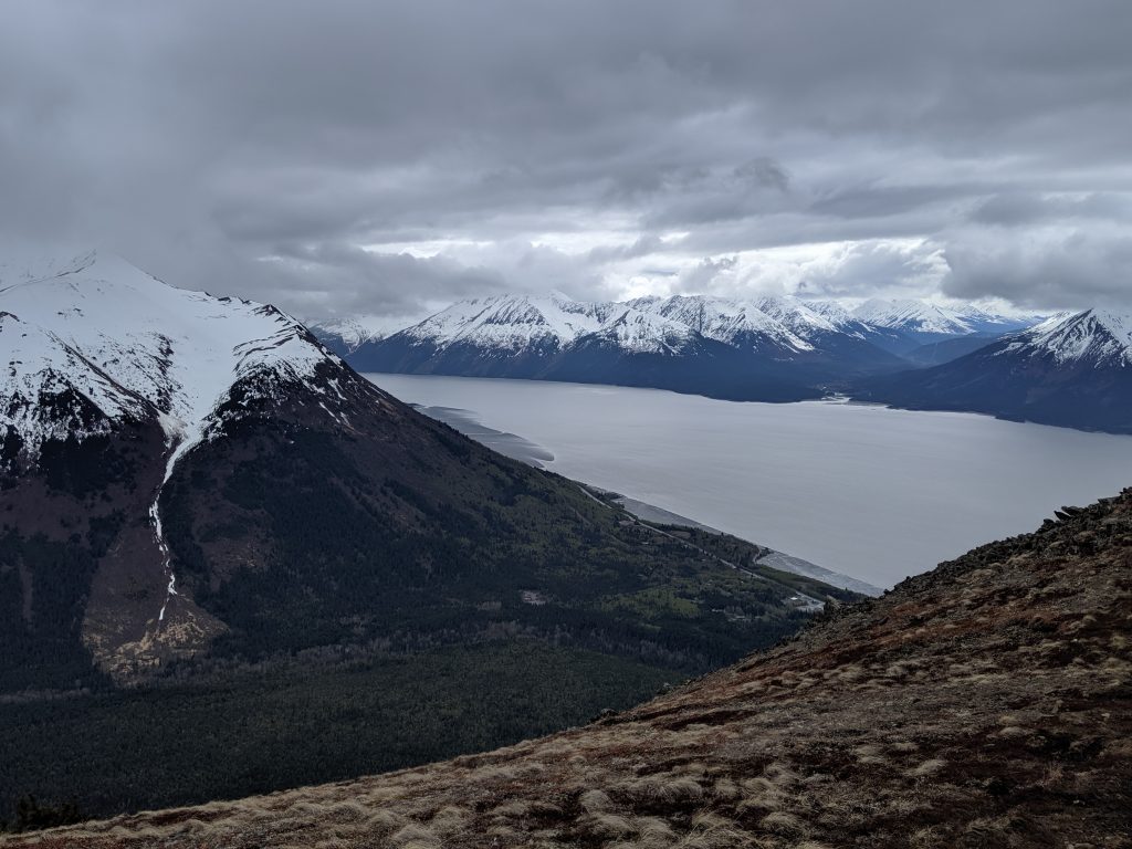
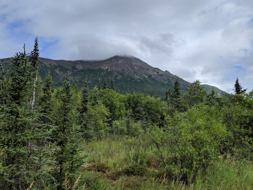
Bird Ridge— Girdwood. 4.6mi roundtrip. 3200ft elevation. 2-2.5hrs to the top. 4hrs roundtrip. Amazing views of the surrounding mountains and Turnagain Arm.
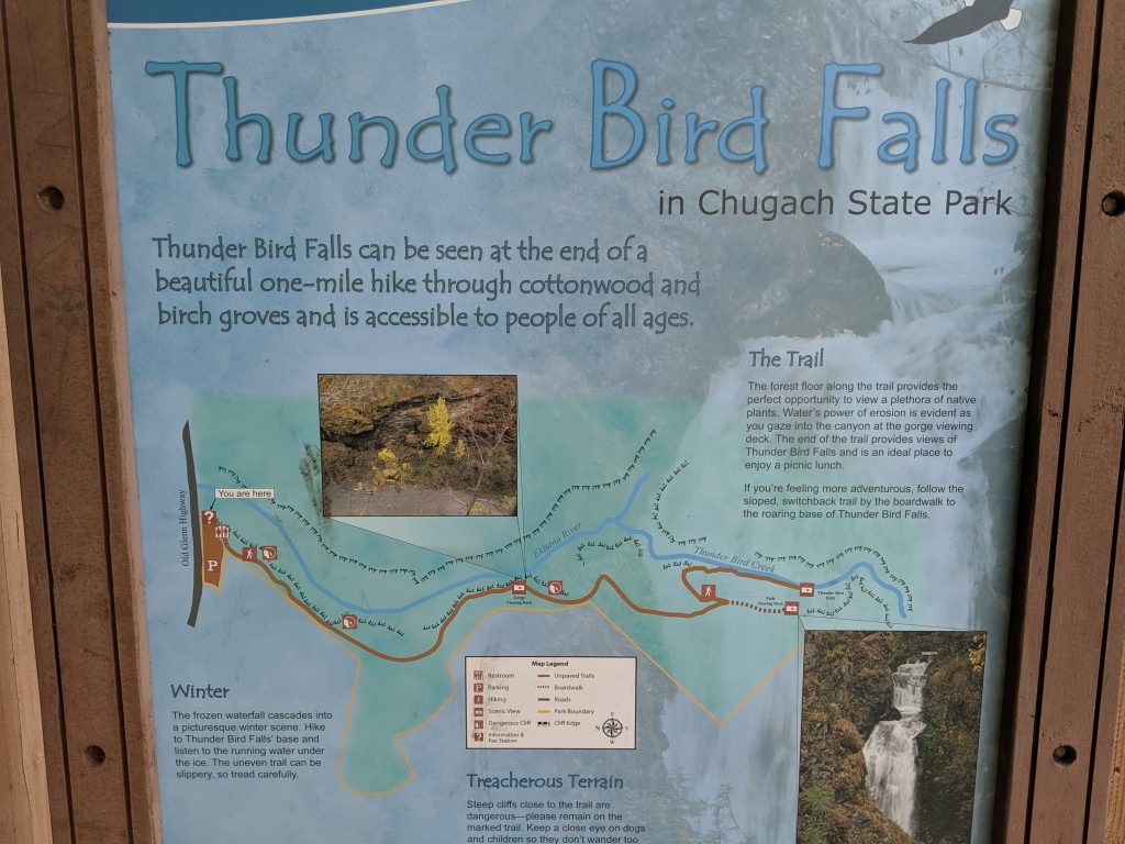
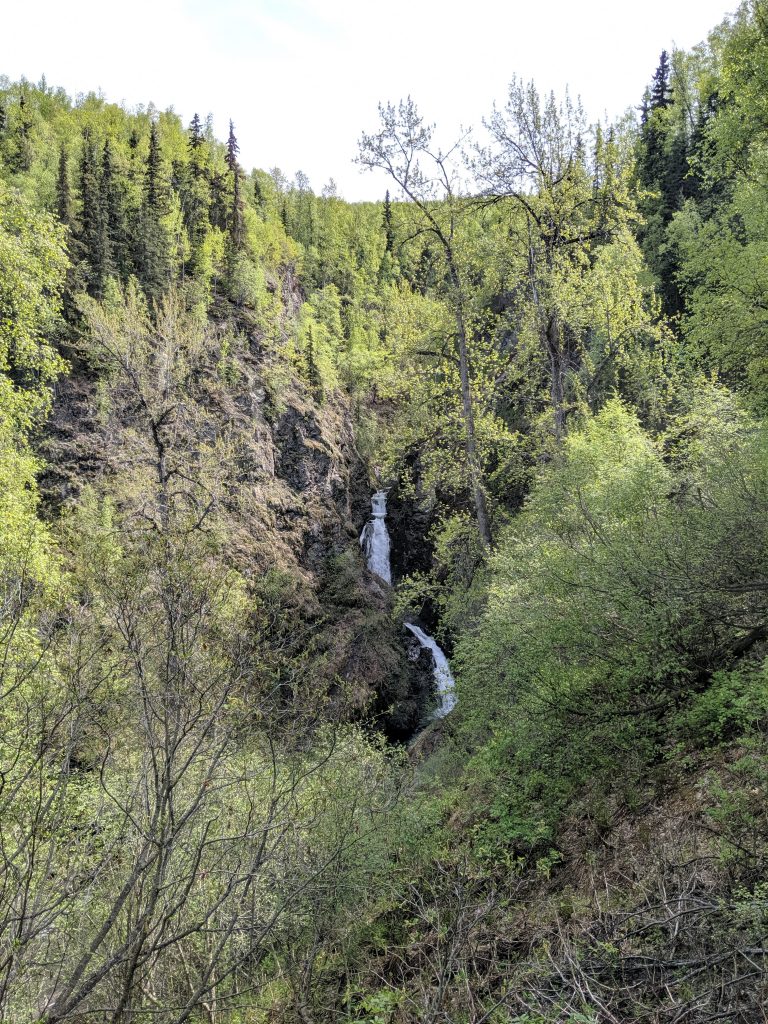
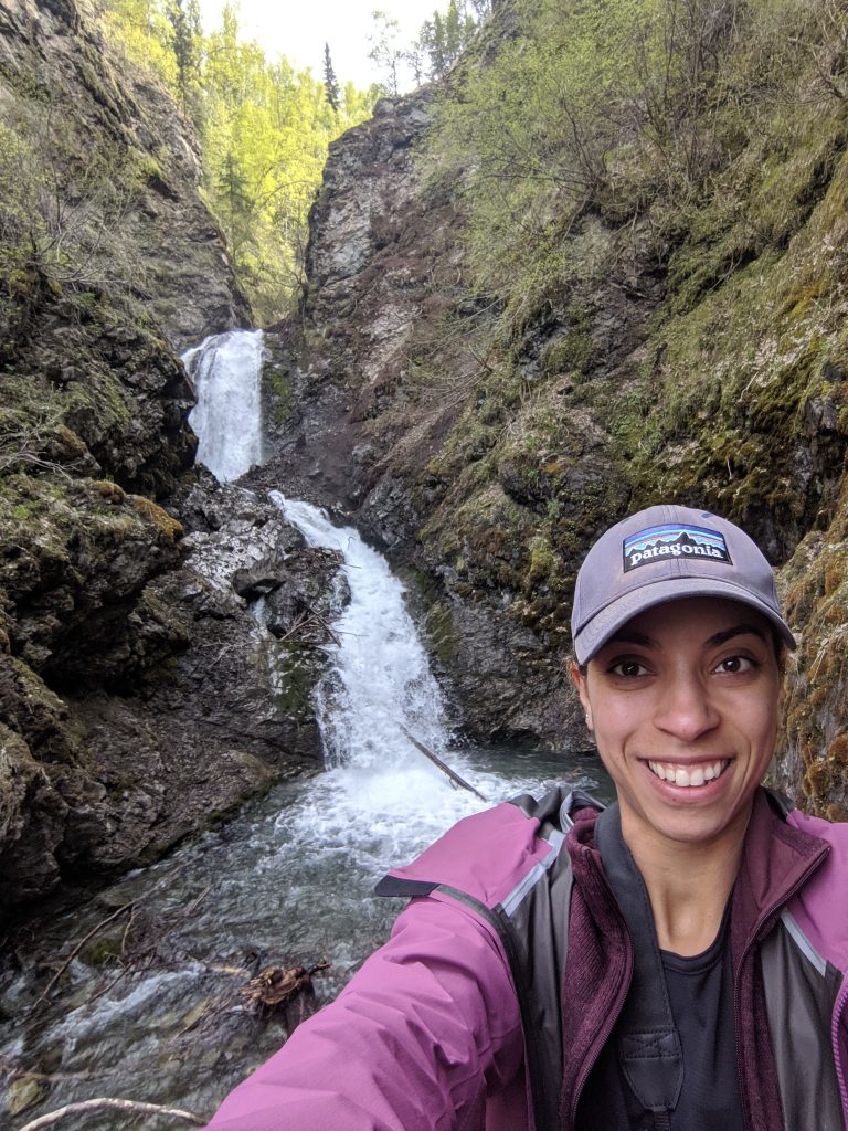
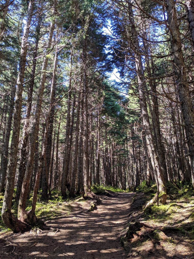
Thunderbird Falls— Chugiak. 1.8mi roundtrip. 1.5hrs roundtrip with time at the falls. Easy trail with 300ft elevation gain. Ends at the falls. Hidden feel though well-trafficked.
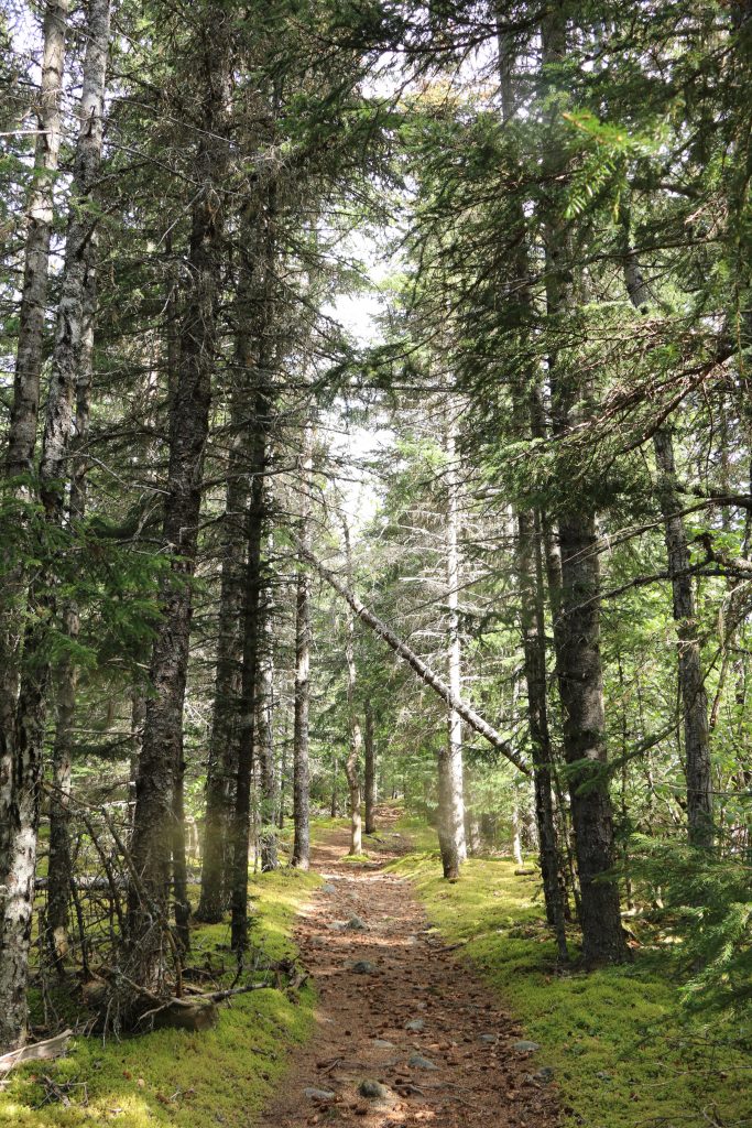
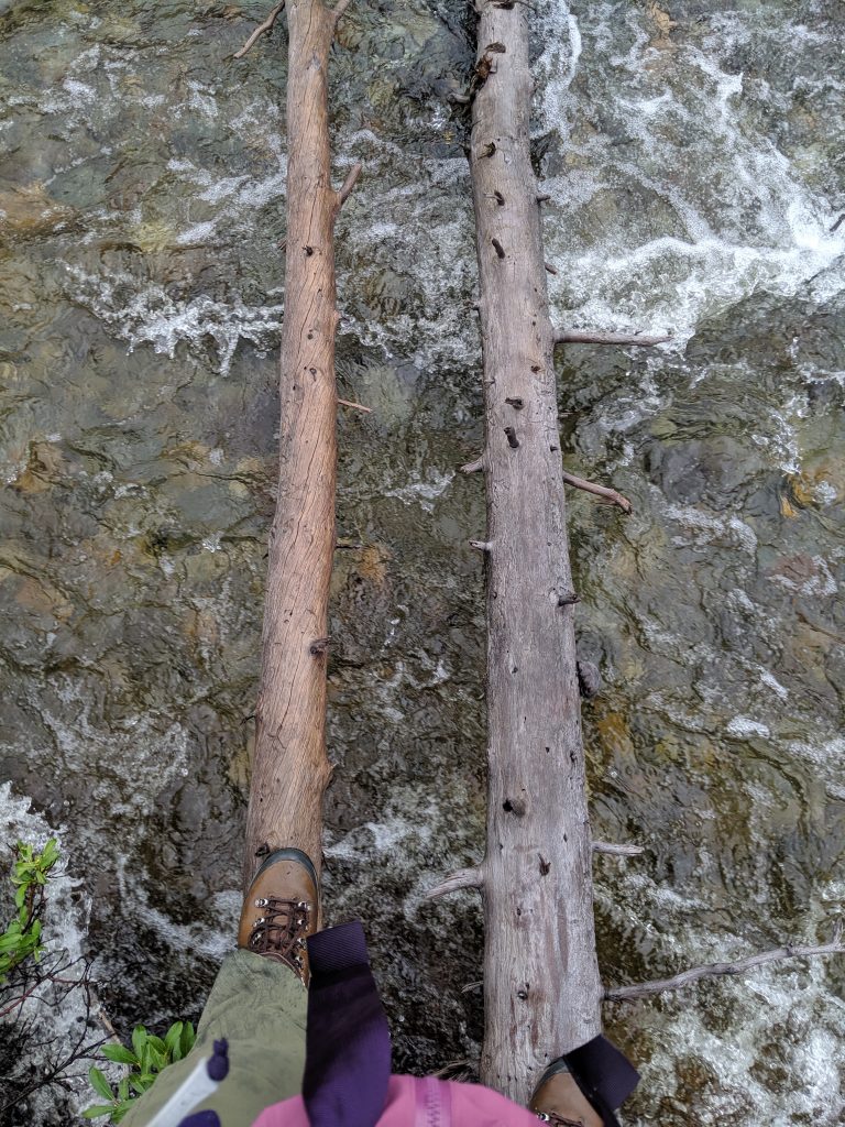
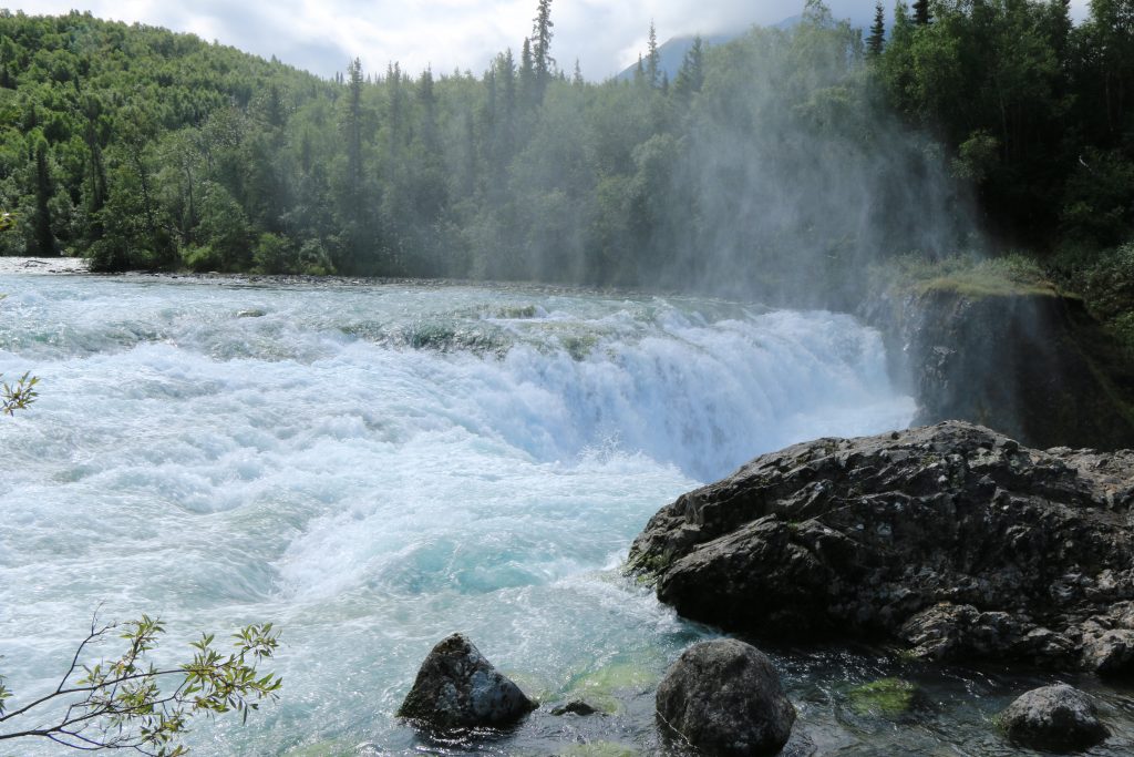
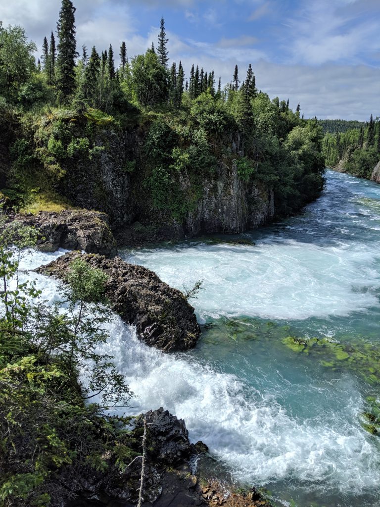
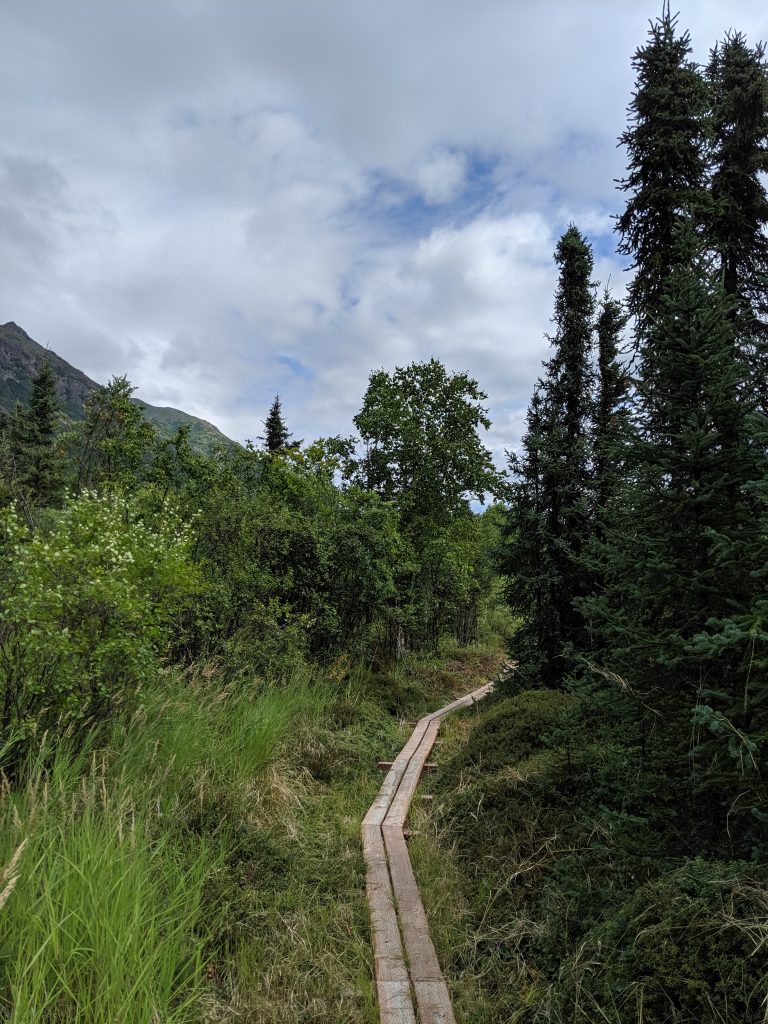
Winner Creek Trail & Handtram— Girdwood. 6.4mi roundtrip. 1200ft elevation gain. 2-2-2.5hrs roundtrip. Easy, wide, and well-maintained trail that features small waterfalls and beautiful green forest. Planks bridges cross smaller waters. Handtram in the middle for the river. Very fun and vibrant hike.
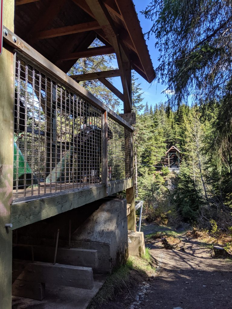
Handtram! 
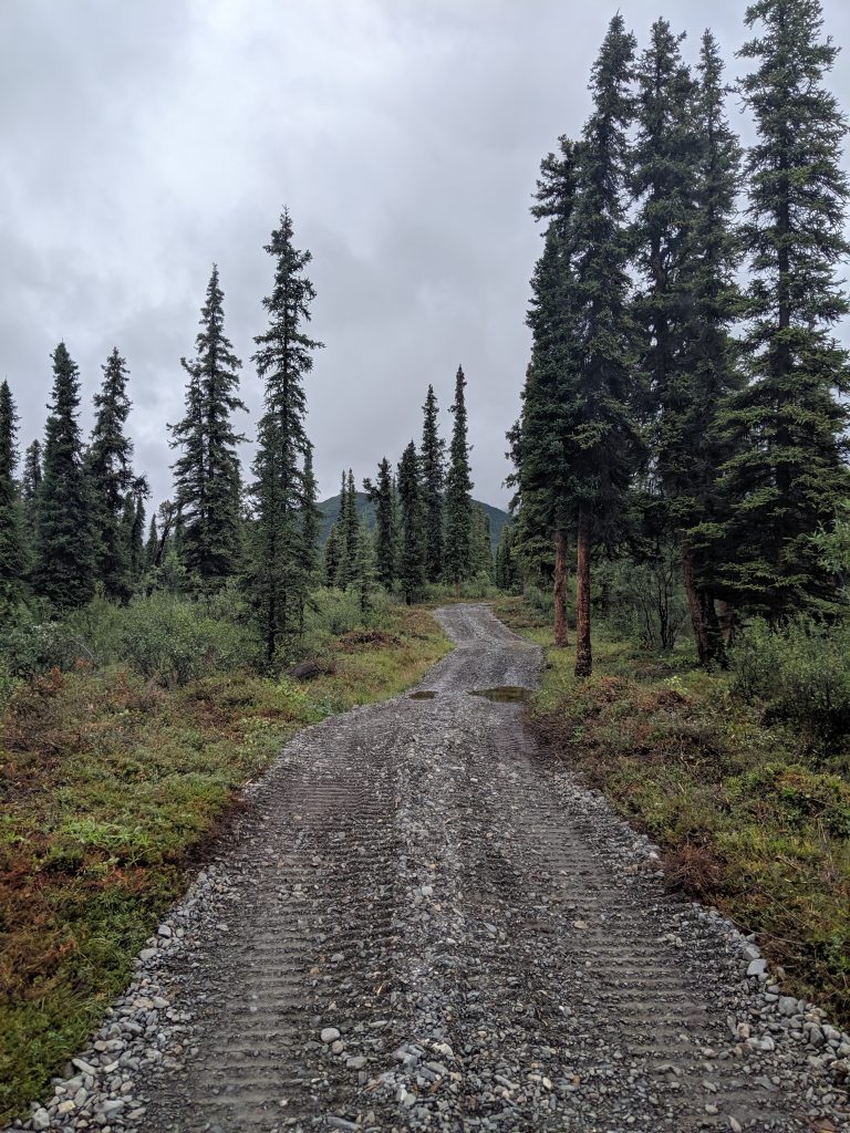
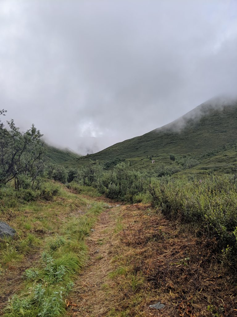
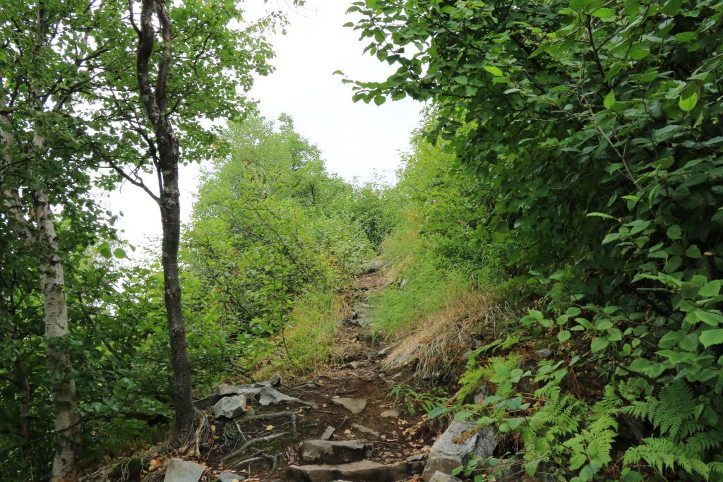
Some elevation gain 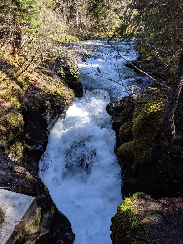
Mini waterfall! 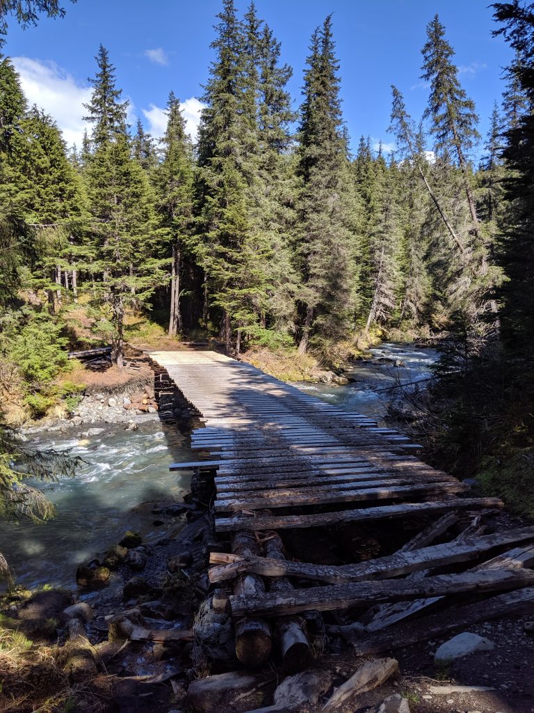
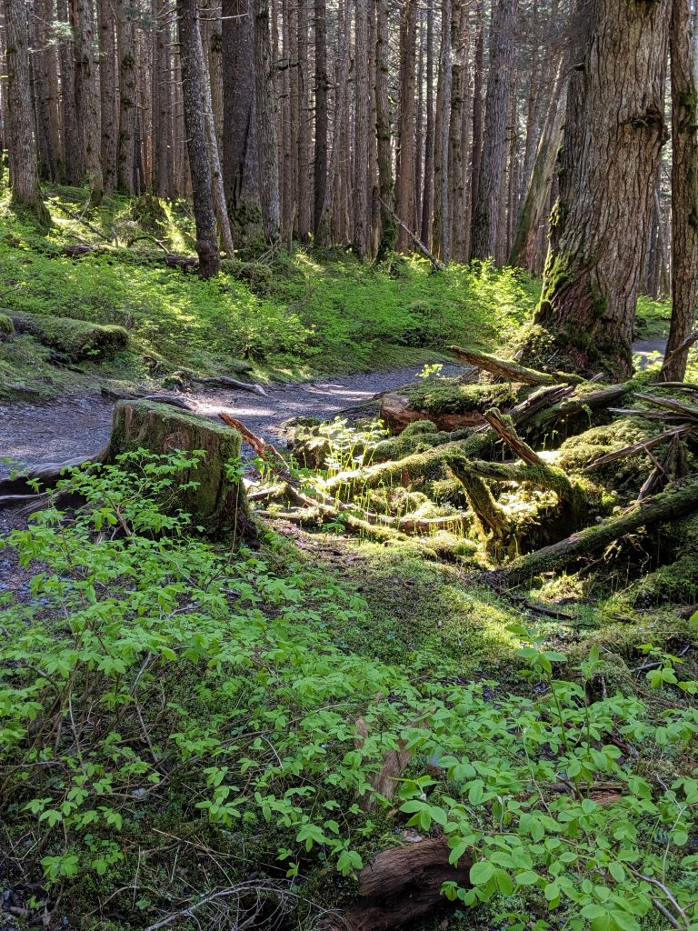
Love the brightness of this green!
Mt. Baldy— Eagle River. 2mi roundtrip. 1500ft elevation. 45min to the top. 1.5hrs roundtrip. Though this trail can technically be a loop making it 4.6mi roundtrip, a stop at the peak is more than enough. Straight up. Tough. Beautiful views of Eagle River Valley and the water.
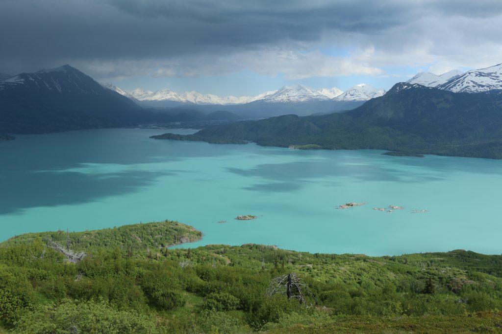
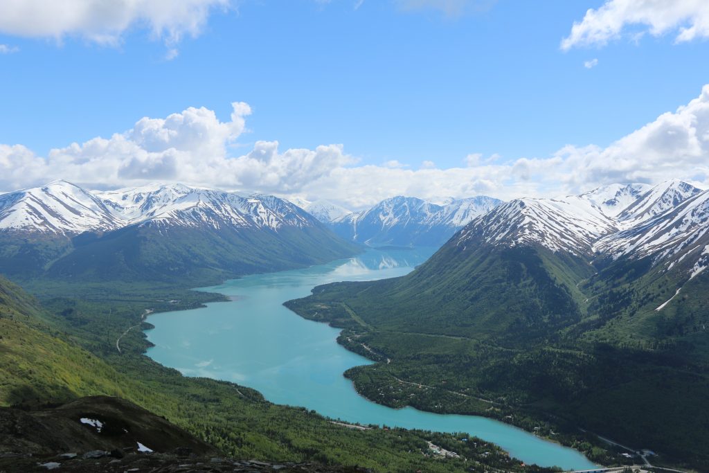
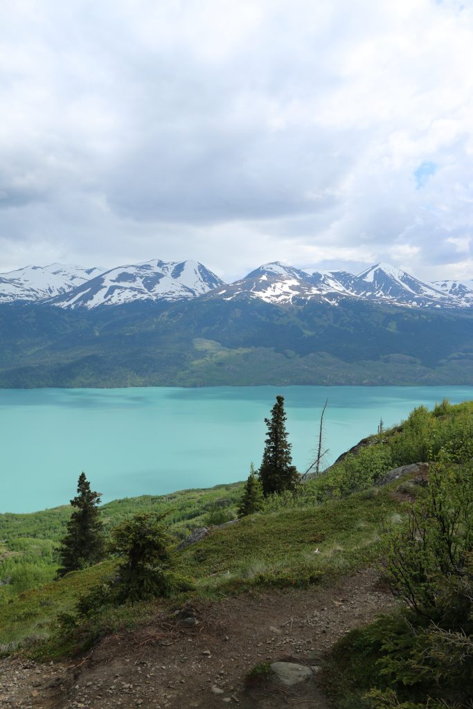
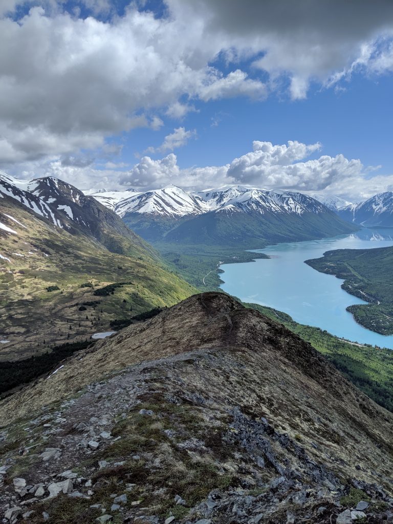
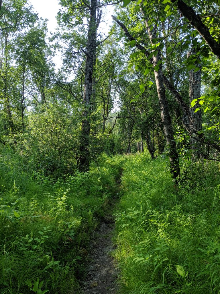
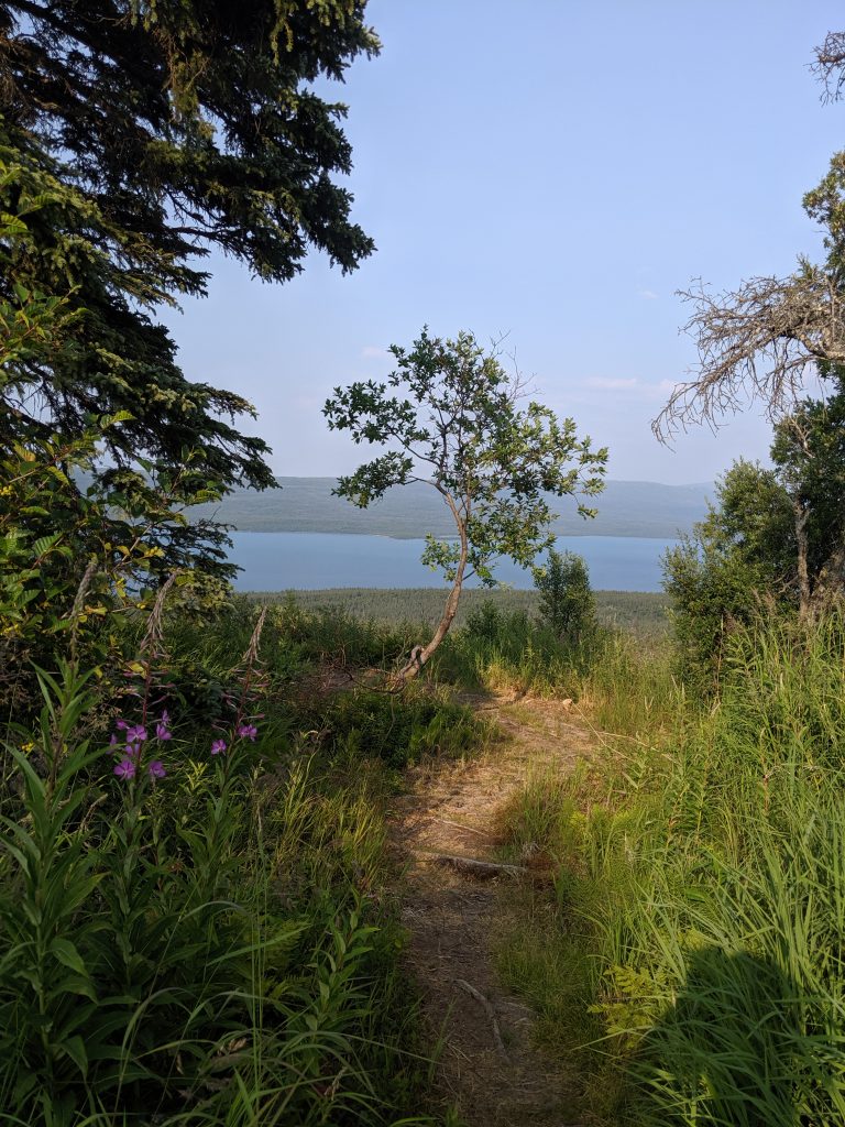
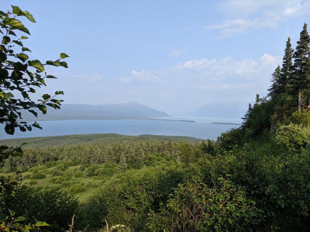
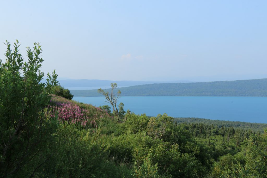
Skilak Lookout Trail— Cooper Landing. 4 1mi roundtrip. 800ft elevation. 45min to the top. 2hrs roundtrip. Magical experience. Unique blue color of the lake. Steep.

Slaughter Gulch— Cooper Landing. 3.9mi roundtrip. 2600ft elevation. 2hrs to the top. 3hrs roundtrip. Every bit a slaughter! Steep uphill. False summits. View of the lakes including Skilak Lake way off in the distance to the right.
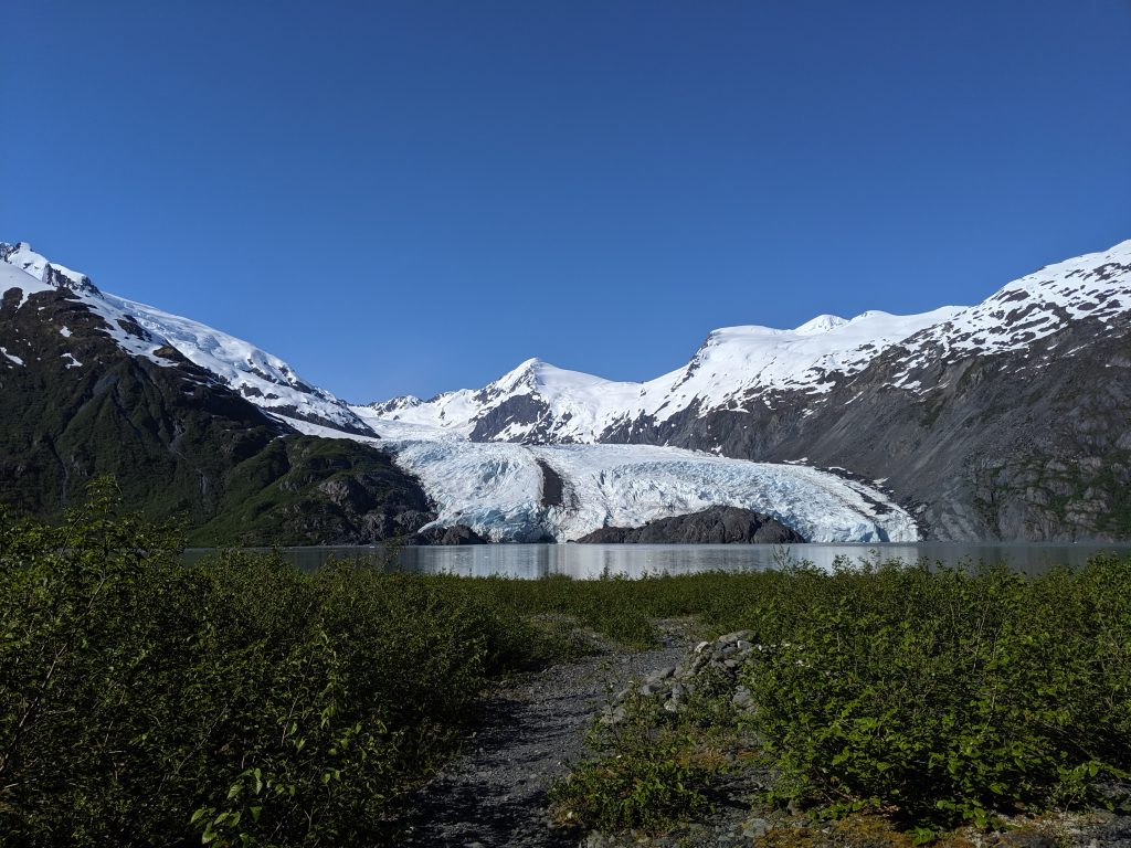
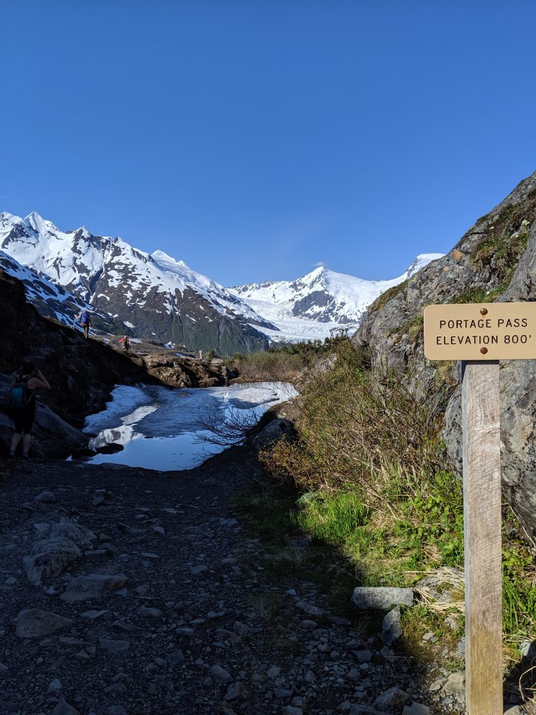
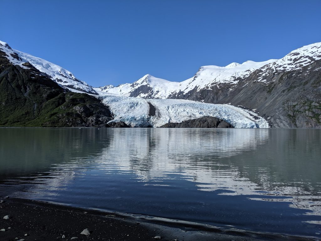
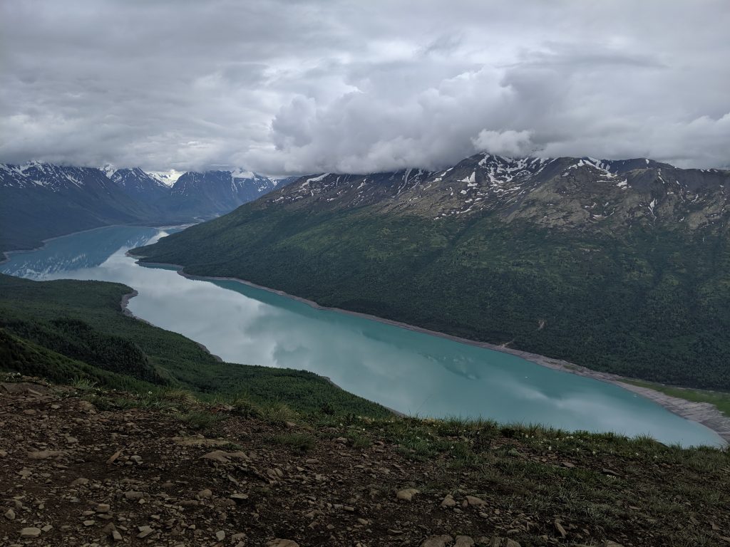
Portage Pass Trail— Whittier. 5.4mi roundtrip. 1600ft elevation. 2hrs roundtrip not including time relaxing at the lake. Starts out very steep until reaching to actual Portage Pass. Remaining is relatively flat with some inclines here and there and then a steeper decline for a few minutes to the actual lake. Small lake on the right roughly half way through the pass. Trail ends right at the lake with Portage Glacier across from it. Great place for a picnic. No obvious way to hike up to or onto the glacier.
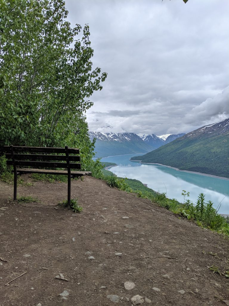
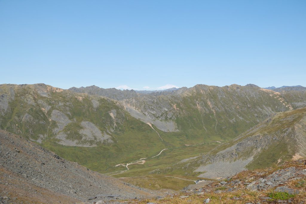
Twin Peaks w/ Lake Eklutna Overlook-– North of Anchorage. 4.8mi roundtrip. Roughly 1hr to the first Lake Eklutna overlook. Roughly 40min to Twin Peaks overlook. Roughly 2hrs 15min to the peak and second Lake Eklutna overlook. Beautiful views the entire way. Steep but manageable. Trail well-maintained. Well worth the effort– continue endlessly along the ridge line or just bask in the glory of the lake below!
The Bodenburg Butte— Palmer. 0.9mi roundtrip. 670ft elevation. 40min to the top. 1.5hrs round trip. Steep, dusty trail with choose-your-own-adventure to the top of you want to stick to the trail it climb a few rocks. Glacier, farm land, and river all in view.
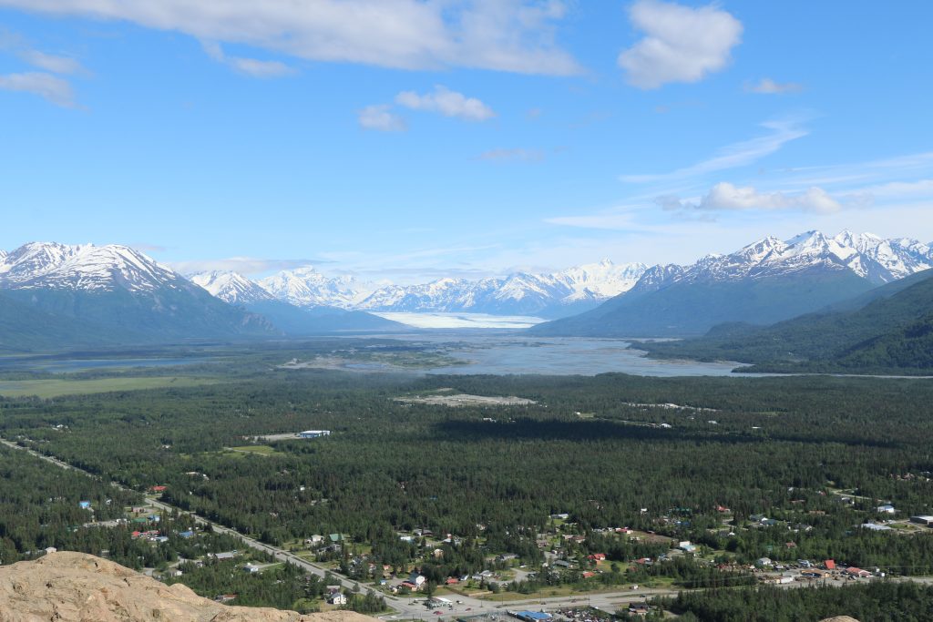
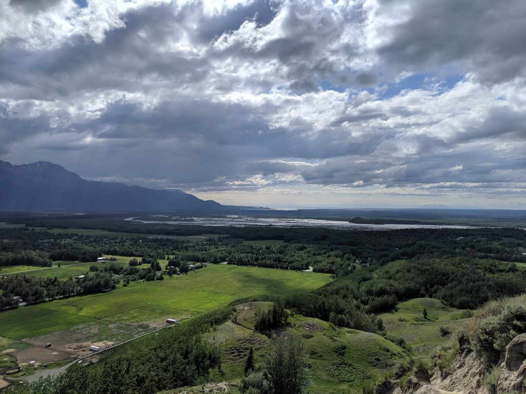
West Butte— Palmer. 2.3mi roundtrip. 700ft elevation. 30min to the top. 1hr round trip. Same ending as above. Easier trail, though, several stairs to the top for the second half.
Lazy Mountain-– Palmer. 4mi roundtrip. 3000ft elevation. 1hr 40min to the top. 3hrs 20min roundtrip if you take the Loose Moose trail down. Take roughly 30min off if you just throw yourself back down Lazy Mountain. At start of trail, signs point Lazy left and Moose right. The two trails eventually meet up to scale the ridge. Extremely steep on Lazy. Switchbacks on Moose. Gorgeous views the entire way either trail. Added bonus of wildflowers on Moose.
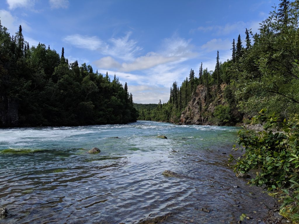
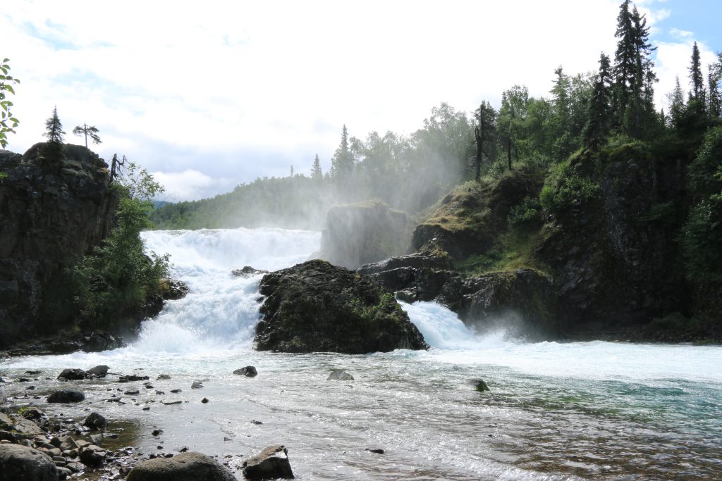
Valdez Goat Trail— Just north of Valdez. 4.3mi roundtrip. 800ft elevation. 2-3hrs roundtrip. Easy-moderate difficulty with some narrow spots along the way with steep drops offs the whole way. Muddy patches. Buggy. Easily traversed and family/pet friendly. Amazing outlooks. Ends at a wide and powerful waterfall. Very beautiful, jungle-like trail with high payoffs. Highly recommend. Trailhead starts off of the Richardson Highway between the two vehicle pulls-off between Bridal Veil Falls and Horsetail Falls closer to Bridal Veil Falls. AllTrails app is accurate.
Dumpling Overlook— Brooks Campground; Katmai NP. 4mi roundtrip. Roughly 45-50min to the Outlook if being very bear aware and turning corners slowly and cautiously. 30min if walking a normal pace. To the summit is 4mi one-way so about 8mi roundtrip and roughly 5-6hr roundtrip if being cautious and bear aware. Well worn path but not greatly maintained so lots of over growth. Wear long sleeves and pants to avoid accidental exposures to harmful plants. Beautiful view of the lakes, mountains, and flowers at outlook– solid choice if pressed for time or traveling solo and don’t want to push your not-yet-eaten-by-a-bear luck.
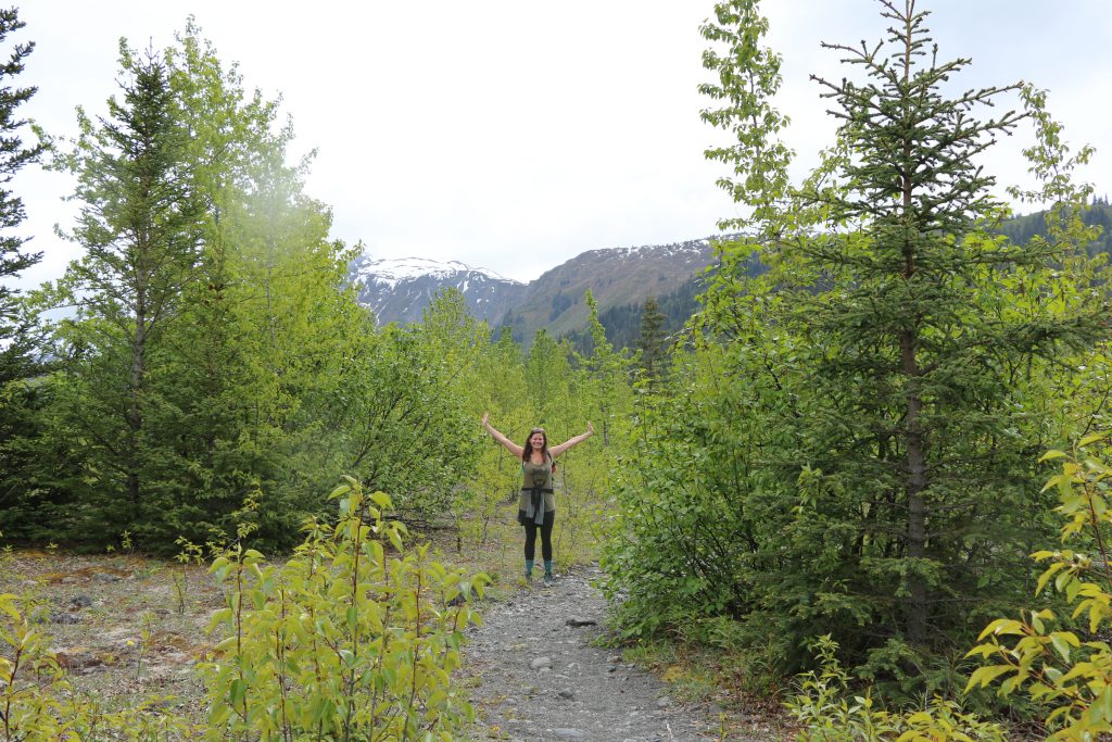
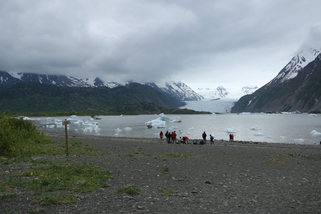
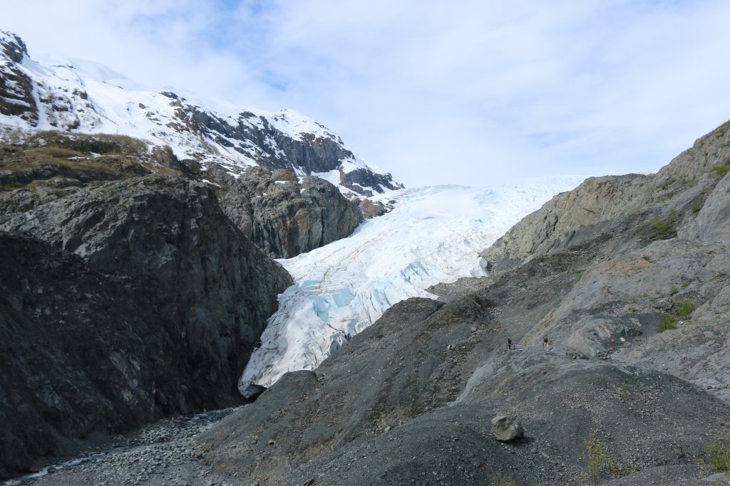
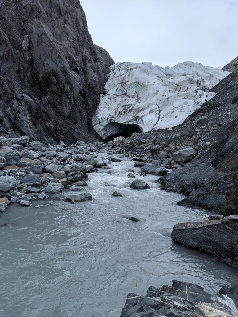
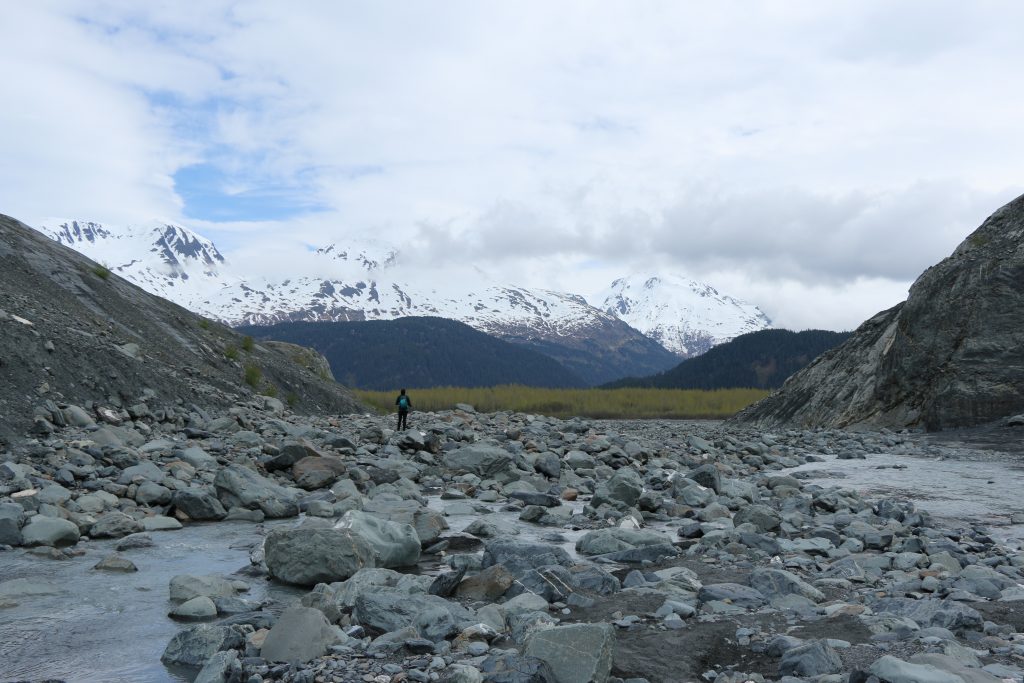
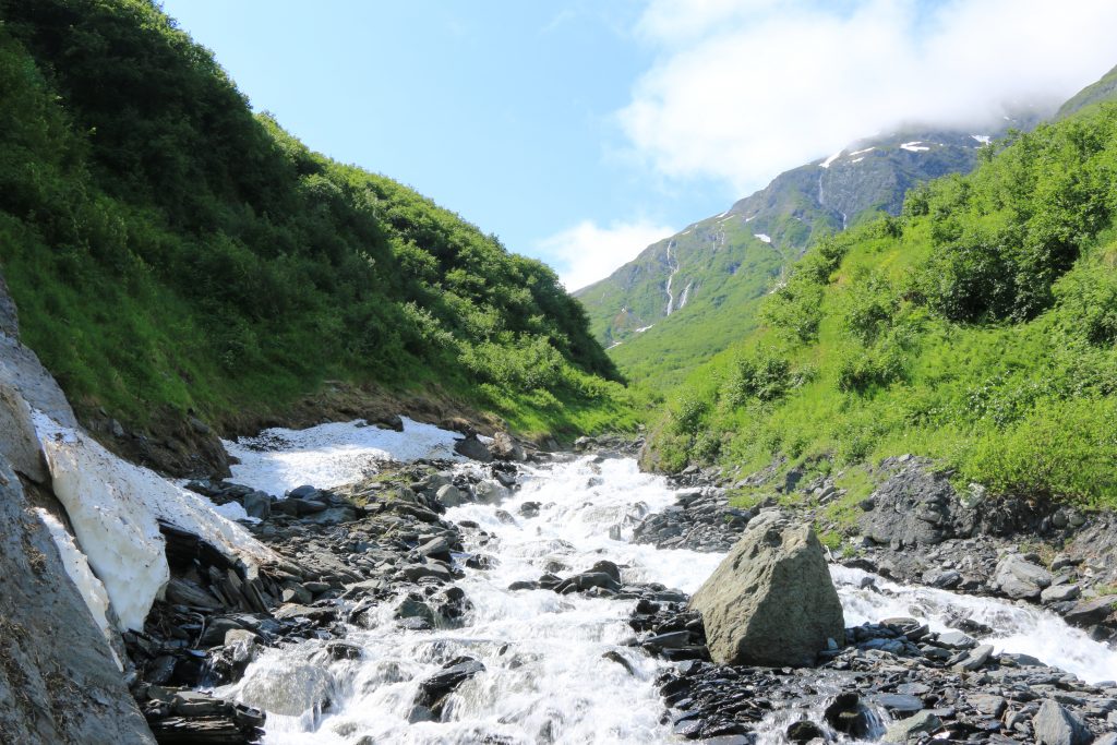
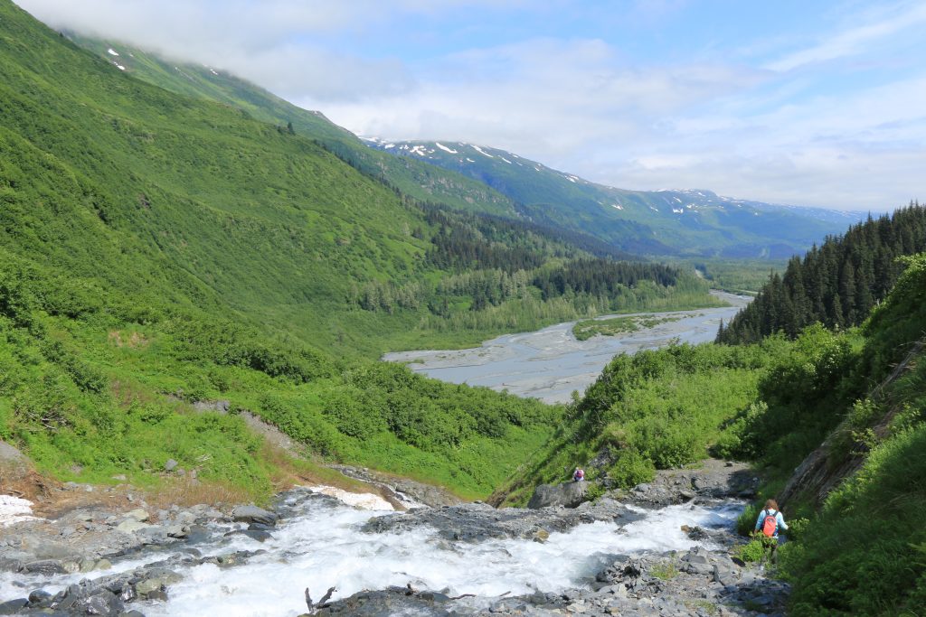
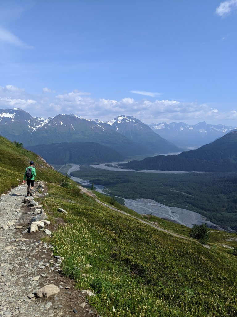
Harding Icefield – Seward; Kenai Fjords NP. 9.7mi roundtrip. 4hrs roundtrip. 3800 ft elevation gain. Moderate hike. First half is below treeline with enough flies to drive you mad. At roughly 1hr in, you come to the first overlook or clearing and many people stop here to picnic and enjoy the view. Continue on another 45min or so to reach the cabin. Another 30min past the cabin and down the ridge will take you onto the ice of the glacier. Beautiful view of the glacier and the water the entire way. 360 panoramic views once above treeline. Look out for mountain goats!
Exit Glacier’s silt below 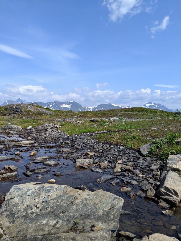
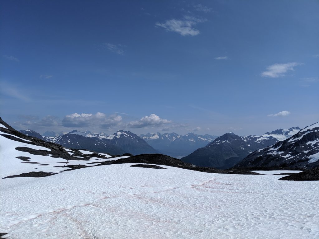
Traversing the snow 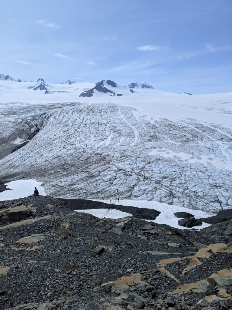
Hikers on the ice of Exit Glacier!
McKinley Bar Trail— Wonder Lake; Denali NP. 4.3mi roundtrip. Roughly 2hr roundtrip. 1000ft elevation gain. An easy and beautiful trail that traverses rocks, crosses streams, and travels through spruce forest ending at the river. Mosquito infested during the later summer days.

Spruce forest 
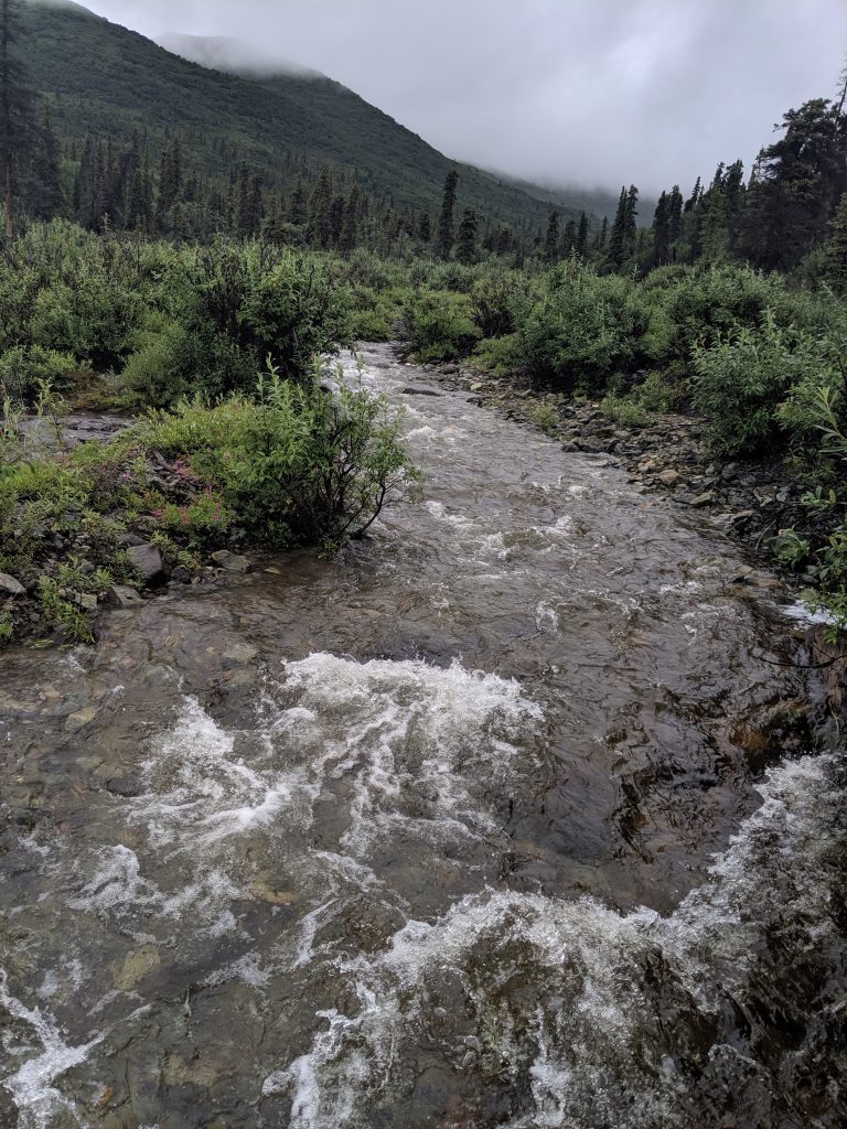
The river
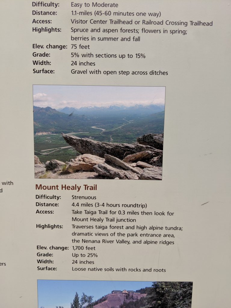
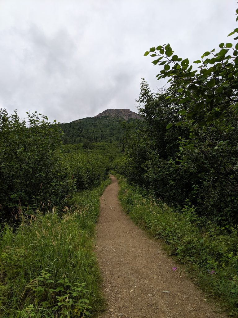
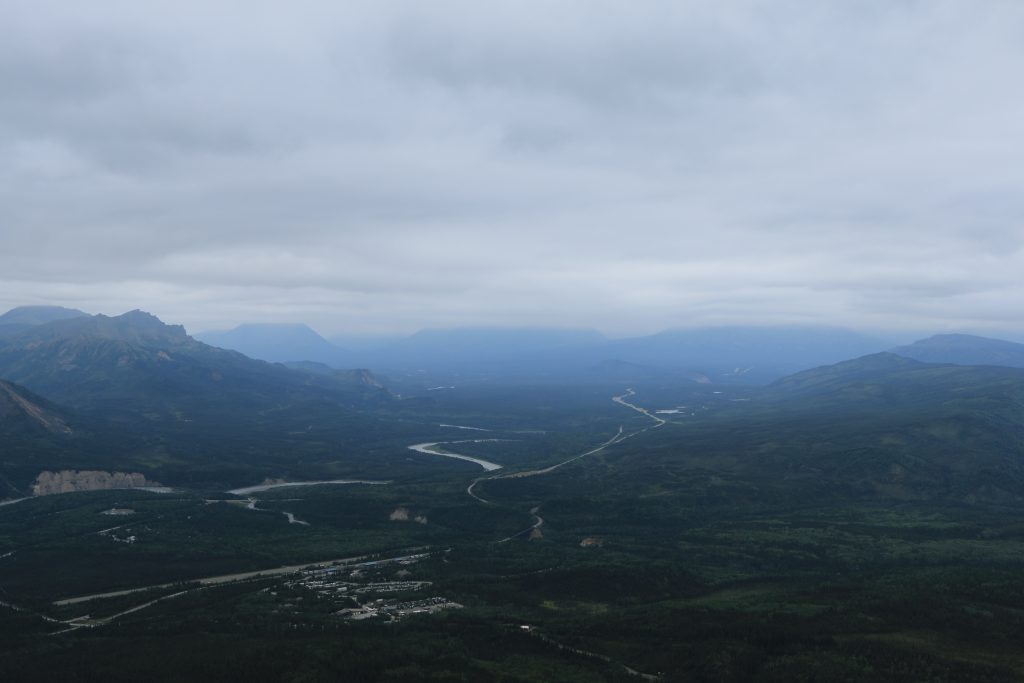
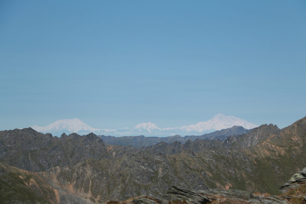
Mt. Healy Overlook— Denali NP. 4.4mi roundtrip. 2.5hr roundtrip w/ roughly 1hr and 15min to the top. 1600ft elevation gain. Views of Denali on a clear day. Rewarding hike. Not too difficult. Ridgeline continues endlessly.
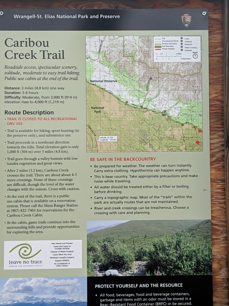
Caribou Creek Trail— Nabesna; Wrangell-St. Elias NP. 7mi roundtrip. 3hrs roundtrip. Requires two wide and possibly forceful but not deep stream crossings that are manageable w/ appropriate footware and a walking stick or trekking pole. If you bushwack to the right of the trail where it meets the first water-crossing and remain along the water’s edge, someone placed a few logs over which one can scramble. Trail starts as a very wide dirt/stone path where construction is being done– minimal elevation gain. Once past the first water-crossing, a steady and moderate incline begins. Beautiful views of the water and valley opens up behind you as you climb. Muddy trail. Ends at the cabin just on the other side of the 2nd water crossing. A very serene hike. Accessible from Nabesna Road prior to any potential vehicle water crossings.
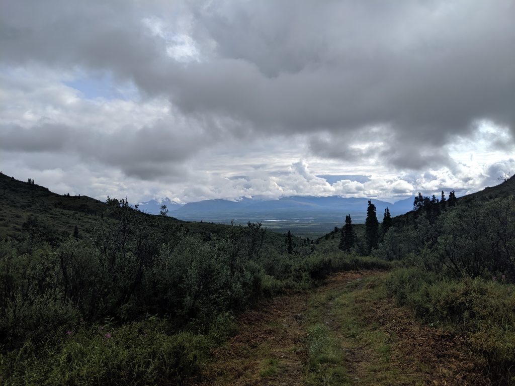
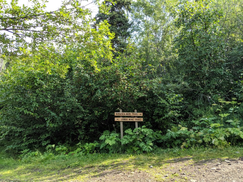
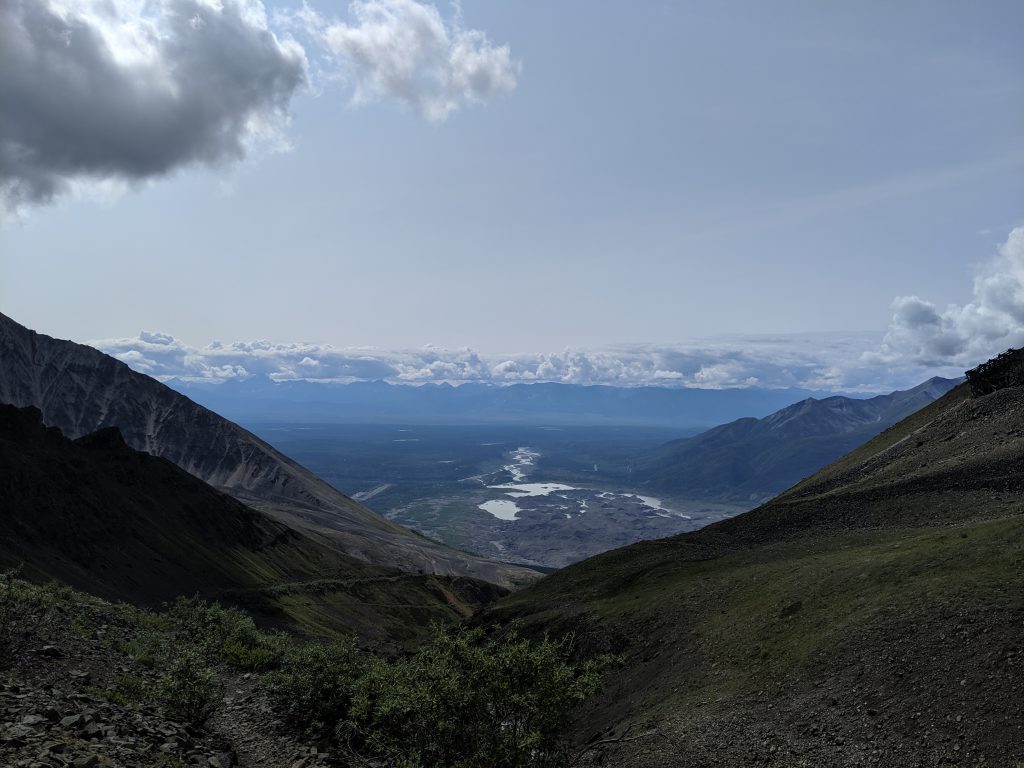
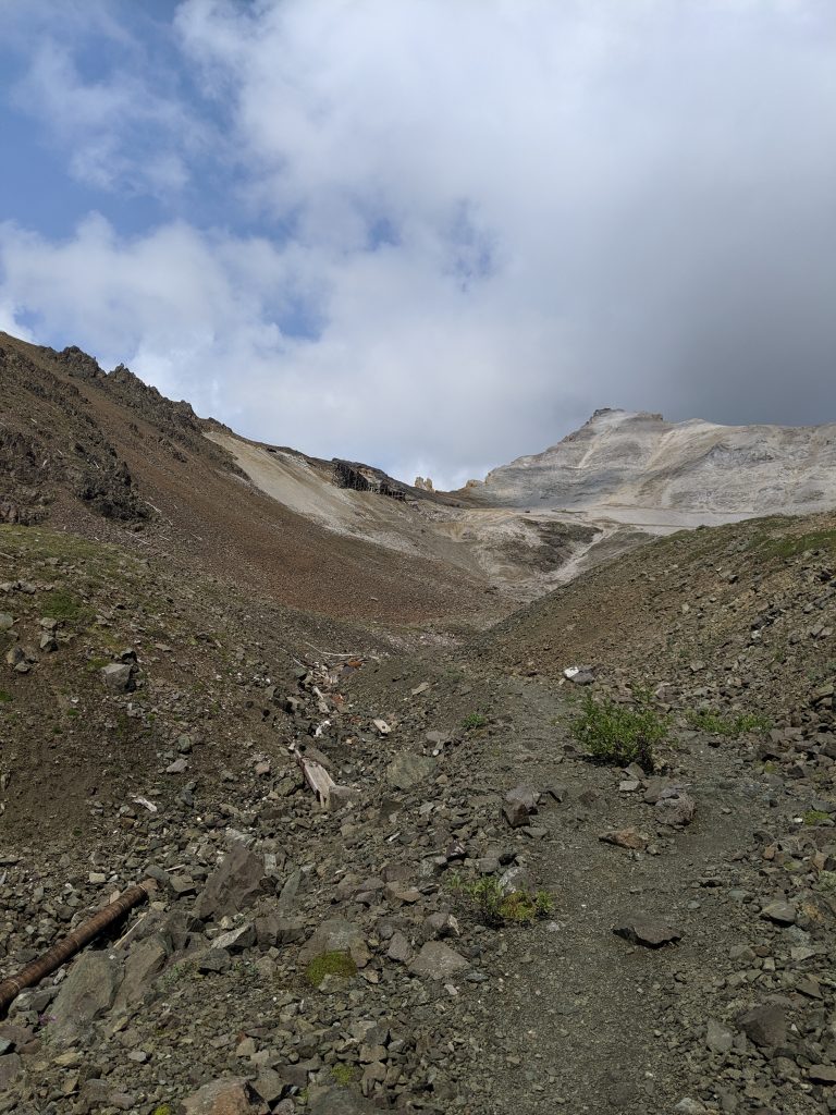
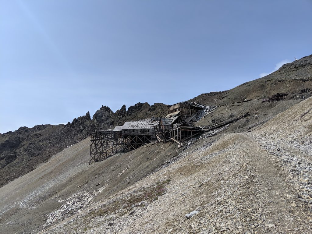
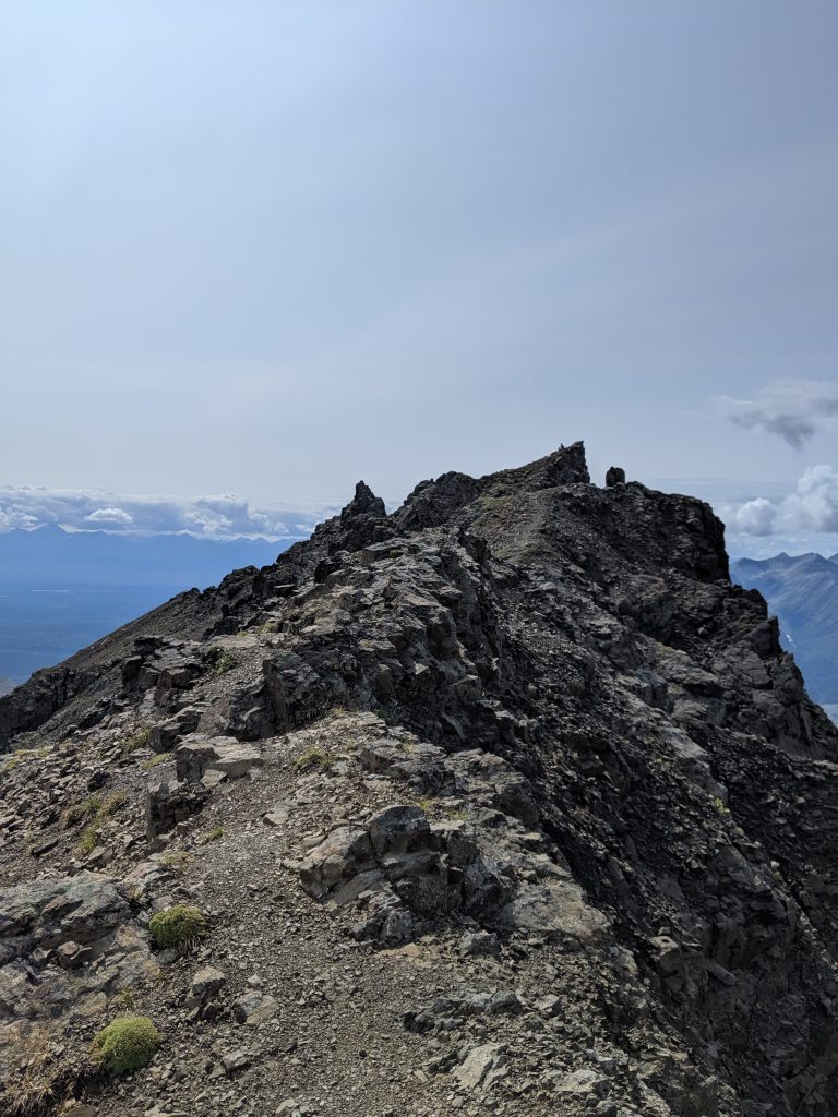
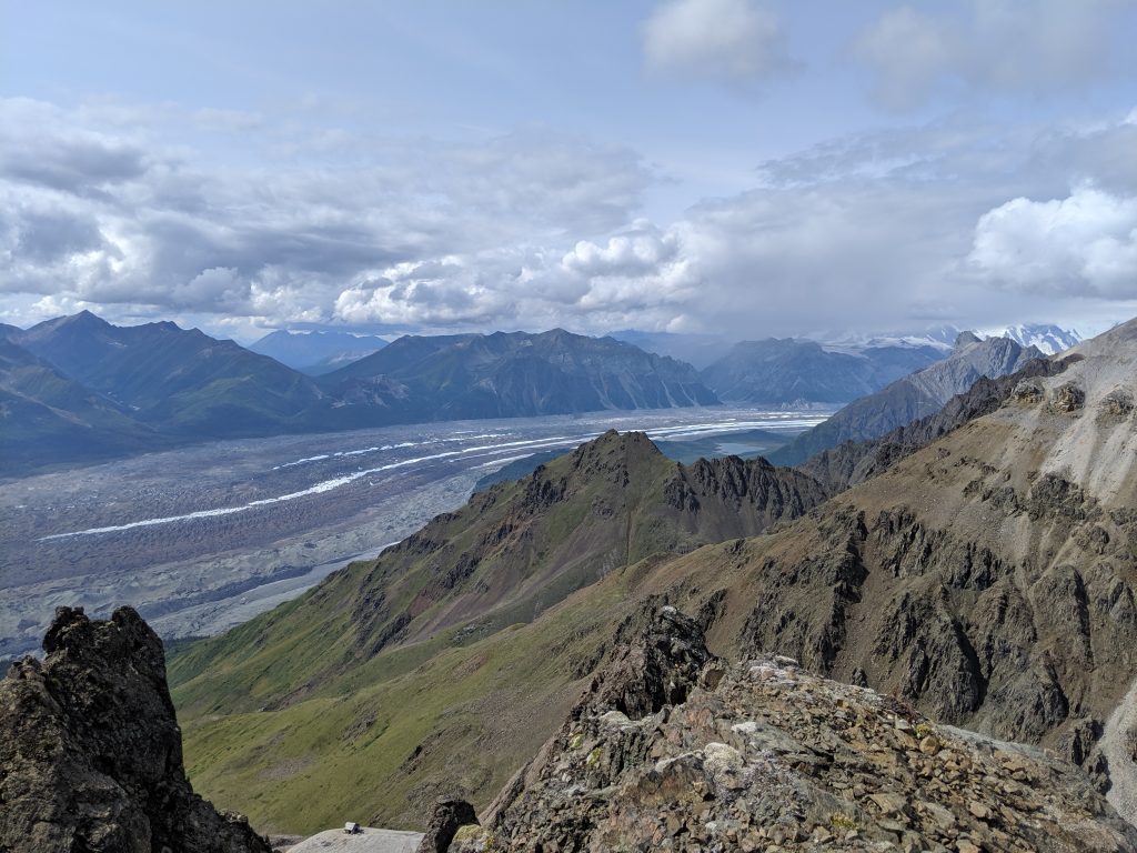
Bonanza Mine Trail-– Kennicott; Wrangell-St. Elias NP. 8.3mi roundtrip. 3.5hrs roundtrip; 2.5hrs to the summit. 3900ft elevation gain. One hell of a hike! Trail starts as a moderately steep town road with homes on both sides along the way. Trail opens up to a smaller summit on the right and the first set of mine ruins on the right (what I assume is remains of the tram system). A perfect spot for a picnic. Just past this, the trail becomes a footpath only– get ready to work! Very steep. Waterfall in the center of the valley. Trail curves left past the waterfall to the mine ruins. Scramble up past the ruins (a true scramble on small rocks, some two steps forward and one step sliding back required) until you are on the ridgeline. Enjoy amazing views of the Mt. Blackburn, the glaciers, the town, the water, and the mountain range. A fabulous hike but definitely difficult for the 2nd half to the top.
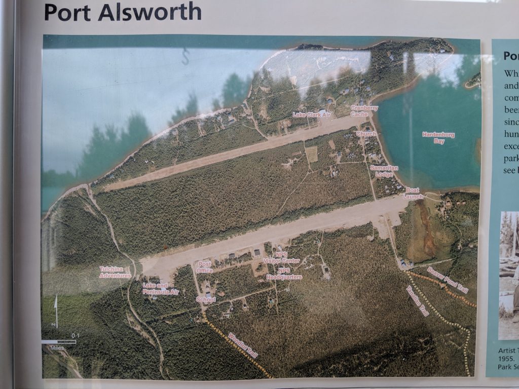
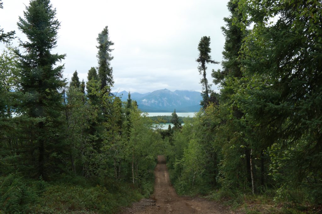
Tanalian Falls— Port Alsworth; Lake Clark NP. Roughly 1 hr one way. Part of the roughly 7.5mi roundtrip maintained parks service trail. Moments of steep incline and uphill/downhill; generally a flat trail. Views of the Tanalian Mountain as you go. A breath-taking site to see. One of the most impactful waterfalls I have ever seen in my life. The force of it. The array of colors. The clarity of the water. The way the trail opens up to the falls and the river feels like you just stepped out of the jungle and into a fairytale. Stay at the lower falls or walk 3 more minutes up the trail and scramble onto the rocks at the upper falls– you won’t be disappointed!
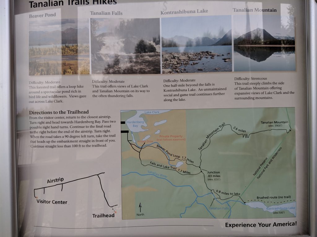
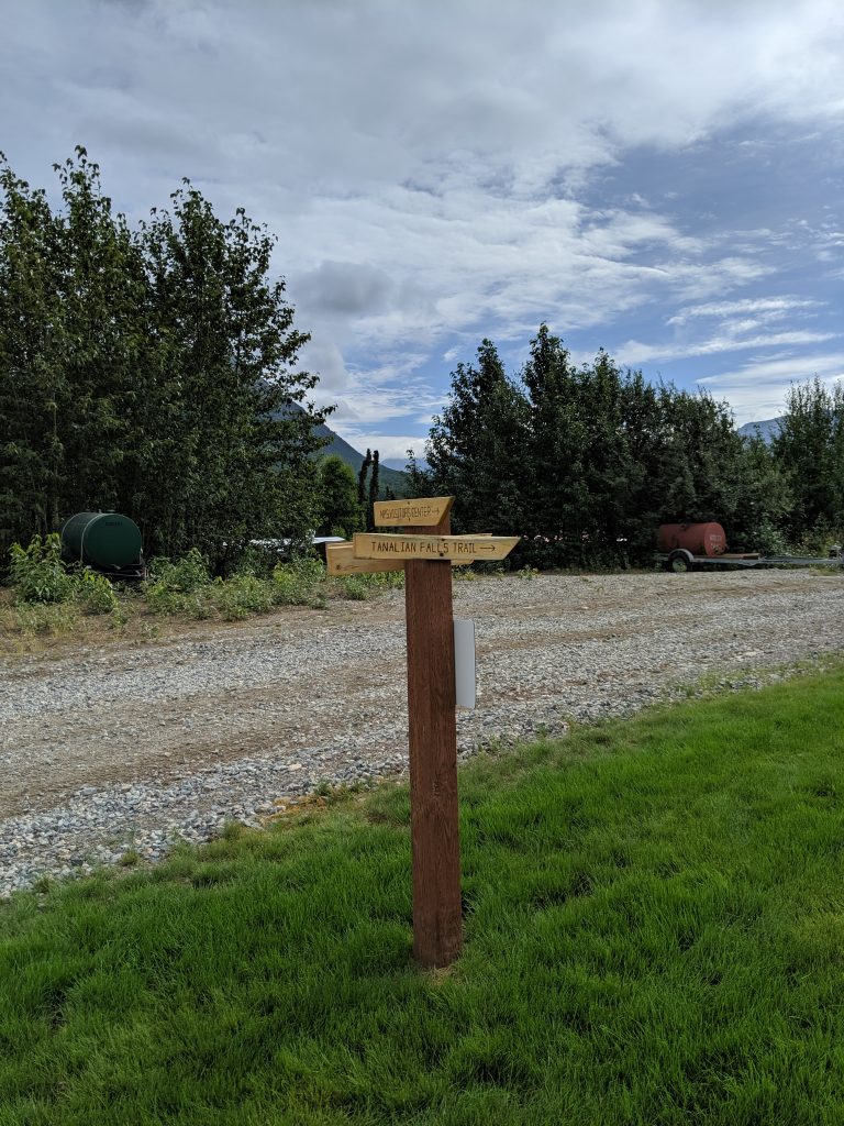
Markers along the way for Tanalian Falls Trail vs. Mountain vs. Beaver Pond Trail 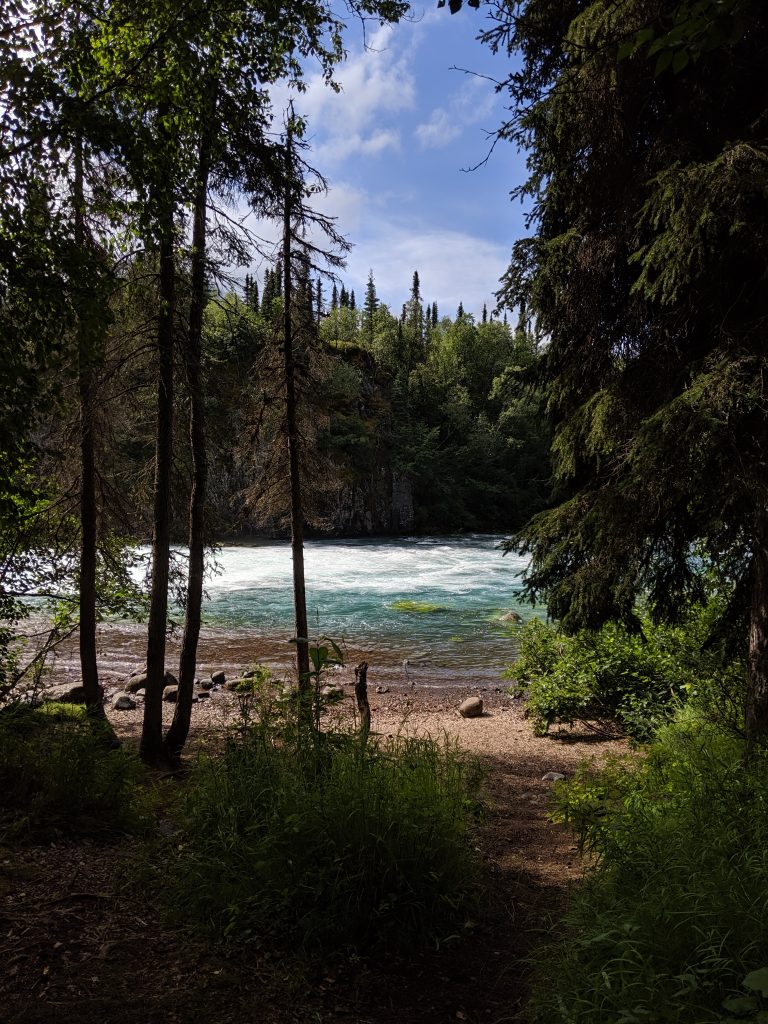
Lake Kontrashibuna via Tanalian Trail— Port Alsworth; Lake Clark NP. 1.5hrs one way. Completes the roughly 7.5mi roundtrip trail maintained by the parks service. Moments of steep incline and uphill/downhill; generally a flat trail. Roughly 30min past the Tanalian waterfall. Clear ending where trail opens up to the lake with firepit in the center but one can follow the brush trail around the majority of the lake. So peaceful!
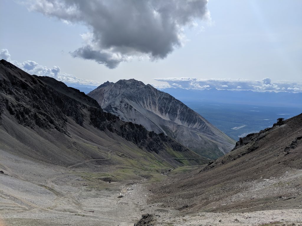
Tanalian Mountain along the way 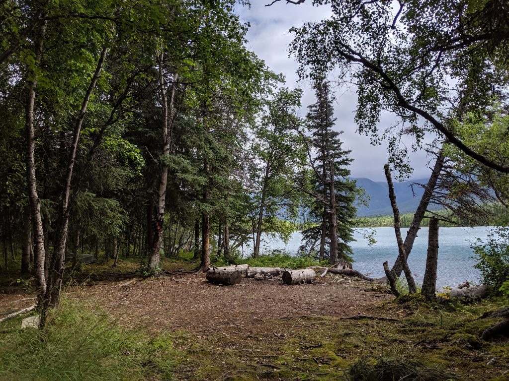
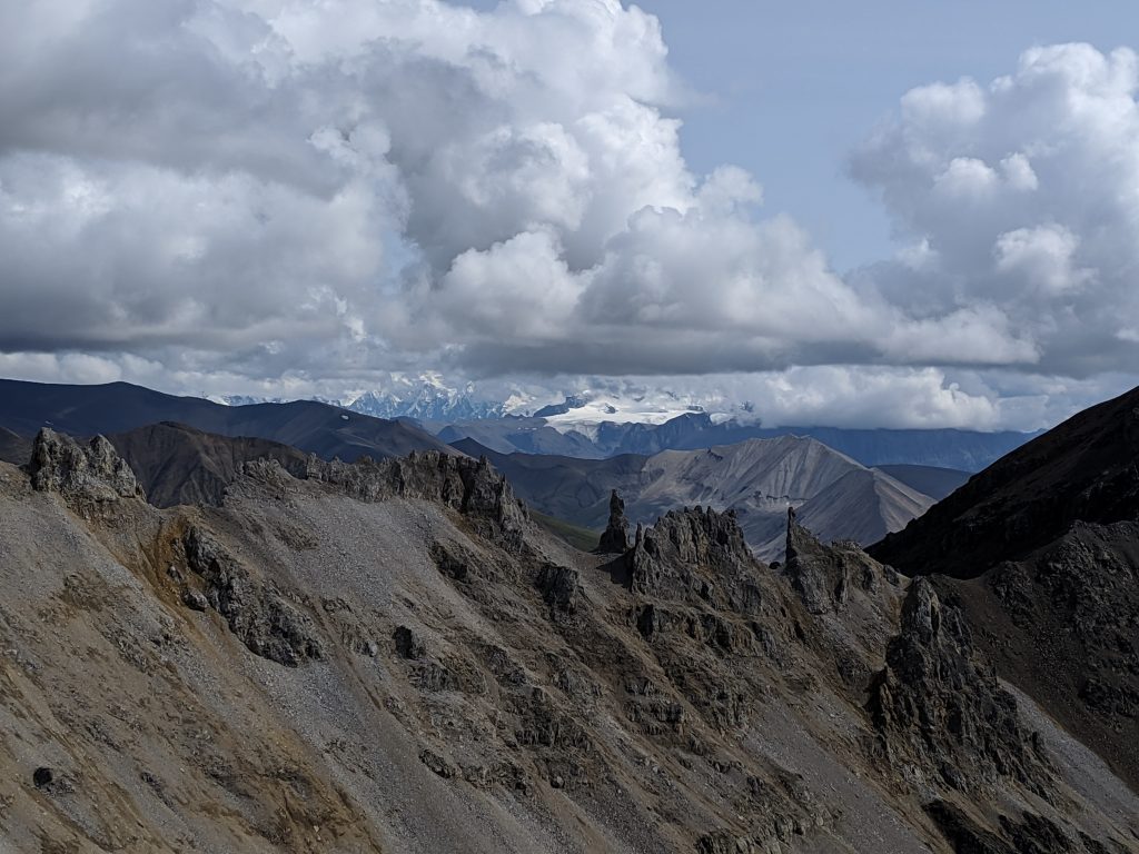
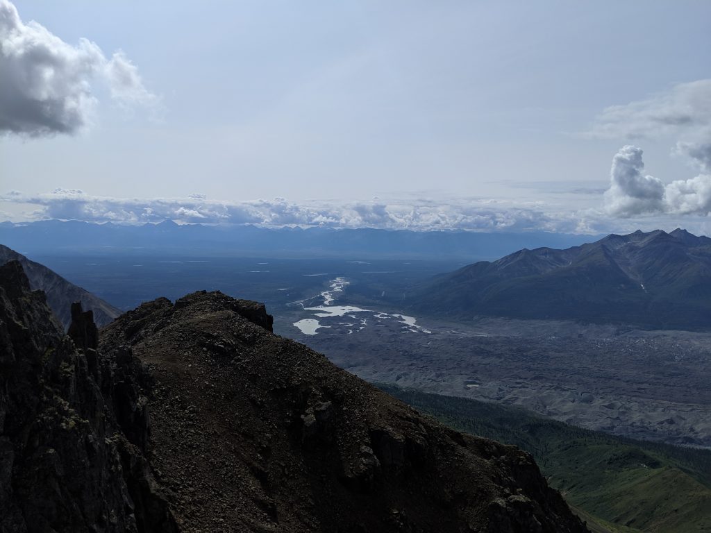
Tanalian Mountain— Port Alsworth; Lake Clark NP. 8.2mi roundtrip. 3800 ft elevation. 2hrs to the summit from the start of the Tanalian Mountain trailhead. About 3hrs to the summit from the Tanalian Trails marker at the very beginning at the airstrip in town. About 5hrs roundtrip from airstrip. Roughly 30min more along the ridgeline once past the pipe marker. Narrows quite a bit over rock near the summit so be careful and don’t attempt if the peak is in the cloud. Trail opens up the entire way for sweeping panoramic views of Port Alsworth, Lake Clark, the Tanalian Falls, and the surrounding mountains. View keeps getting better as you go up. Very overgrown on the switchbacks near where the trail becomes above treeline but very easy to follow. Trail overall very well maintained. Would do it again in a heartbeat. Would do it multiple times a year for the joy of the hike and the breathtaking views if I could!
A steep incline 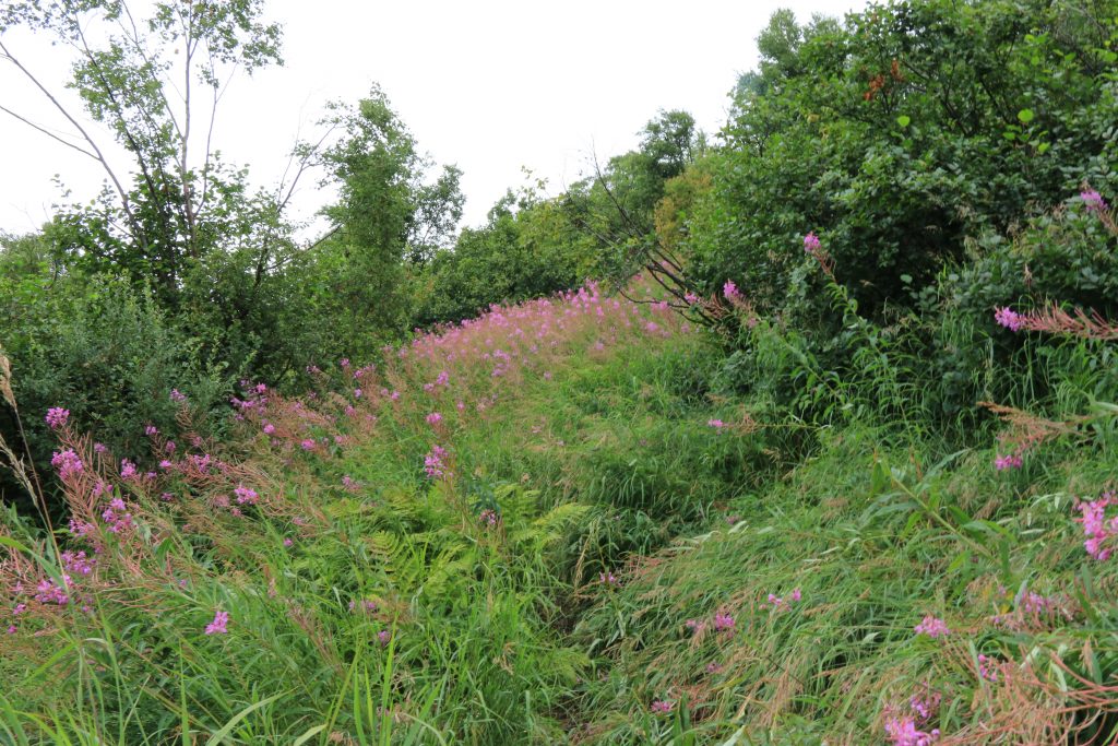
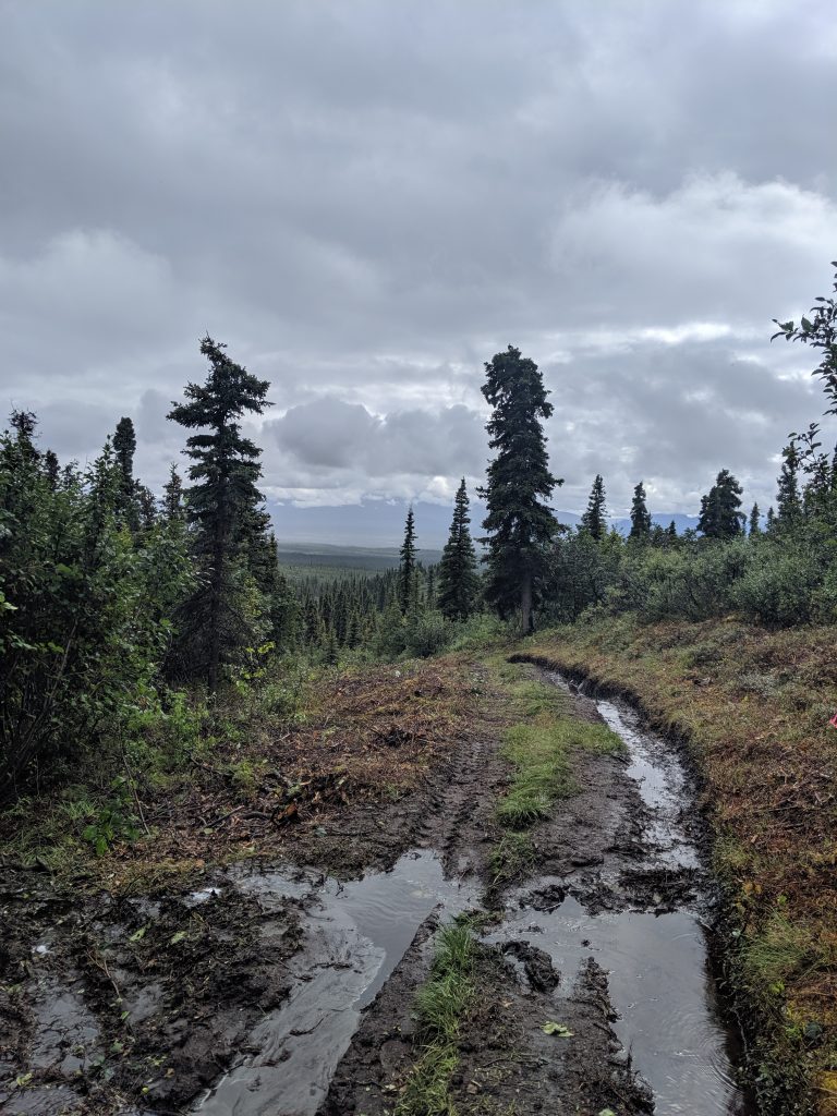
Overgrown trail 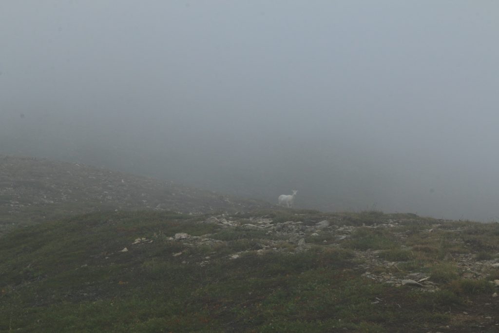
Mountain goat in the cloud! 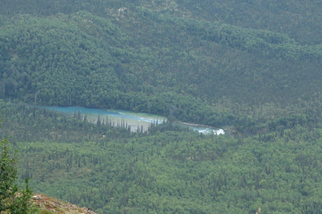
Tanalian Falls from up above! 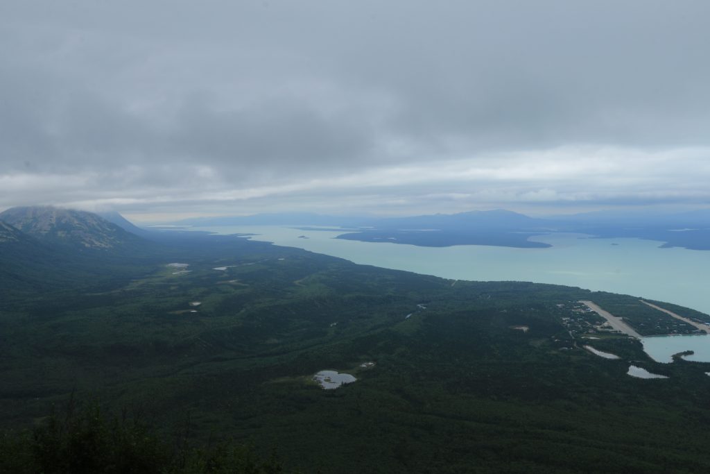
The view from the pipeline
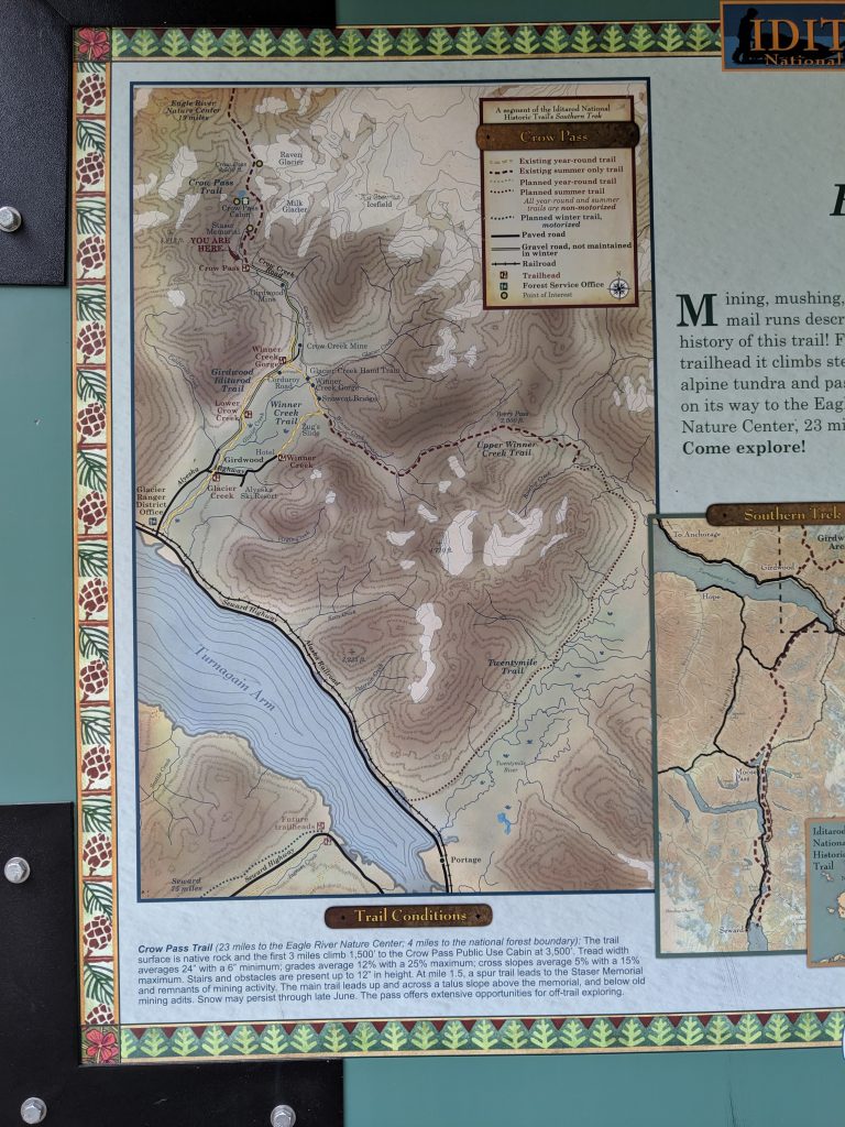
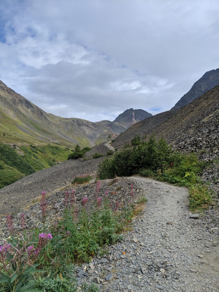
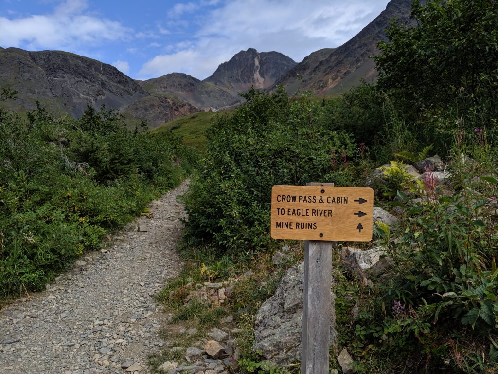
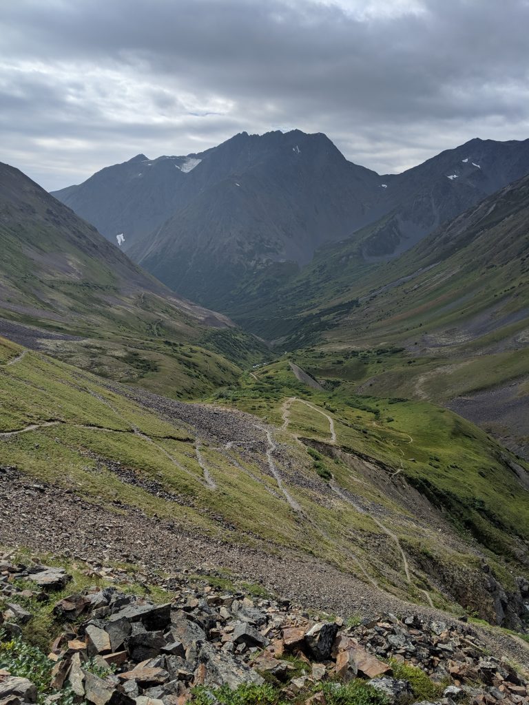
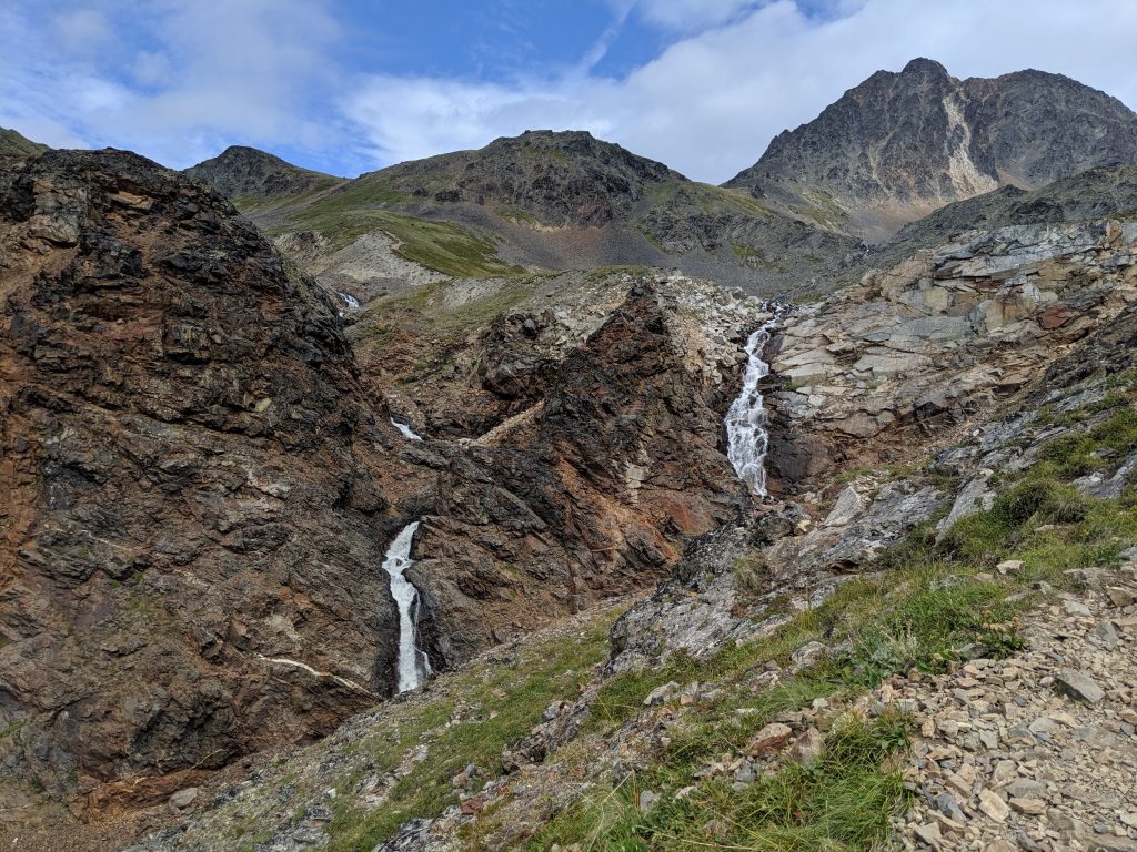
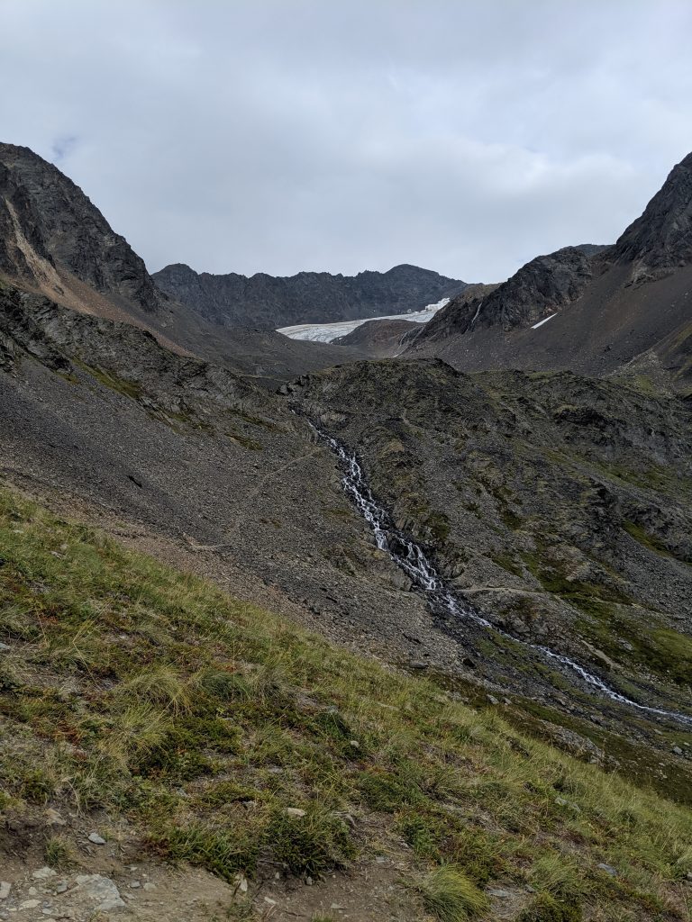
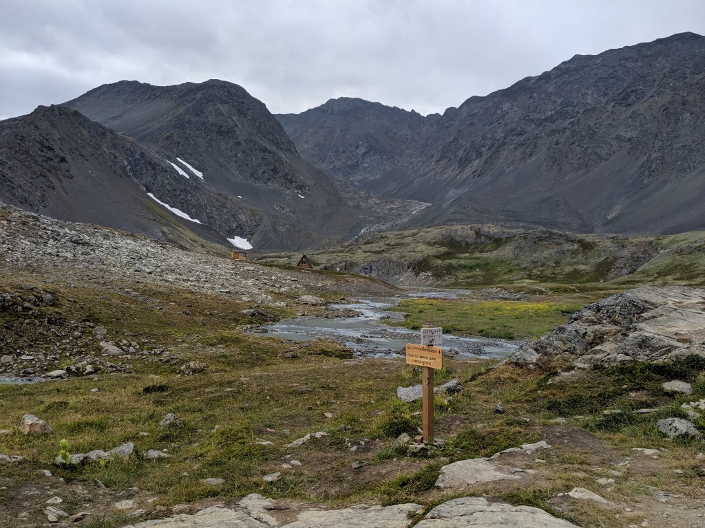
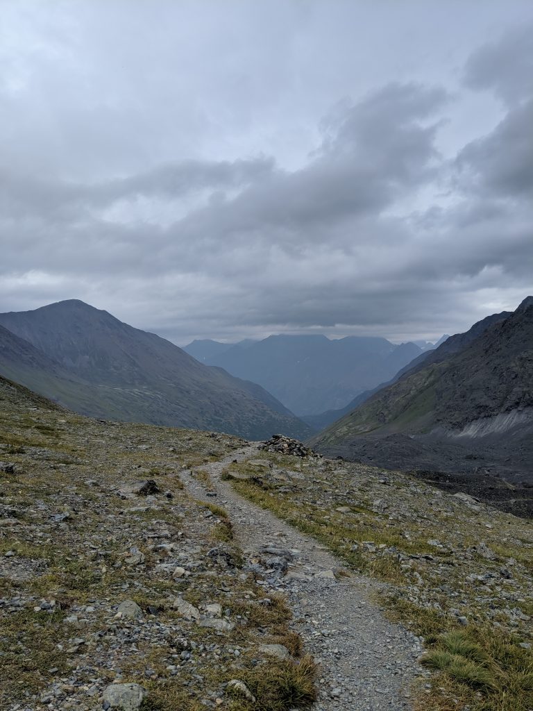
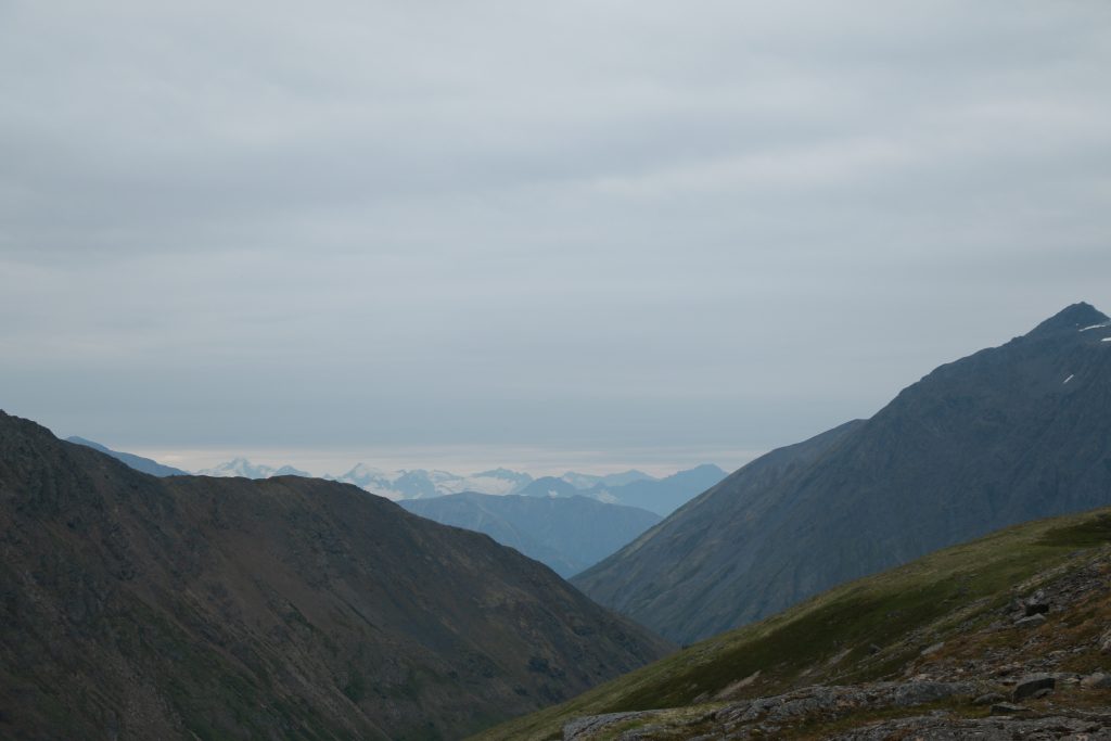
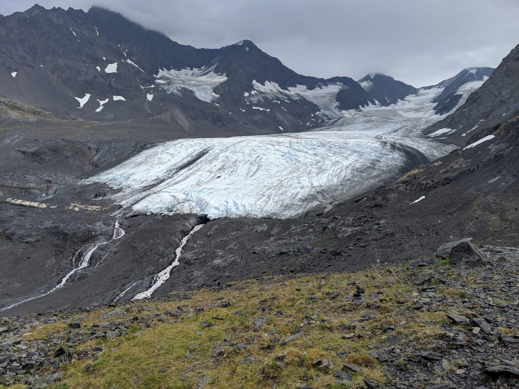
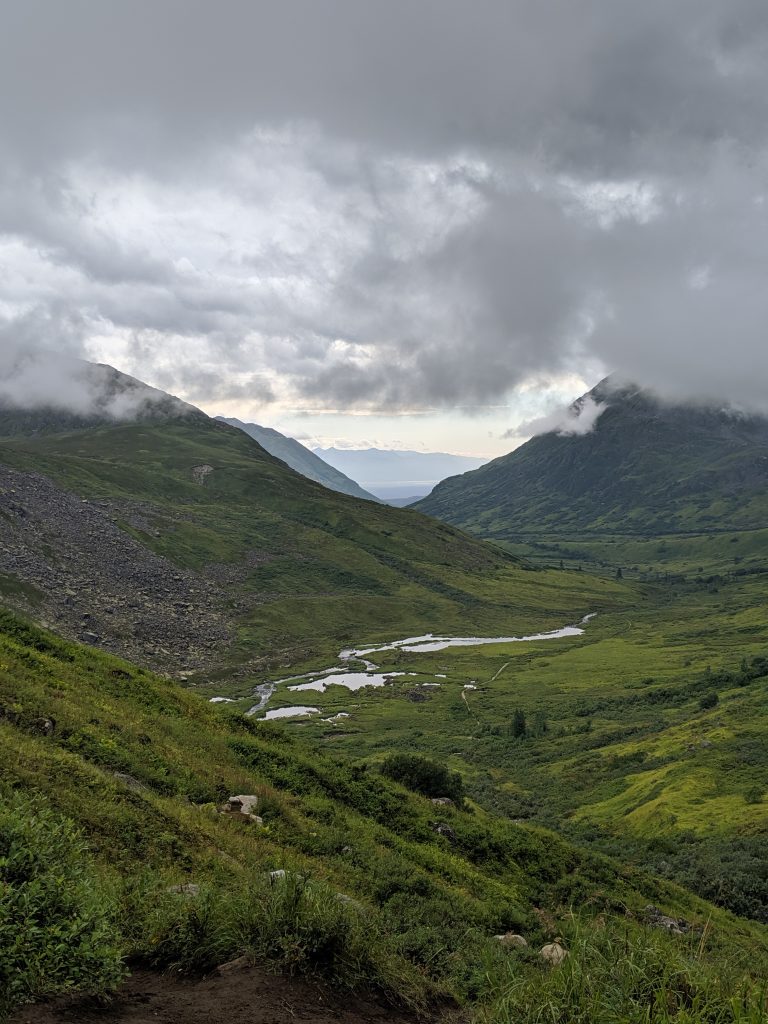
Crow Pass: Crystal Lake & Raven Glacier— Girdwood. 6.2mi roundtrip. 1900 elevation gain. 3hrs roundtrip with time spent on the at the lake and/or glacier. Trail splits once in the valley– to the left is more steep because it takes you too the waterfall at the mine tailing and then requires one to scramble up to where the trail converges again; keep to the R for a much more steady ascent. Trail steepens to the lake traveling along the waterfall on the left. Amazing views the entire time once above treeline/ in the valley. Historic trail due to the mines. They ask that you not go on the tailings. Cabin at the lake is booked by reservation only– so serene, peaceful, and beautiful as it is right on the lake. Glacier only a short walk past the cabin– maybe 20-30min. Trail continues on to the rest of Crow Pass.
Reed Lakes— Hatcher Pass near Palmer. 8.7mi roundtrip. 2250ft elevation gain. 4hr 20min roundtrip. Several areas of larger boulder scrambling. Can be very slippery. Very worth the danger! First section is a relatively flat, wide path. Trail features a small pond after the largest rock scramble, the Lower Reed Lake roughly 30min later with a waterfall just next to it, and the Upper Reed Lake roughly 30 more min at the end trail.
View of beginning valley 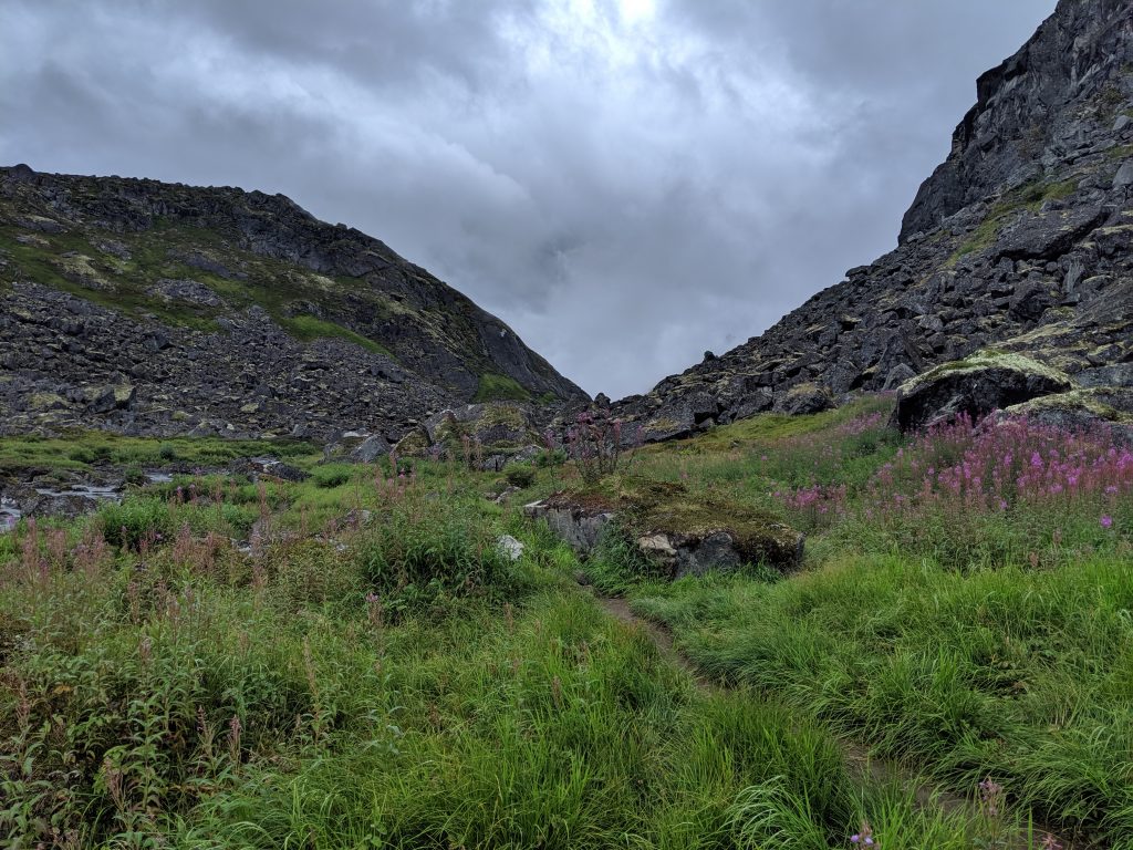
Boulder Scramble 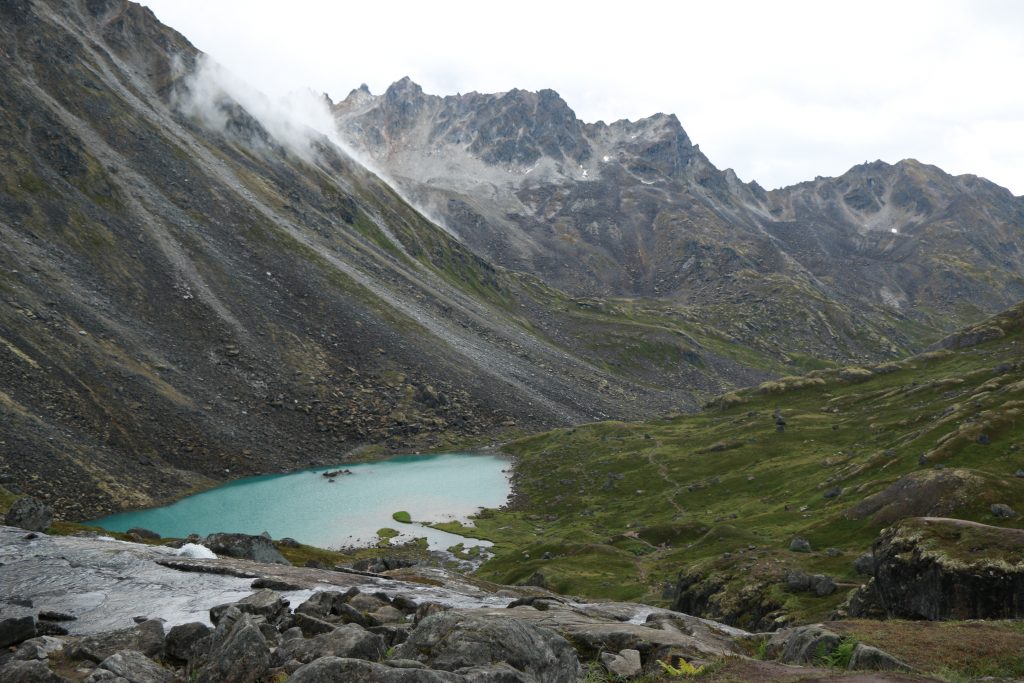
Lower Reed Lakes 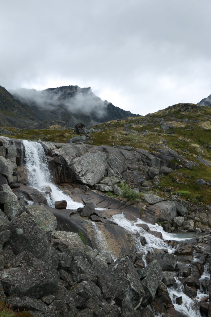
Waterfall! 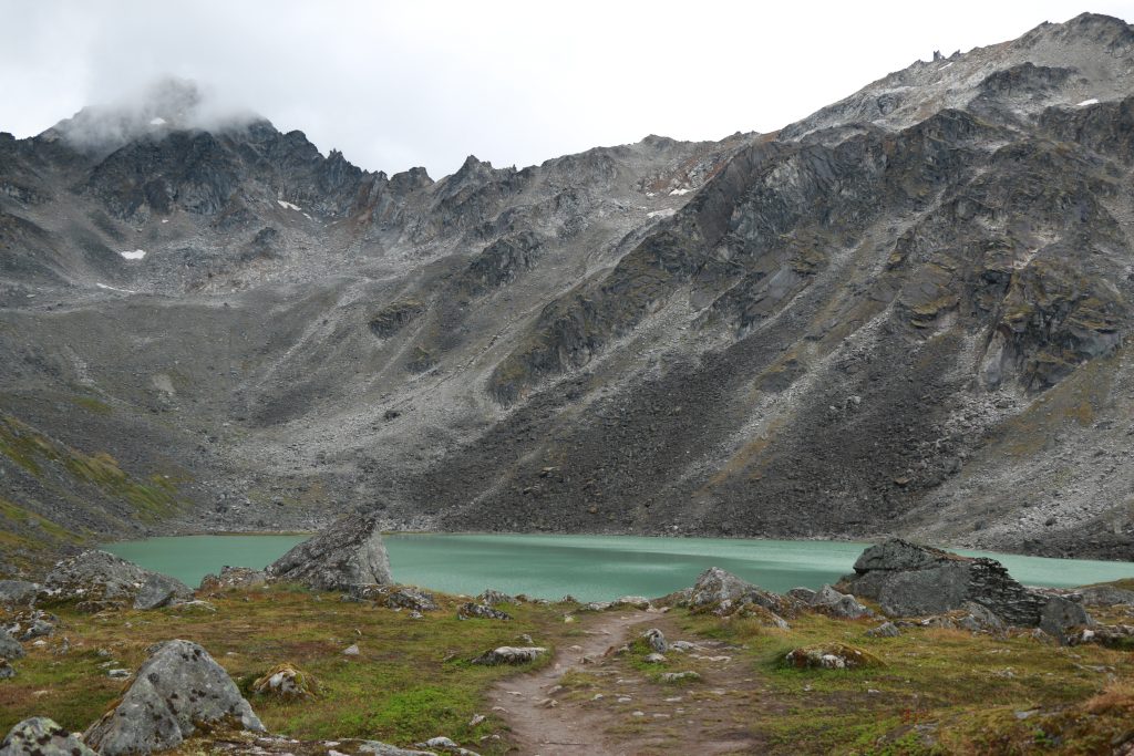
Upper Reed Lake
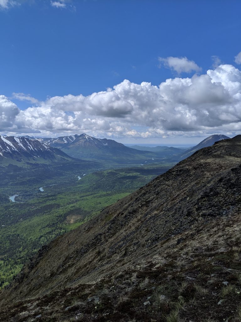
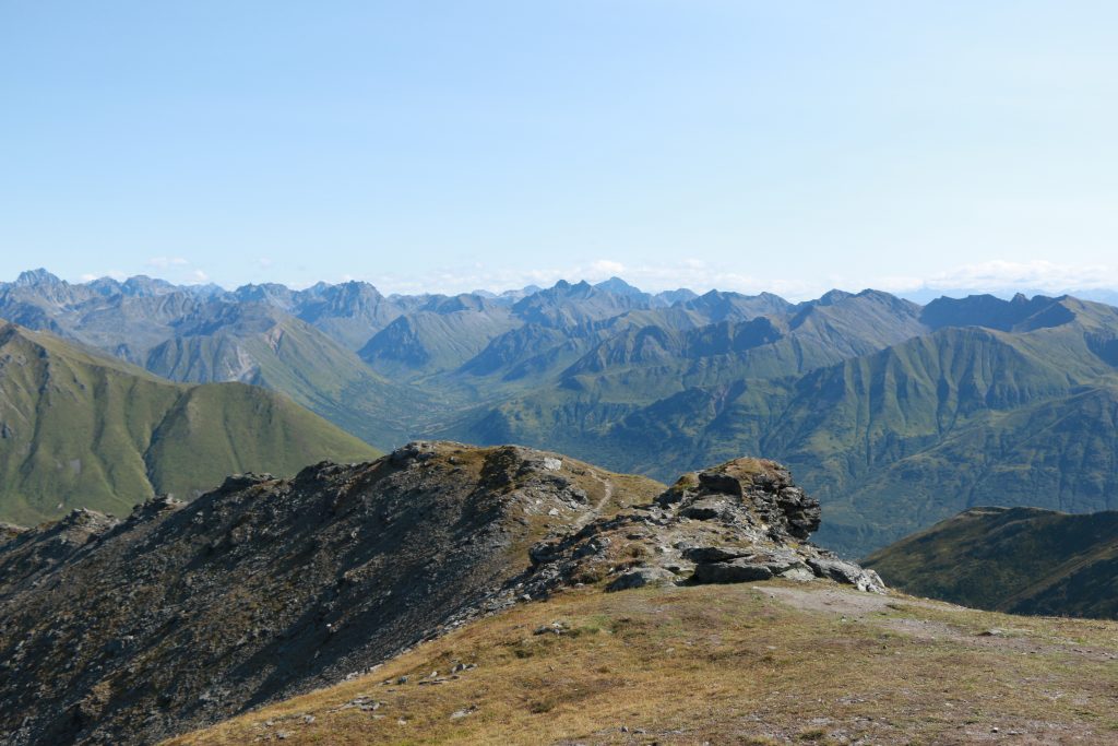
Wolverine Peak— Anchorage. 8.3mi roundtrip. 3600ft elevation gain. 4-6hrs roundtrip depending on tolerance for incline and number of stops. Roughly 2-3hrs to the top. Better view than Flattop though similar terrain. Beautiful lakes in the valley on the other side of the peak. Flat overlook half way to the peak is a great place to stop or to enjoy lunch on the way.
Anchorage w/ snow capped mountains in the back! 
Mountains for dayzz! 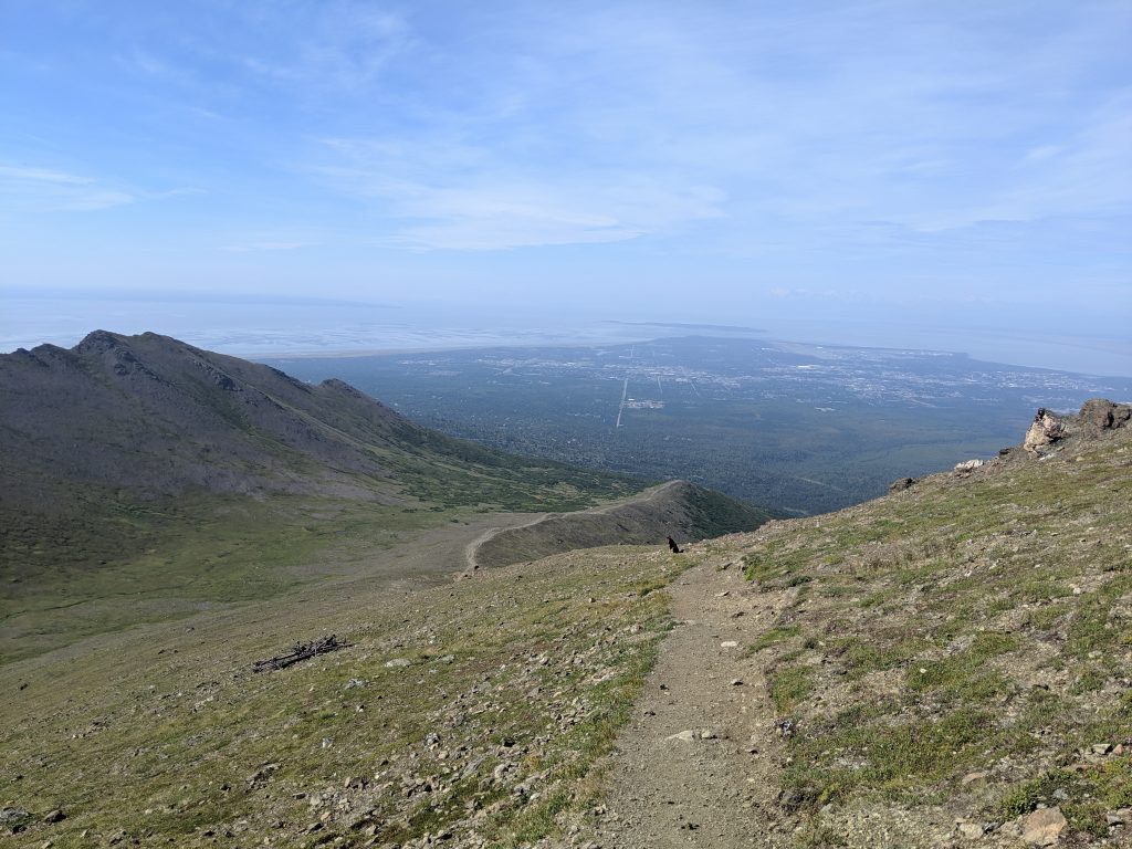
We climbed that… :/ 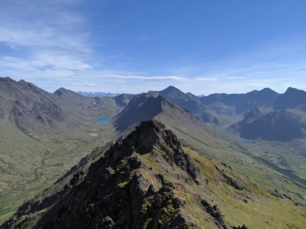
Lakes seen from the peak!
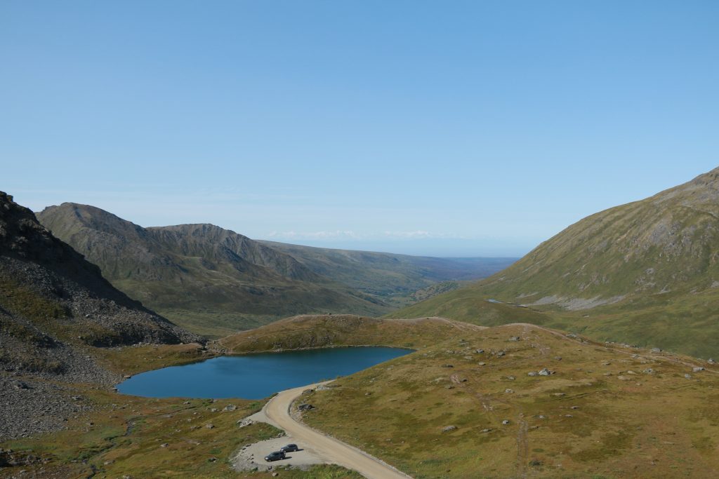
April Bowl— Hatcher Pass near Palmer. 2.2mi roundtrip. 850ft elevation gain. 2hrs roundtrip. Starts immediately with incline and doesn’t stop until at the ridgeline. Offers miraculous views of the Denali Range. Trailhead is unmarked and located across the road from the Hatcher Pass stone monument and main overlook/ parking lot.
Bartlett Lake Trail— Roughly 7mi and 4hrs roundtrip. Follow Tlingit Trail from Visitor Park Services (VPS) about 0.6mi and cross the park road where trail picks back up as the Barlett Lake Trail on the left. Continue straight to go to the river on the Barlett River Trail or veer right to hike to the lake. DO NOT follow AllTrails version of Barlett Lake Trail as it starts you several miles away from the VPS and the lodge at the end of Park Road, which doesn’t make sense if you are camping or staying at that the lodge. Instead, follow the Barlett River AllTrails map and zoom in to confirm placement along the lake trail.
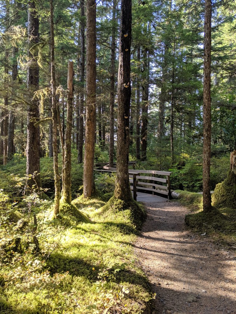
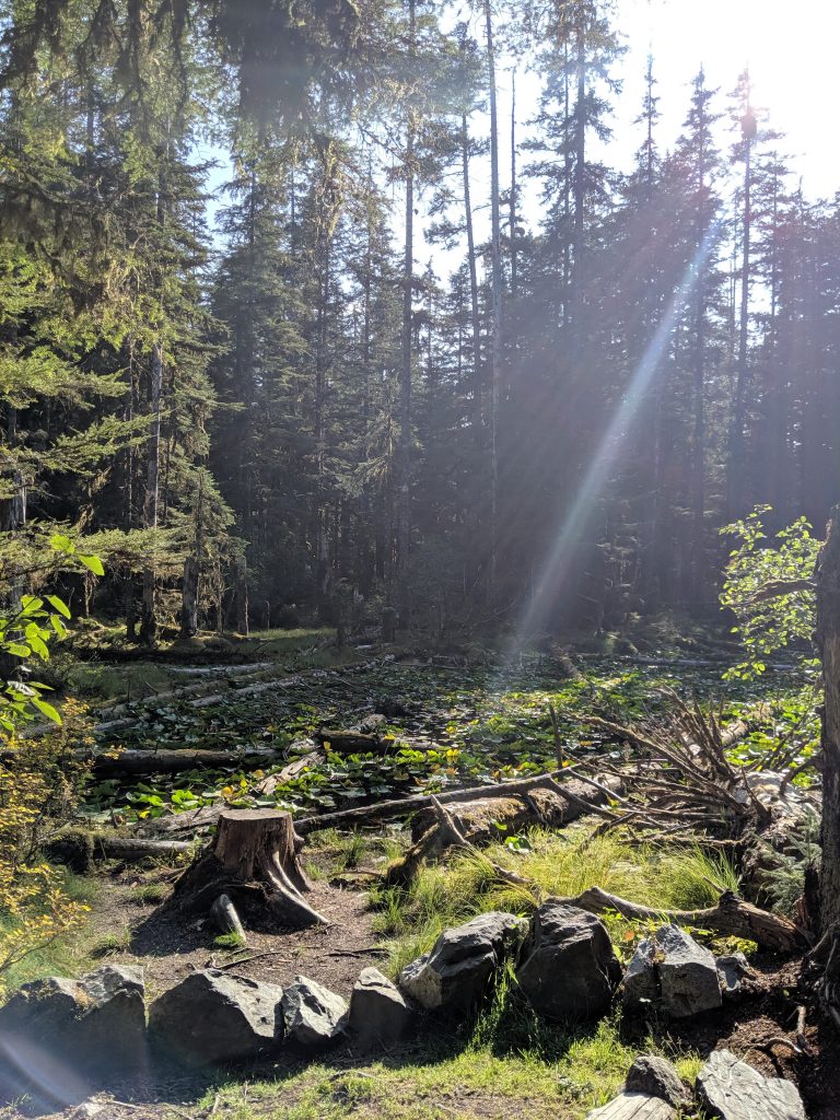
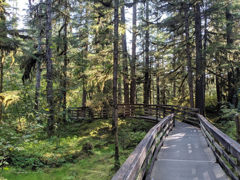
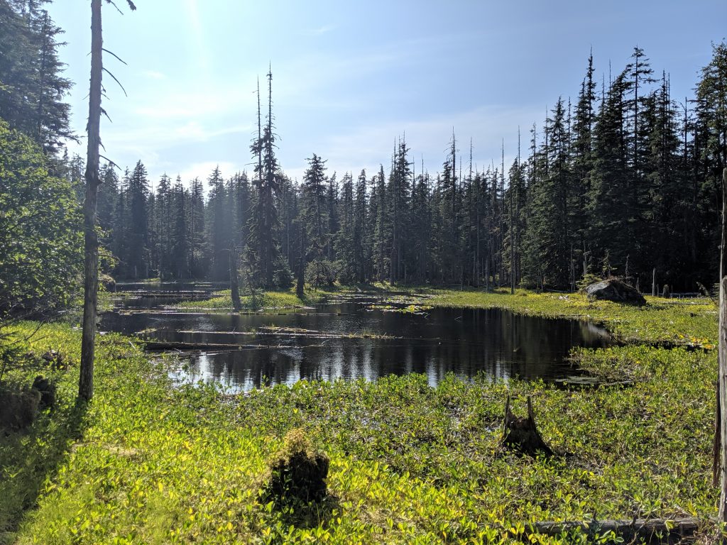
Bartlett Cove & Forest Loop Trail— 1.1mi roundtrip. 100ft elevation. Leisurely walk from Glacier Bay Lodge & Visitor Center that passes campground site and loops back to lodge. Features small ponds. Great representation of the temperate forest.
West Glacier Trail to West Glacier Spur Trail— 4hrs roundtrip just hiking plus roughly 1hr at the glacier exploring the ice caves. Take the West Glacier Trail to the West Glacier Spur Trail which is a split to the right shortly before it becomes the Mt. McGinnis Trail. Trail is slightly hidden– stay straight whereas Mt. McGinnis trail curves left as a switchback; look for pink and yellow ribbons throughout– lifesavers! For two amazing vistas, go 5-10min on the Mt. McGinnis trail and then double back. DO NOT take the first available split to the right called Ice Cave Trail. Unnecessarily difficult rock climb with nearly same reward and only slightly more front-on views of the glacier and Nugget Falls. AllTrails is not correct with total milage if trying to reach the glacier as trail on map ends at a viewpoint. Keep curving to the left if facing the glacier and go around the water to find where glacier meets rockface– this is where ice caves are. Very slippery and larger rocks cannot be depended upon for stability or balance. Be safe and have fun!
Temperate Rainforest 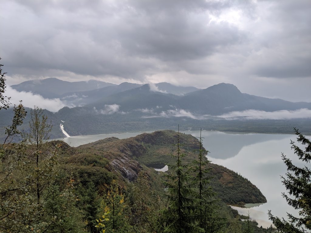
Nugget Falls! 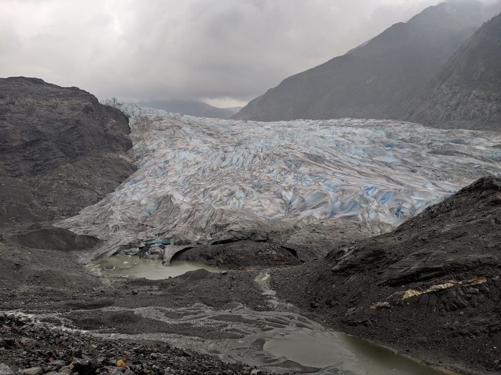
Mendenhall Glacier from the front! 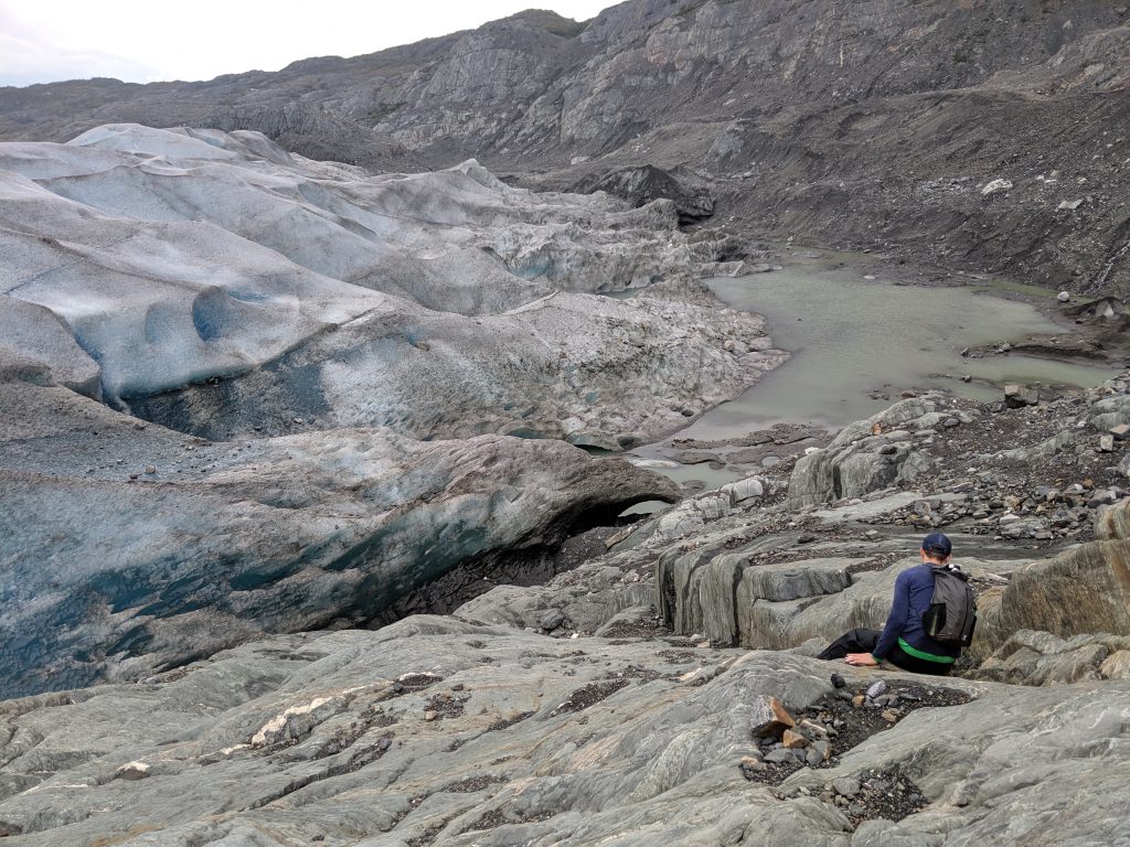
On the Left side of the glacier 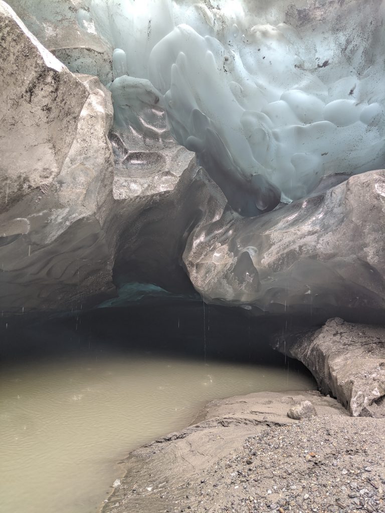
Ice cave by the water 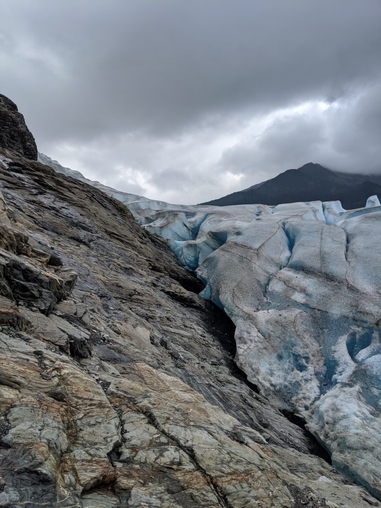
Climb up a bit further; slippery area 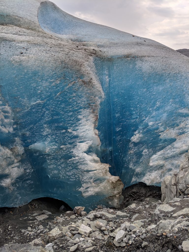
That blue though…! 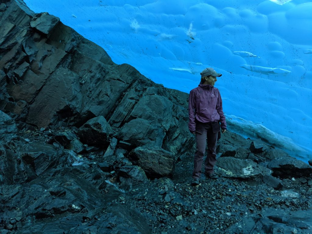
Standing in an ice cave! 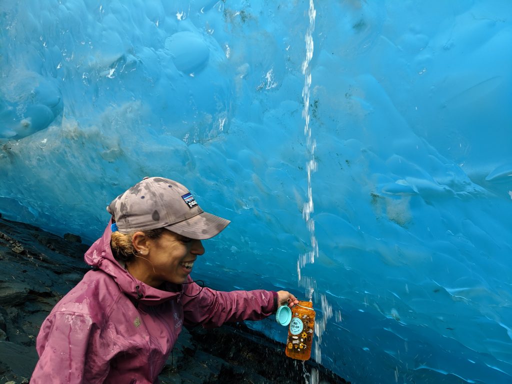
Drink that glacier water!